Always worth taking a lead from the GSDM (Global Synoptic Dynamical Model) at all times in my opinion, but in the context of current discussions then NWP (Numerical Weather Prediction, i.e. the shorter-range deterministic models such as GFS, ECM and UKMO) may be especially likely to oscillate in the period ahead, both with the tropospheric pattern, but also across the polar field in terms of the AO (Arctic Oscillation) benchmark.
Each post for quite some time from my own point of view has, in anticipation of possible outcomes, focussed on the upsides and then the downsides in terms of where atmospheric angular momentum is to be led during the upcoming transition of the MJO (Madden-Julian Oscillation) (tropical convection) from the current wave to the start of the next one.
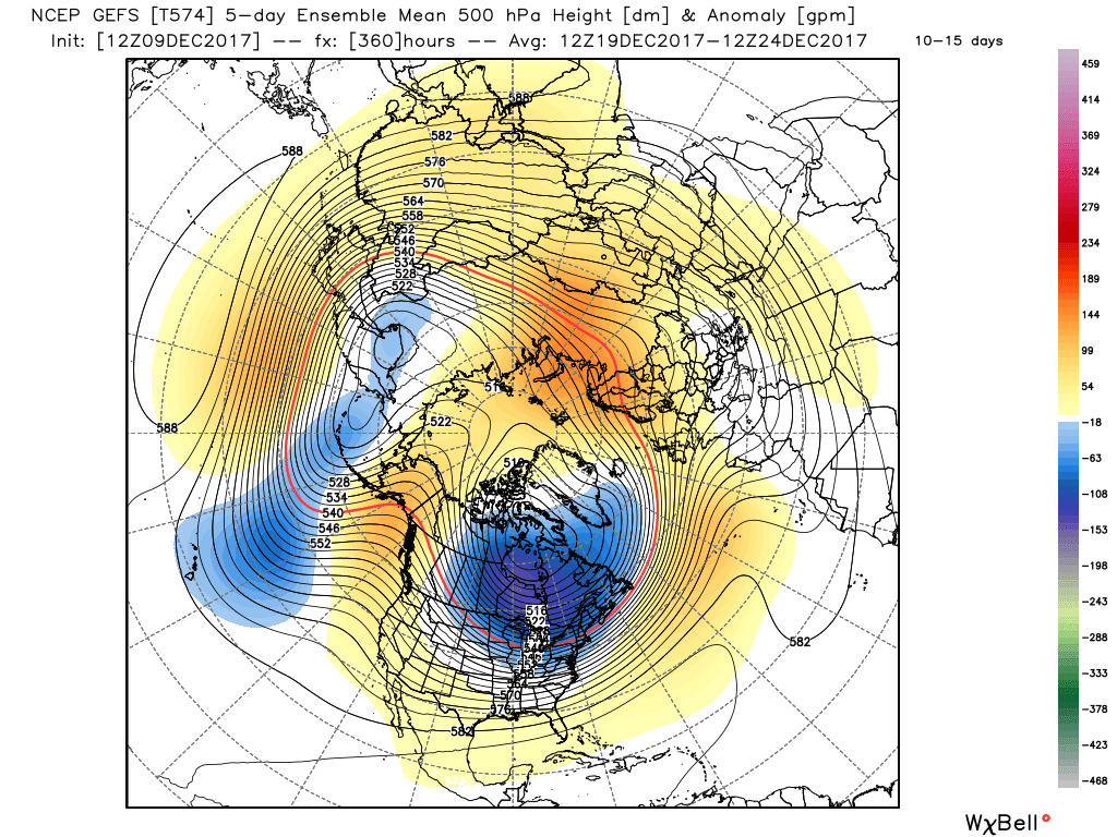
As stated yesterday, definitely coming off the fence with this one, though still stressing the need, as expressed in each post, to monitor how far AAM (Angular Atmospheric Momentum, the tendency of tropical convection to cause the jet to become meridional as tropical winds interact with the earth's surface and the system tries to conserve overall angular momentum) falls from the maximum disconnect with the La Nina base state currently happening - to the cyclical ebb as the tropics re-set patterns through the mid period of this month.
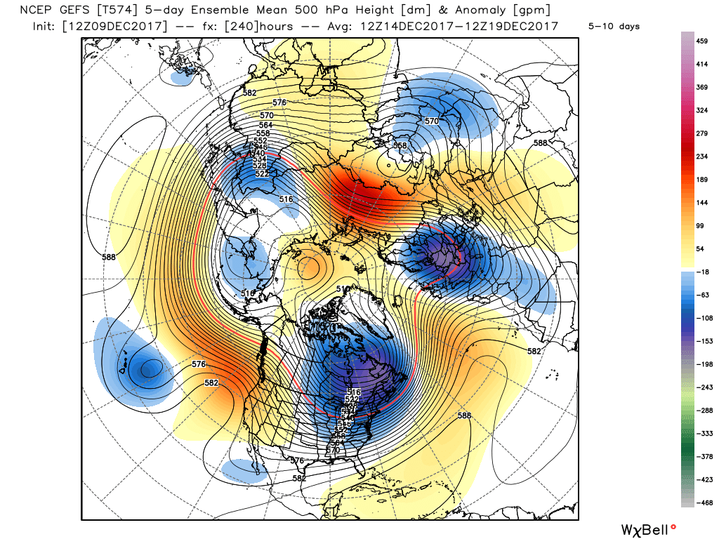
The Phase 4 Global Wind Oscillation (at present) orbiting to Phase 8 and then in turn back to Phase 4 (and not heading back into Nina Phases 1,2 and 3) will underpin the bullish notions that the atmospheric circulation wants to continue to pave the way towards an even colder trend heading towards and into the New Year as the North Pacific ridge and Canadian vortex configurations relax sufficiently to allow height rises to the NE but without too much northern branch of the Jetstream to spoil deeper sources of upper cold air advection to head south-westwards across the North Sea.
We could espouse the easterly of late December 2005 as an example of this sort of thing, but not at face value in terms of "intensity" (or otherwise )of cold air and snow distribution necessarily, or indeed replica precise timing to take too literally. It still has good purpose for illustration use though of how things could conceivably evolve in principle.
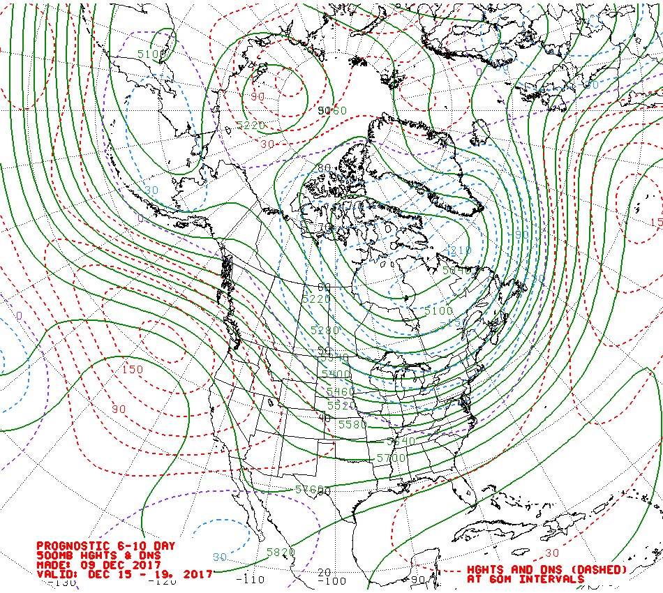
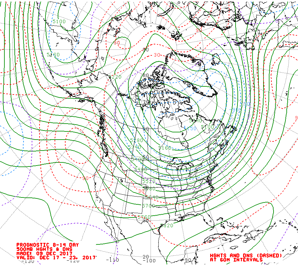
I expressed slowly growing confidence in this sort of evolutionary possibility to NE heights yesterday. However the UK initially fares, the jist of it is that a deep source of cold air would be in place in this scenario that is highly unlikely to move very far in these circumstances and sets up a very very interesting January scenario
Still with the attached caution caveat that prospects of a fall back in AAM sufficient to take the GWO (Global Wind Oscillation) back to Phases 1,2 and 3 is becoming less likely with each passing day of positive data - *should* this occur then the more traditional La Nina pattern would re-surface which implies the North Pacific ridge and Canadian vortex combo not retrogressing and in this way pressurising the polar jet and neutralising an -AO profile. At the same time, the Azores/Atlantic ridge would be ascendant at the expense of greater influence of heights to the NE and too much energy transport to the N to allow the pattern to back deeper cold air advection westwards
Its highly possible that the models will show especially erratic trends on the way to the final destination, notwithstanding that as posted earlier on this thread, the GEFS (GFS model ensemble output) suite is pointing a way towards the upside scenario in the extended period.
But as a precaution anyway, in terms of keeping a sanguine open mind to keep enjoying the ride, I would suggest not allowing any model vicissitude to correspondingly engulf human emotions into equal vicissitude. On that basis best also to take AO/NAO forecasts with an equal pinch of salt - these will simply reflect the swings of NWP, and equally, ensemble suites
The theme is the same old for me - the signals lead the models, the models don't lead the signals.
Highly interesting start to the winter (for a change), if you don't let every model suite overwhelm you, whichever way

") P.
P.