- Messages
- 2,549
Windy and warm here at the moment with only a smattering of rain, which I'll happily settle for.

Unfortunately, Colum, by the weekend I expect that you'll have had a great deal of rain.Windy and warm here at the moment with only a smattering of rain, which I'll happily settle for.
Ya boo sucksUnfortunately, Colum, by the weekend I expect that you'll have had a great deal of rain.
It is Glasgow though, if they bulldoze the campsies it might be betterBeen pretty much constant rain this year Chris, although that isn't really ' much wetter ' than our weather has been for the past couple of years.
JohnnyO. o/

I merely report, sadly.Ya boo sucks
I merely report, sadly.
I'd be disappointed if it did!Don't fall into the error of believing that will stop us unfairly blaming you Chris !
JohnnyO. o/
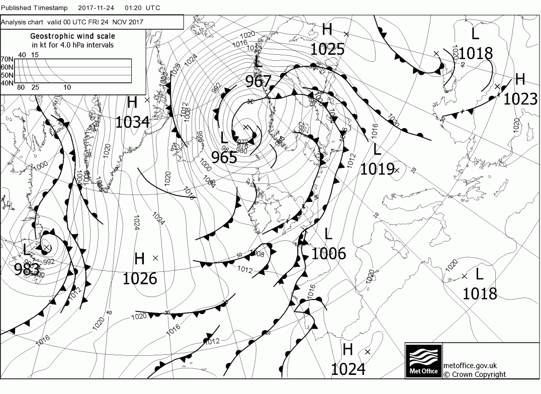
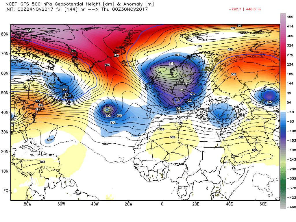
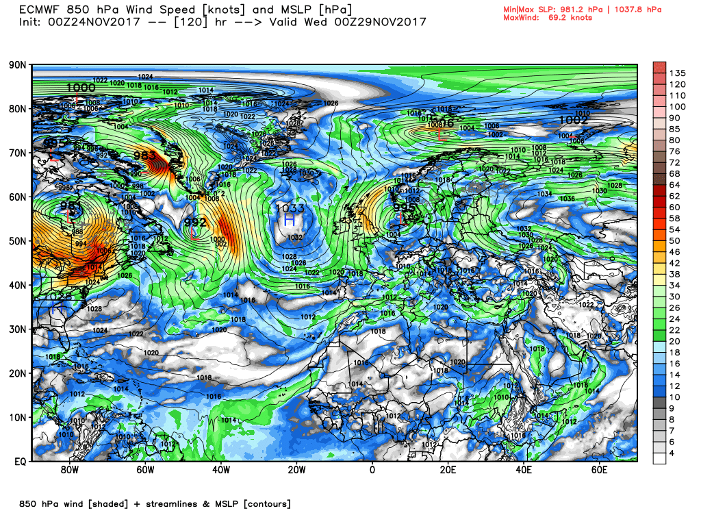
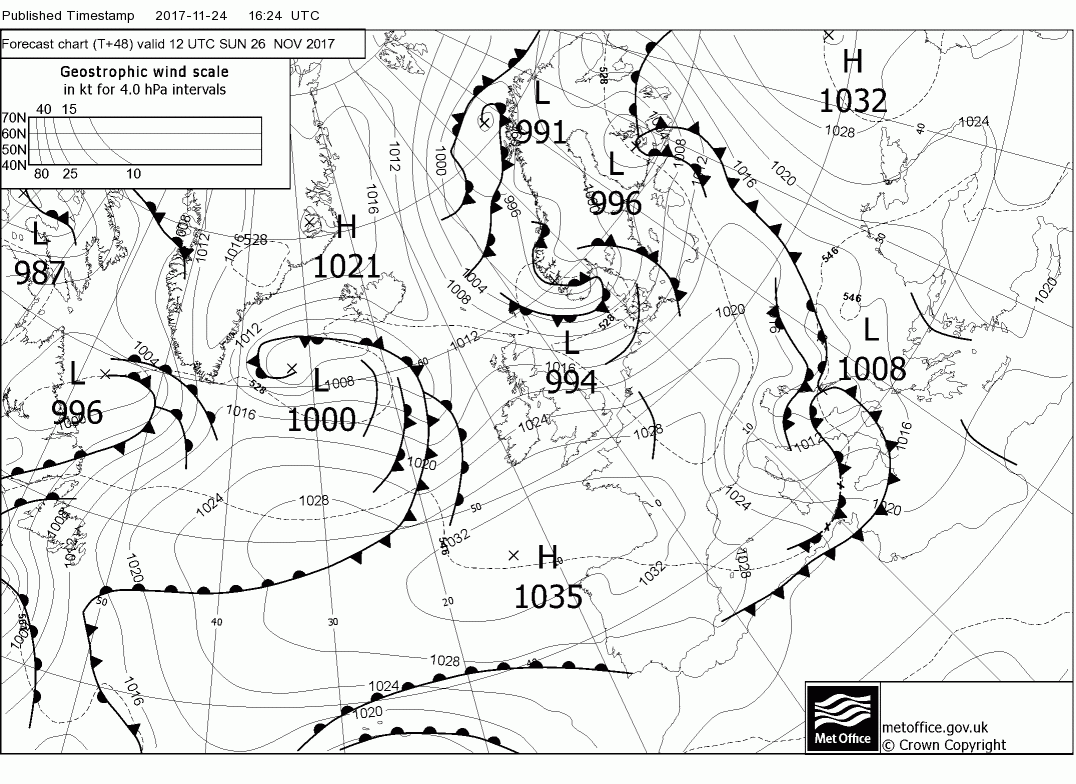
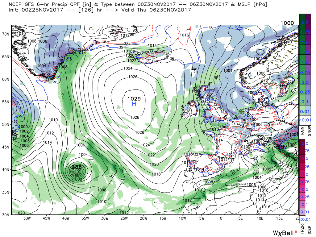
Over the next couple of days the UK in an unstable north westerly airstream, courtesy of a deep low around the Norwegian Basin, giving frequent squally showers in the west which in N. Ireland and Scotland will be very frequent and often of snow even down to low levels. In these areas there will also be quite strong winds, The exception to this early on will be the SW & S of England which will be cloudy with sporadic rain. Feeling cold in the blustery wind particularly the further north you go.
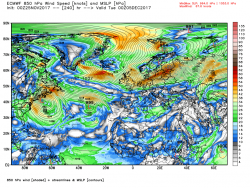
So on to this morning's gfs
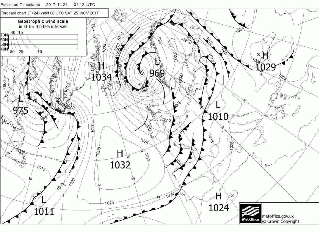
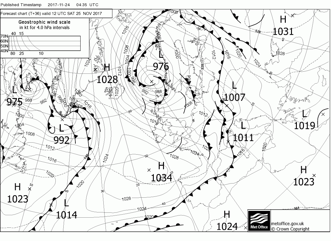
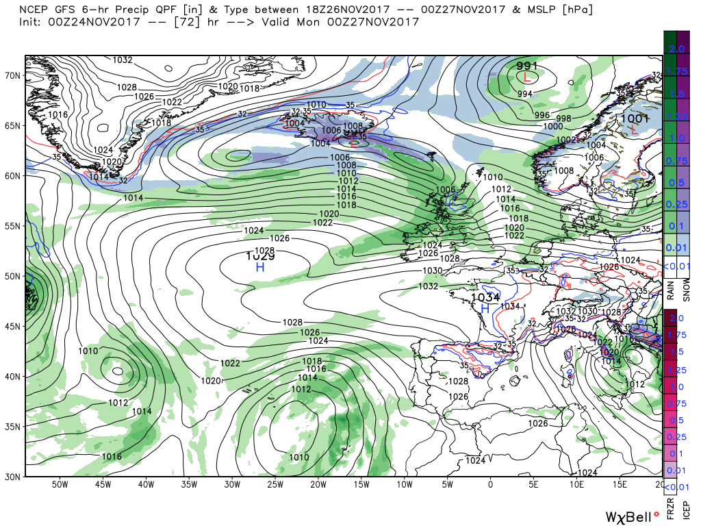
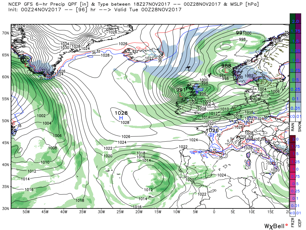
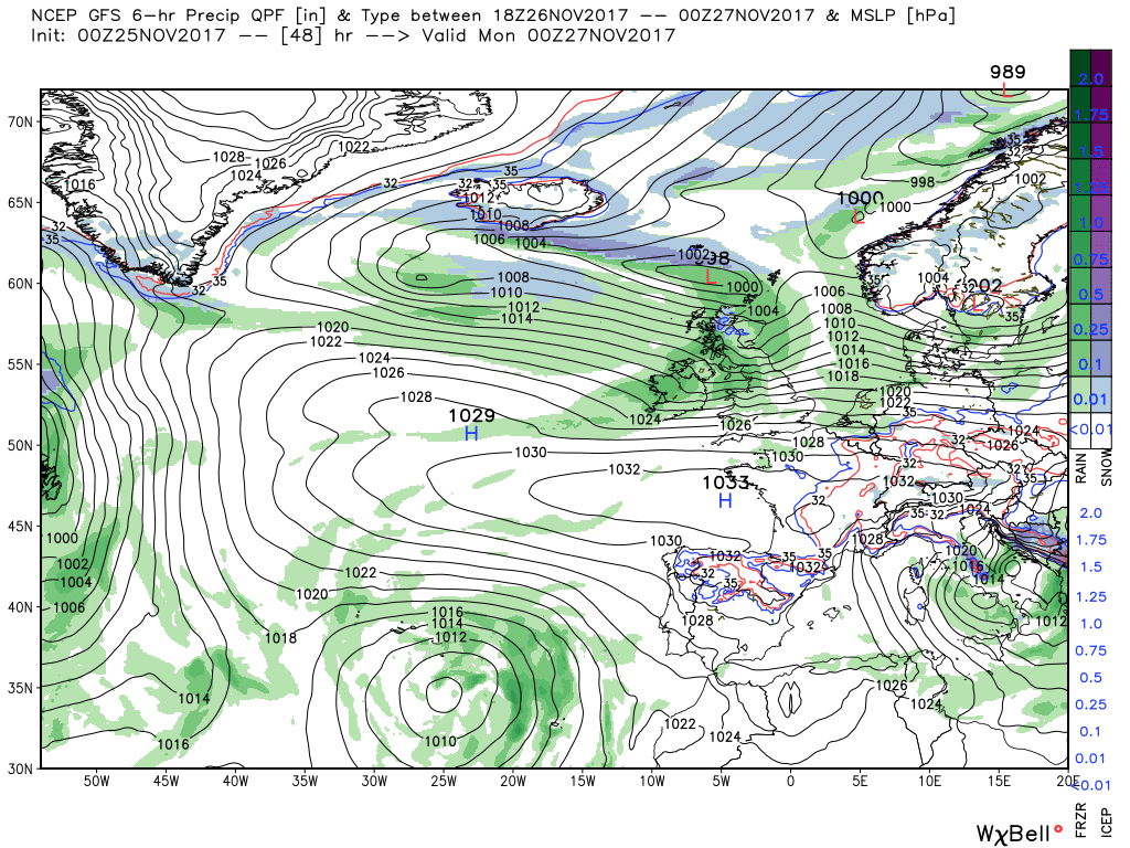
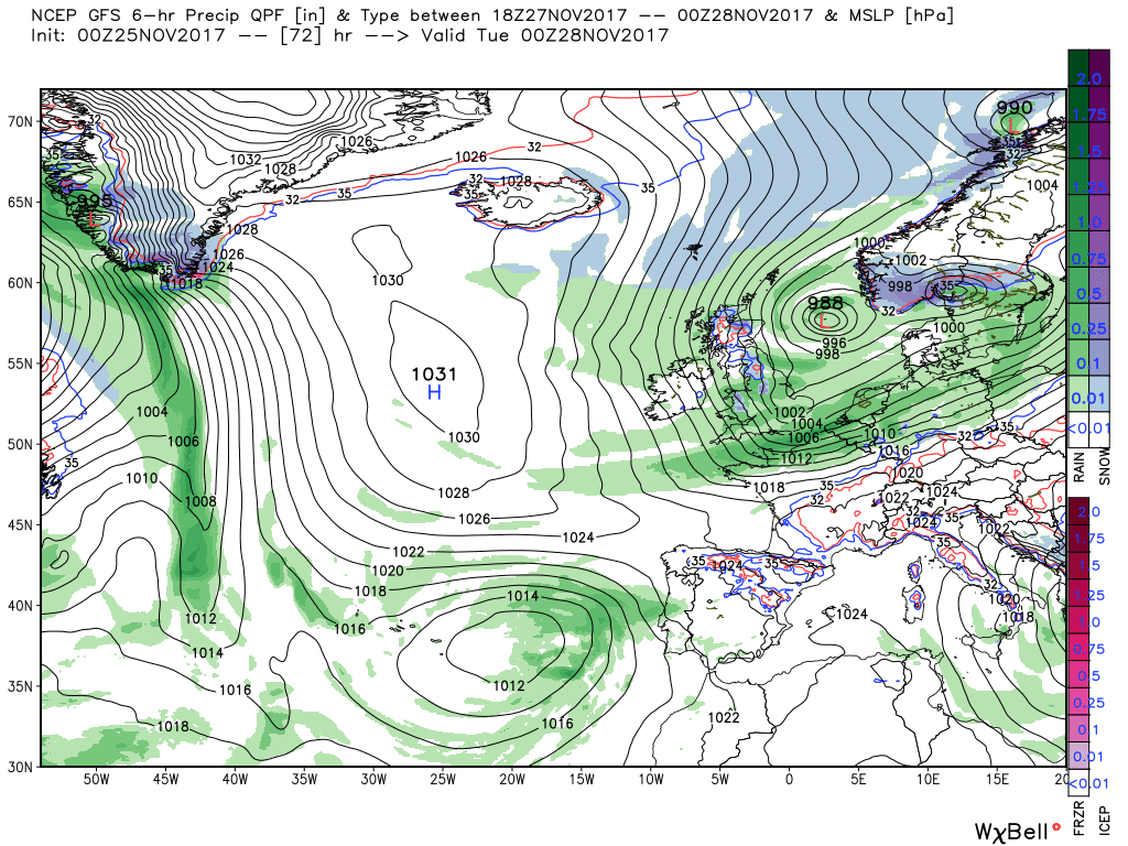
Sunday a much quieter day as a ridge pushes in from the west but this is very transitional as by Monday 00 a front and wave depression have already impacted the north west (the low tracking a bit further north than yesterday) accompanied by rain Over the next 24 hours the front traverses the country south east as the low deepens and tracks east into southern Norway. Simultaneously another low has swept in from the north west, phases in with the main trough to the north east, and is over Scotland by Tuesday 00 and this time should dump a fair bit of snow on the high ground, and even lower fround, in N. Ireland and Scotland.
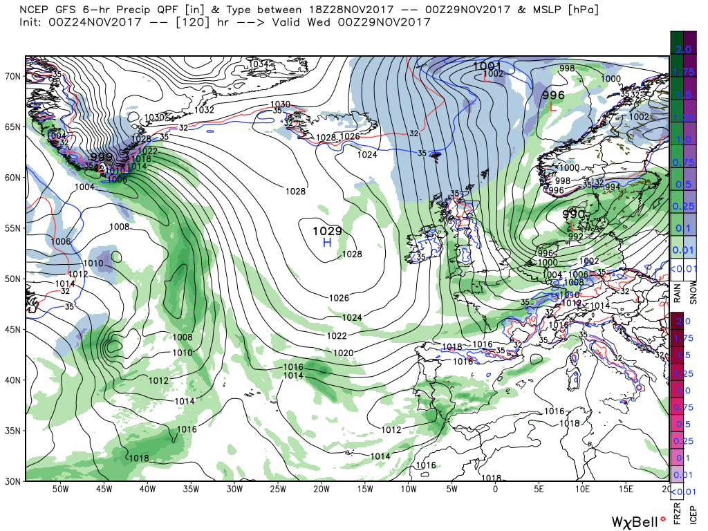
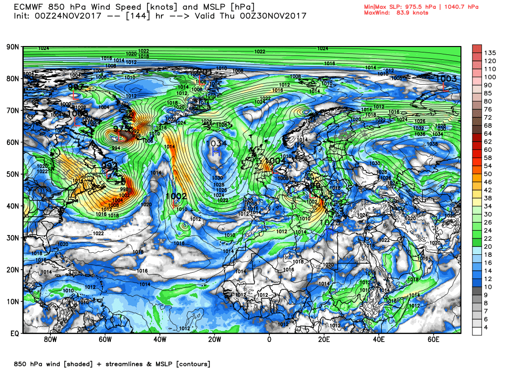
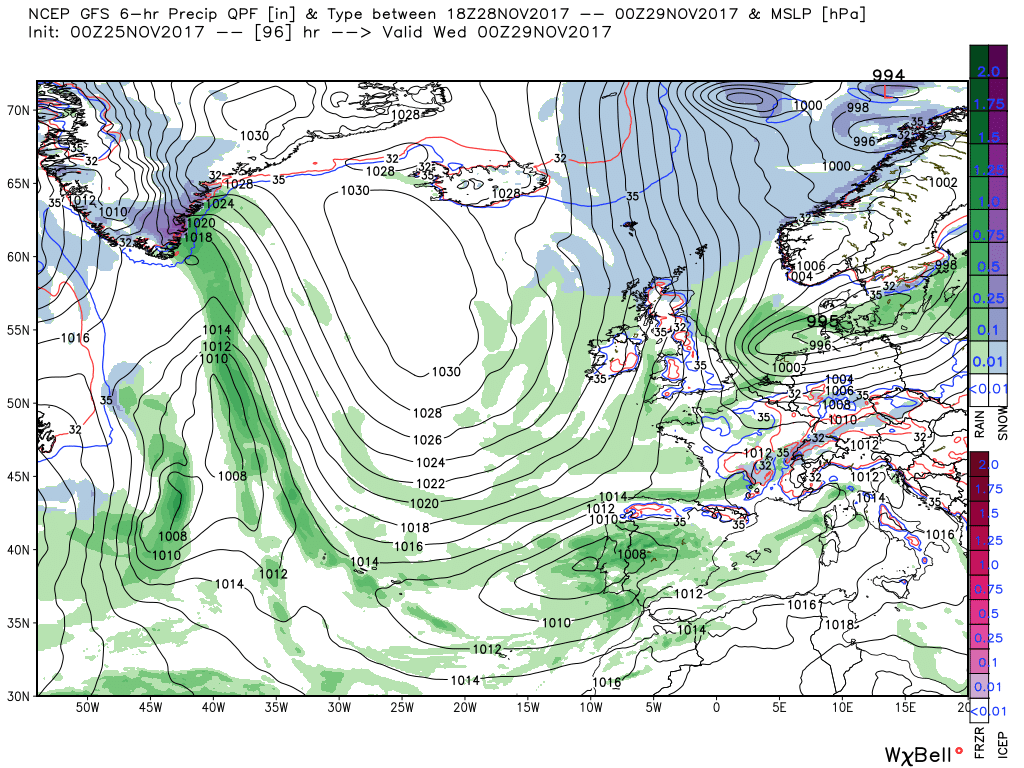
By midnight Wednesday the low has tracked south east into Denmark and with the high pressure amplifying and ridging north in the west the UK is plunged into a chilly northerly. But the main upper trough to the north east is very active and spawns a number of surface lows as it puts the ridge to the west under pressure and by 00 Thursday one of these is tracking south into the North Sea which backs the surface wind across the UK whilst at the same introducing colder air. This could well produce wintry showers further south and thus snow on the higher ground of NW England, Wales, the midlands and the south west.
By Friday midday the low has continued it's journey south into northern Germany and the UK is under a slack northerly drift as the ridge moves in from the west.which would produce a quite severe air frost on saturday morning. All of that of course assuming the detail remains unaltered next week which of course unlikely and o course as yet I've not cross checked it with this morning's ecm
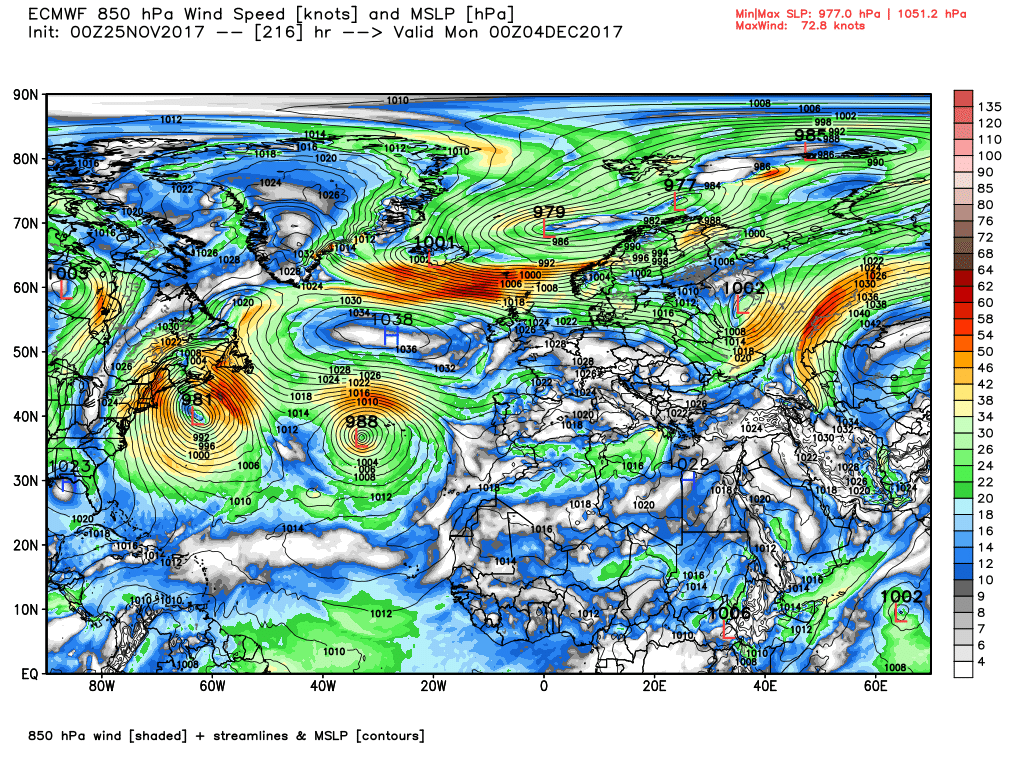
The ecm deviates quite quickly from the gfs. At Monday 00 it has the front starting to impact north west Scotland but it is tracking the wave further south and snow on the high ground in Scotland is on the cards. The front and rain quickly cross the country during Monday and by 12 Tuesday the low has tracked south east into the southern North Sea. With the high pressure amplifying north into Iceland a northerly airflow is initiated over the UK, albeit not unduly cold.
From here until Thursday 00 the low drifts a little south west to be over the Dover Straits whilst the HP to the west ridges a tad north east thus creating a fairly strong north easterly across the UK. This would produce many shower's along the east coast, wintry in the north, and perhaps longer periods of rain in the south east, but the airmass is not particularly cold.
From here the low quickly loses it's identity and the HP becomes more influential.
As a footnote I have to say the latest EC46 is quite encouraging.
Latest model thoughts:
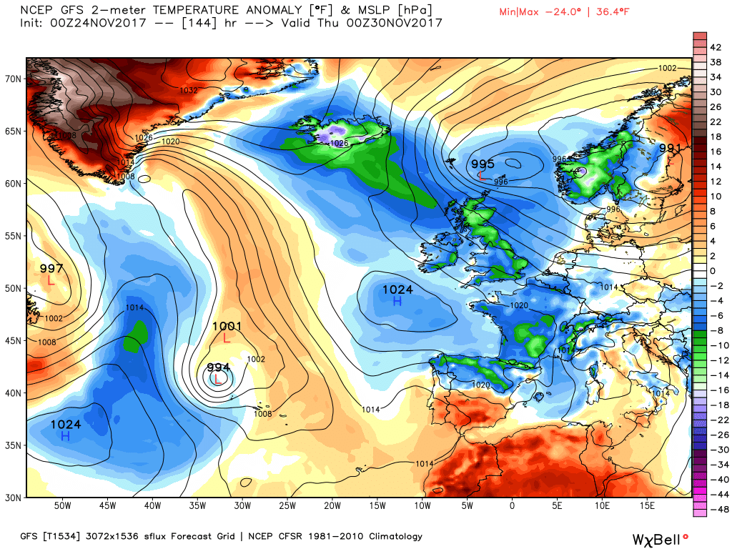
Briefly, Colum; I think it'll be mild by this time next week and it appears that's likely to be it for cold this winter - very mild and wet seems most probable for January and February thanks to a strong La Nina strengthening the jet. I I were you I'd be thinking more about flood protection than heating.Heating on then?
Briefly, Colum; I think it'll be mild by this time next week and it appears that's likely to be it for cold this winter - very mild and wet seems most probable for January and February thanks to a strong La Nina strengthening the jet. I I were you I'd be thinking more about flood protection than heating.
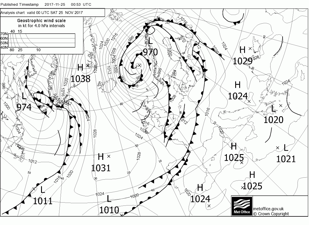
): This weekend is really about a transition into a new pattern which introduces a colder period with some extensive air frosts the middle of next week and, it has to said, this weekend with extensive icy patches this morning. Today the UK is still under the influence of the deep low to the north east around the Norwegian Basin and thus a cold north westerly wind persists which will be quite strong in the north and west (gales in northern Scotland) accompanied by frequent squally wintry showers with just about everything in the mix. These continue overnight but the low is losing it's identity and a transient ridge nudges in from the west on Sunday.
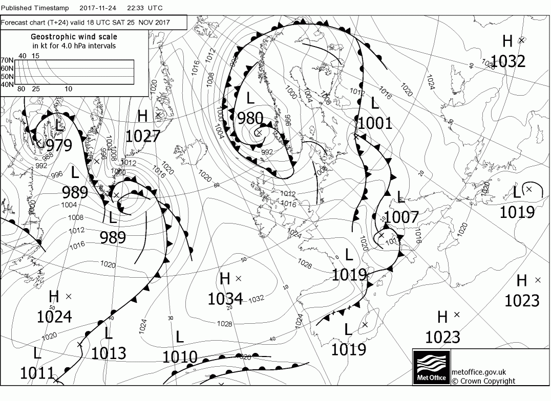
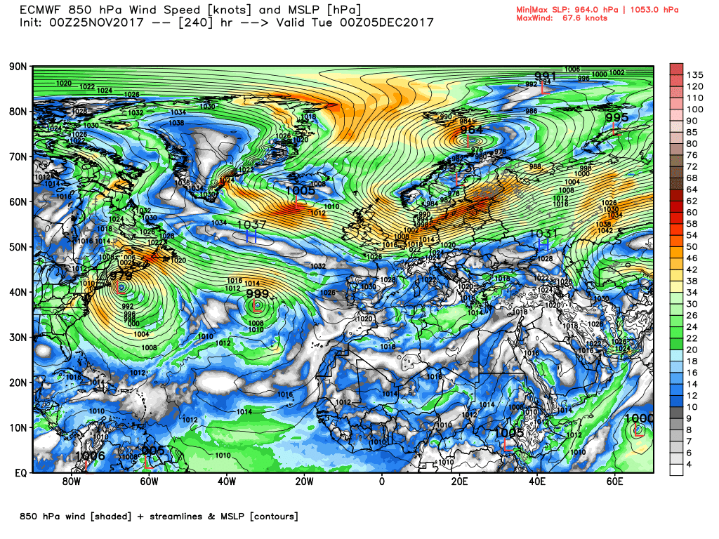
But by Sunday evening a front has tracked in from the north west with rain already into N. Ireland and NW Scotland (perhaps some snow on the mountains in northern Scotland) and by Monday 00 has spread south east with the wave depression 998mb north of Scotland. Over the next 24 hours the aforementioned transition is well underway and the low is east of Scotland and the front just clearing the south coast. At the same time the high pressure to the west is ridging north between Greenland and Iceland. This initiates a strong northerly airflow over the UK with squally wintry showers particularly in the north and down the coasts. This continues until Weds 00 as the low fills and tracks SE to Denmark and the winds abate somewhat over the UK, particularly in the south facilitating freezing conditions.
In these northerly regimes there is always the likelihood of small perturbations occurring in the flow and the gfs has one such tracking south early Thursday which could bring some quite inclement weather to the east coast, Not forgetting extensive wintry showers in the north and west either and a pretty severe frost through the spine of the UK
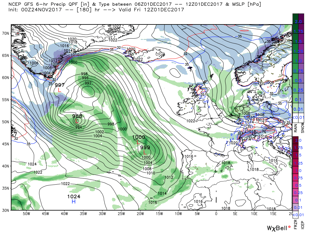
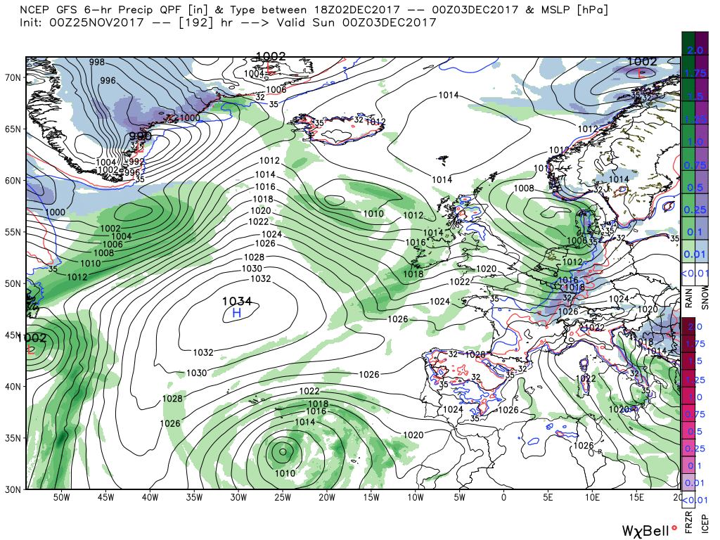
The cold northerly continues to abate over Friday as a transitional ridge moves in from the west and by midday Saturday temps are back to normal in a light north westerly. I say transitional advisedly as from here things get a tad messy. The Canadian lobe has ejected another trough which tracks quickly east dissecting the ridge whilst the trough to the east has spawned a shallow low in the North Sea. Essentially this would appear to open the door to the Atlantic and relegate the high pressure to a watching brief to the south west but I think best left here as I don't believe a word of it without substantial support from elsewhere
Anyway putting aside the fine detail the ecm is pretty much in the same ball park as the gfs up until the weekend. here it diverges although it does nod in the same direction as the gfs and has energy shooting out of north east North America across Greenland which does flatten (not through though) the ridge quite quickly and eventually relegating the high pressure to the south west. This allows the Atlantic a route and allows troughs to track east from the north west which could well produce gales in the north whilst returning temps to around normal.
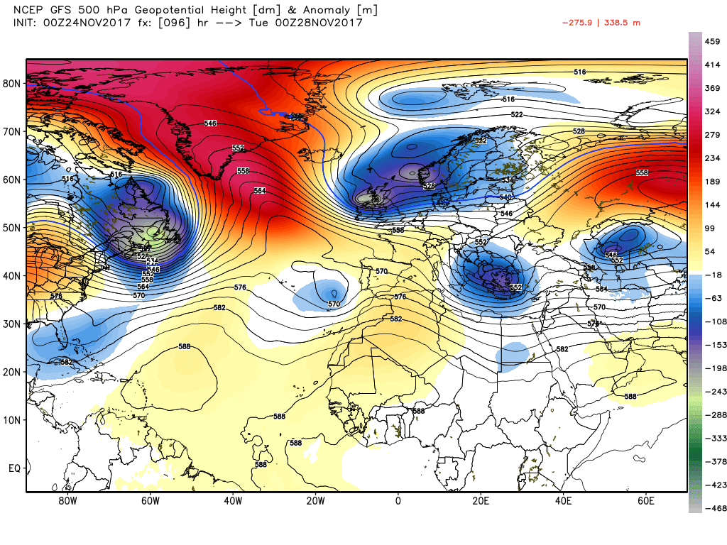
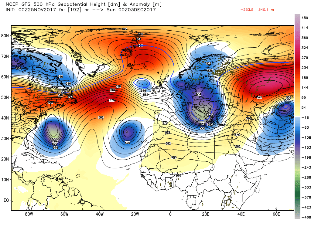
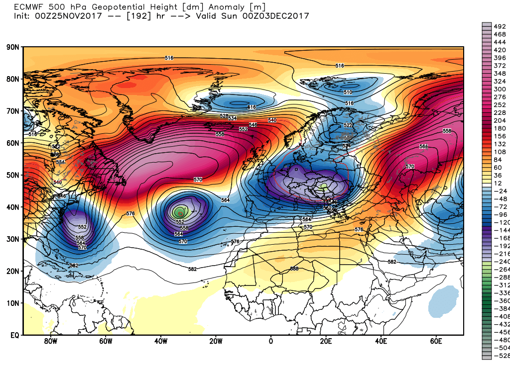
This one of the possible scenarios that one could deduce from last night's anomalies