- Messages
- 2,549
I'm starting to hope for a couple of rain free days, getting harder to get up the drive on a daily basis at the moment.

There is quite a lot of interest over the coming weekend meteorologically speaking so I hope its okay to extend the remit of the thread a tad to save ending in the middle of the transition. Apologies if it's not.
It's difficult to integrate the narrative so for simplicities sake I'll deal with a couple of the important issues separately.
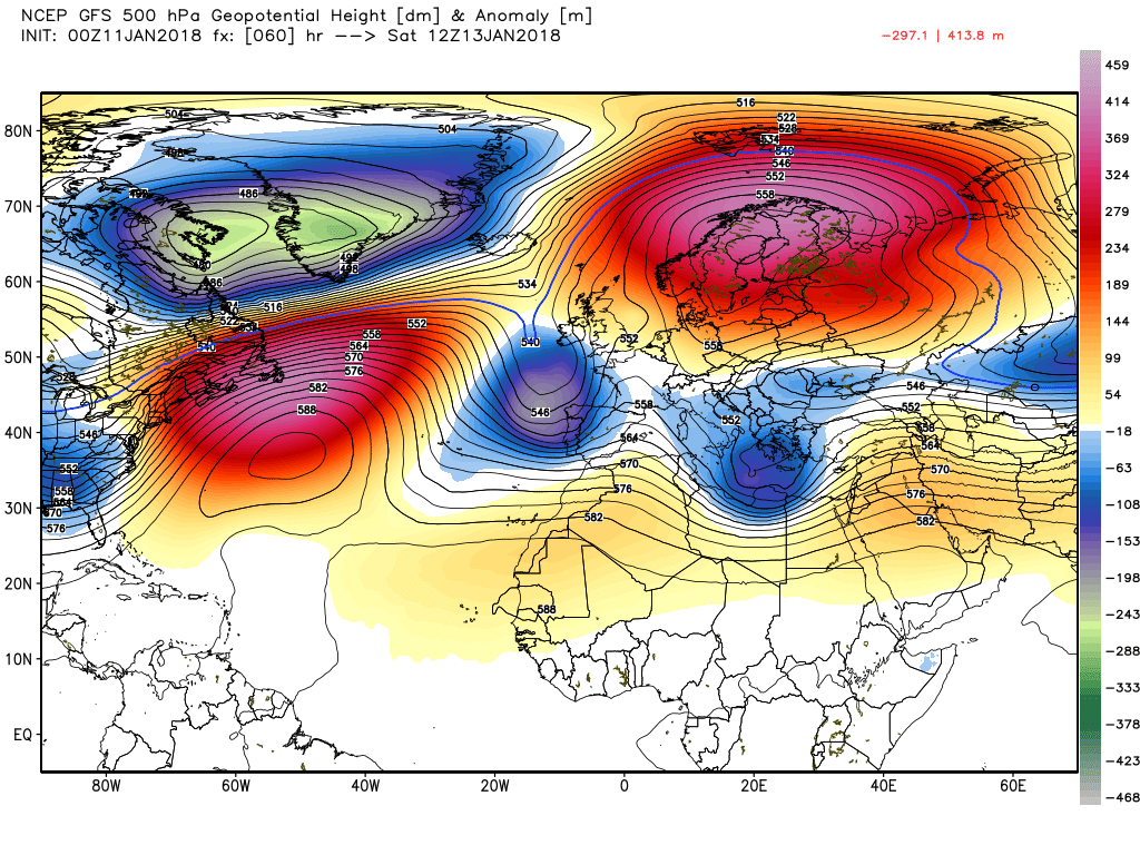
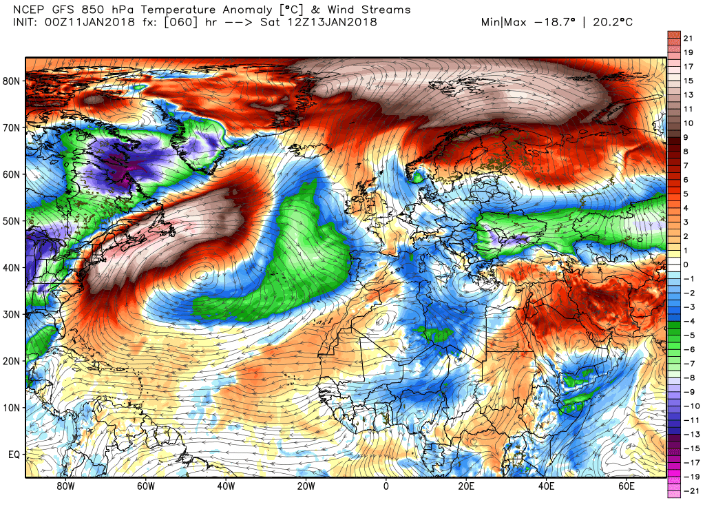
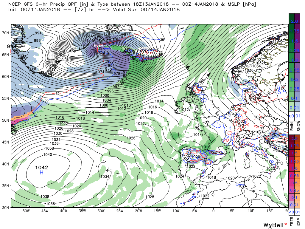
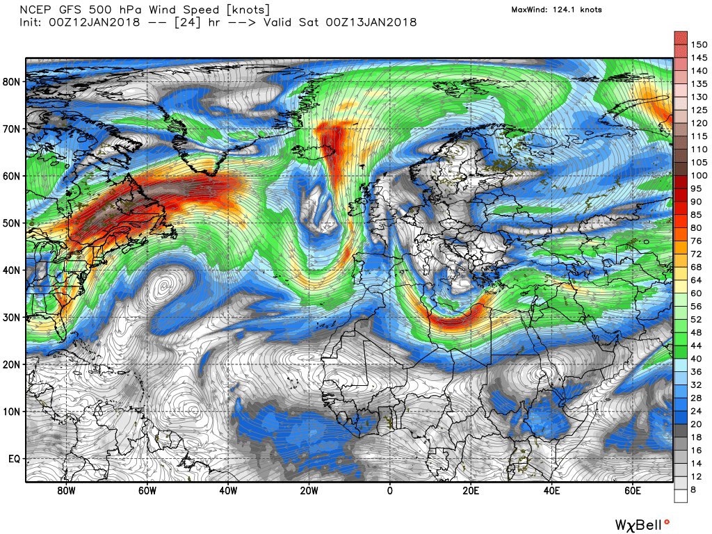
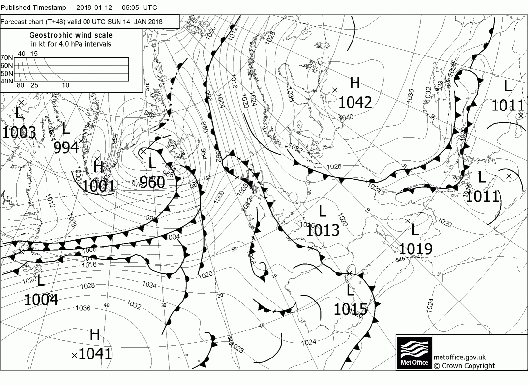
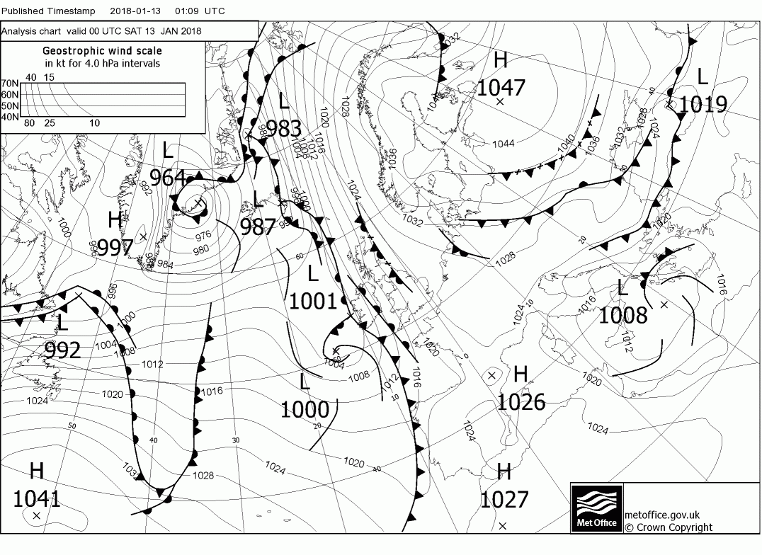
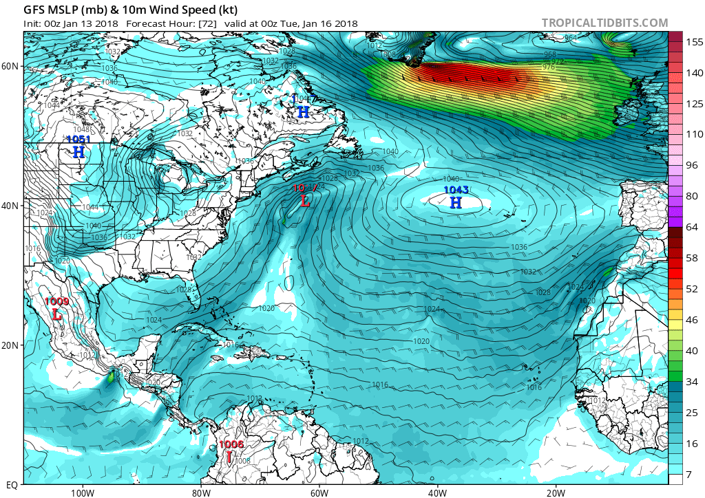
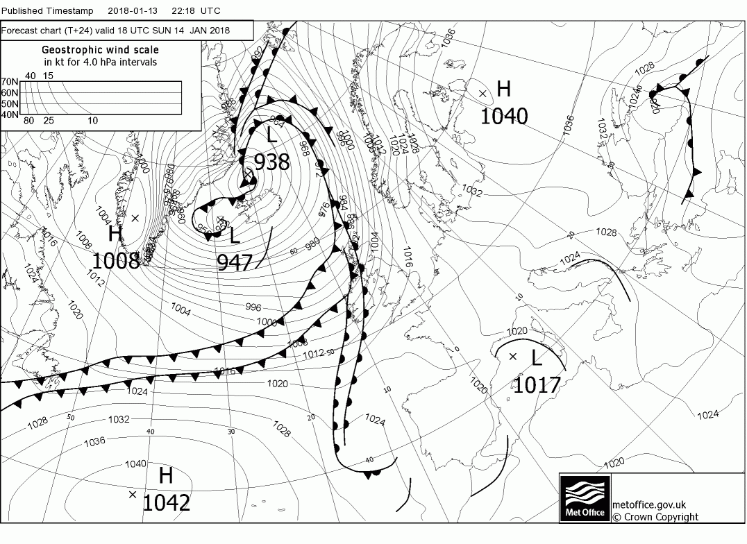
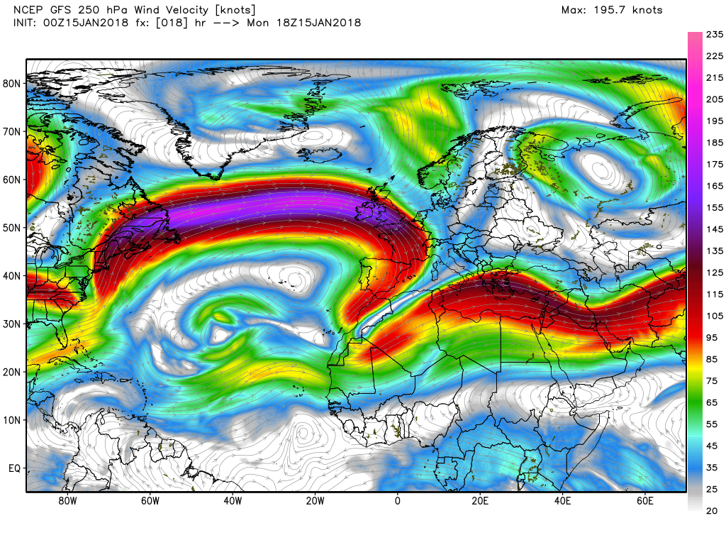
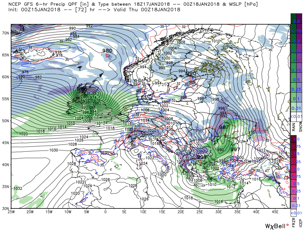
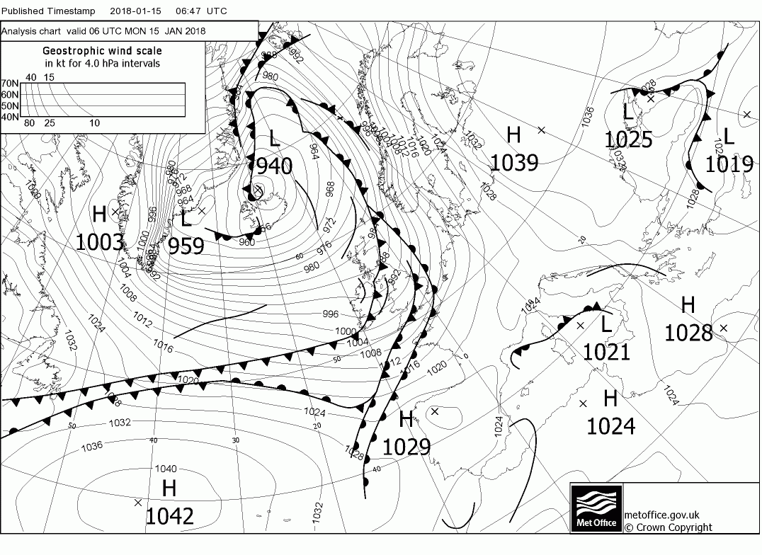
By 12 Saturday there is a huge amount of moist air and WAA taking place around the north east coast of North America and the tip of Greenland as the air is transported around the Bermuda high pressure. With the cold Arctic air to the north west we have a baroclinic zone and a breeding ground for cyclogenesis which is precisely what takes place with the resulting very powerful jet.
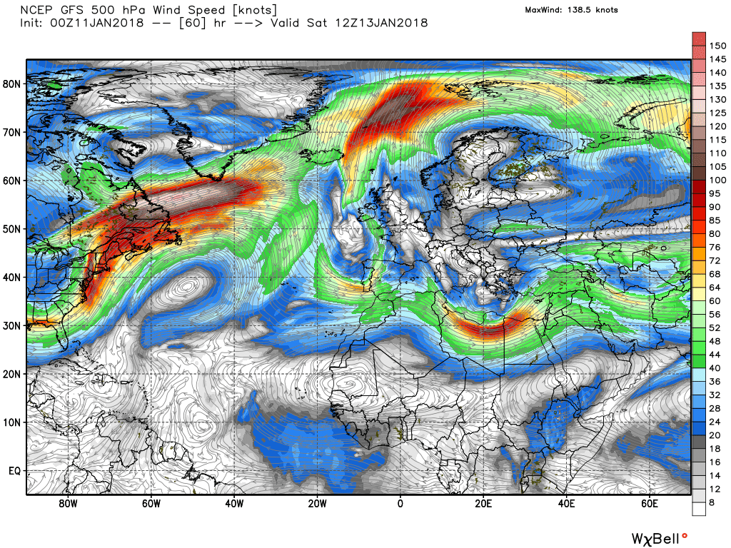
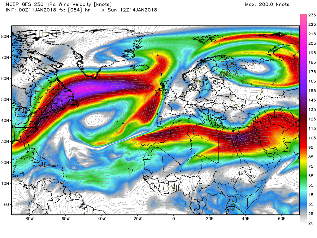
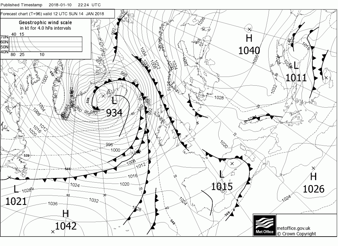
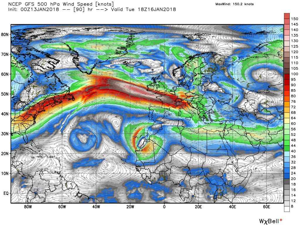
The result of all this on the surface can readily be seen with the rapid formation of a very deep depressions one of which moves east to Iceland over the weekend as the jet realigns and the colder air/trough also heads east which heralds the breakdown of the block over the UK with the jet in the region of 200kts.
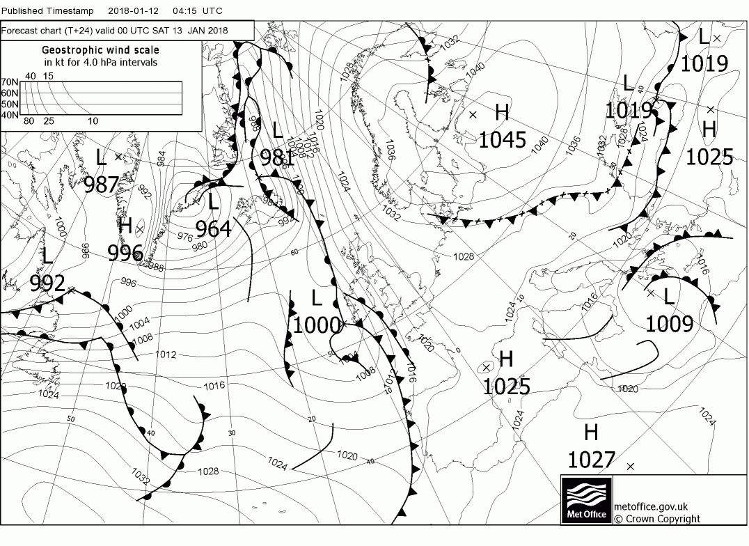
Whilst all this is going on it's a relatively quiet weekend over the UK as the block is still holding initially. Thus we have the front edging east on saturday stalling with the rain becoming intermittent in western parts whilst the rest of the country remains dry,
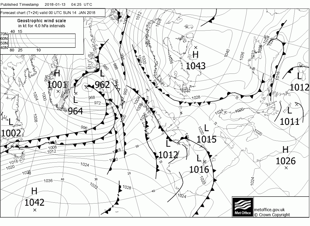
But by Sunday fronts and rain are beginning to affect the north west and they proceed to track south east under the massive pressure already discussed above and by Monday the block is no more.

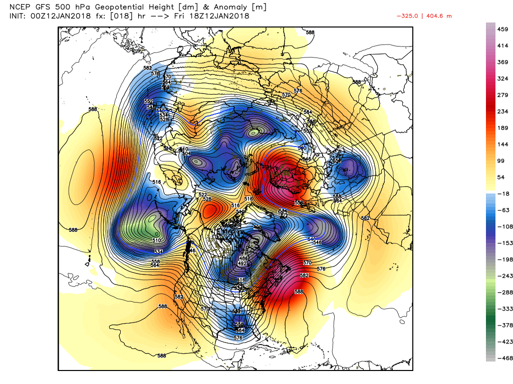
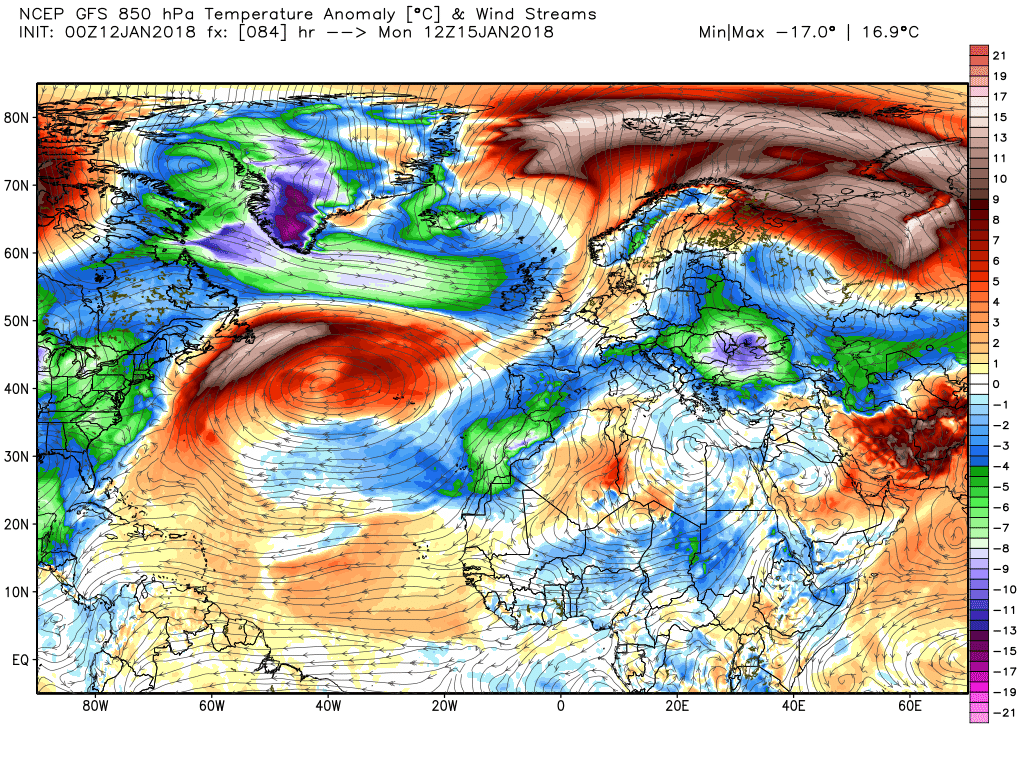
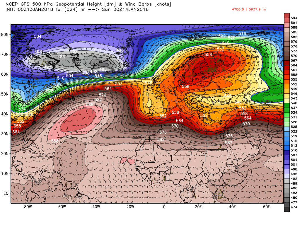
As I pointed out in my medium term anomaly update posted yesterday evening in the ramp thread it would appear that our upcoming weather will be greatly affected by the Canadian vortex lobe taking a hike east, facilitated by the Pacific jet and ridging in north west North America, Best and quickly illustrated here by a couple of NH charts this morning.
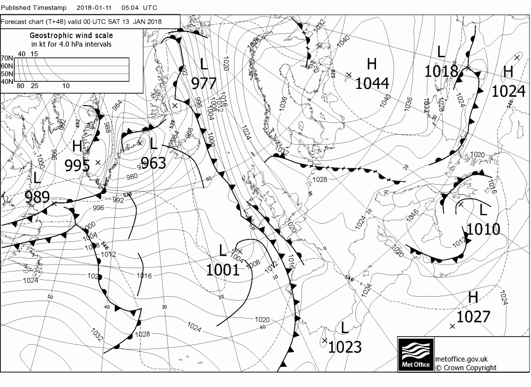
That's the overall picture so following on from yesterday morning's post a bit more detail. By midnight tonight the Atlantic upper trough is deconstructing as it hits the still effective block to the east with the shallow surface low and fronts virtually stalling over Ireland whilst the main trough over north east Canada is on the move east with a very strong thermal gradient in place as the Bermuda high pushes north.
Wind forward 24 hours and most of the UK is in a col as the front is still faffing about in the west but stronger winds are starting to impact the north west as the evolution the the west and north west gets into gear. In a nutshell the trough has continued it's movement east initiating some very rapid cyclogenesis in the Iceland are and realigned the very strong jet which is in the region of 200kts.
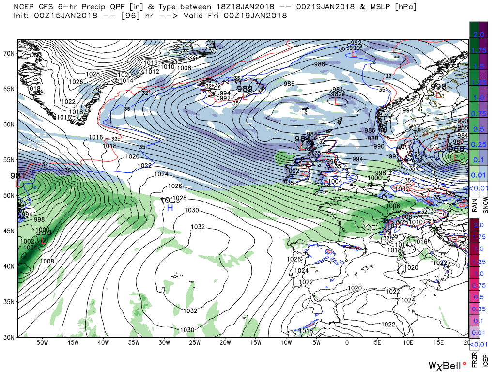
So now the transition to the next phase is well under way with the energy and colder air associated with the lobe tracking east rapidly impacting the UK from the north west with fronts and rain moving south east through Sunday/Monday before clearing. All of this accompanied by strong winds veering north westerly on Monday with frequent wintry showers
As previously mentioned my thoughts on the medium term are in the ramp thread One thing worth noting but outside the remit of this thread is that the major upper trough to the north west does drag in some Am air.
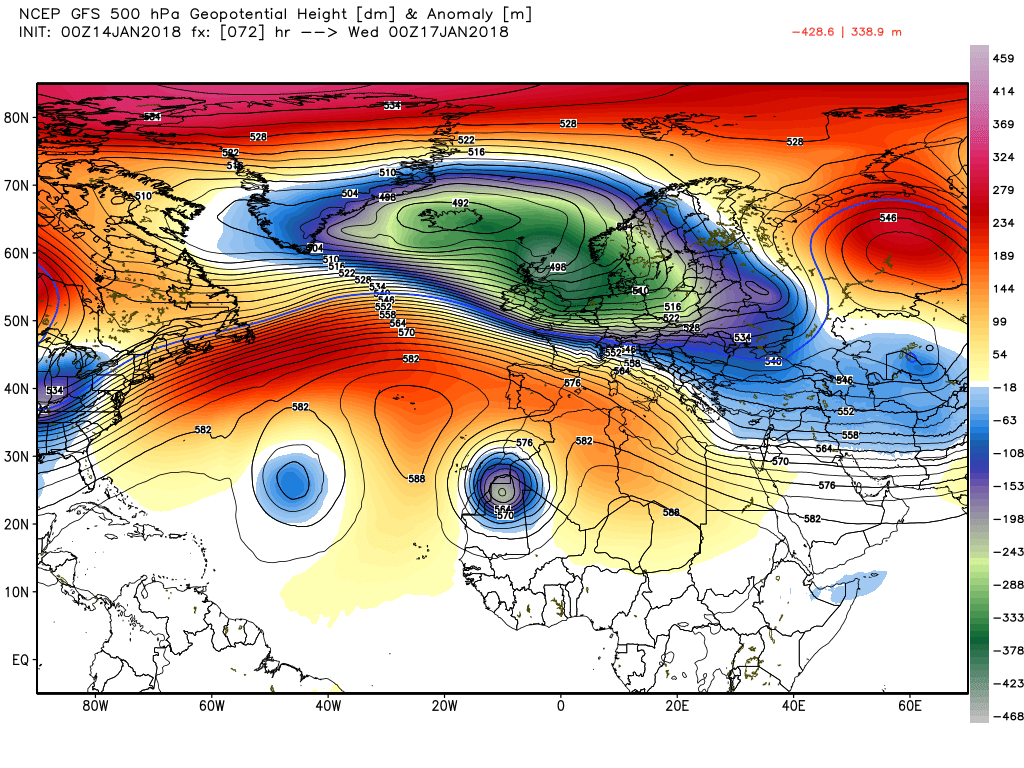
06z GFS continuing the protracted cold outlook, we still get the amplification from upstream from around day 7 which allows a ridge to build north toward Iceland next weekend and results in a N or NEly flow, -10C T850 into Scotland by day 10. GFS breaks down the cold from the west thereafter, but in low res, so wouldn't worry at that range, particular given ens support for ridging to maintain near Iceland area out to day 15.
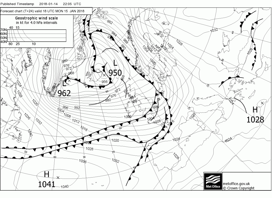
As John has mentioned we have now arrived at the transition to a much more volatile period of weather with the likelihood of a bit of everything. And this weekend is the start of the transition. With this in mind there are two or three aspects worth noting.
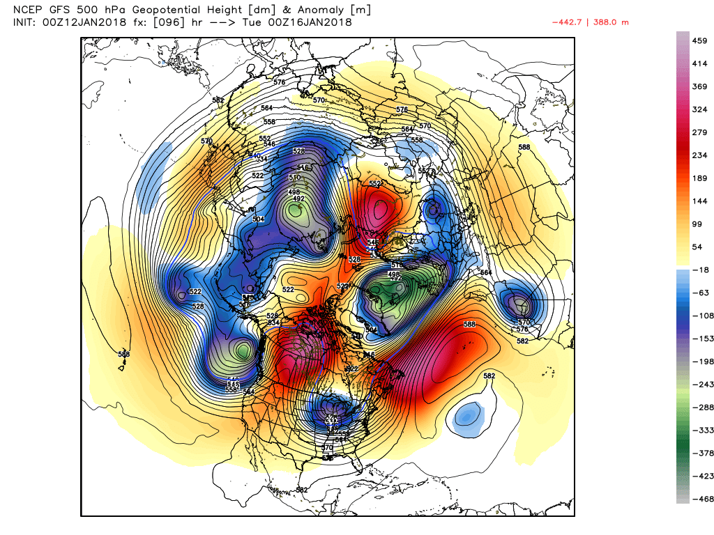
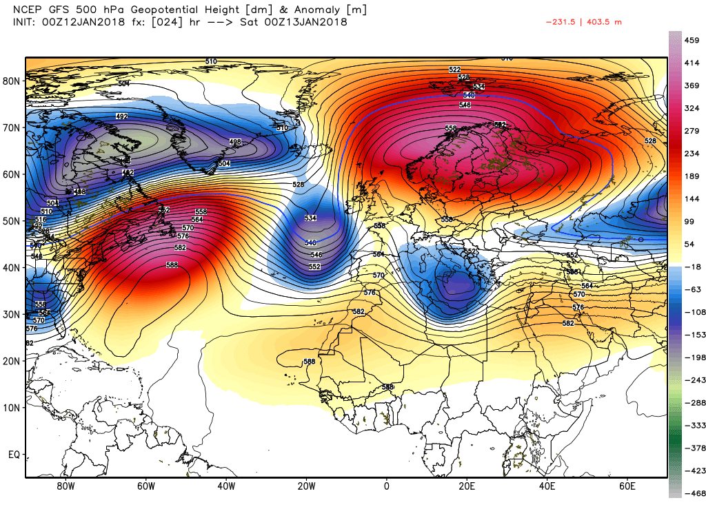
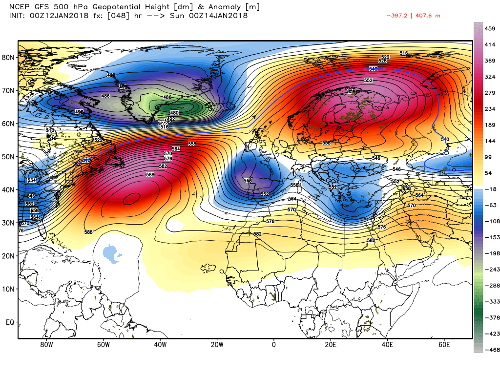
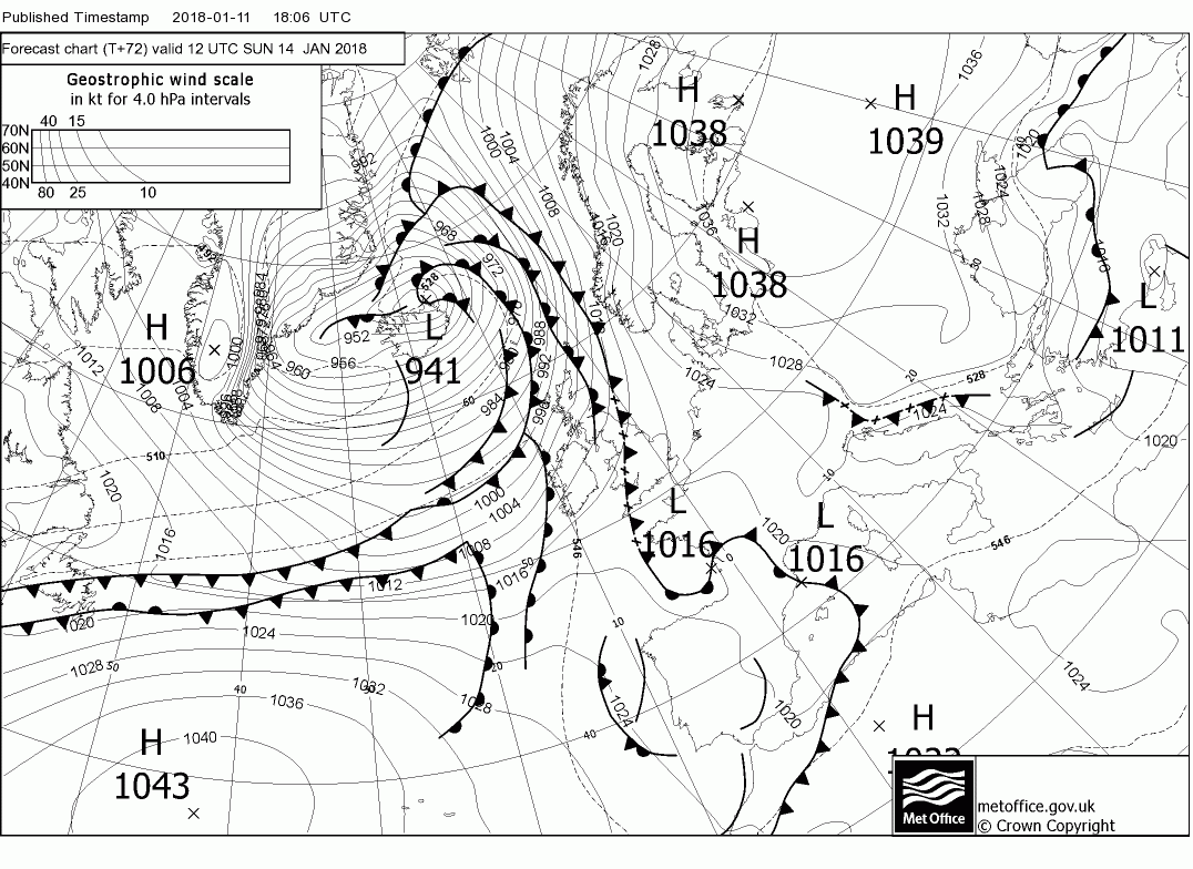
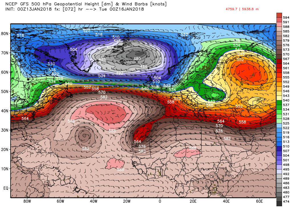
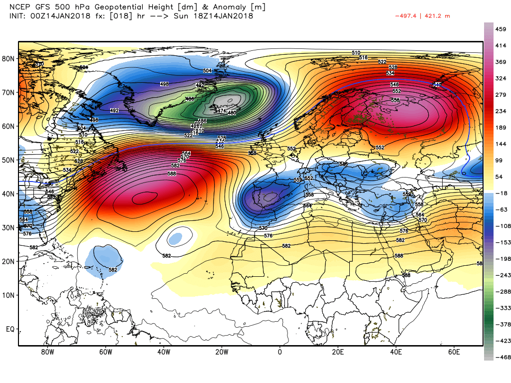
Firstly, a glance at the 500mb field showing the height in decametres (10s of metres) of the 500mB pressure level, with lower figures indicating areas of low pressure (lower heights) for Sunday 00 and Tuesday 00 indicates that the segment of the vortex, now the intense upper trough to the north west, is poised to duck south east over the UK, along with the much colder Pm Polar maritime airmass see https://www.metoffice.gov.uk/learning/learn-about-the-weather/how-weather-works/air-masses/types.
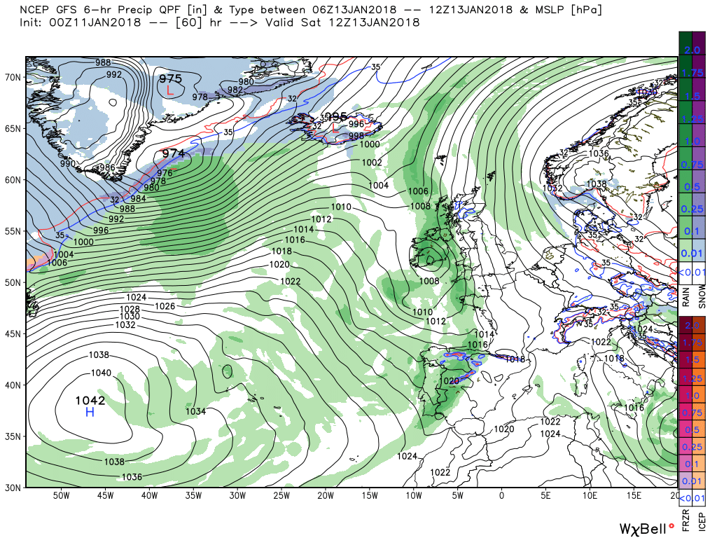
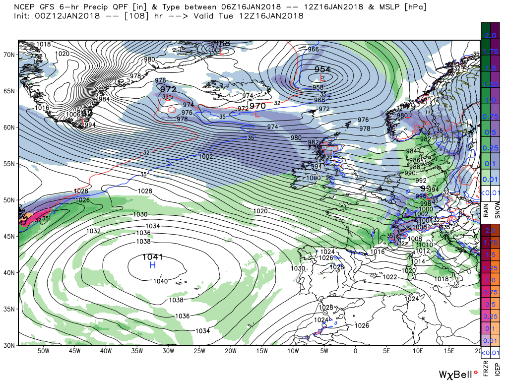
The other aspects involve the detail over the weekend. First the shallow low and front(s) just to the west are going to lose their identity and stall over the western regions over today with the rain eventually petering out but not until maybe 20mm or so has fallen in places.(currently moderate rain here)
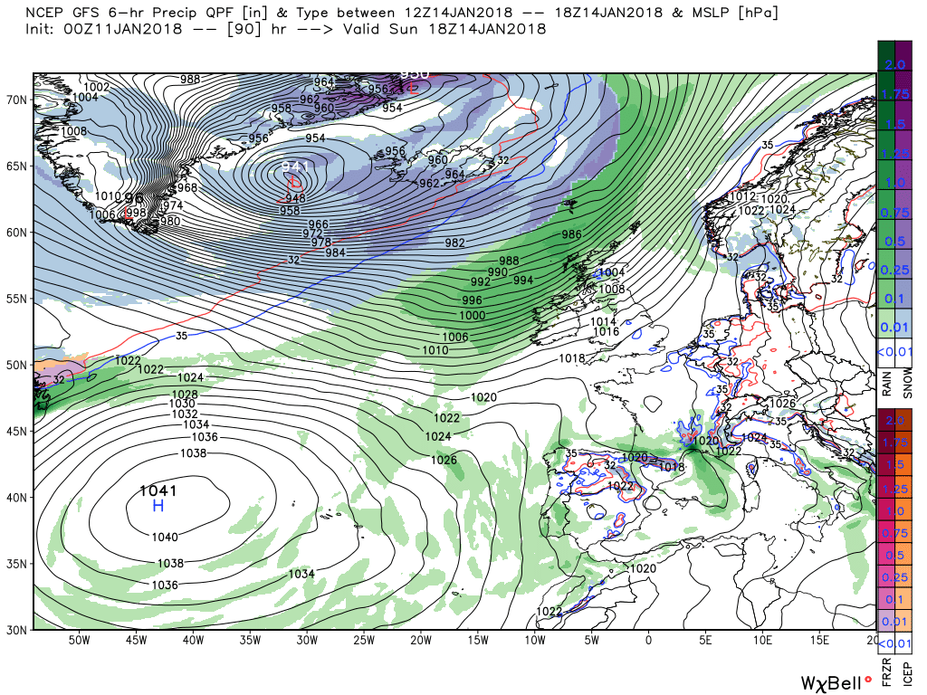
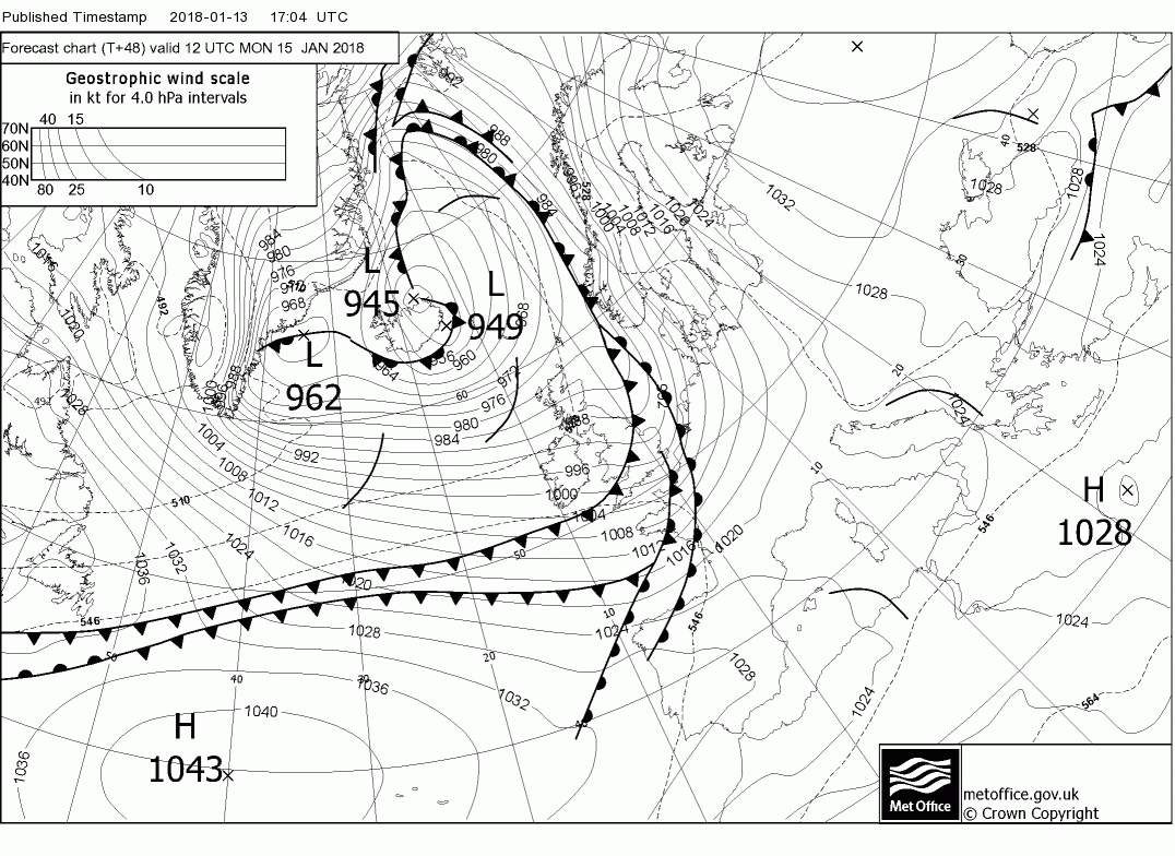
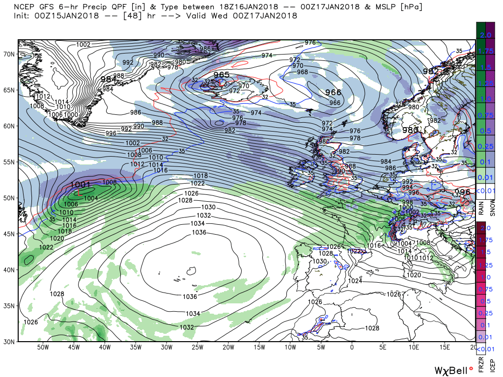
Secondly, and more importantly regarding future events, by Sunday 12 the deep surface low associated with the aforementioned upper trough is now in the Iceland area with it's associated fronts just impacting the north west of Scotland They continue to track south east during the day and overnight before clearing the south east by 12 on Monday. Thus over the24 most places will receive a fair amount of rain, perhaps some snow on the mountains.
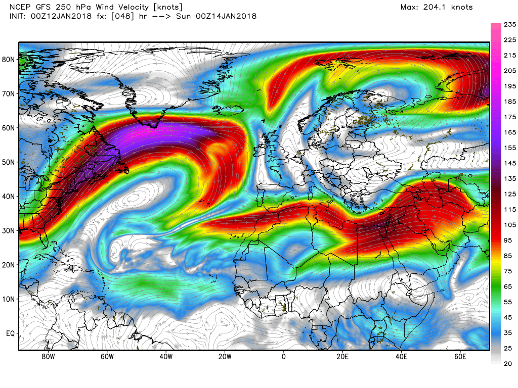
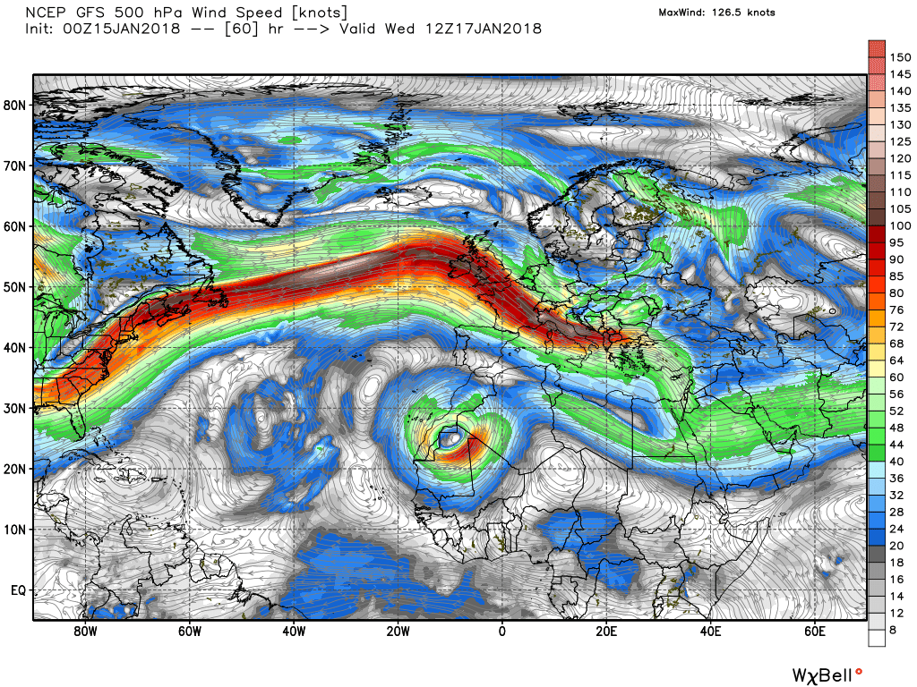
But the unfolding scenario behind the passage of the front(s) becomes centre stage now, A very cold and strong WNW wind is now in place, perhaps gale force along western coasts, with frequent squally wintry showers which could include thunder hail, snow and even rain. Predominately these will affect western and northern areas but also could spread a fair way inland. Also, as can be seen, the alignment of the jet is slowly changing to a more ESE direction as the upper trough tracks south east as indicated earlier.
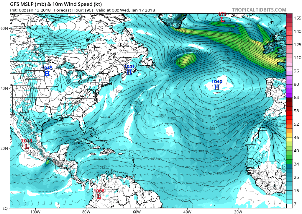
The alignment of the jet, courtesy of the positioning of the high pressure to the south west and the aforementioned trough is important because it dictates the direction of travel of the low that has formed of the eastern seaboard and is winging around the high pressure towards the UK. A track which this morning's gfs has adjusted a tad north

An area of rain will remain slow moving over Cornwall throughout Saturday. This will be heavy at times with 20-30 mm of rain building up over parts of the county, much of this falling in 3 hours in some places. There is also the chance of 40 mm in a few spots.
Attention BM - Met Office warning for rain in Cornwall due to the stalling cold front:
Thanks for the heads up Chris, been raining at a steady rate all day but looking at the sky it looks like it could get worse . P.Attention BM - Met Office warning for rain in Cornwall due to the stalling cold front:
We're going to get it later tomorrow and through much of Monday, though I don't think we're going to have as much as you're getting.Thanks for the heads up Chris, been raining at a steady rate all day but looking at the sky it looks like it could get worse . P.
Yesterdays front which hung around western regions has finally dissipated, not before dumping 30mm of rain down here, leaving a mainly dry day with perhaps some sunshine in most areas. The exception being the far north west where front(s) associated with the deep upper trough over Iceland will impact the Hebrides by 12 and move south east bringing some heavy rain and strong winds to Scotland and N. Ireland.
The front(s) and rain will continue their journey south east overnight and though tomorrow thus bringing rain and increasing wind to most places before clearing the south east around 1800 tomorrow,. In their wake the surface wind will veer WNW introducing a much colder airmass which initially bring frequent wintry showers of snow, hail, thunder as well as rain to western and northern areas with snow starting to accrue in the north.
This scenario continues through Tuesday with the wintry showers progressing further inland and the snow showers further south thus lying snow becoming more widespread.
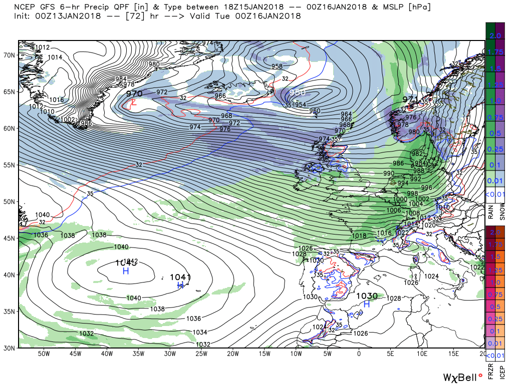
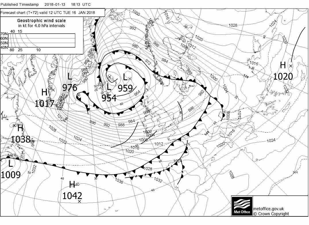
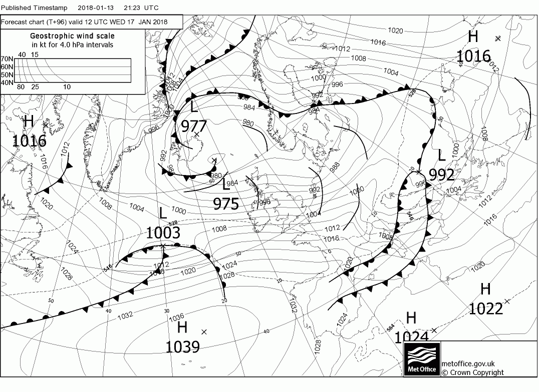
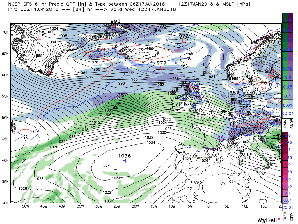
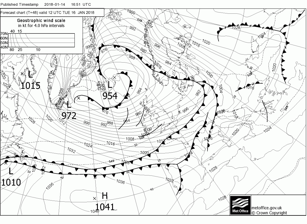
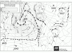
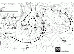
Overnight Tuesday into Wednesday some subtle changes take place as the upper trough to the north east and the high pressure to the south west slightly alter their alignment resulting in the surface wind veering north west whilst at the same time the wave depression that originated off the eastern seaboard is tracking quickly east around the high and is at 30W by 1200 Wednesday. But there is no agreement on the position of the wave and , in particular the depth and track as can be seen by a quick glance at the fax and this morning's gfs.
Outside of the remit of this thread but the latest fax has the low 968mb northern Germany at 1200 Thursday but this is still along way from being a done deal.
The front and rain that has been tracking south east overnight will clear the SE during the day leaving clearer, colder conditions in it's wake as the wind veers.WNW. But this will be accompanied by much stronger winds, with perhaps gales in places along western coasts and frequent showers in the same areas, mainly of rain but turning to snow in the north. Worth noting the jet winging across the Atlantic as it reaches around 200kts.
Overnight tonight and through Tuesday the colder air becomes more established across the UK with a continuation of the very strong WNW winds, reaching gales force in places, and frequent squally showers with the snow showers moving further south with lying snow reaching lower levels in the north.
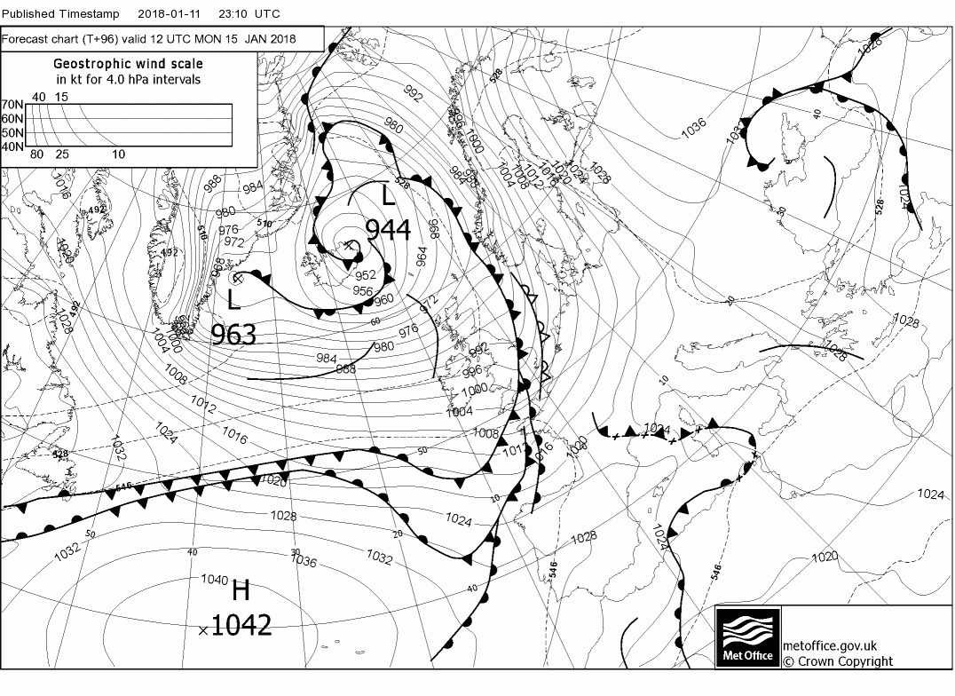
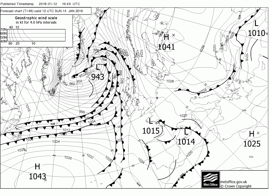
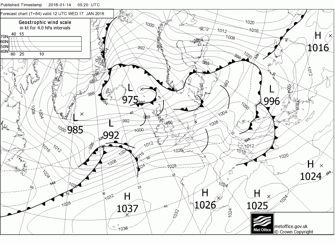
By midnight Wednesday the strong winds over the UK have veered more to the north west as the main players the upper trough and the Azores high pressure realign a tad whilst at the same time the eastern seaboard low has appeared on the scene north east of Newfoundland 1001mb. Over the next 24 hours it tracks rapidly ENE on the very strong jet and deepens very rapidly to be 965mb over western Scotland by midnight Thursday. This potentially could bring a fair amount of snow in the Scottish mountains and, more to the point, gales with winds gusting in the 75kt region across N. Ireland and northern England as the low tracks quickly into the North Sea. I say potentially because any alteration the the track and intensity in the interim could still change the detail
In the wake of the low the UK is back in a cold, showery north westerly airstream as the the Azores begins some transitory ridging in mid Atlantic but that's for another time.
The ecm not in agreement still with the gfs vis the handling of the low. More or less the same position Thursday midnight but the center is around 10mb higher and it doesn't clear into the North Sea quite so quickly and perhaps a tad further south thus the swathe of stronger winds, after initially affecting N. Ireland. may well be NW over NW England and Wales gusting in the 65kt region during the early hours of Thursday. But the detail of this will probably not be settled until late in the day.
For your area, possibly. Johnny, probably. Me and BM, no!Snow? Maybe Snow? Iddy biddy lil chance of snow?