OP
- Messages
- 6,299
- Location
- Norfolk, England
- Thread Starter
- #1,201
Meanwhile, away from the frozen North, it's dry and bright here as the sun sets.

Blanket, shovel, snow chains and a ridiculously thick bright red down jacket are my standard winter kit when snow is in the offing
Which, together with the statutory top hat and wicked leer, should present a suitably gothic and Countly image !
JohnnyO. o/

...and a suspiciously large cigar...Ah yes, before I started compensating for baldness with ever bristlier moustaches.
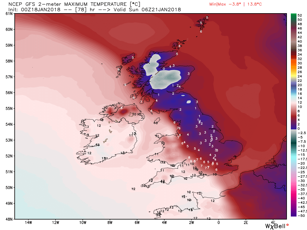
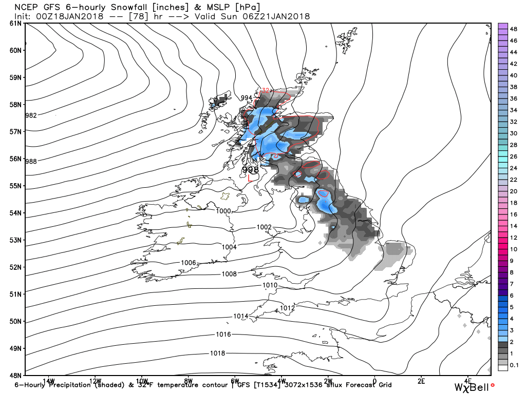
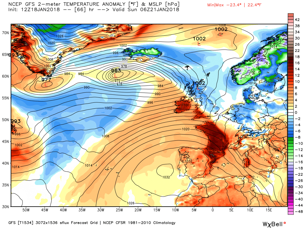
According to the Icon the position of the low at 0200 with the main rain belt through England and Wales with snow N. Ireland northern England and southern Scotland The strong wind band over Wales, the Midlands and the south.
The winds will veer during the track into the North Sea and perhaps strengthen in the east of England.

Seriously? I was going to quote another post of his discussing prospects towards the weekend, but I could stop if you'd prefer.That guy's as bad as The Liam, Chris. Going right off him.
JohnnyO. o/
Seriously? I was going to quote another post of his discussing prospects towards the weekend, but I could stop if you'd prefer.
He's just saying that to appear civilised, Chris. He thinks Liam et al sit around in feathers and paint burning strange incenses and chuckling about how cold and wet JohnnyO will be today! I think he still suspects you of the same, there's just no telling him I'm afraid.Just jesting Chris ... I promise I do know that these guys just do their best to forecast weather patterns, not cause them !
JohnnyO. o/
Oh woad is thee!It's woad they wear Count, woad I tell thee !
JohnnyO. o/
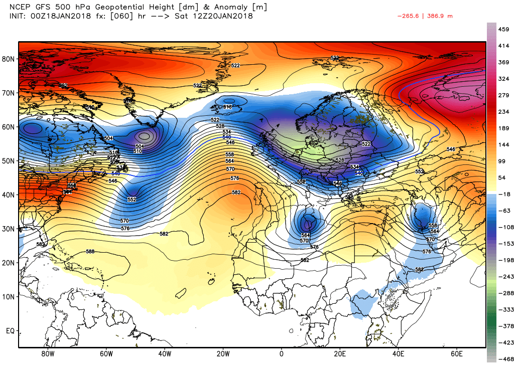
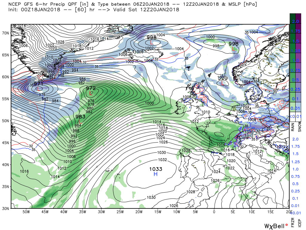
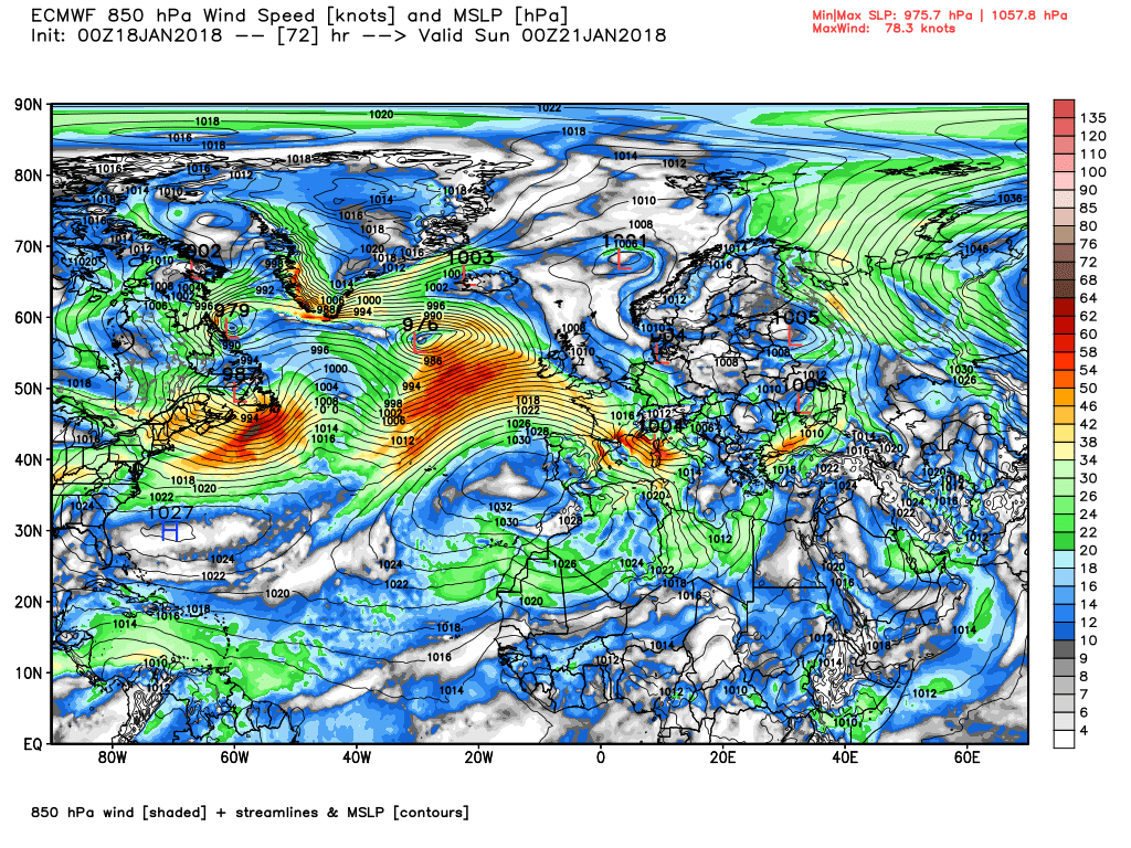
Once the storm has had a final flourish this morning as it move rapidly into Poland and points south east the next couple of days can be best summed up by saying the upper trough that has been so influencing our weather will slip slowly south east and by 12 Saturday be in the this position with some transient ridging to the west. But as also can be seen the next troughs are leaving the North American coast courtesy the two energy flows, one from the Canadian vortex lobe and the other across the southern US.
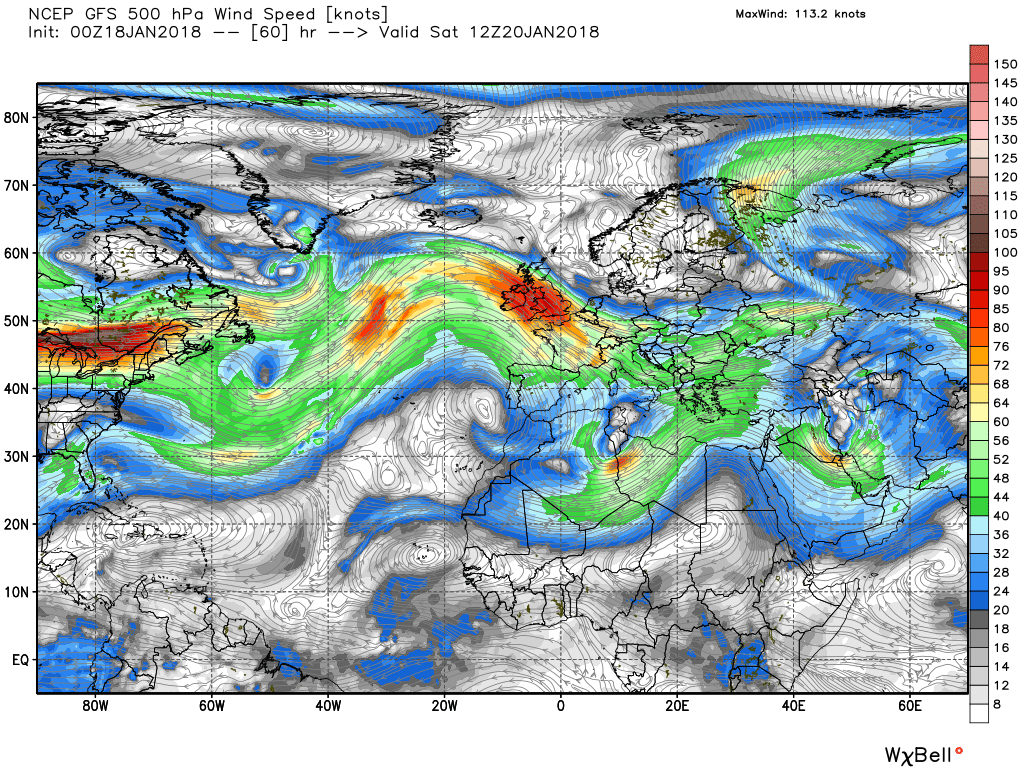
So what does this mean on the surface? This morning still very strong winds down the eastern side of England, perhaps gusting 75mph in coastal ares and reaching violent storm 11 in the North Sea before the low departs, Elsewhere back into the unstable north westerly and squally showers with hail in the mix, mainly down down western areas and more frequent the further north you go. This will continue overnight and into to tomorrow with more wintry stuff in the form of snow in the north west as perturbations form in the flow
But by 12 Saturday as the upper trough slips south east there is a very slack area of low pressure to the north and east of the UK which is under a transient ridge and quite cold air, whilst out to west the systems associated with the aforementioned upper troughs are tracking north east and the warm front associated with one low is now orientated southern Ireland to Cornwall.
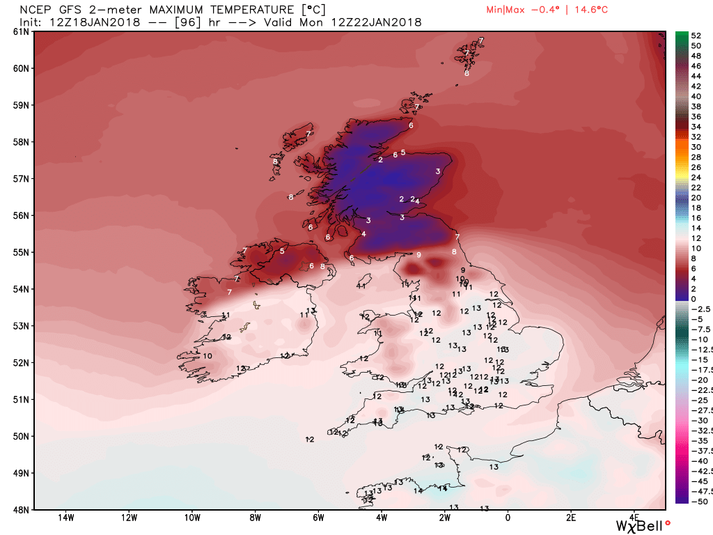
As the the front continues to track north east it will bring rain to most but could well be of snow in the north and in Scotland with much milder air in it's wake.
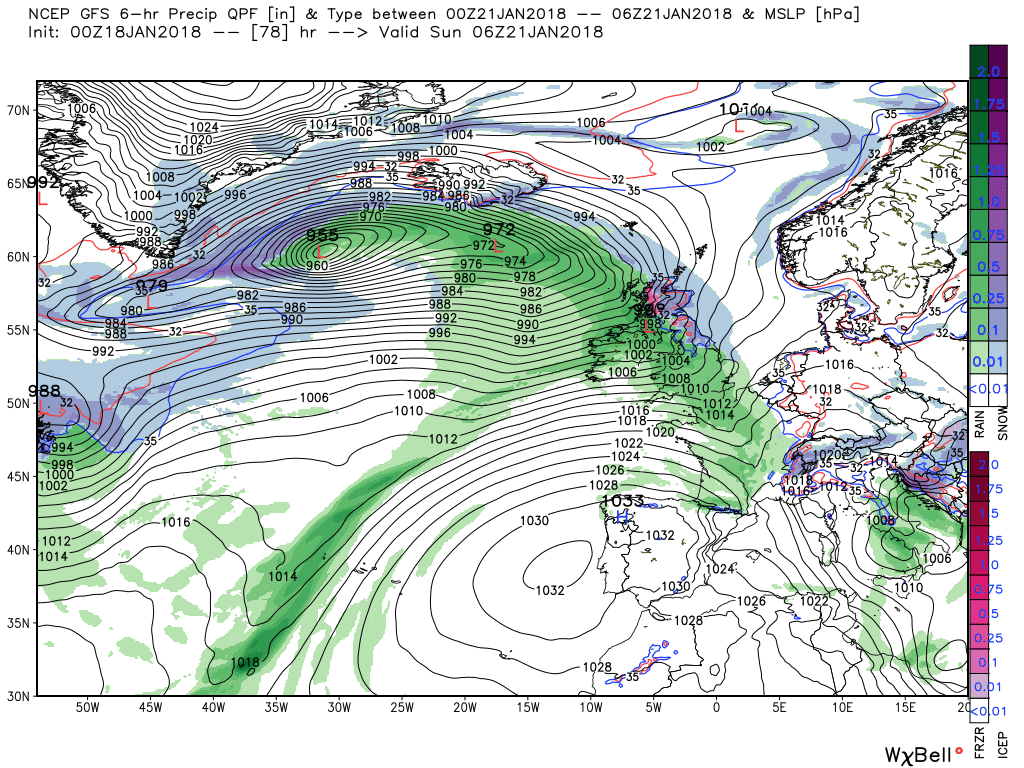
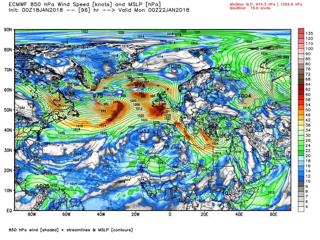
The ecm also has snow on the leading edge early Sunday but it also forms another wave in the southern quadrant of the main low to the west of Ireland which is 990mb over NW Ireland by Monday 00 en route across norther Britain. Thus more rain and quite possibly more gales.
Showers will continue overnight and through tomorrow again concentrated in the west and particularly the north west.
Late Friday and into Saturday morning a frontal wave will form on the approaching front and pop south east and bring rain to the far south west
The aforementioned front will continue to track north east bringing rain to most parts overnight saturday/Sunday but perhaps some snow in Scotland and the north as it meets the colder air.
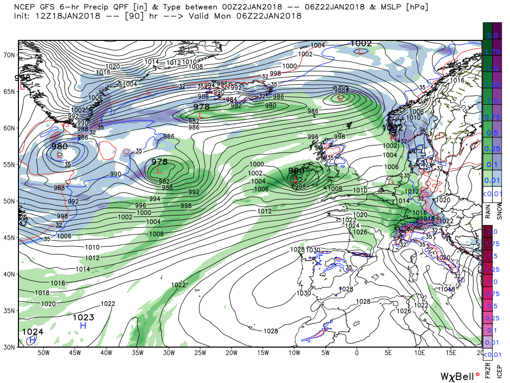
By 00 Monday the front is in the North Sea but after some very brief ridging the next low is on it's way driven by the east bound energy and is duly over Ireland 990mb at 06 on Monday bringing more rain as it duly traverses the country en route to the North sea.
But it also drags in some very warm air and a marked thermal gradient latitudinally across the UK

More rain! At least it's not snowing down hereEvening discussion:
P.