- Messages
- 2,549
Ice and snow for me with a traffic jam on the way to work to top it off

I do count myself lucky to get away with only rain and windIce and snow for me with a traffic jam on the way to work to top it off
")
Sounds nasty, Colum - it'll be milder across the board by Monday, but your area might be wet and possibly windy for a while, I think. In the interim, however, the Met Offfice have an amber warning for Southern and Central Scotland:Ice and snow for me with a traffic jam on the way to work to top it off
Between 07:00 Fri 19th and 22:00 Fri 19th
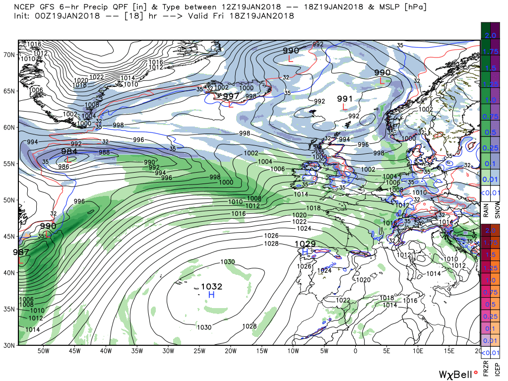
Snow showers will become heavier and more frequent early on Friday and will continue on and off through the day. One or two spells of more persistent, heavy snow seem quite likely, although amounts will vary from place to place. A gradual improvement seems likely during the late evening. Travel delays on roads are likely, as are public transport cancellations. In some places vehicles may become stranded. There is a chance of power cuts, while services such as mobile phone coverage may be affected. Some rural communities may be cut off.
There is a fair bit going on weather wise over the next few days so need to restrict the waffle and keep this reasonable succinct.
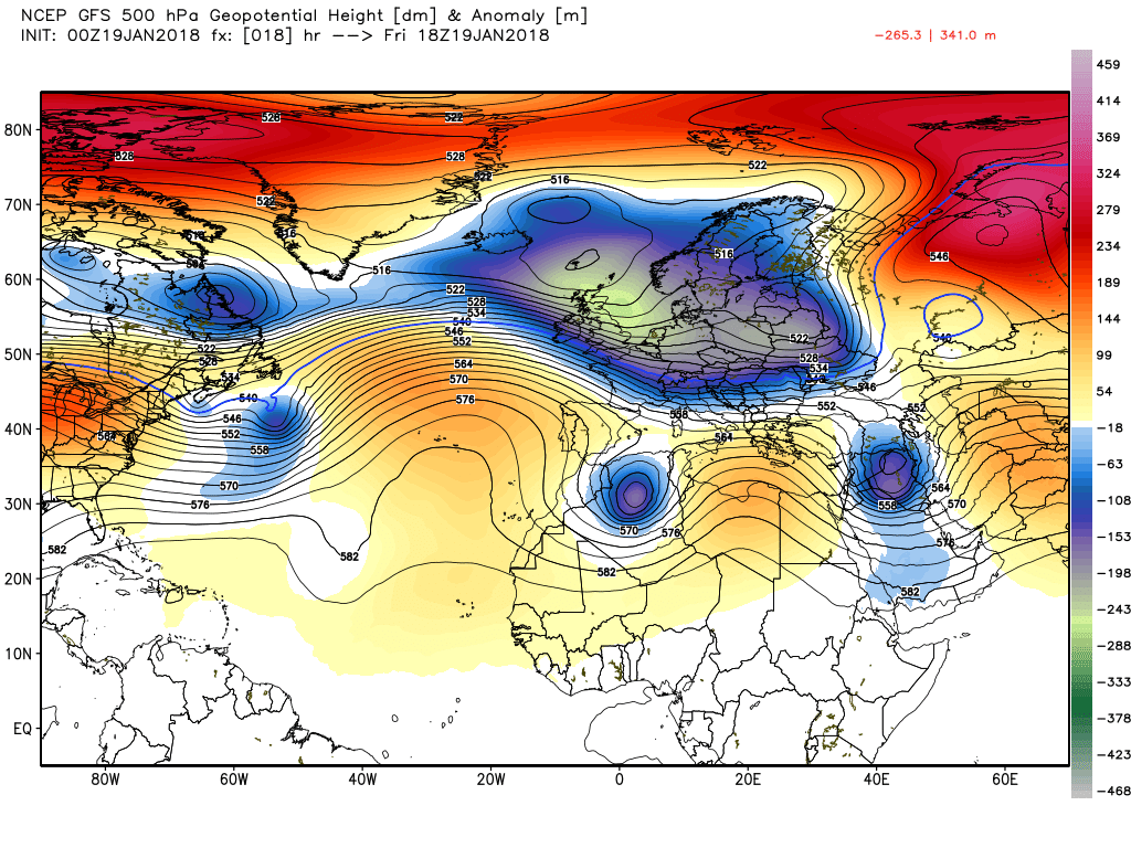
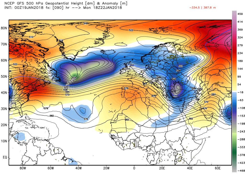
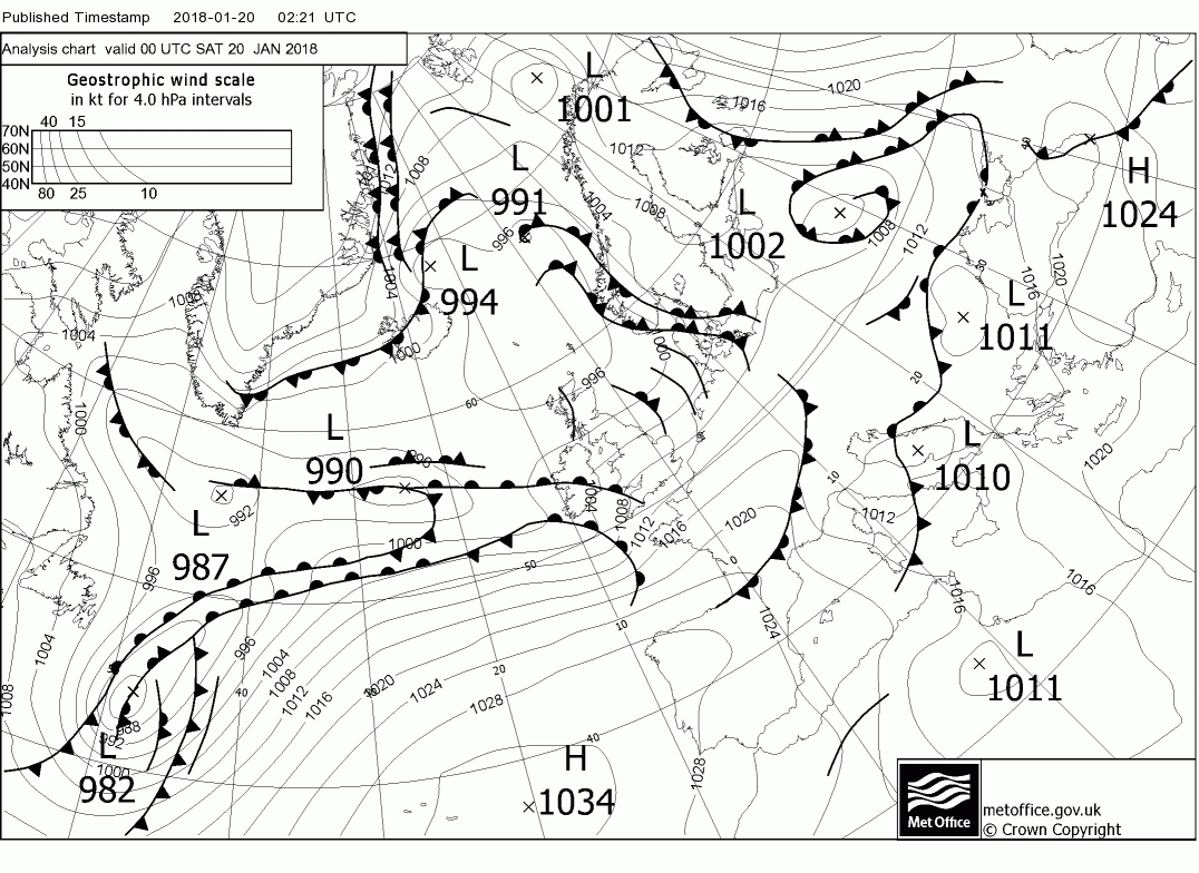
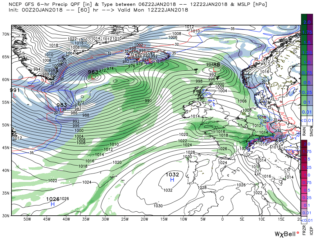
Firstly a quick overview of the general synopsis at 1800 today. The major upper trough that has been the main influence of our recent weather is slipping south east whilst further troughs in the western Atlantic are entering the picture and starting to move east driven by the enery flows from the Canadian vortex lobe and around the southern US. Whilst at the same time the Azores high pressure is pushing north in mid Atlantic.
So a bit more meat on the bones.
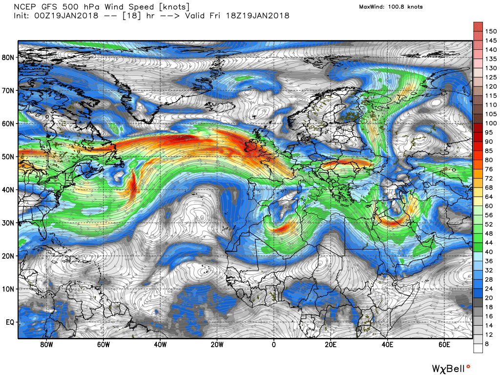
Today a continuation of wintry showers in western areas but particularly in the north where they are likely to be of snow whilst the rest of the country will be sunny but cold. Quite breezy in western coastal areas, Later a wave forming on the front lying to the west will track south east and bring rain to the far south west.
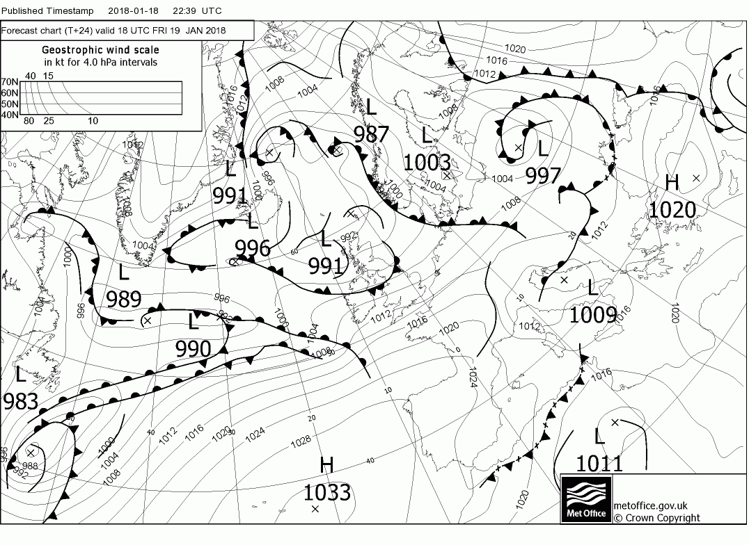
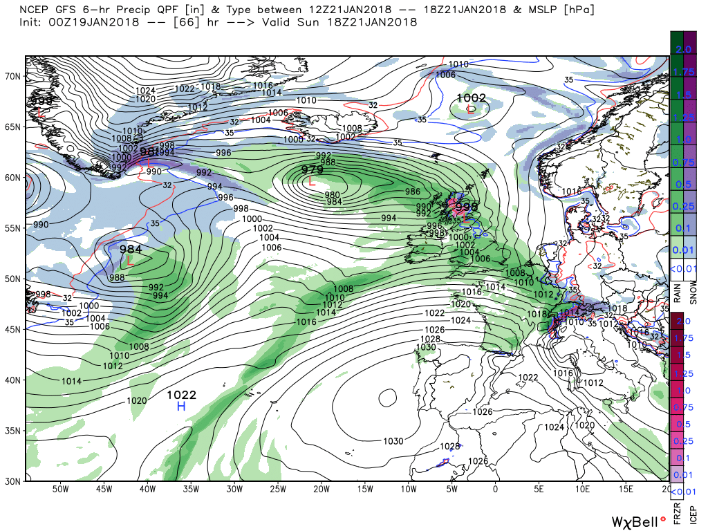
So during Saturday the south west remains cloudy and in the milder air but elsewhere, particularly in the north, the gradient becomes slack as the low pressure fills and moves away and colder air pools with a marked temp contrast being established. This is important because the aforementioned warm front is moving steadily north east overnight on Saturday and during Sunday bringing with it wet and windy conditions but as it comes up against the colder air along the norther edge this could fall as snow in northern regions. Just where and how much still to be ascertained.
This could be further complicated if little perturbations form on the front and also as can be seen another little wave is forming south west of Ireland and that tracks swiftly east bringing more rain to southern England and Wales overnight Sunday and into Monday.
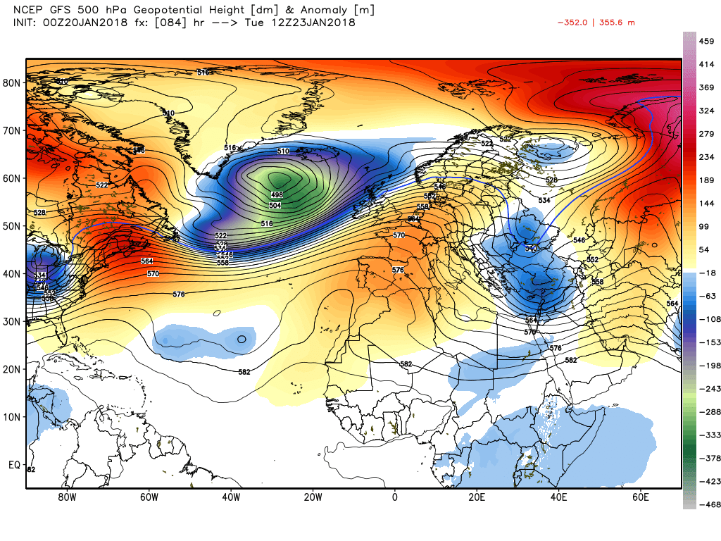
And by now the previously mentioned energy emerging upstream has coalesced into a complex upper trough covering most of the Atlantic to the west
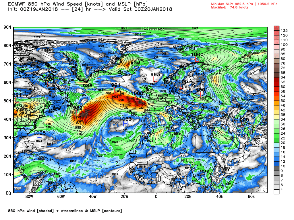
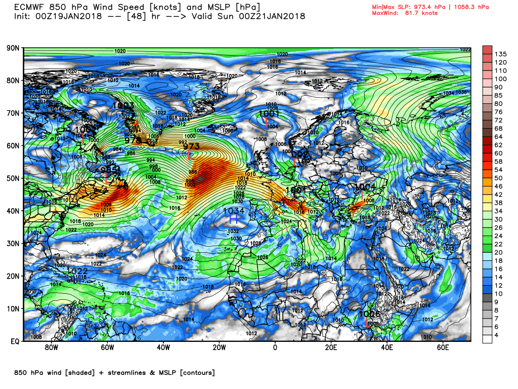
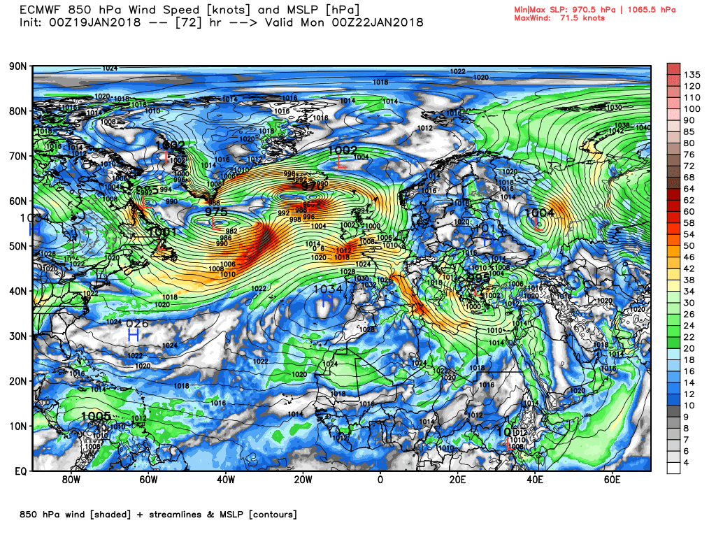
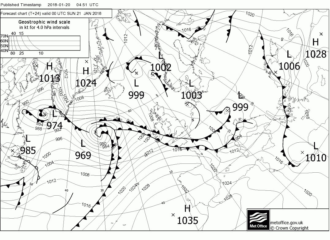
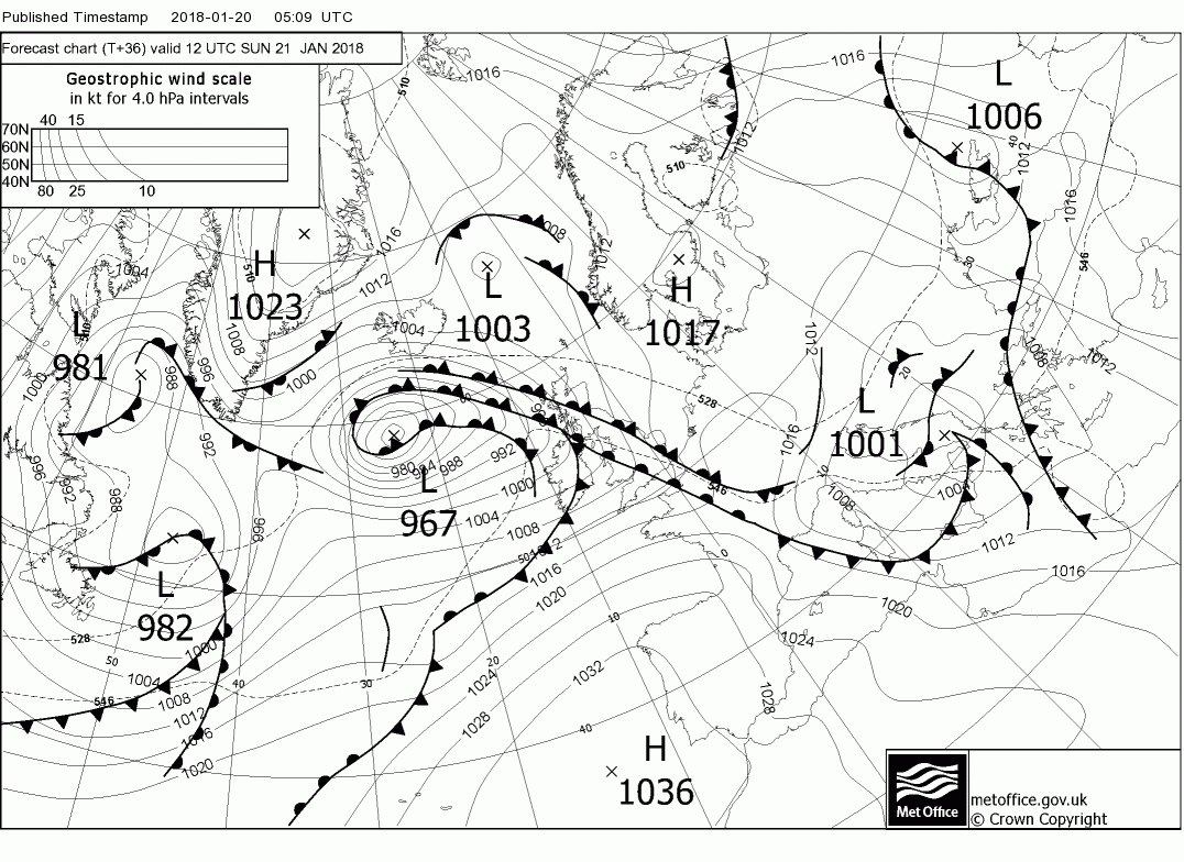
Not surprisingly the ecm is very similar so just the surface analysis for T24,48,72
Today sees the transition to a different weather pattern over the UK, as the low pressure to our north fills and slides south east and systems from the Atlantic move in. Thus today it's more or less a Scotland and the rest split. The former will be quite clear and dry, perhaps the odd wintry shower in the west whilst England and Wales and just about N. Ireland will be cloudy with outbreaks of rain as a front tracks east with little waves running along it which last most of the day in most places. Not feeling particularly warm either and quite windy in the west.
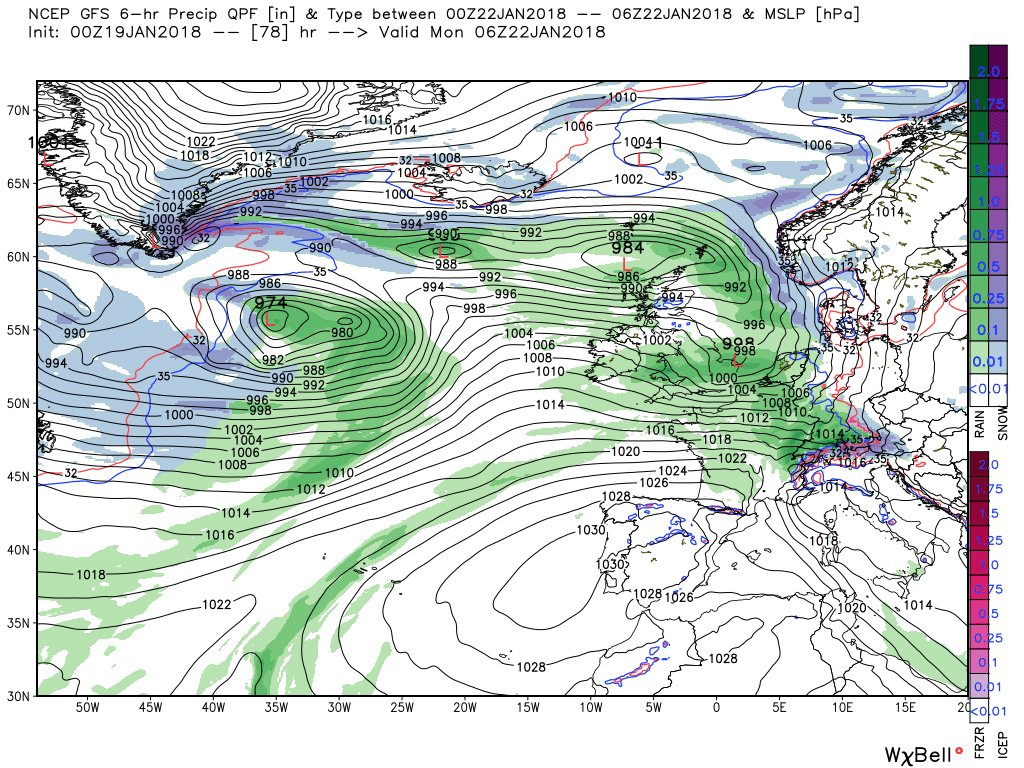
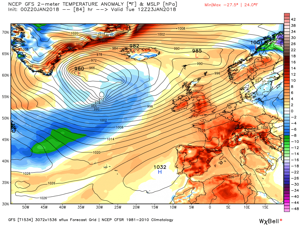
Overnight drier weather pertains with quite a severe frost in Scotland but the next front(s) arrive in the early hours, Associated with a deep depression in mid Atlantic, and they sweep quickly north east bringing rain to many areas but along the leading edge quite possibly some significant snow in the north and Scotland and also very windy for a time over the latter before the fronts clear overnight. Behind the fronts much milder air.
During Monday the Azores HP attempts some transient ridging north east but fails to stop another little wave that has formed to the west running quickly east up the channel bringing rain to the south, albeit it clears very quickly.
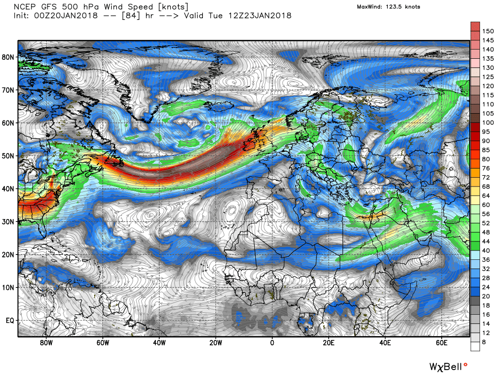
From this point through midweek the controlling factor is the upper trough in mid Atlantic as it moves east, initially bringing a strong, mild, south westerly flow over the UK but the question is, what happens when it disrupts later?
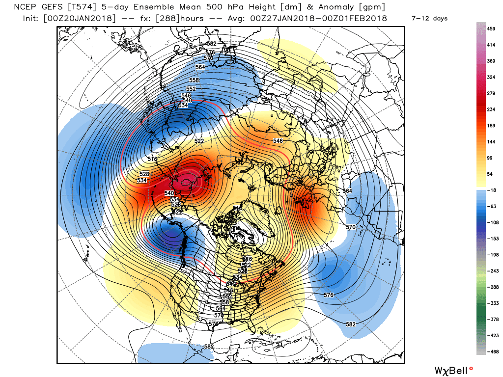
Anomalies of late have been indicating the Azores being much more influential in the medium term as the forecast pattern change occurs in the North Pacific. This is again indicated by this morning's GEFS.
Interesting Chris, just a little over my head but that is my problem and nothing to do with the way you explain things. My meds can slow my thinking somewhat so please don't take it personally, I'm sure others can understand it perfectly well.Any interest?
P.Sorry mate. What's relevant to us in the UK are cold-core Lows. I mentioned warm-core lows out of interest as they affect other areas that might be of interest.Interesting Chris, just a little over my head but that is my problem and nothing to do with the way you explain things. My meds can slow my thinking somewhat so please don't take it personally, I'm sure others can understand it perfectly well.
You have no need to apologise Chris, I'm sure everyone else gets it. P.Sorry mate. What's relevant to us in the UK are cold-core Lows. I mentioned warm-core lows out of interest as they affect other areas that might be of interest.
You have no need to apologise Chris, I'm sure everyone else gets it. P.
Thanks for the rain warning Chris. P.Two things - I'm modifying the post to make it clearer, and I ought to warm BM that a wave on the front to the south of the UK may bring heavy rain to Cornwall.
Thank youThat warning was for overnight tonight, BTW.
P..Thankyou Chris for reworking the lesson, I could get my head around that. P.I thought I'd post a lesson this afternoon as I've found some information that clarifies some of the details of different types of high and low pressure areas, and I thought it might be of interest here. This is the link:
http://www.theweatherprediction.com/basic/pressuretypes/
For this lesson, I'll describe the structures of various types of low pressure; if I get time tomorrow, I'll do a similar post covering high pressures.
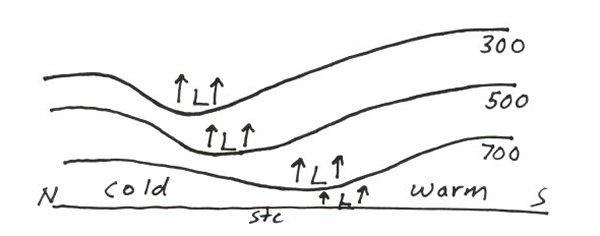
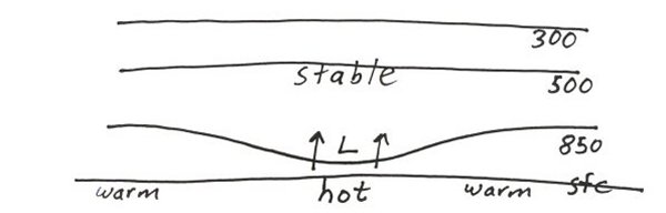
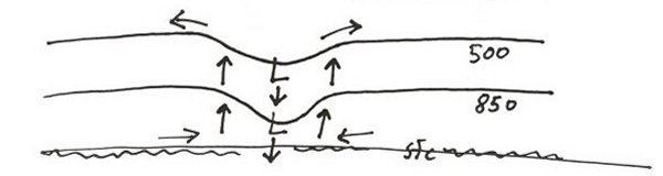
Here in the UK, areas of low pressure are always cold-core lows As a reminder, I explained in a previous lesson post that, in low pressure areas, air spirals away from the ground due to divergence at upper levels creating a slight vacuum which draws-in air at ground level, rather like a cyclone vacuum cleaner. This divergence at the upper level of the low reduces the density of the airmass, and this is the main reason for the air in the low being cooler than the surroundings as air cools as the density decreases. Evaporation from precipitation in the fronts associated with low pressure accounts for the remaining cooling effect. Although the net movement of individual air molecules is upwards, the atmosphere lies lower in cold-core lows due to being cooler than the atmosphere surrounding it (warm air rises, cool air sinks); hence we say that heights (the altitude of air at a given pressure such as 850hPa for low-level air) are lower, and a chart showing heights at various pressure levels (usually 860hPa,700 hPa, 500hPa and 300hPa) will show this. Determining the exact location of the core of the low at lower levels is complicated by the fact that cold-core lows angle to the north-west with height, so the centre close to the ground isn't directly below the upper circulation. This is shown by the diagram below, which is a simplified cross-section with north to the left and the pressure heights shown by the horizonatal(ish) lines). I've taken these diagrams from the link I posted above:
Generally-speaking, cold-core lows are smaller than standard warm-core highs and show positive vorticity (the rising air spins anti-clockwise).
There are two types of warm-core lows, neither of which affects the UK, but I'll quickly mention them as they are of interest. The first is a thermal low which develops in arid regions such a the south-western US deserts. Surface heating under intense sunlight creates warm air which rises through the lower levels of the atmosphere, but it can be prevented from rising high into the atmosphere by stable air higher up. In this respect they're similar to (though much larger than) convection showers we get in summer due to heating of the ground. Here's a simplified cross-section:
As the air is dry in these systems, they usually produce isolsted thunderstorms at most.
More common are tropical cyclones (including hurricanes and typhoons) which form over warm ocean waters near the equator. These are deeper than thermal lows and do not angle with height, but the strength does decrease with height more rapidly than cold-core lows. They feature subsiding warm air at the core (the eye), which differentiates them from cold-core and thermal lows, but this is caused by cooler air rising rapidly around the eye wall, causing the destructive winds that are typical of these systems. Unlike cold-core lows, which strength as they angle with height, wind shear, which would be likely to angle the circulation, weakens tropical cyclones as they need the eye walls to be near vertical due to their structure. Here's a cross-section of a cyclone: