UK meteorology

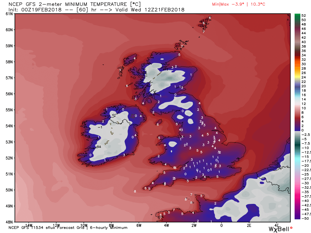
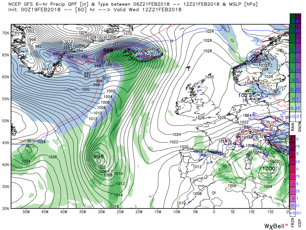
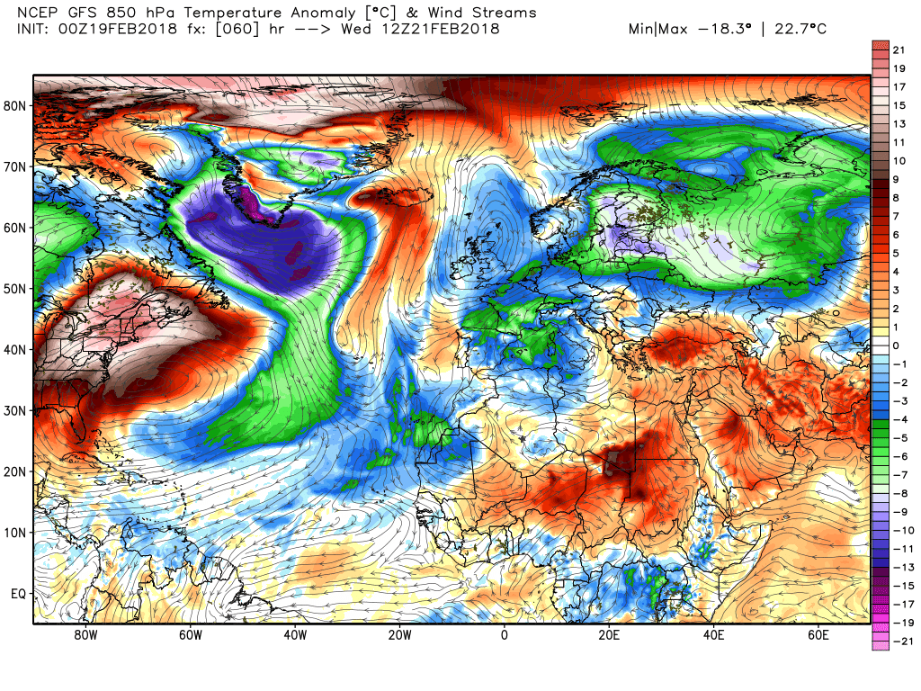
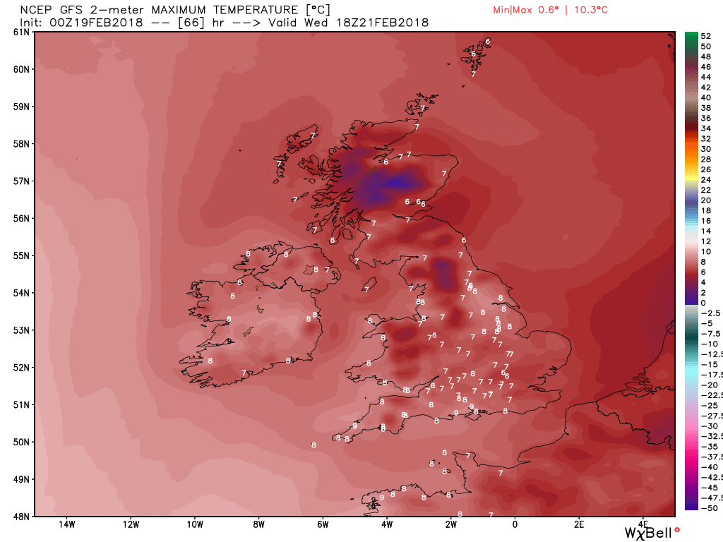
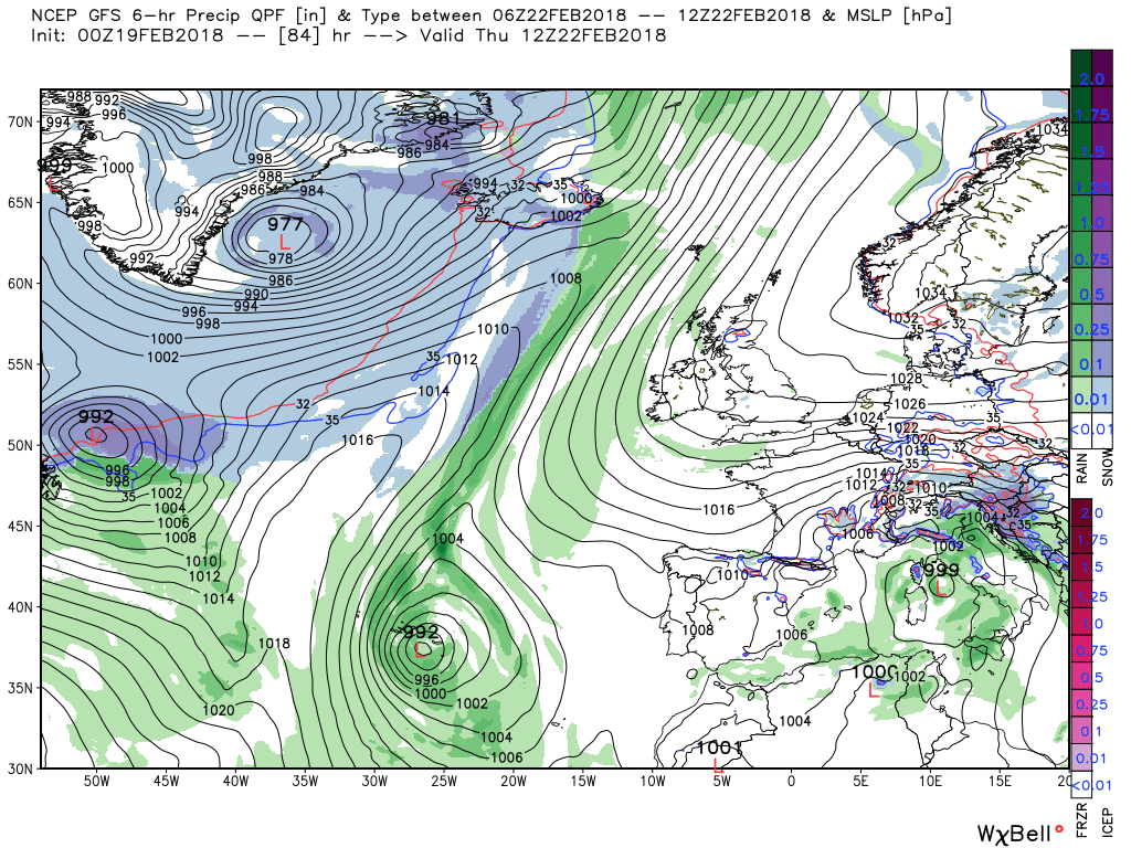
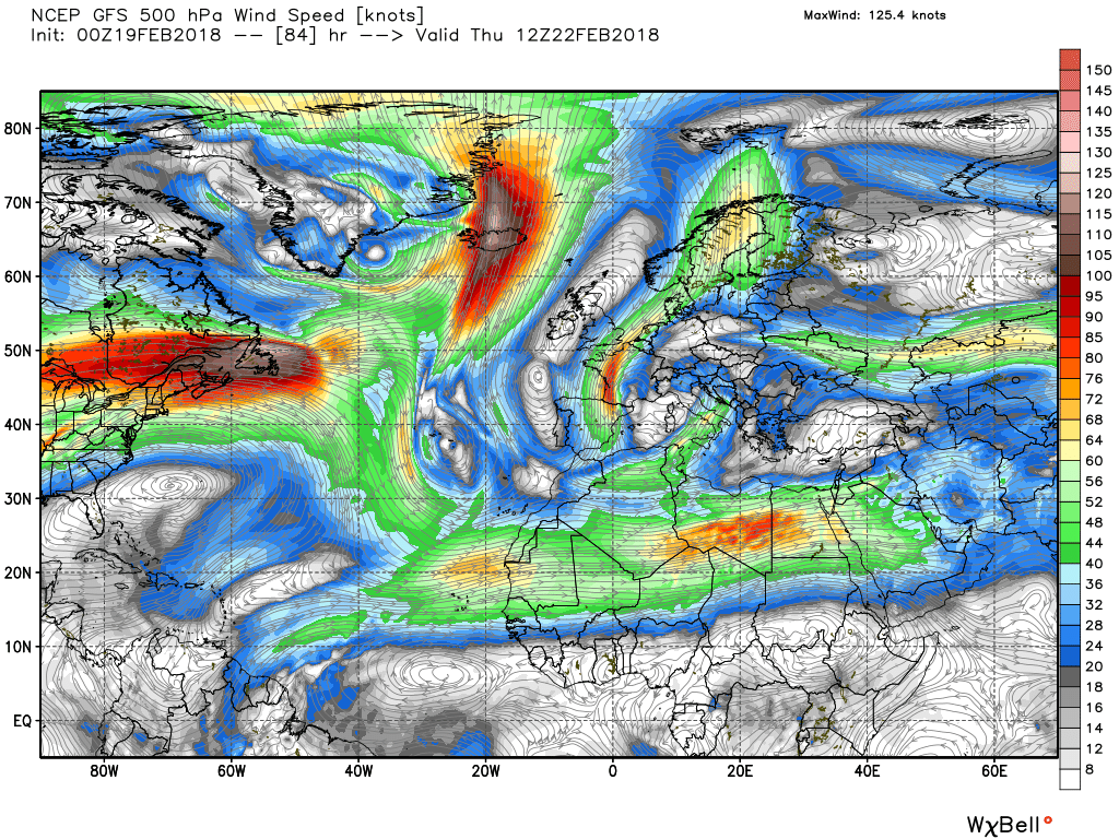
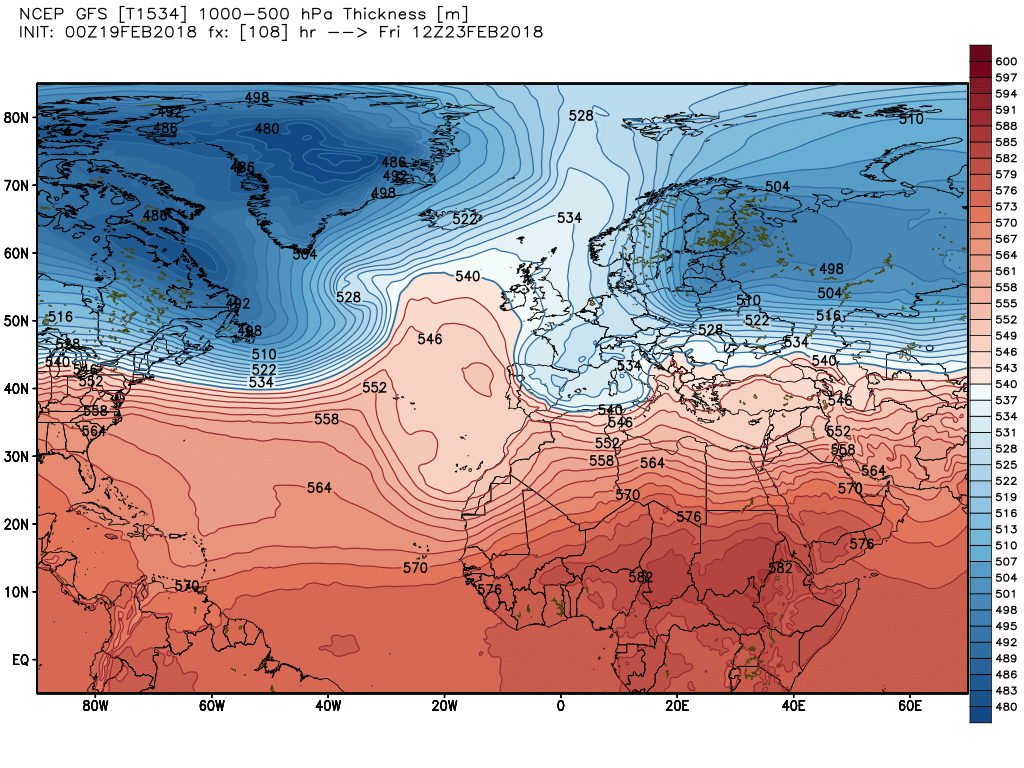
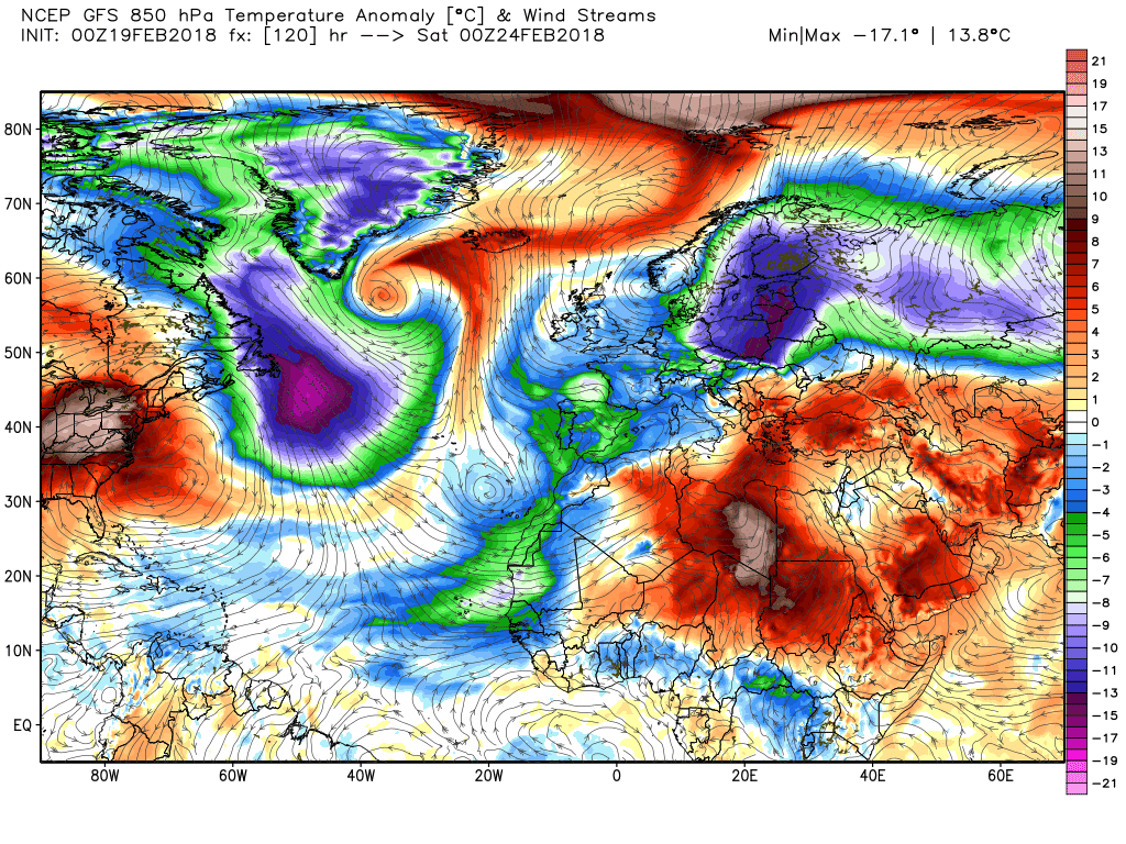
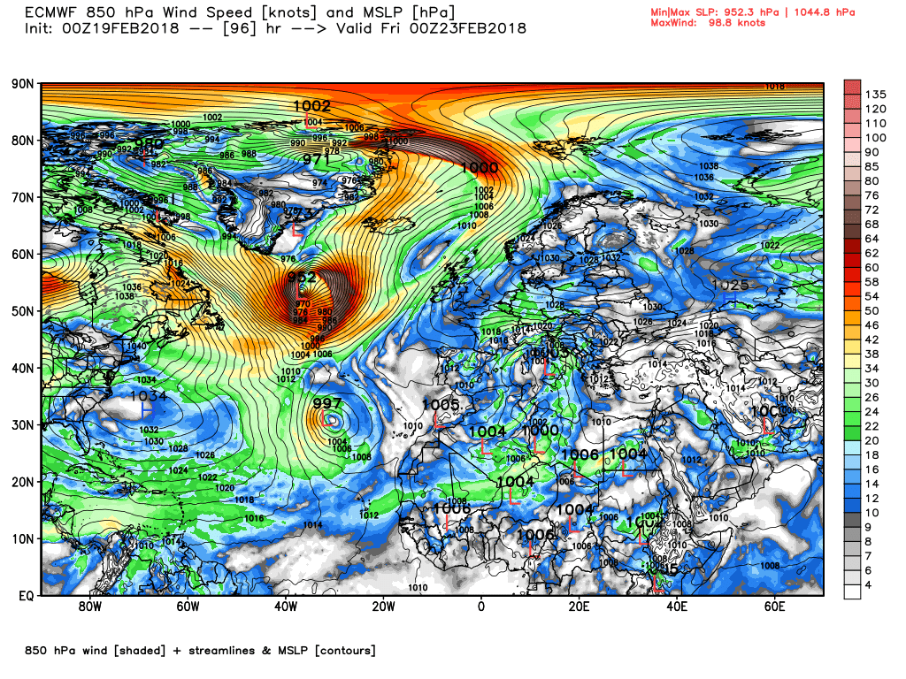
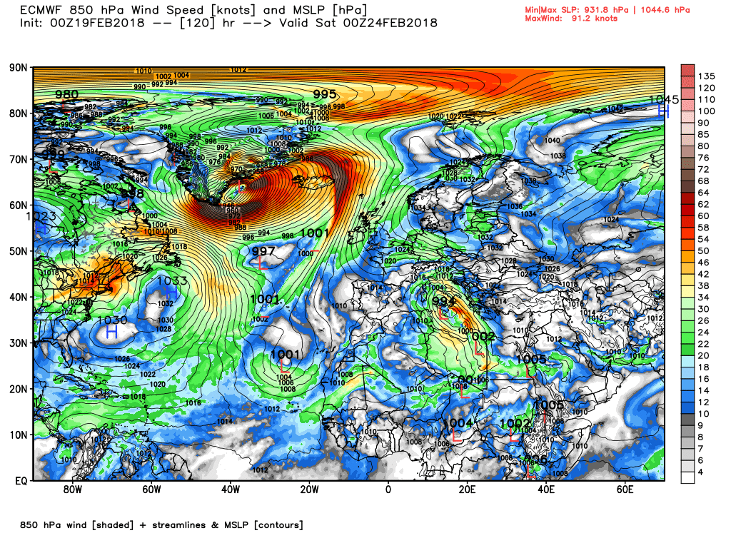
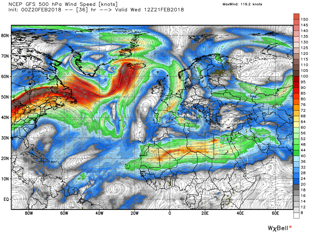
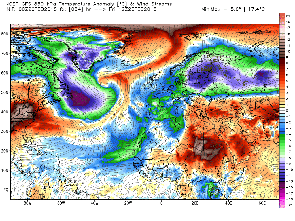
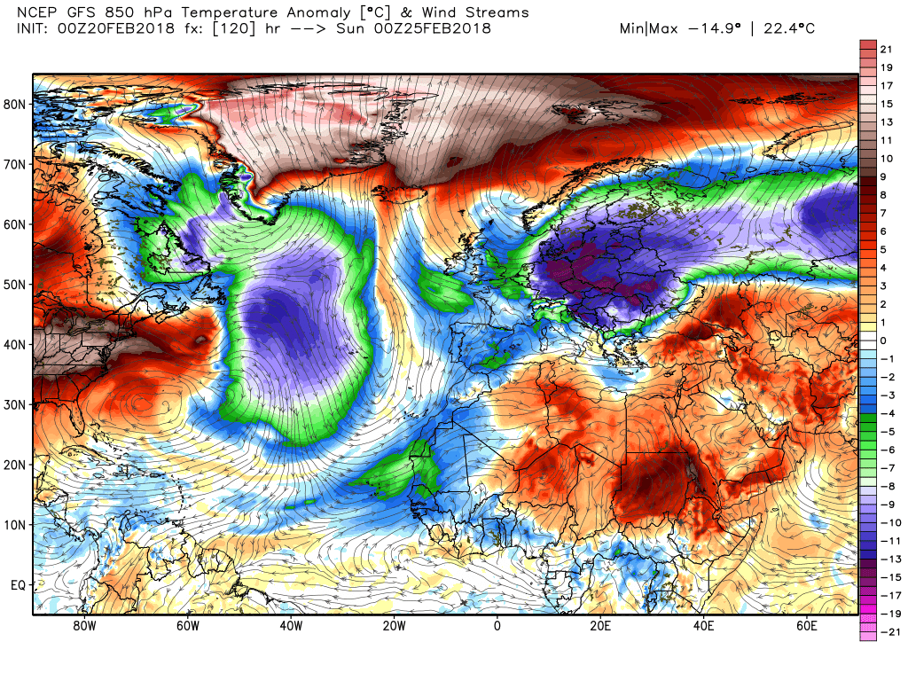
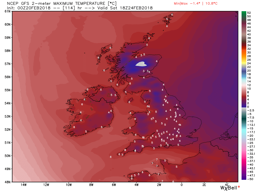
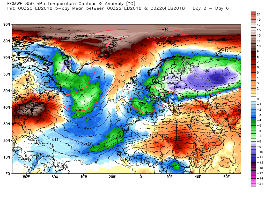
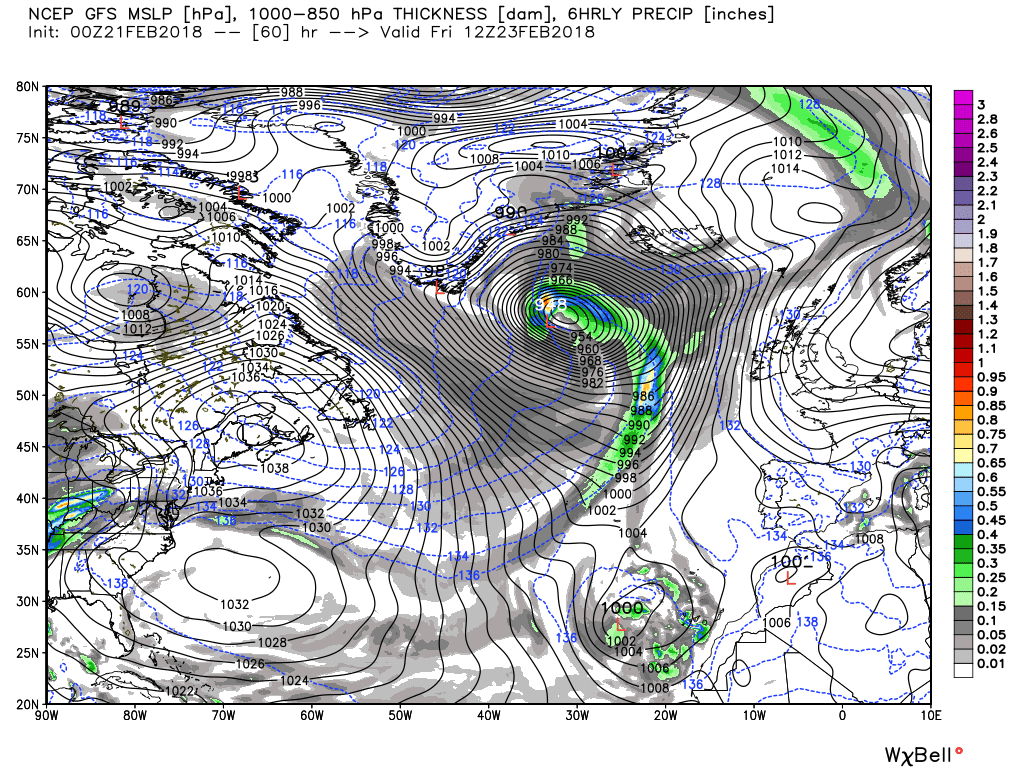
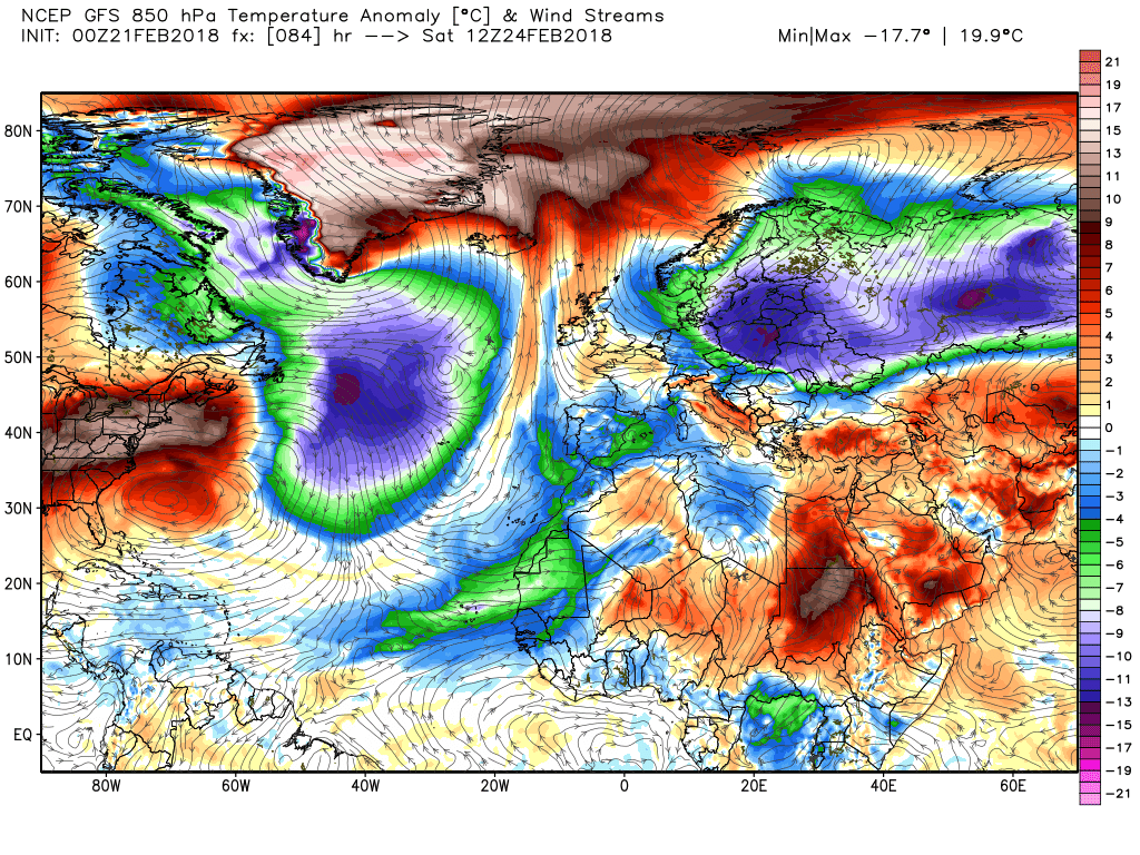
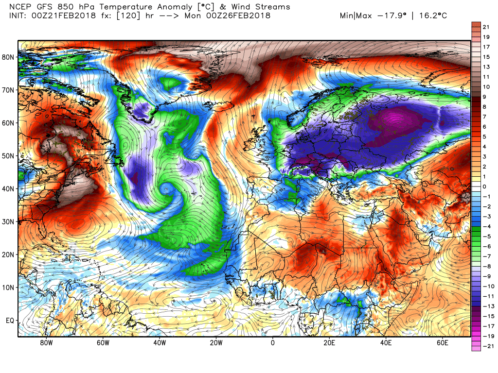
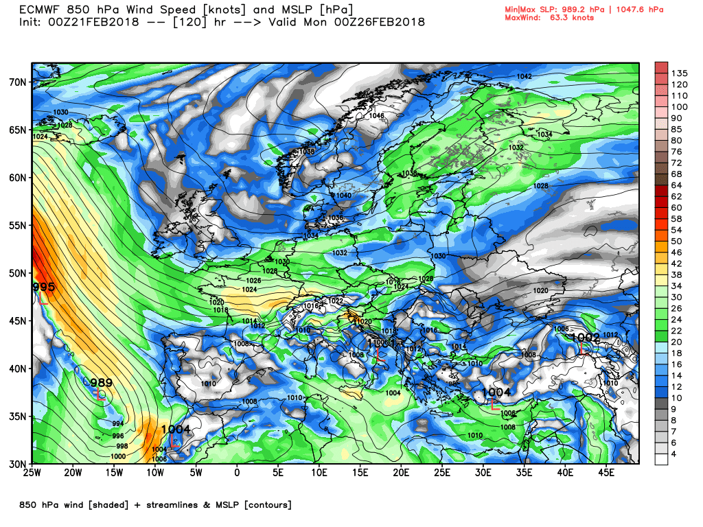
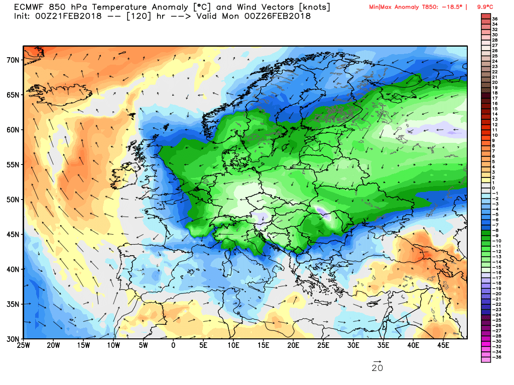
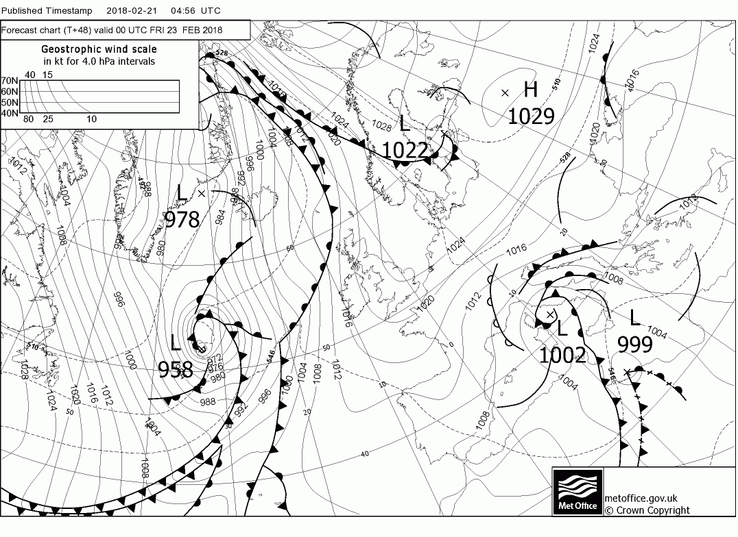
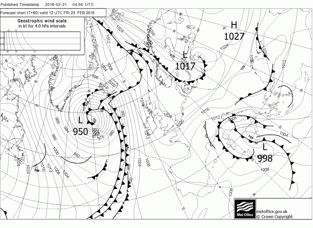
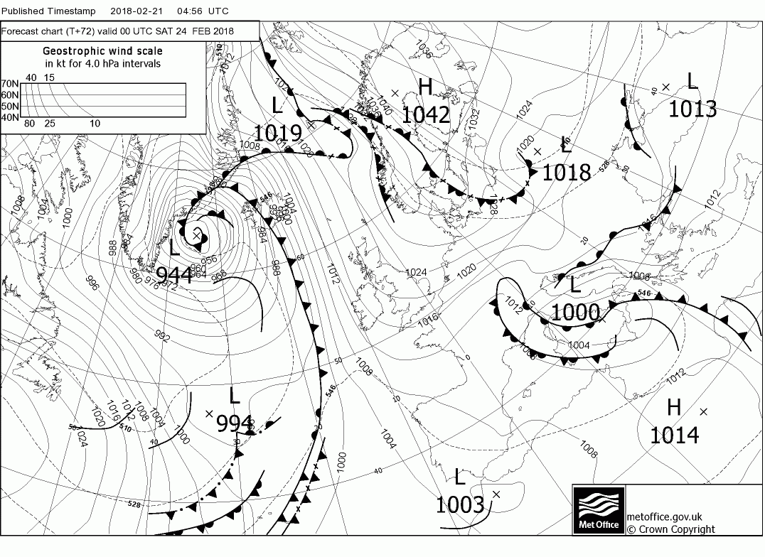
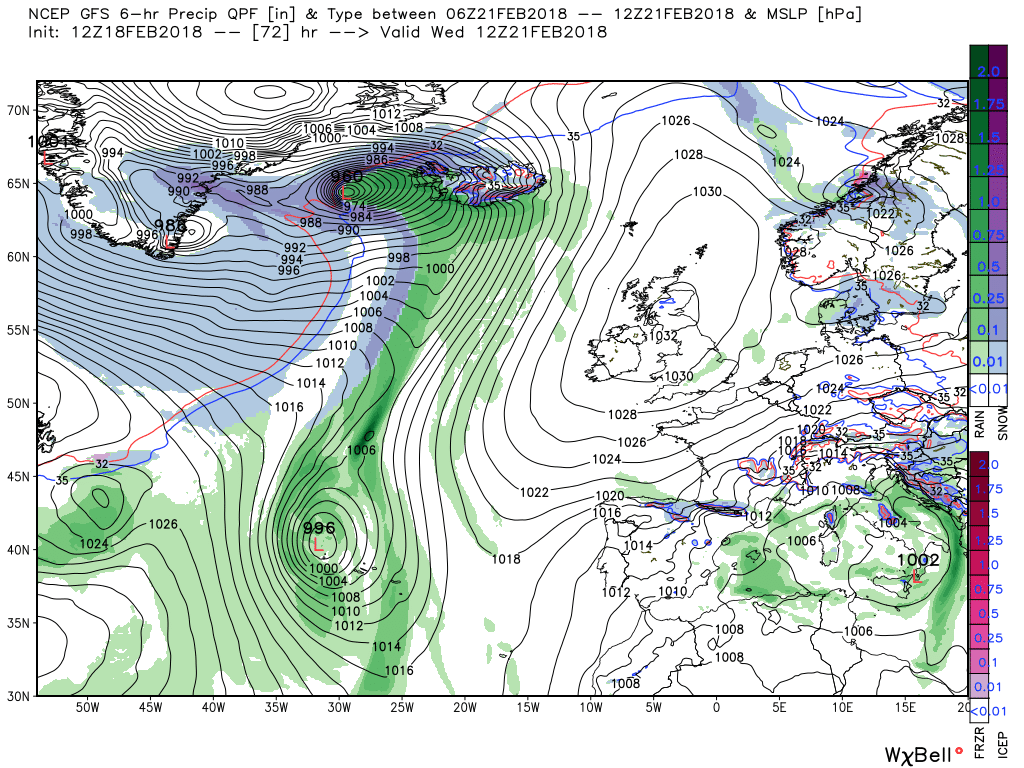
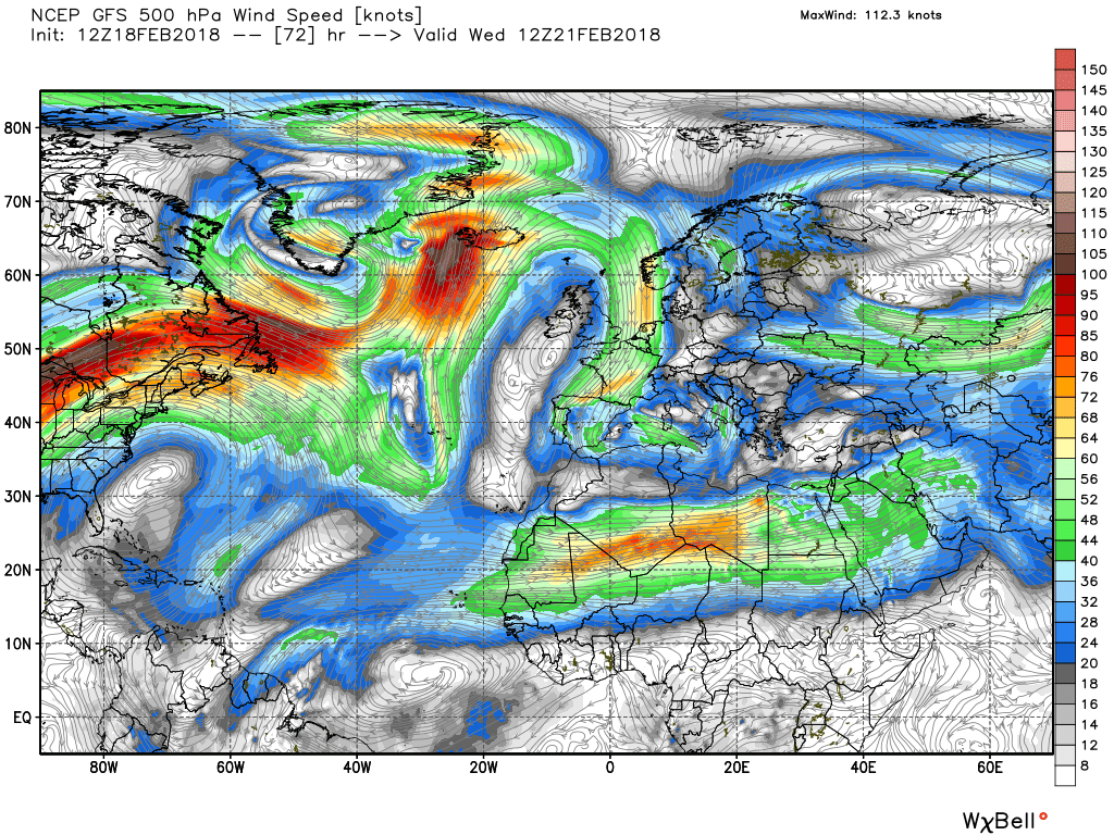
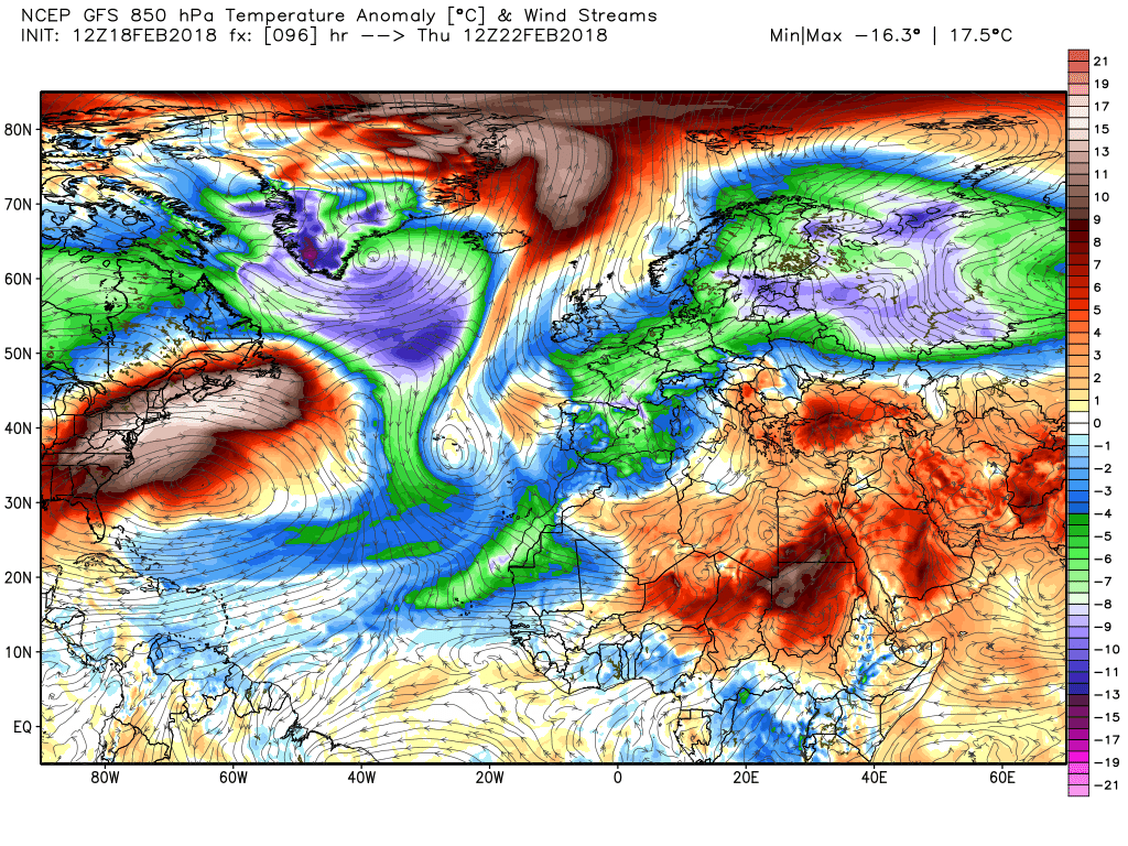
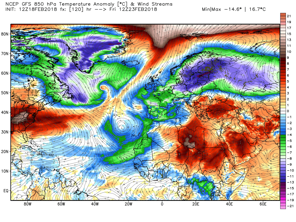
More from Malcolm, in case anyone is interested:
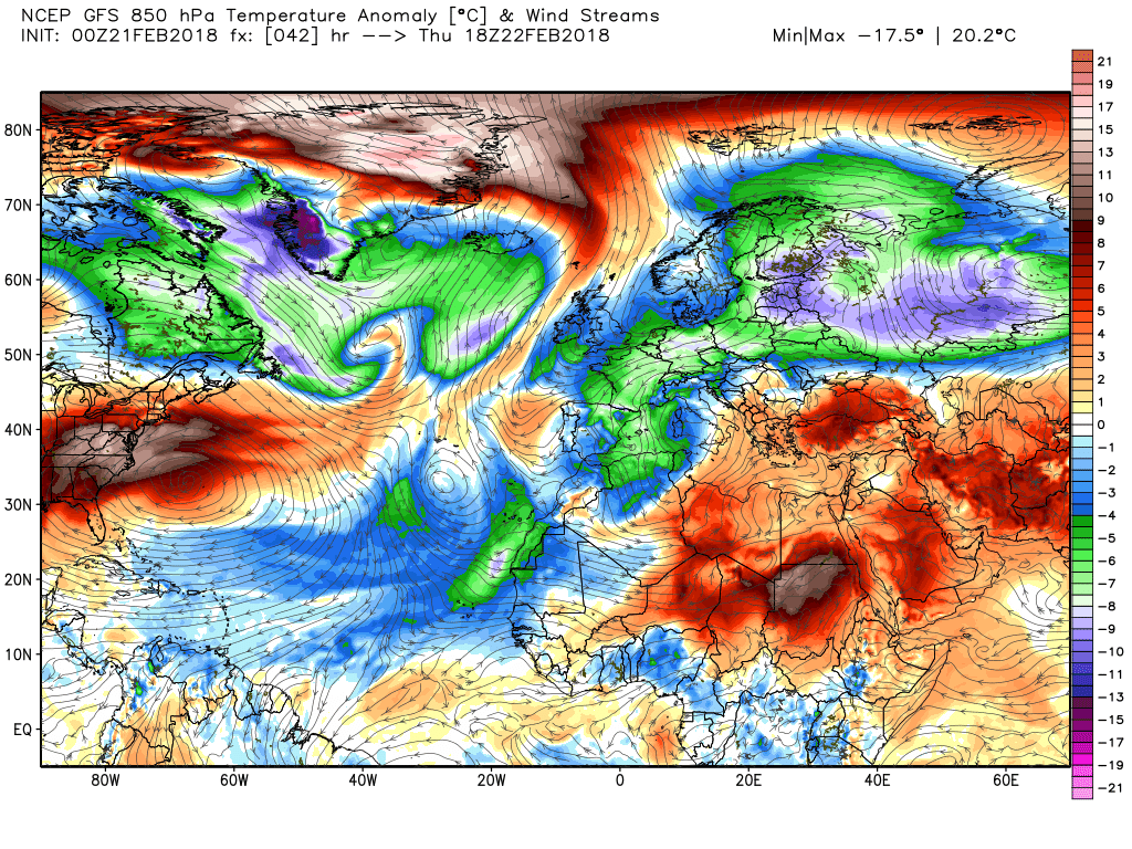
As with last evening the ecm has a 160kt jet leaving the NE of North America and thus a lot of energy running east south of the detached vortex lobe which again puts much pressure on the ridge with a front affecting north west Scotland by T120. But the amplification quickly puts the kibosh on this.


Evening analysis from Malcolm:
The weather here today has generally been thick fog, sky obscured and intermittent rain and drizzle. This is probably emblematic of many areas particularly in the western half of the country and will continue to be the story through the night as the warm front edges east and the warm sector expands it's influence.Thus temps in the morning on the mild side. By midday the front has cleared the east coast and a wave has formed on it.Max temps up as high as 13C


Rain will linger near the east coast overnight and into Tuesday as the cold front peters out in the west giving clear periods as the high cell moves north east.


This continues overnight Tuesday into Wednesday whilst out to west the detached vortex lobe and the energy running south of it has created a split trough in mad Atlantic with the said energy hitting the brick wall of the block to the east.


It does have a partial success forcing the high cell to realign which initiates the easterly regime into southern England


The stage is now set for the cold upper troughs in the east to track south west under the high pressure establishing a conduit for the cold air which are all linked to the vortex lobe and split upper trough in the Atlantic.

 
Mild and damp, well that make's a change! :)
It won't be mild for much longer!
Today most of the UK will remain in the warm sector as the warm front continues to track east with the little wave on it doing the same across northern France. Thus most areas will also remain cloudy with patch rain/drizzle with some fog with some clearer periods in the west as the weakening cold front approaches which will bring rain to N.Ireland and western Scotland later.. Very mild with temps in the 12-13C range


The cloud and patchy rain will continue to to move east overnight leaving clearer and cooler weather behind with some heavy showers for a time in NW Scotland This clearer weather will eventually reach all areas as the cold front clears eastern areas during the afternoon albeit the weakening occlusion does linger a while as the high pressure moves in from the south west.


Wednesday heralds the start of a colder and drier period as the high cell continues to track north east to be centred over Scotland at midday whilst to the west in mid Atlantic there is the lobe of the vortex that has detached over southern Greenland and a trough stretching south with a front between the two surface low pressure areas being the interface between the distinct airmasses.


Despite pressure from energy running south of the aforementioned detached lobe the high pressure remains steadfast and reorientates to the north east and by so doing initiates the easterly regime in southern England


By Friday this regime is firmly established with light snow flurries possible in the south east as attention now turns to the east where the colder air resides.


The ecm does not follow that closely to the gfs around t96-120 . The easterly is initially established but pressure from the west ensures a slightly different position of the high which serves to isolate the colder air to the east and tends to veer the quite light wind south east.


Malcolm's view of the next 72 hours:
Essentially today marks the beginning of the transition into a pattern change and a different regime, albeit not overnight. Today frontal systems are still affecting the east so pretty much an west/east split with the east remaining cloudy with patchy rain and drizzle whilst the west will be bright with sunny periods with perhaps the odd shower in the north west. Much the same picture this evening and overnight, the patchy rain in the east may move a little west on the dieing occlusion qQite likely a frost in the north west after a clear night


By 1200 tomorrow the high cell is established across the country thus light winds and plenty of sunshine in the north and west but cloud and patchy drizzle may linger in central, southern and eastern England on the remnants of the front and temps in the 7-8C range Away to the west another front marks the interface between the airmass over the UK and the major upper low over southern Greenland and the cut off low to the south west which have linked and at this stage there is still a lot of energy leaving NE North America eastbound.


By 1200 Thursday the energy has pushed the northern section of the front east whilst the high cell tilts and migrates north east thus initiating the aforementioned new regime as an easterly component to the wind is introduced in the south but at this stage not adversely affecting the temp noticeable.


Over the next 24 hours, by 1200 Friday, the front does actually get quite close to NW Scotland, and further south the wind is picking up and veering a tad.


Which brings us to the weekend. The wind continues to freshen in the south and with the colder air gradually encroaching from the east it will feel very cold in the wind chill although it will remain dry apart from maybe some snow flurries it the S/SE


The ecm not in a great rush to bring the very cold air in

 
Our cold plunge is now within range of the 72 hour model thread on Netweather:
The cloud and patchy precipitation that hung around the east yesterday associated with a frontal system will be more widespread over England and Wales today whilst the north and N. Ireland will be sunnier. Winds generally light as the high cell/ridge predominates but a bit breezier in NW Scotland.


The cloud will clear overnight and through tomorrow leading to frosty start in most places but the ridge has reorientated under pressure from the trough in the Atlantic to the north west and a fresh easterly wind has been initiated in the south making to it feel much colder. Less so in north west Scotland in the south westerly wind and the proximity of the front.


The consolidation of the easterly in the south continues on Friday so starting to feel colder in the wind chill but complications are afoot in the north, The previously mentioned front associated with the deep depression south east of Greenland is now orientated WSW-ENE north of Scotland and this is associated with warmer air and upon which a shallow wave has formed.


Over the next 24 hours the shallow wave drifts south east to the Norwegian coast and this subtle pressure does impact the ridge to some extent which has the affect of veering the easterly somewhat and temporarily halting the progress of the much colder air to the east moving quickly west.


The scene slowly changes though to 1200 Sunday with the ESE wind continuing to freshen thus feeling very cold, particularly in the east and south with the greater wind chill factor, and the much colder air to the east edges much closer.


And by midnight Monday it has arrived and by now snow showers in the south are quite possible.


The ecm not dissimilar to the gfs in this time frame


Further to the above:
To put more meat on the bone the updated fax charts for Friday/Saturday
default_smile.gif


Back
Top Bottom