- Messages
- 17,589
- Location
- Sunny Cornwall
GOOD LUCK! Be careful mate. P.Snowing heavily now in the South Wales region. Cardiff/Newport area.
Need to drive to Abergavenny at 7.30 am.
Wish me luck.

GOOD LUCK! Be careful mate. P.Snowing heavily now in the South Wales region. Cardiff/Newport area.
Need to drive to Abergavenny at 7.30 am.
Wish me luck.
Did you get there alright?Snowing heavily now in the South Wales region. Cardiff/Newport area.
Need to drive to Abergavenny at 7.30 am.
Wish me luck.
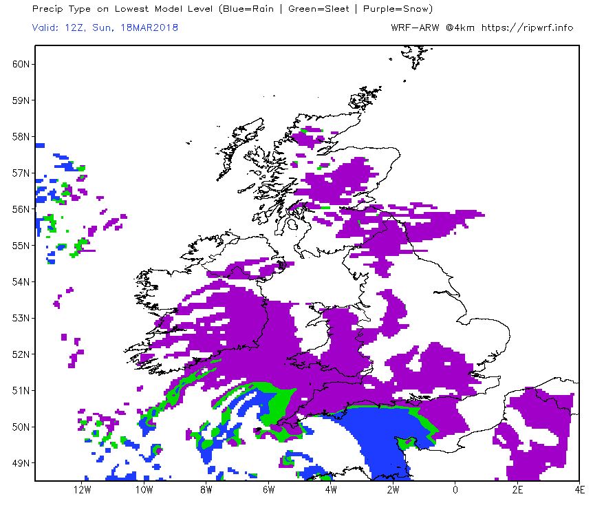
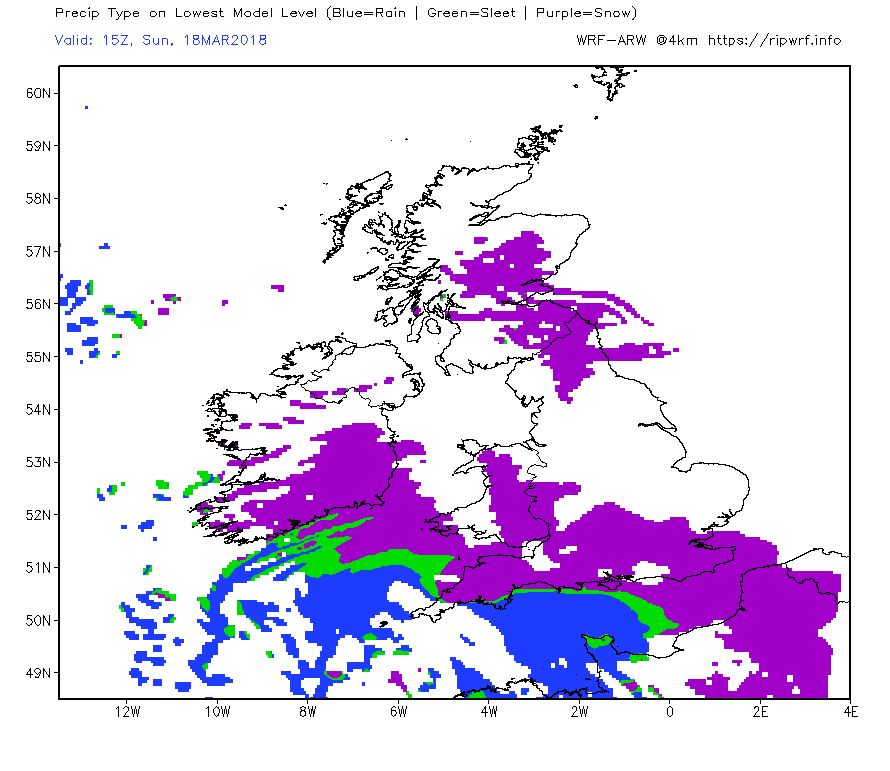
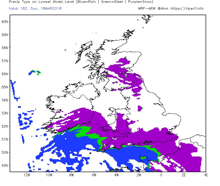
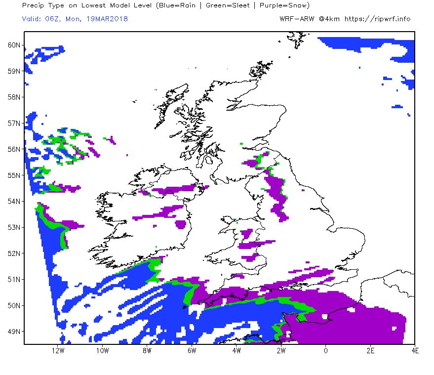
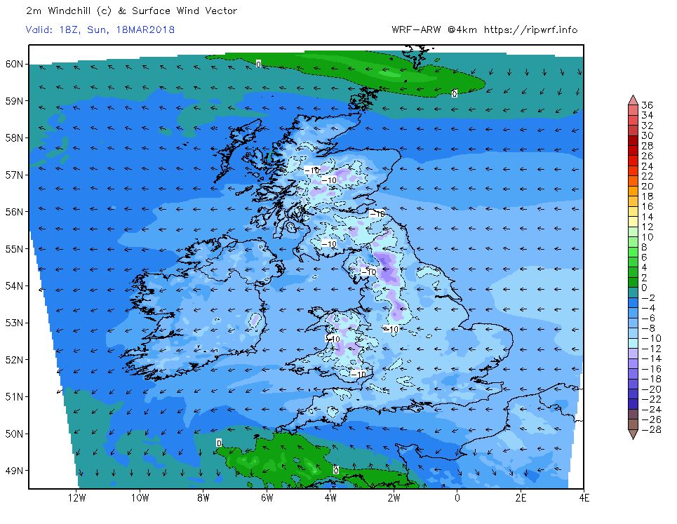
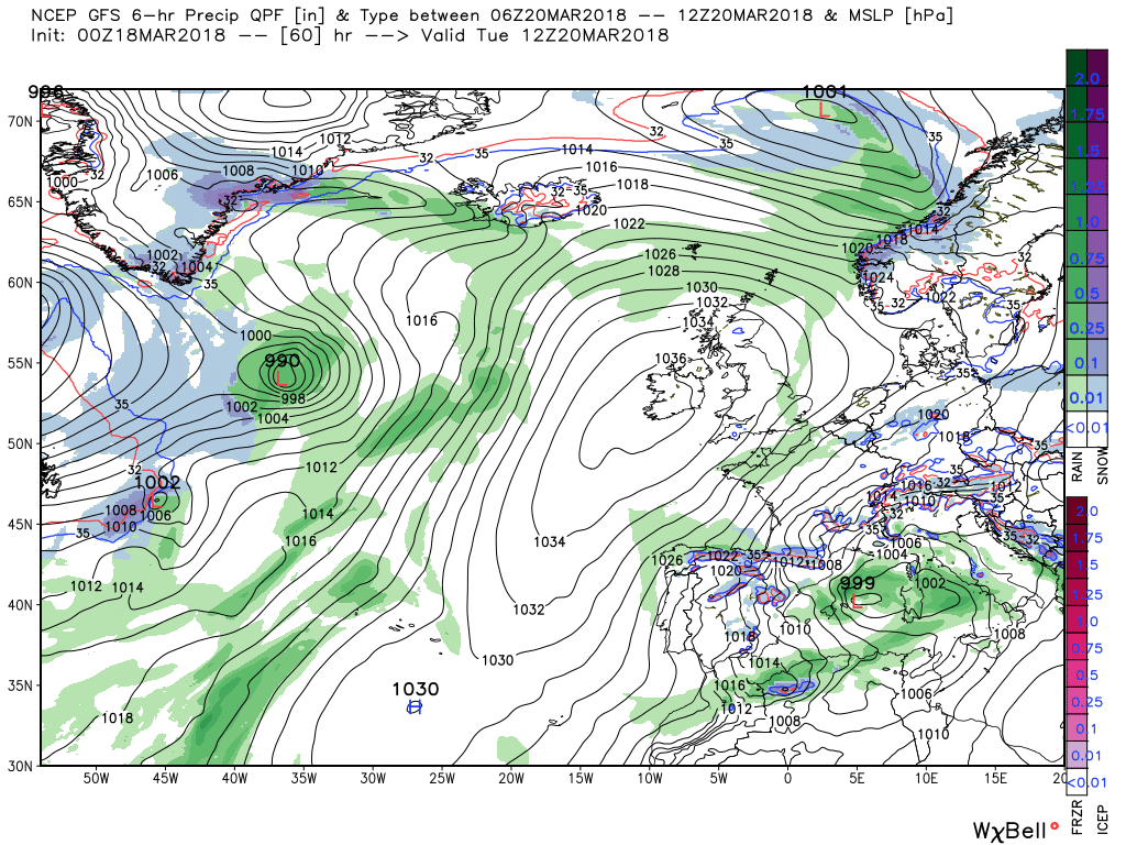
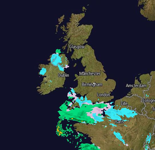
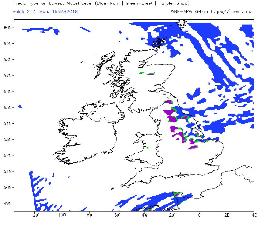
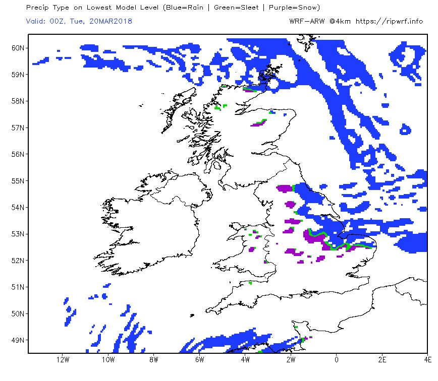
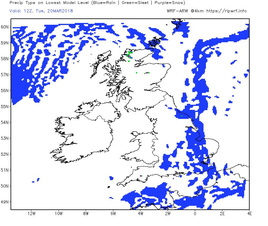
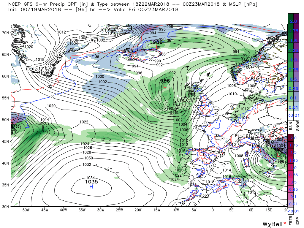
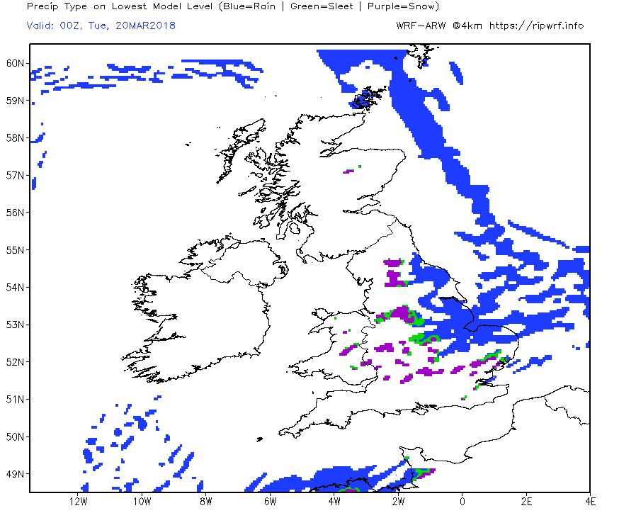
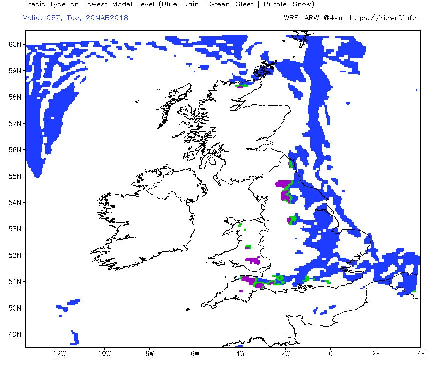
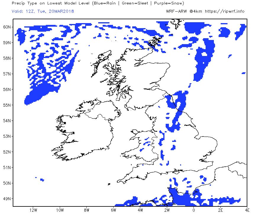
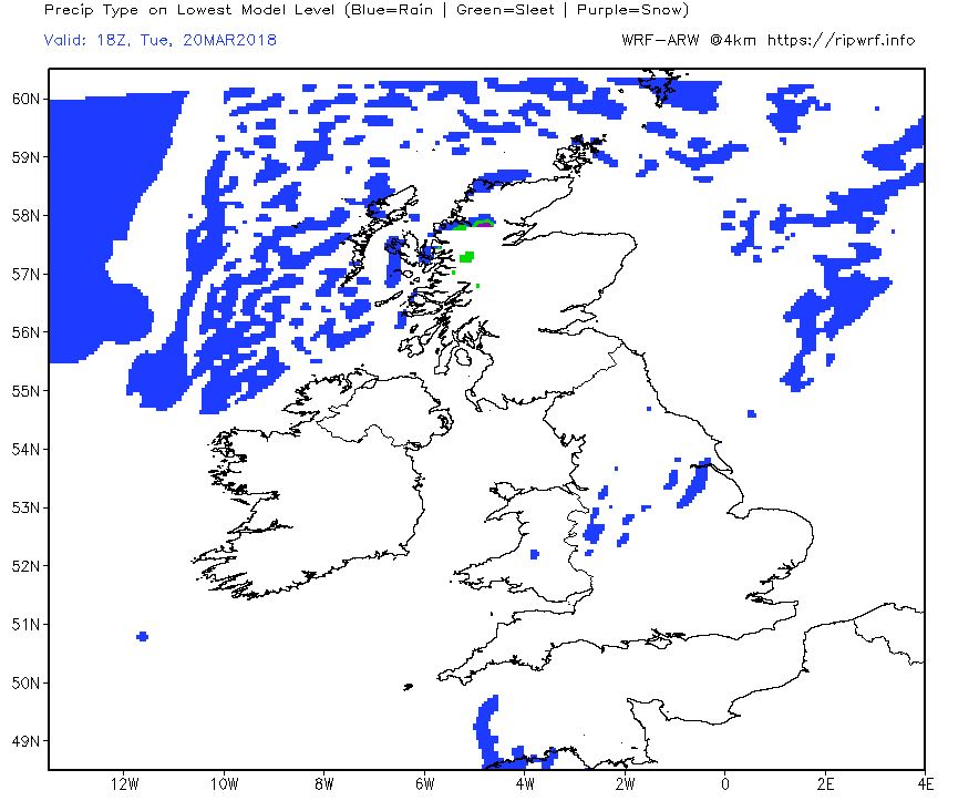
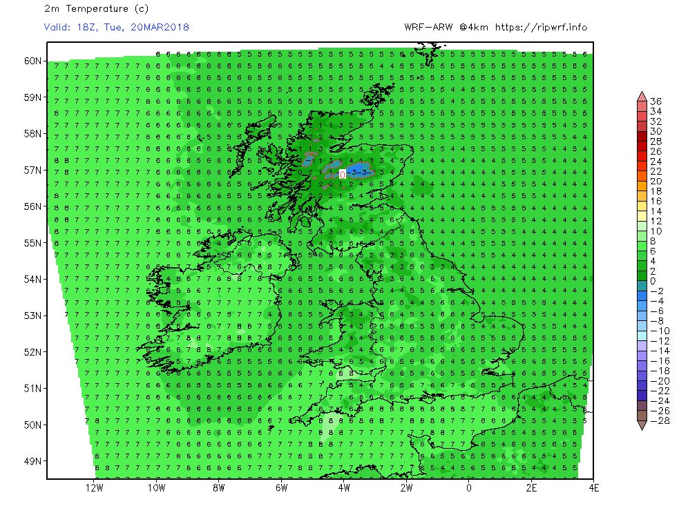
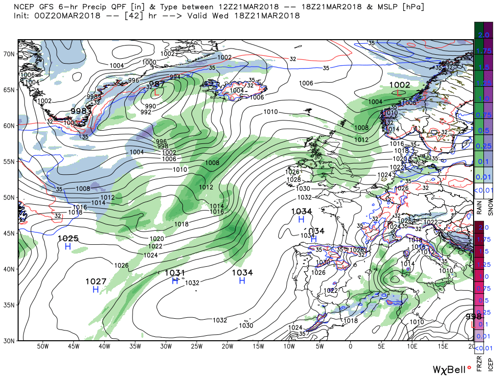
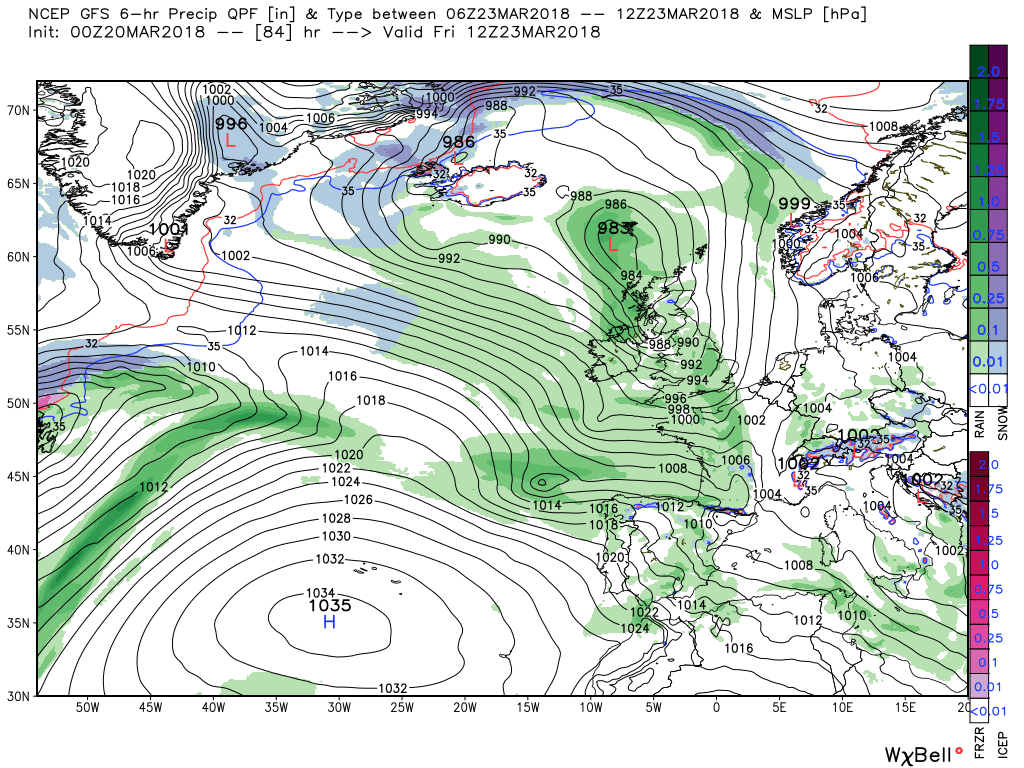
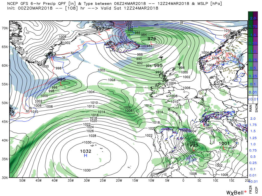
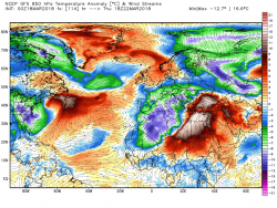
Today and overnight the UK will remain in the bitterly cold easterly regime with the continuation of frequent snow showers in many areas, albeit these will gradually die out later and overnight as another regime gets underway. But a more organized band of snow is already affecting the south as a frontal wave tracks up the Channel which by 1800 has the occlusion close to the south west. Thus the snow here will be more continuous and likely to last through the day and overnight in some areas. I will not attempt detail, even if I could, as this will be essentially a radar watch and well covered in the regionals. As mentioned a bitterly cold day with a severe wind chill.
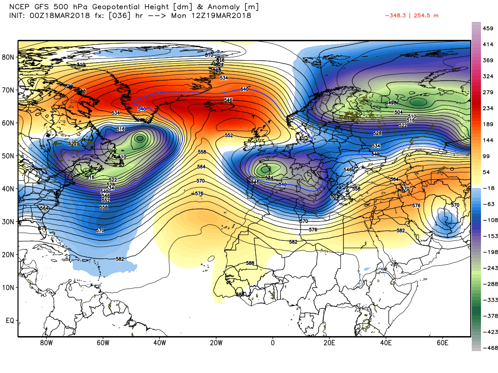
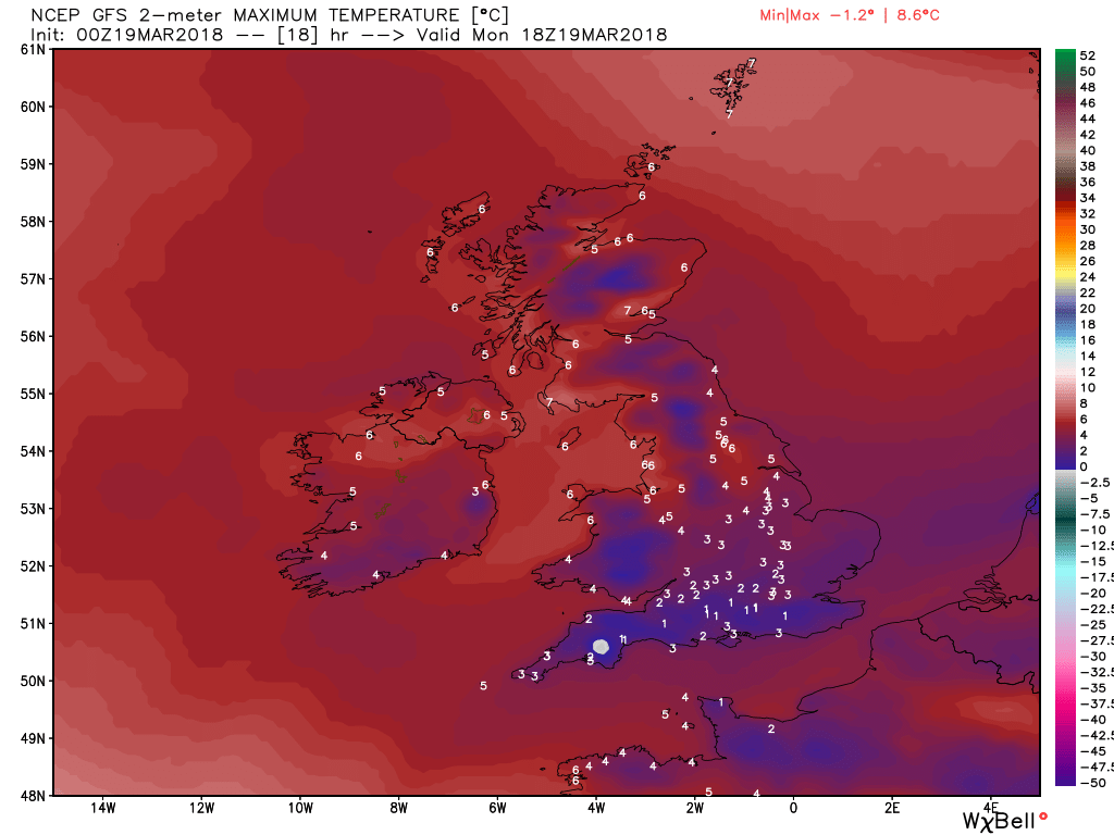
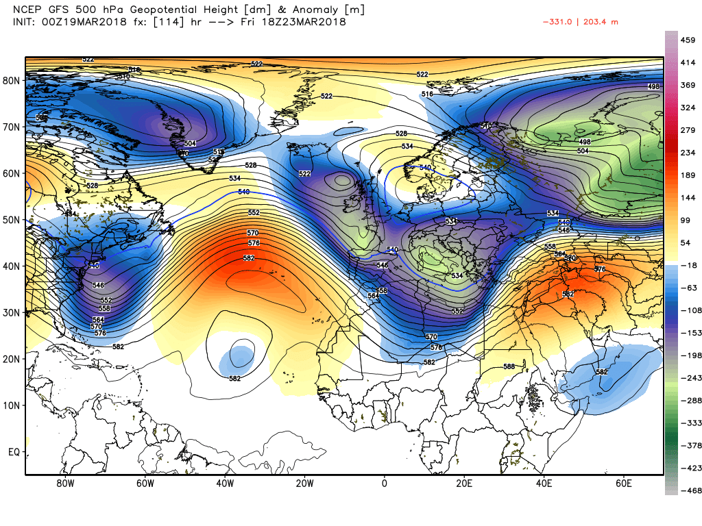
By 1200 Monday the pattern change is well underway with the Azores ridging north to the the high cell which is now NW of Scotland and initiating the movement of the upper trough south over France. Less cold on Monday as the wind abates and backs and quite sunny with just isolated showers.
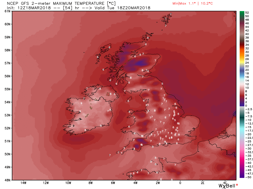
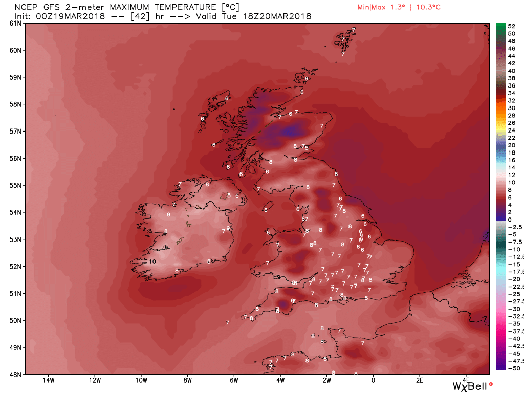
By Tuesday the ridge/high cell has become orientated SW/NE over the UK under pressure from the energy exiting the eastern seaboard portending another quite sunny dry day with the temp continuing to creep up, albeit still below average
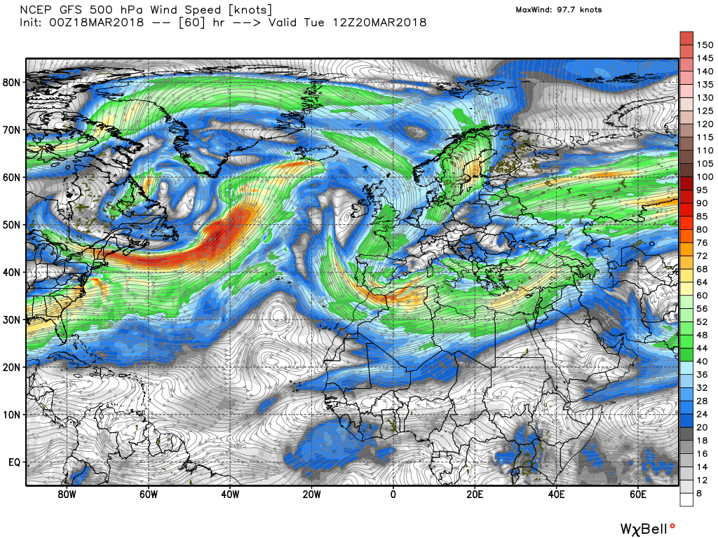
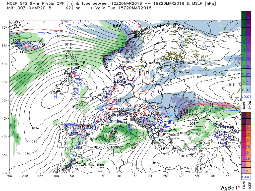
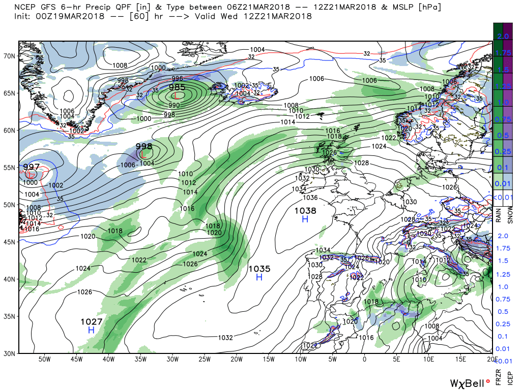
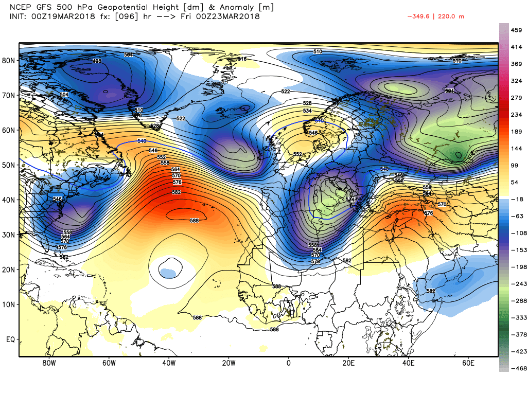
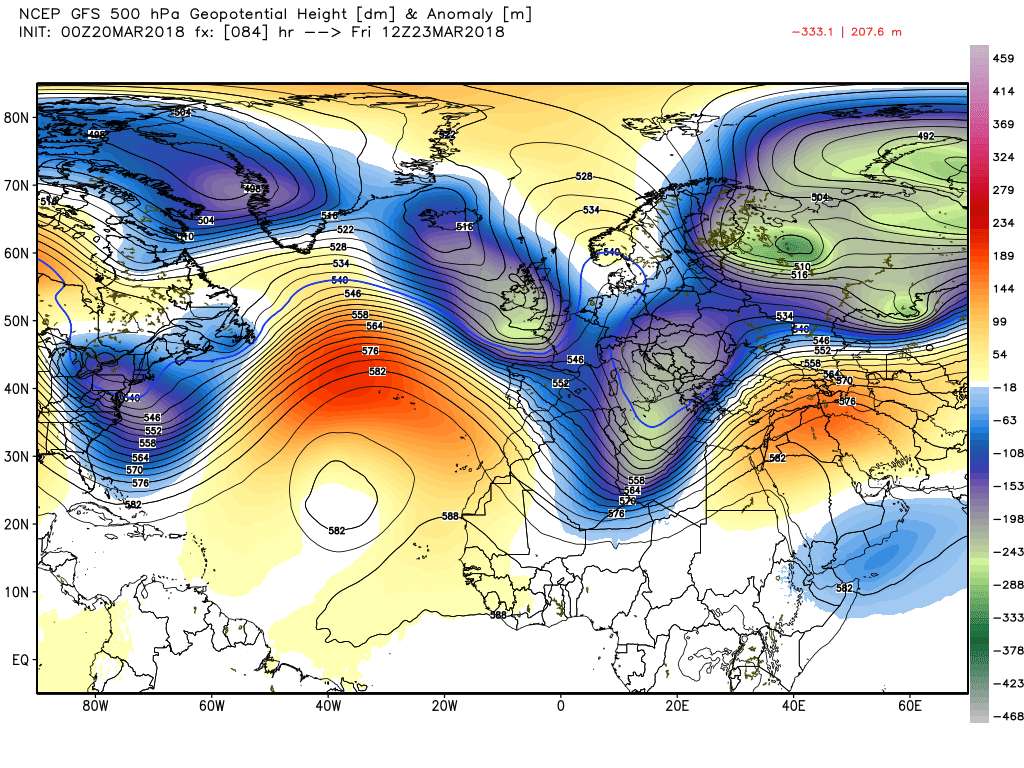
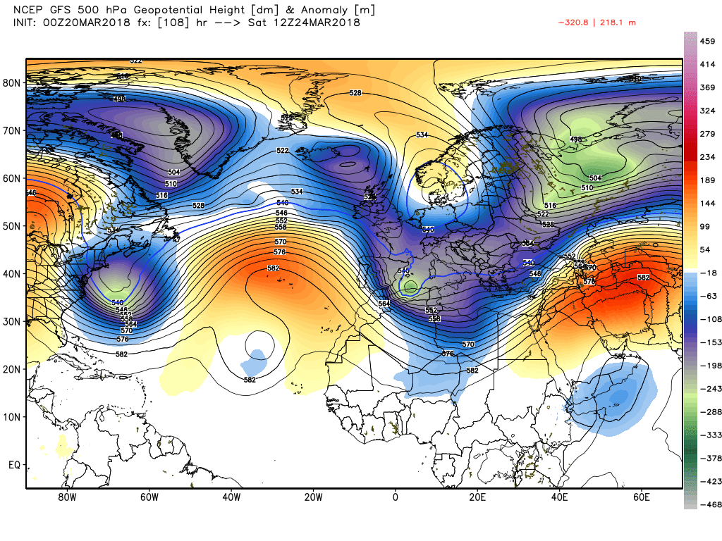
By Wednesday the weather is becoming more unsettled, although the ridge is hanging on. with low pressure starting to dominate the Atlantic as a familiar pattern, of vortex lobe in the Hudson Bay area, trough in the south east US with a lot of east bound energy attacking the ridge gets underway. Temps still a little below average.
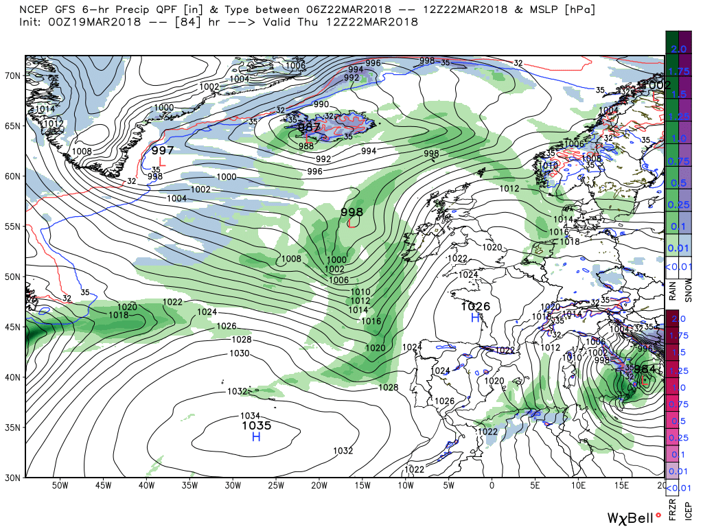
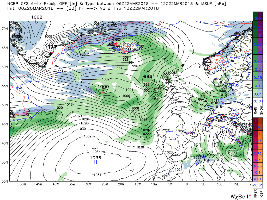
Thus by Thursday it is quite a messy picture to the west with the two energy flows tending to coalesce in mid Atlantic and depressions form in both flows and fronts and rain start to ingress the UK from the north west. By now temps will have returned to around average.
This morning's fax updates for 00, 12 Monday and 00 Tuesday
Thanks for asking.Did you get there alright?
Not a bad idea if possible!Thanks for asking.
No unfortunately I didn't Chris. The roads were too bad and dangerous so I am sat in the living room with the log fire going and intended not to go far.
Take care
Wayne.
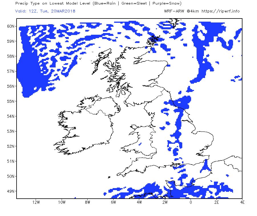
The fax charts for 12 tomorrow and 00 & 12 Tuesday showing the looped back occlusion clearing the Channel along with any lingering snow/rain and thereafter for the rest of the day and Tuesday a dry and more settled period with the odd shower in the east as a cold front battles against the ridge, Temps slowly improving and feeling warmer as the wind abates.
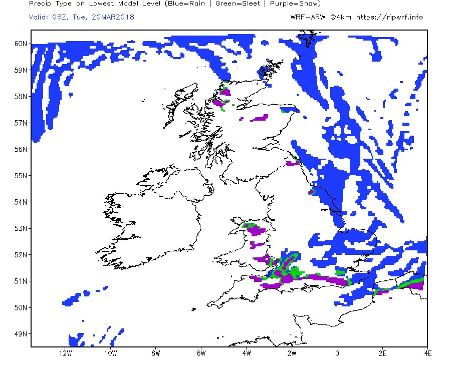
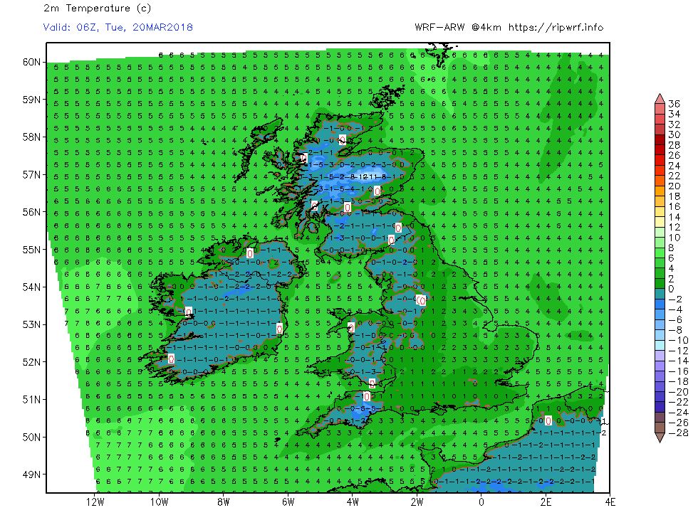
The pattern change gets underway in ernest today with the Azores HP starting to ridge N/NE and become more influential with the upper trough shunted south over France. Thus the remaining snow/rain associated with the wave in the Channel, currently affecting the south west will do the same. So after a very cold night most of the UK should enjoy a sunny day becoming slightly less cold as the bitter easterly abates. This will continue over night but scattered snow showers, turning to rain, will affect mainly eastern areas as the cold front staggers south west.
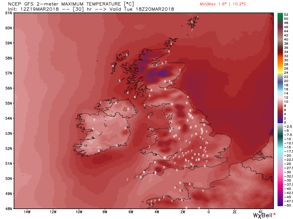
So Tuesday will continue to be sunny in many areas, with scattered rain showers mainly confined to the east,,and temps will continue to rise, albeit still below average, and with the wind fairly light it will actually feel quite pleasant in many areas.
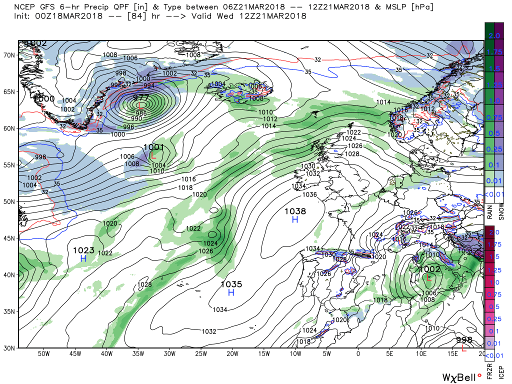
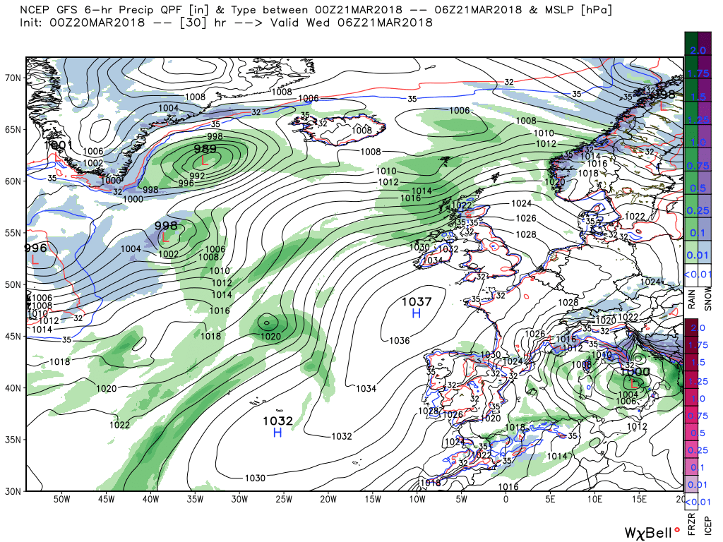
Wednesday sees the continuation of the pattern transition and for the first time for a while we need to look to the west rather than the east, The ridge over the UK comes under pressure from upper trough(s) tracking east driven by the two energy flows from northern Canada and the south east seaboard of the United States. Thus by 1200 rain and strong winds are already affecting Scotland as the ridge is depressed. By now the temps are quite close to average.
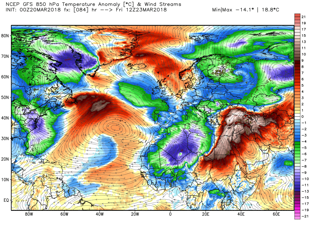
The front and rain quickly clear overnight Wednesday leaving the south dry and still under the influence of the ridge which turns out to be very resilient under renewed pressure from systems pushing east, in which it is helped considerable by the upper trough to the east, Thus the front and low tend to stall over Ireland with just N. Ireland and Scotland being affected by strong winds and rain by 00 Friday. Temps by now much better with the colder air shunted down as far as Timbuktu
On Friday the upper trough to the west deconstructs leading to a static surface pattern with the low parked north west of Scotland so still windy and unsettled there whilst the front fizzles out down the western half of the UK where it will be unsettled with rain showers. This is of course according to the GFS

This morning's updated fax charts to supplement the above, hopefully.
I'm not surprised - the east coast has been affected quite badly. Homes on the Norfolk coast are on the verge of being lost due to erosion over the last few days' conditions.Not sorry to see the back of this weekend's wind, cold and snow, proper hairy getting to Scarborough on Saturday. I was literally having to hang on to the kids to keep them upright when we went for chips in the evening.
It's been sunny and clear here as well, Colum. Anyway, here's Malcolm's post this evening:Not at all surprised bet there's a few up here feeling a mite more precarious as well. Still gorgeous, clear, crisp sunny winter's day her today.
Many western areas will be clear tonight thus the temps will drop and it could be quite icy by morning Tomorrow the same ares may well have a pretty good sunny day But further east it will become increasingly cloudy this evening and overnight as the front struggles south west with some rain/sleet showers although this does reduce the frost and ice potential. Temps approaching average.

Overview
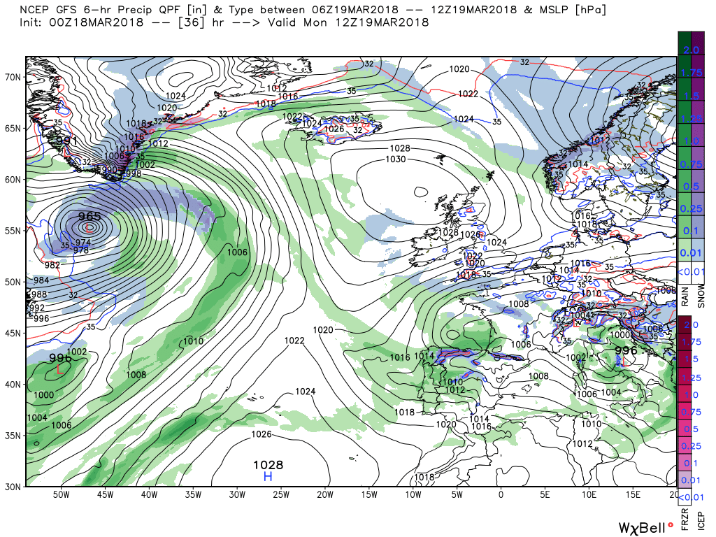
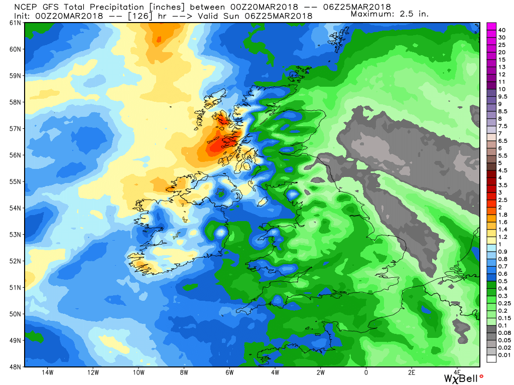
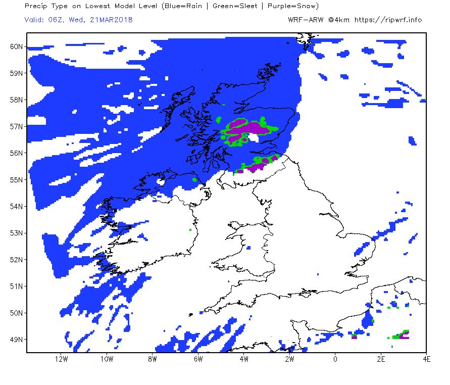
The pattern change will continue today and over the next few days into a more westerly orientated regime with the temp gradually rising to near average and the weather becoming more unsettled but having said that nothing drastic is afoot which a quick glance at the precipitation chart confirms, the western isles excluded.
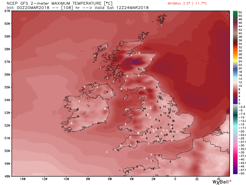
So a bit more detail. Today will be a generally dry day with much lighter winds as the ridge becomes more influential There will be plenty of sunny intervals but patchy cloud in some areas as the front meanders south west with the odd rain shower thrown in. These will become confined to the north west later falling as snow on the high ground. Temps reaching a respectable 5-6C apart from in northern Scotland.
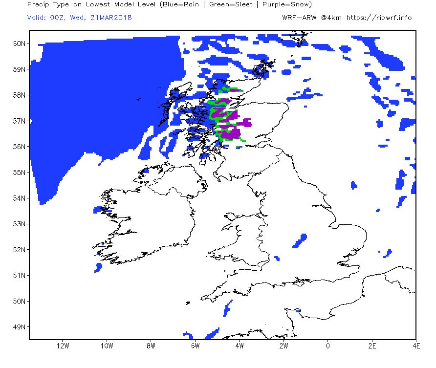
Overnight more general rain and snow will encroach Scotland and N. Ireland whilst elsewhere will be dry with a slight frost developing in many places
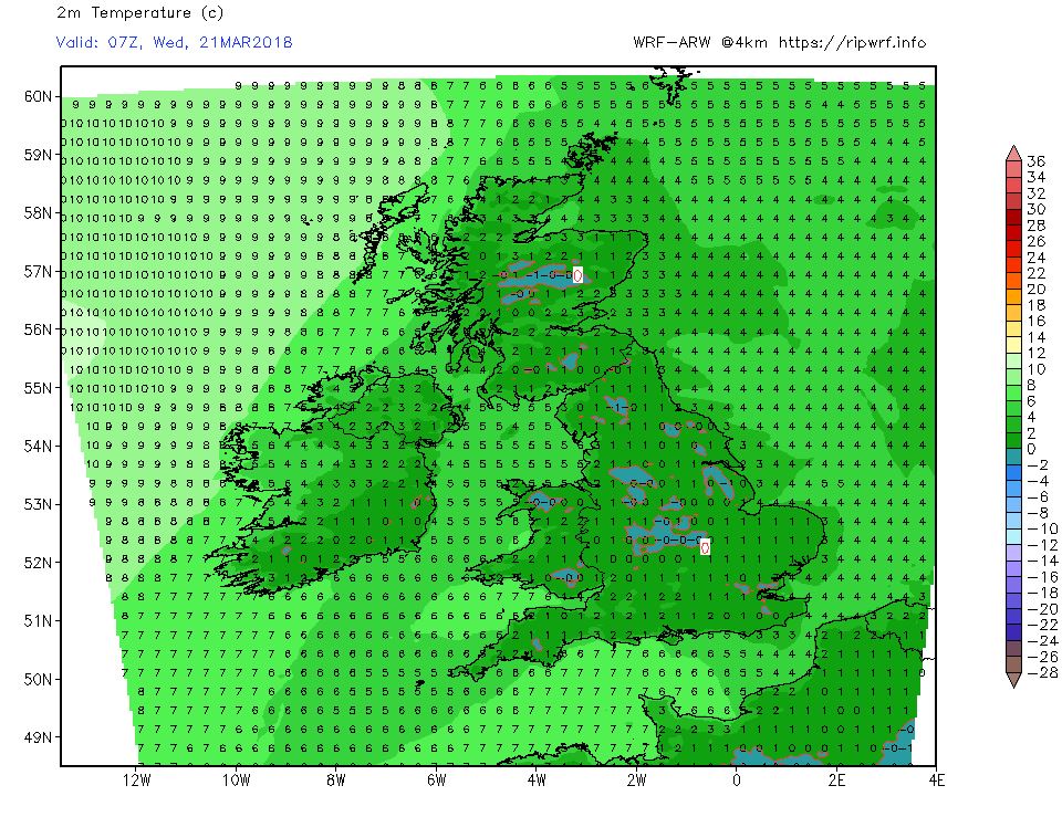
During Wednesday the fronts and rain will traverse the country although they will mainly impact the north with the south remaining dry.and the temp reaching the giddy heights of 7-8C.
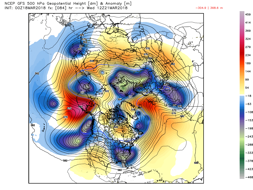
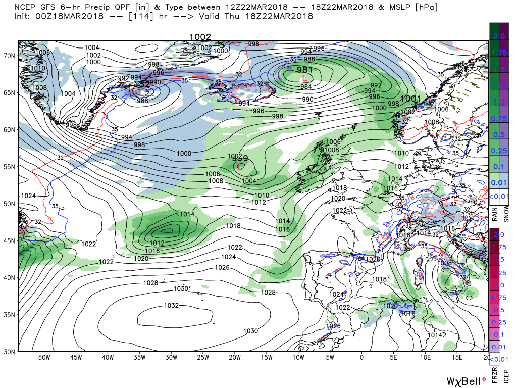
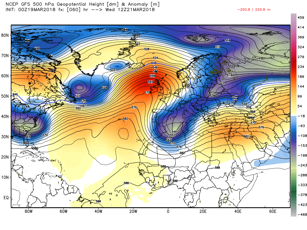
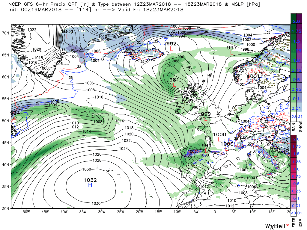
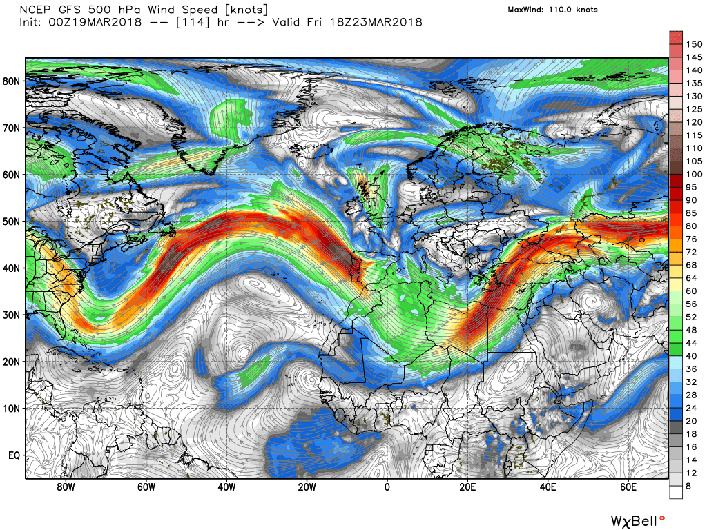
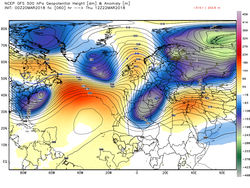
By 1200 Thursday time to take a step back and appraise the situation and we find the upper ridge still hanging in there but under severe pressure from Atlantic trough(s) driven by the two energy flows emanating from northern Canada and the south east United States in particular All of this resulting in a number of surface lows to the west of the UK with a front and associated rain over Ireland.
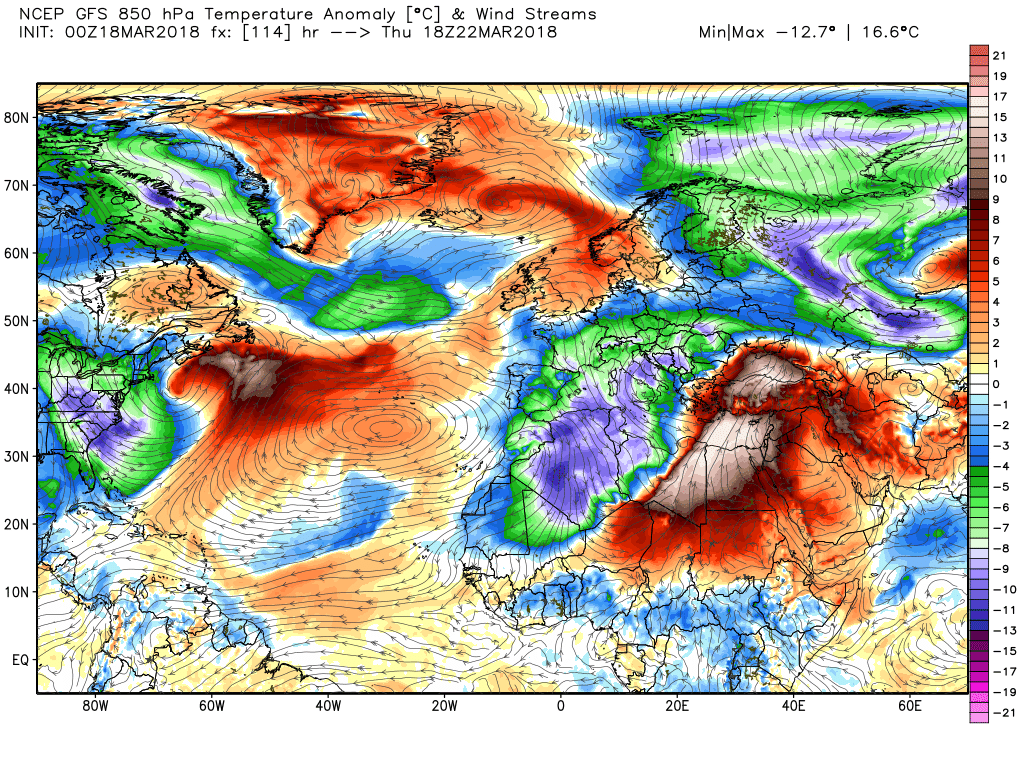
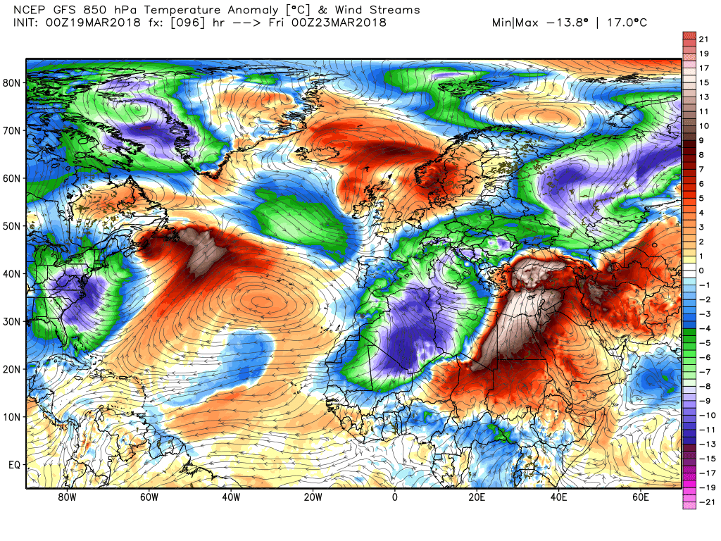
Overnight and into Friday the upper trough develops a negative tilt as it phases with the trough to the south east resulting in the surface front with patchy rain slowly moving east. The two energy flows still being quite well illustrated as is also, connected to this, the distribution of the cold/warm air.
By midday Saturday there is a rather complex upper trough arrangement splitting the high pressure leading also to a rather complex and indeterminate surface analysis resulting in sunshine and showers for the UK and temps now just about average.
The ecm broadly similar the GFS