OP
- Joined
- Saturday January 15, 2011
- Location
- Norfolk, England
- Thread Starter
- #1,681
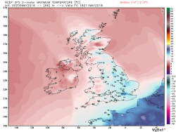
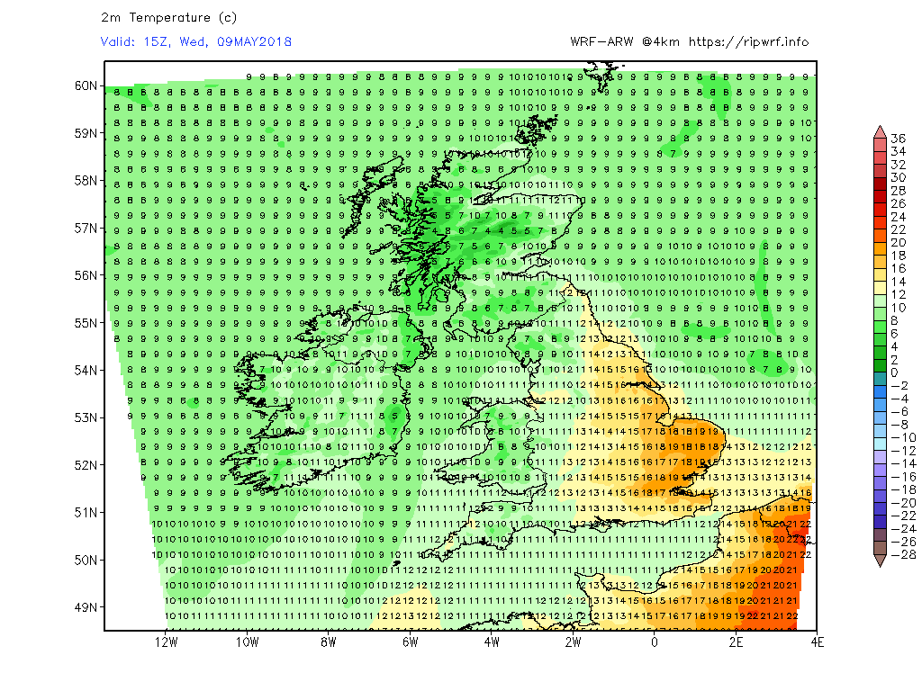
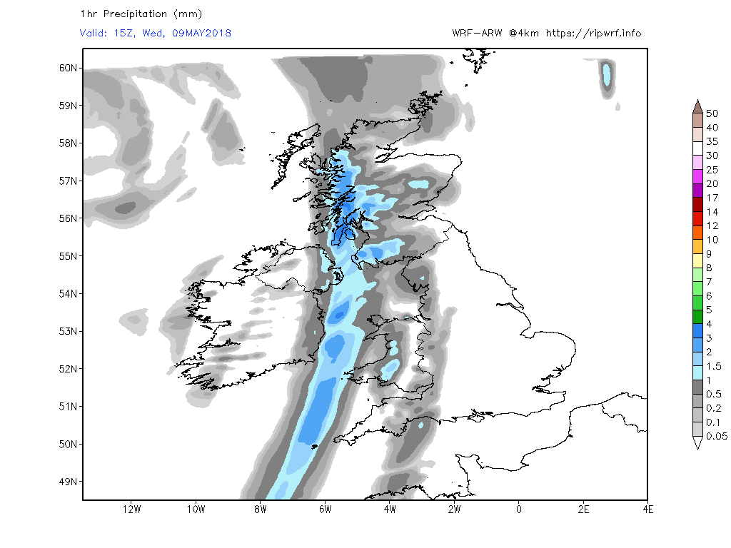
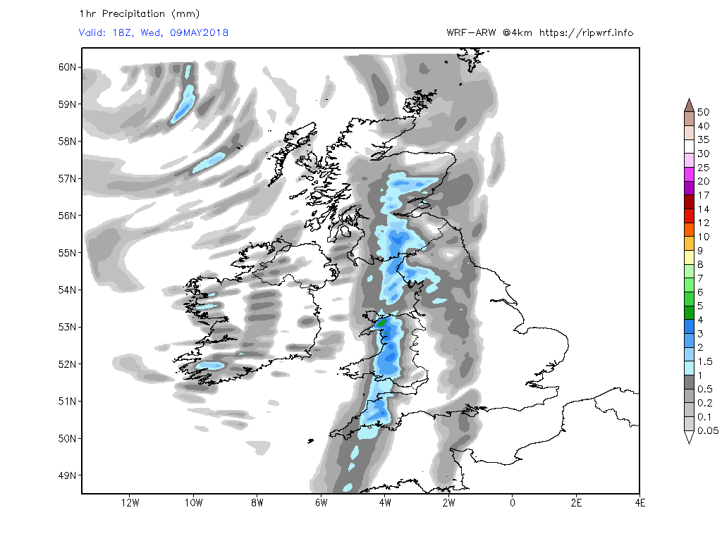
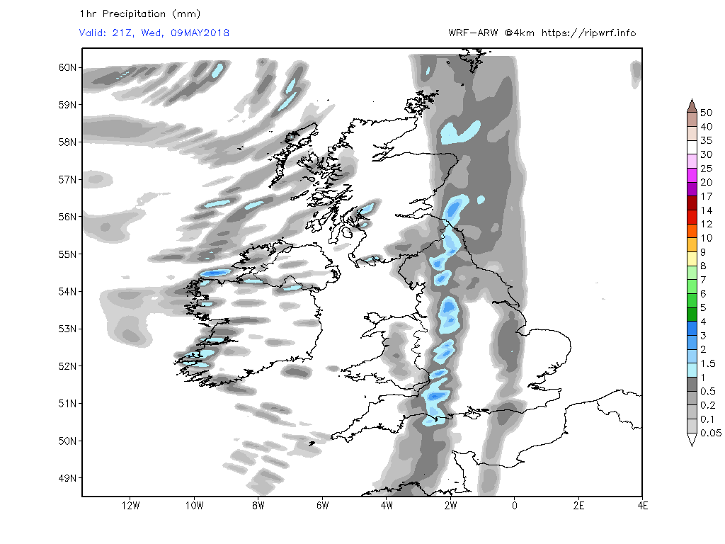
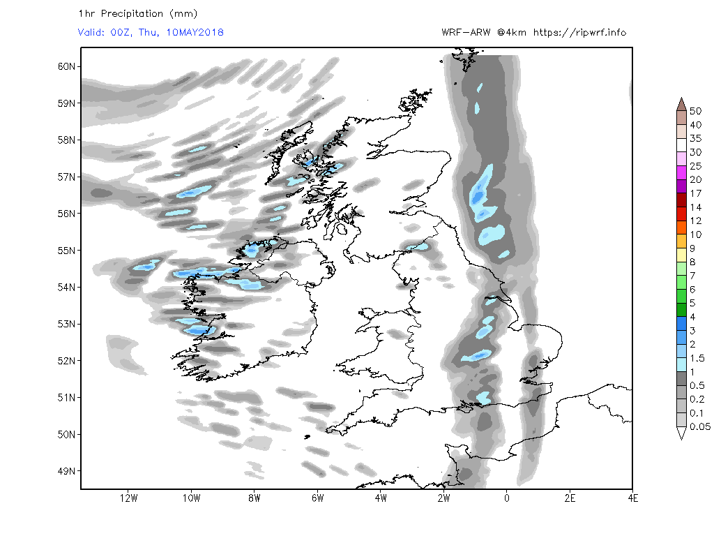
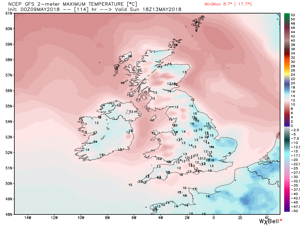
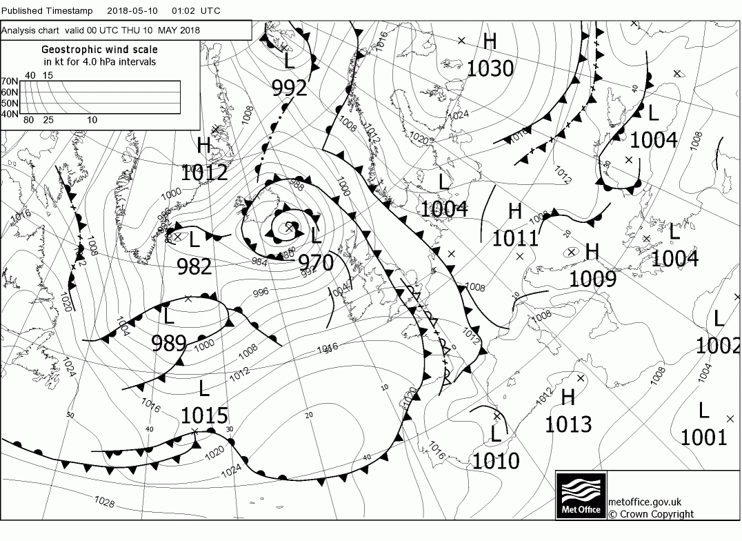
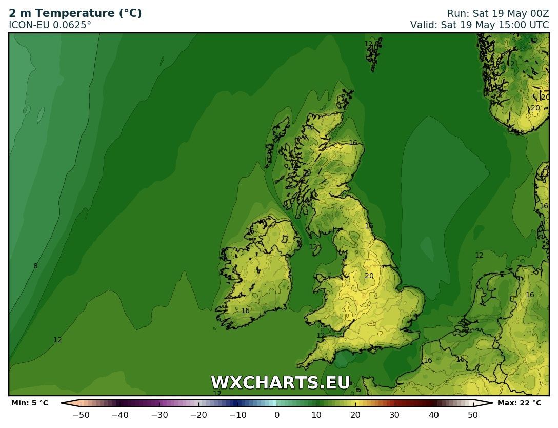
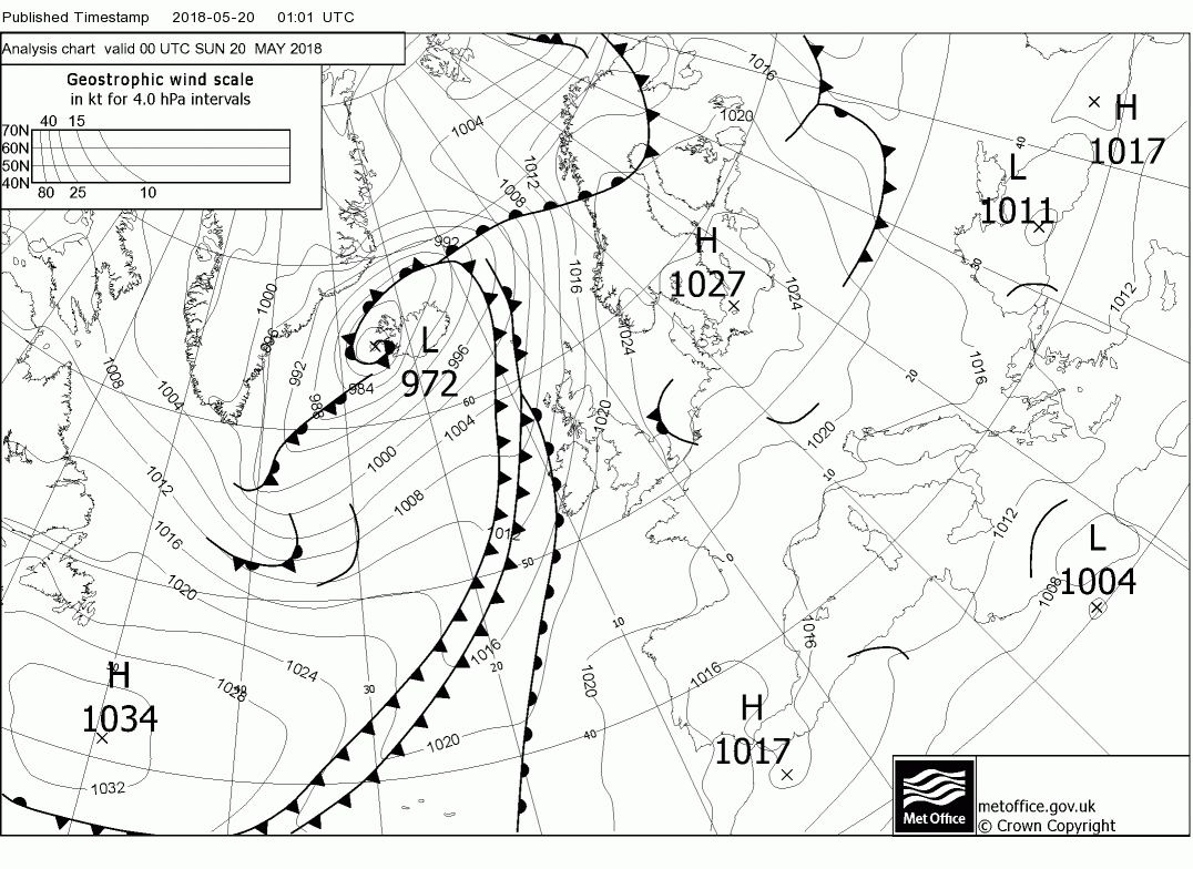
Malcolm's post for 9th (part 1):
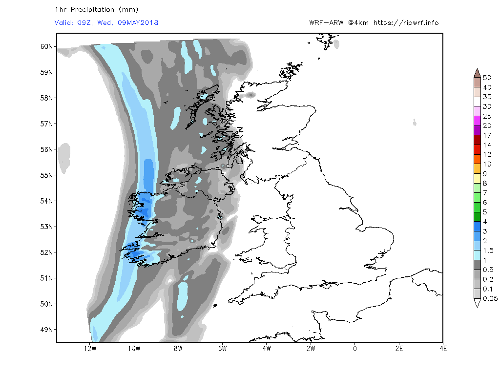
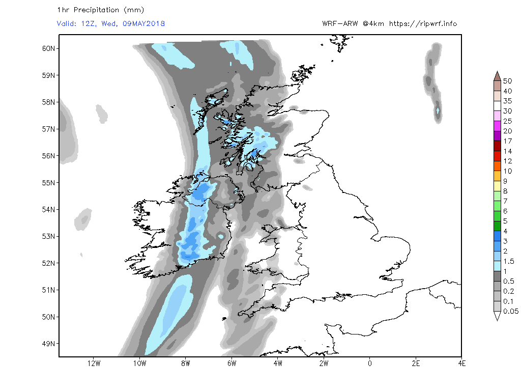
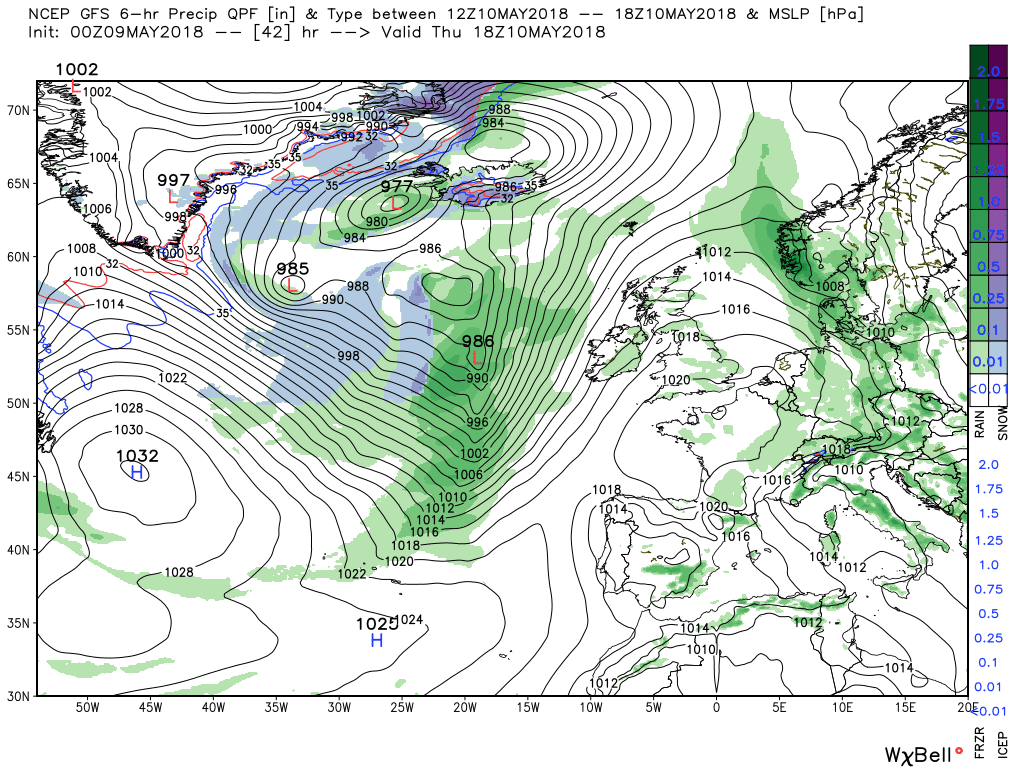
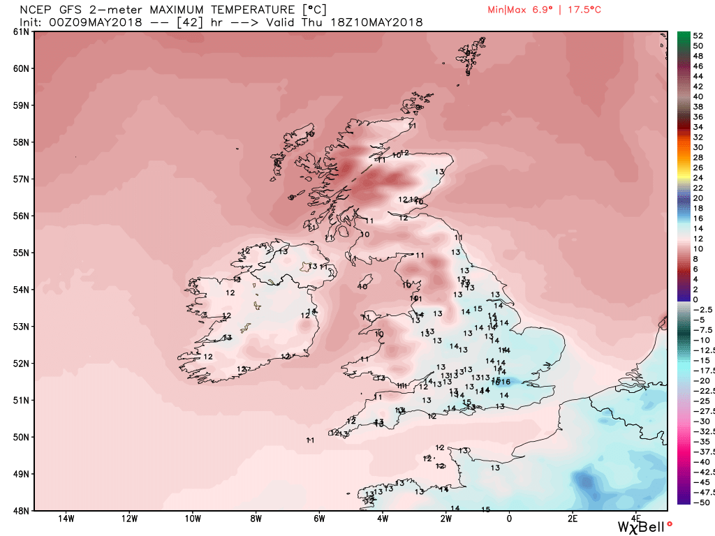
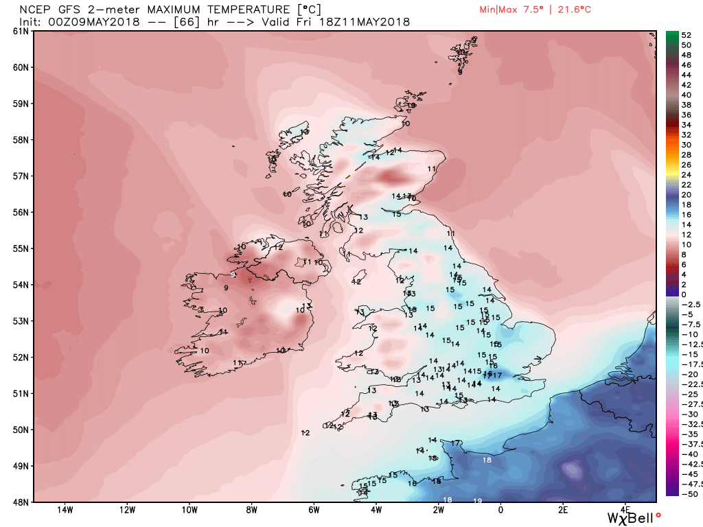
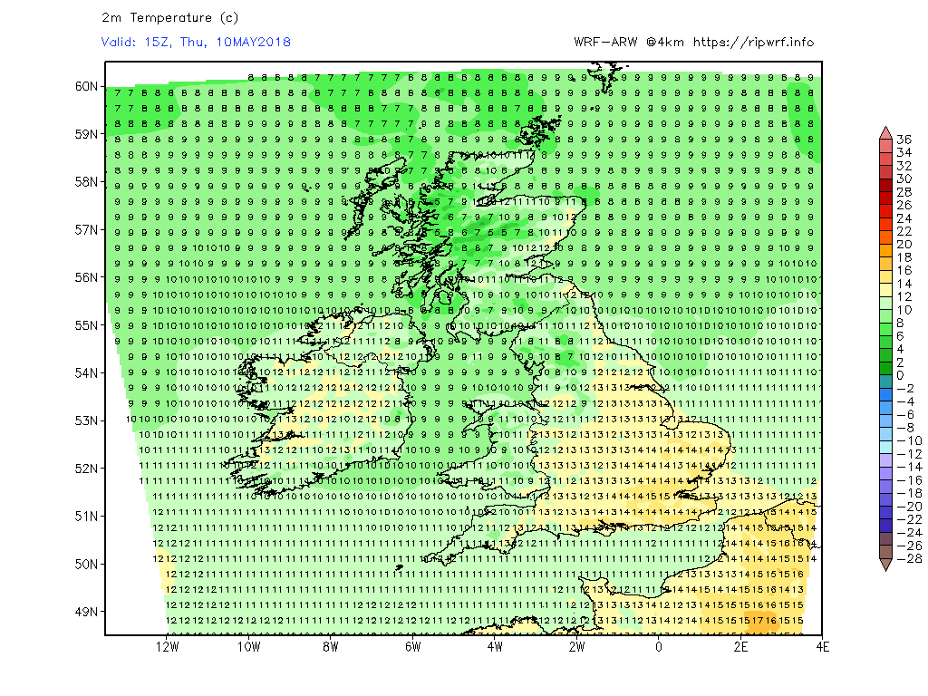
After a relatively cool night today will dawn quite dry and bright in most places but frontal rain will ingress N. Ireland and the Western Isles by 0900 and will slowly cross the country during the day and evening. Thus most of the eastern half will remain dry and pleasant with temps still above average before the rain arrives and clears unto the North Sea by Thursday morning.
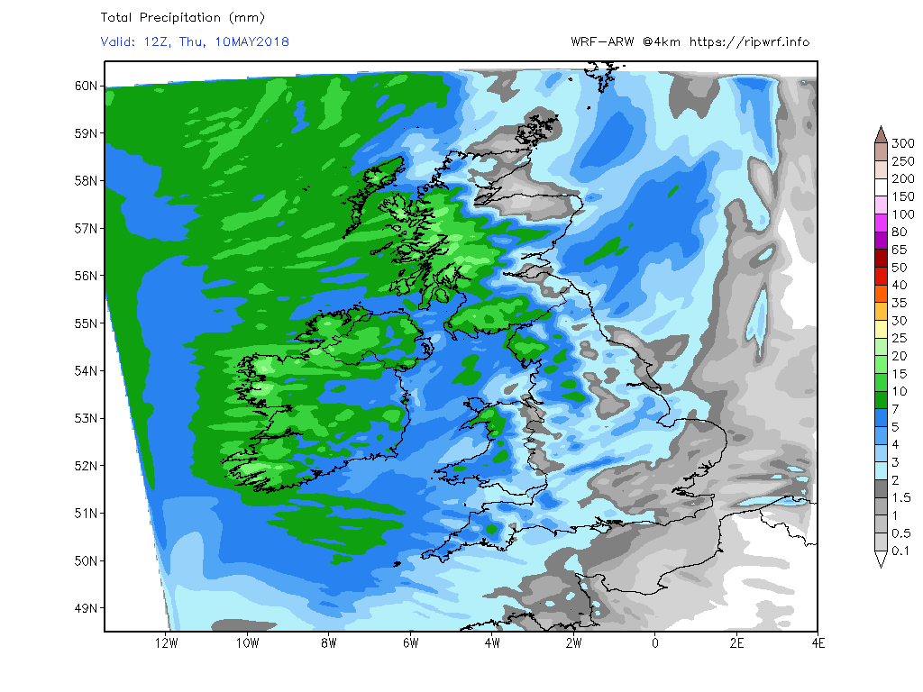
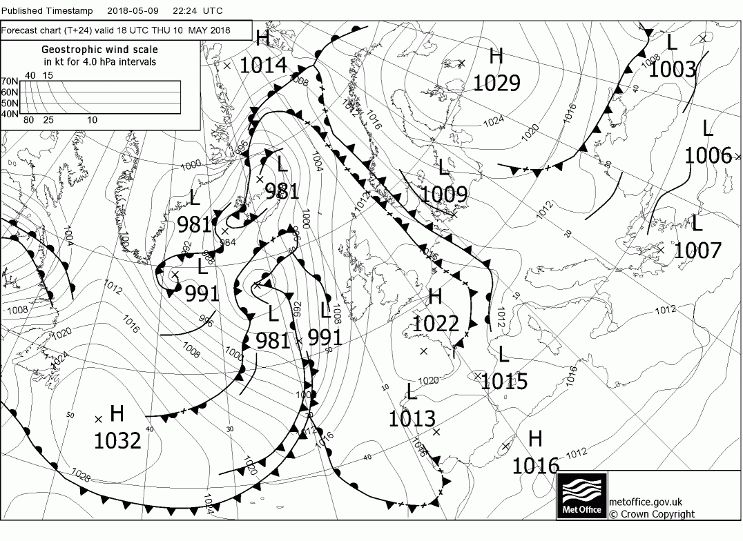
So once rain has cleared Thursday wil generally be a dry and sunny day with showers, more frequent in the north, as a transient ridge becomes briefly influential, witrh temps back to around average.
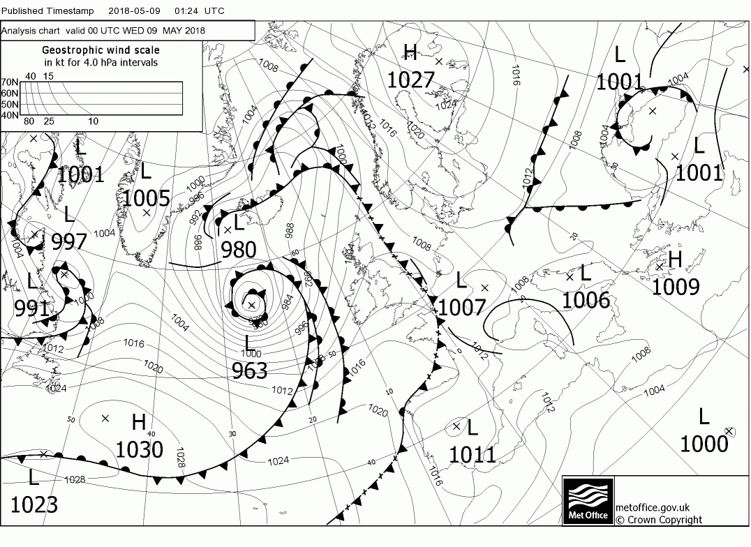
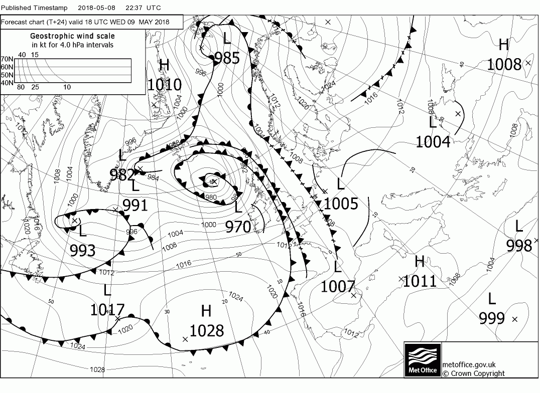
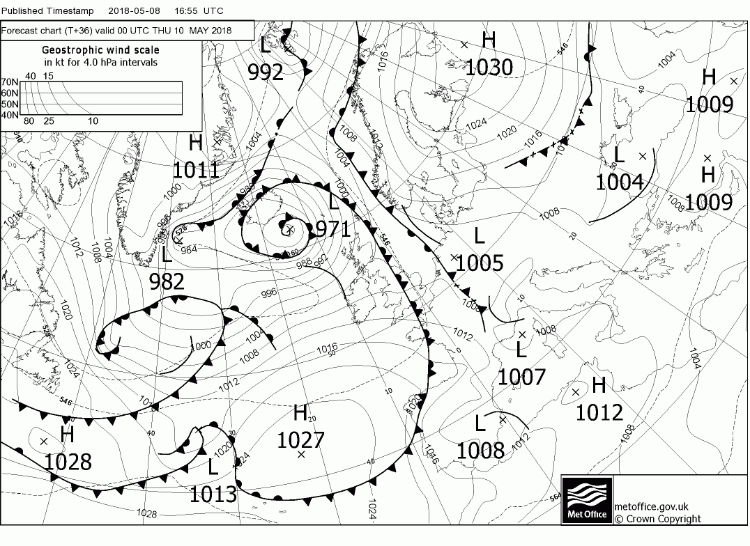
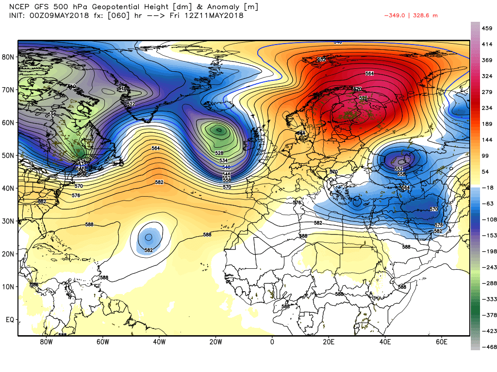
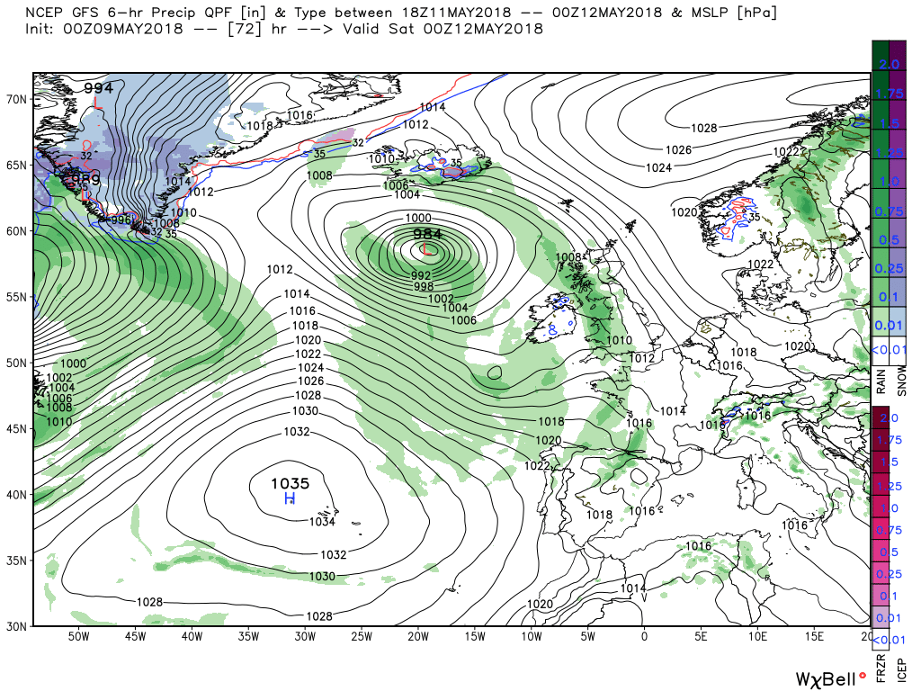
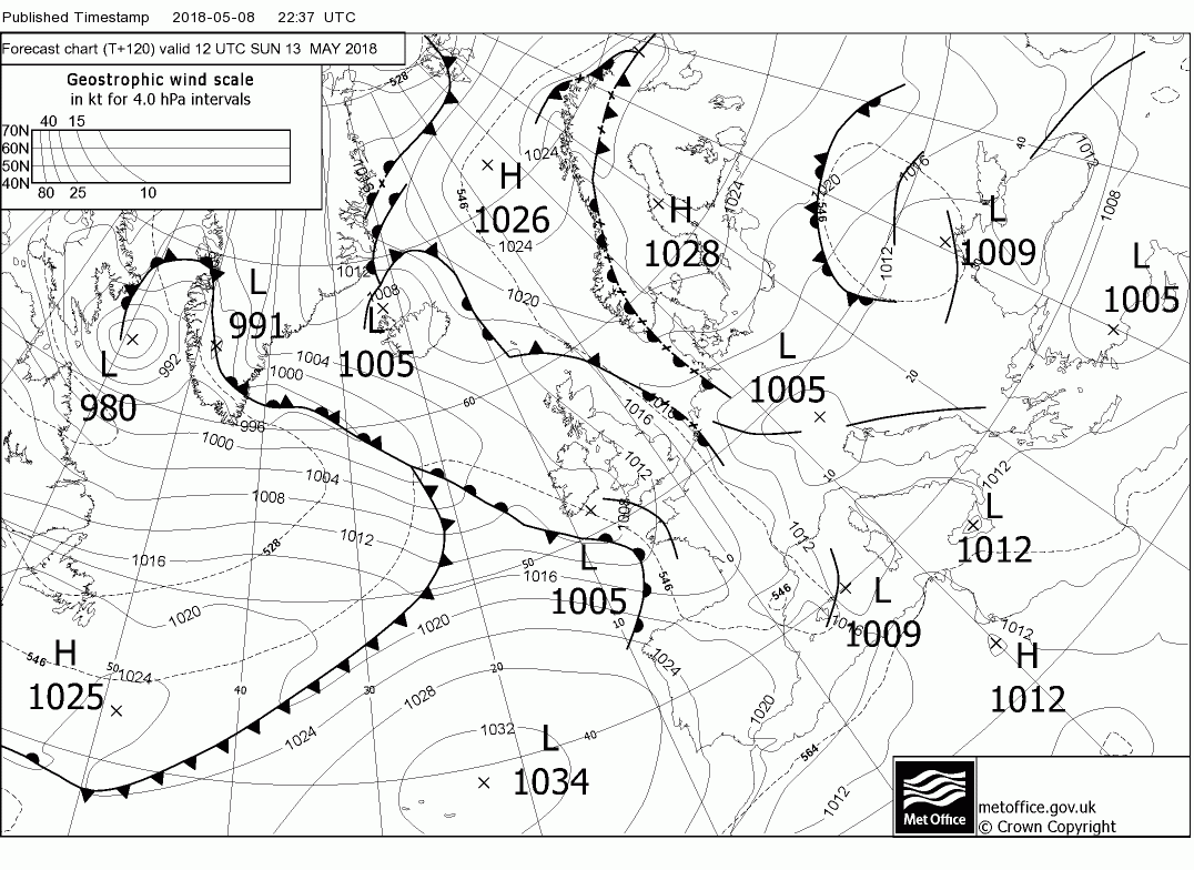
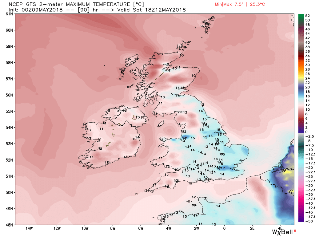
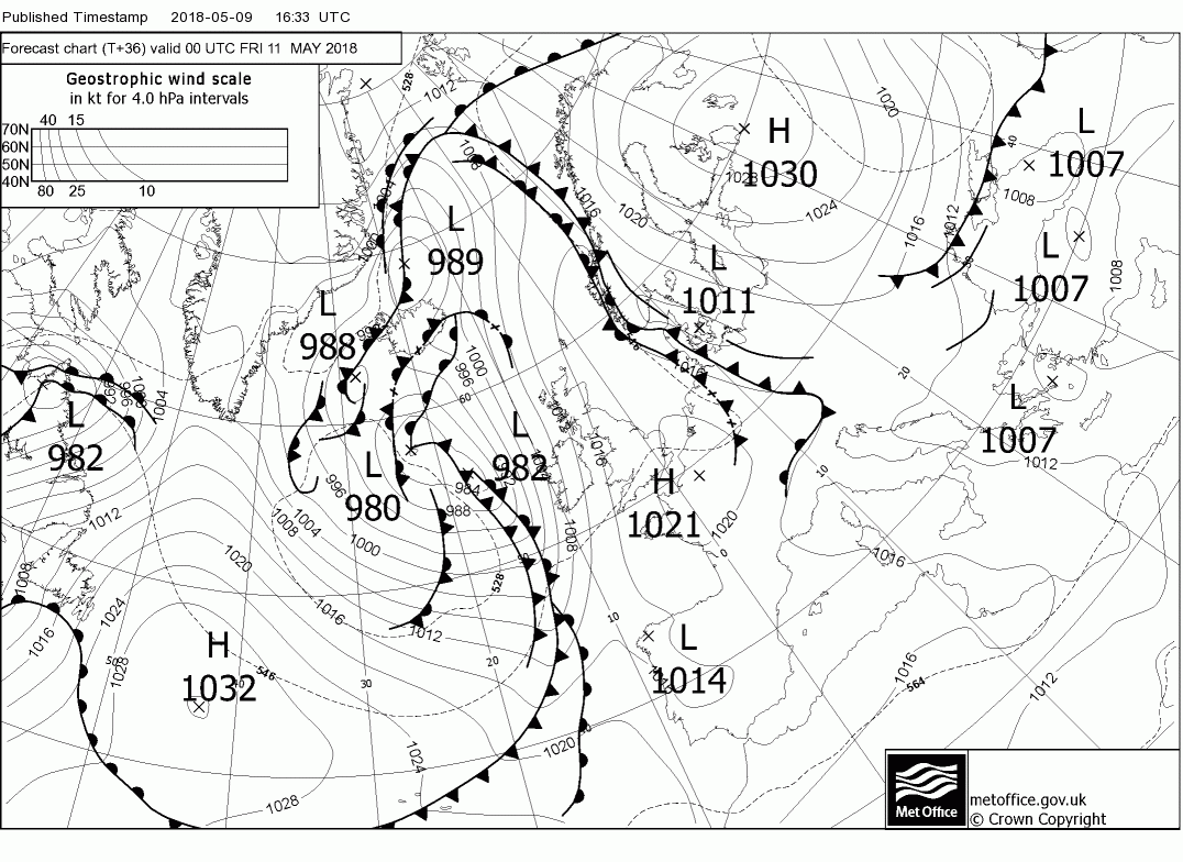
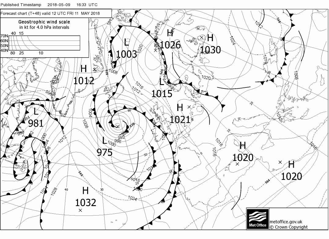
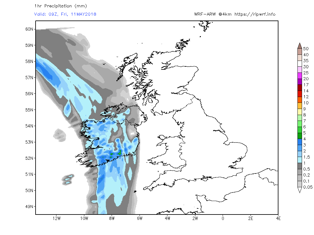
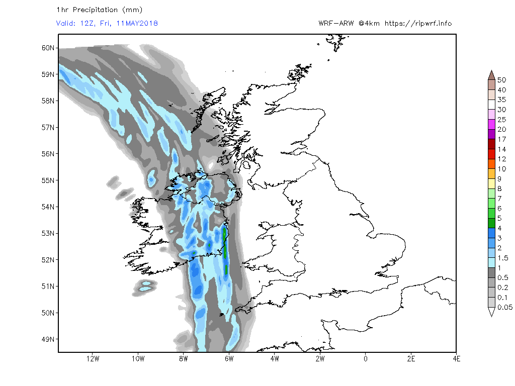
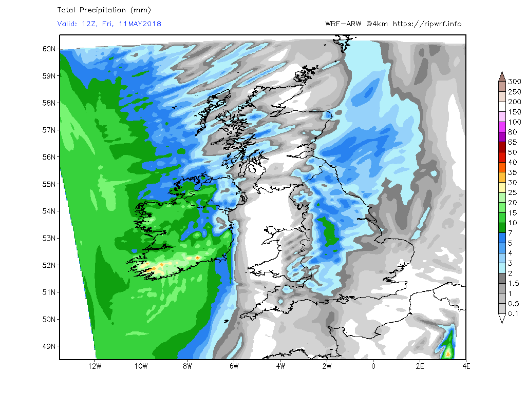
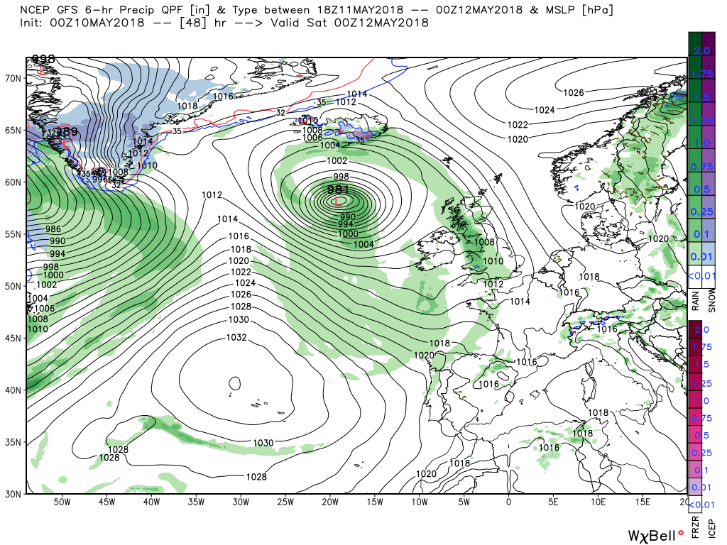
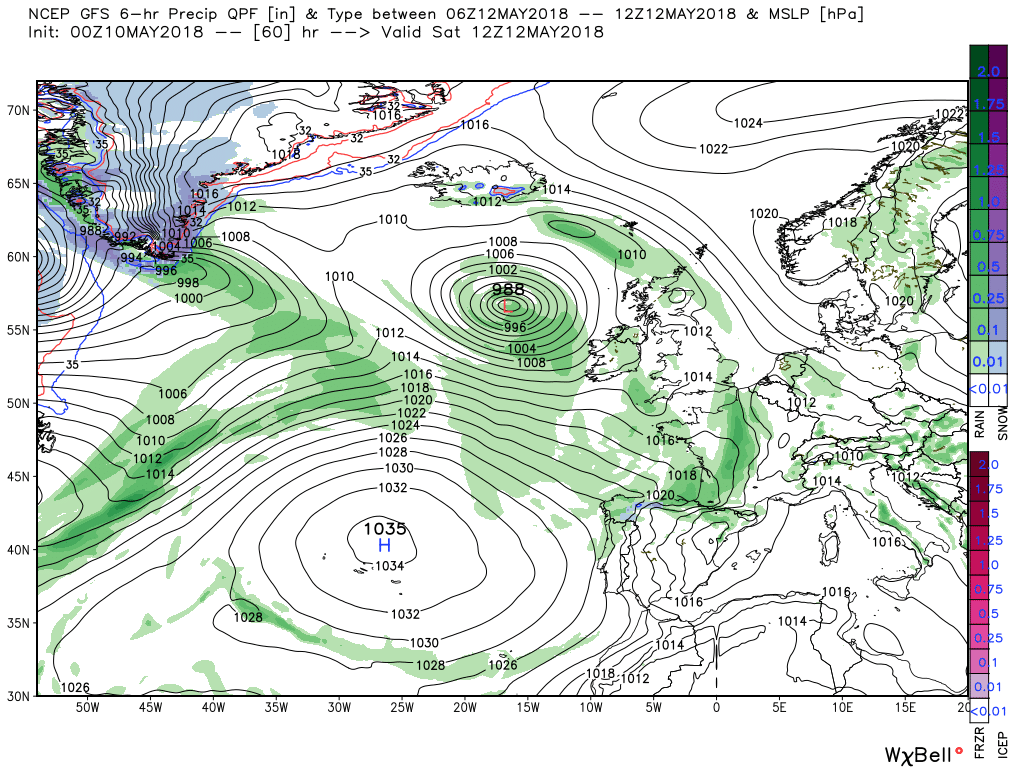
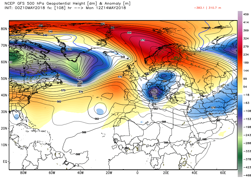
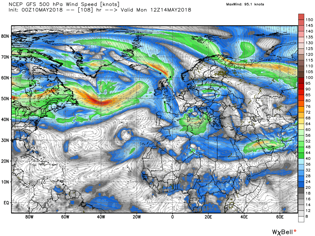
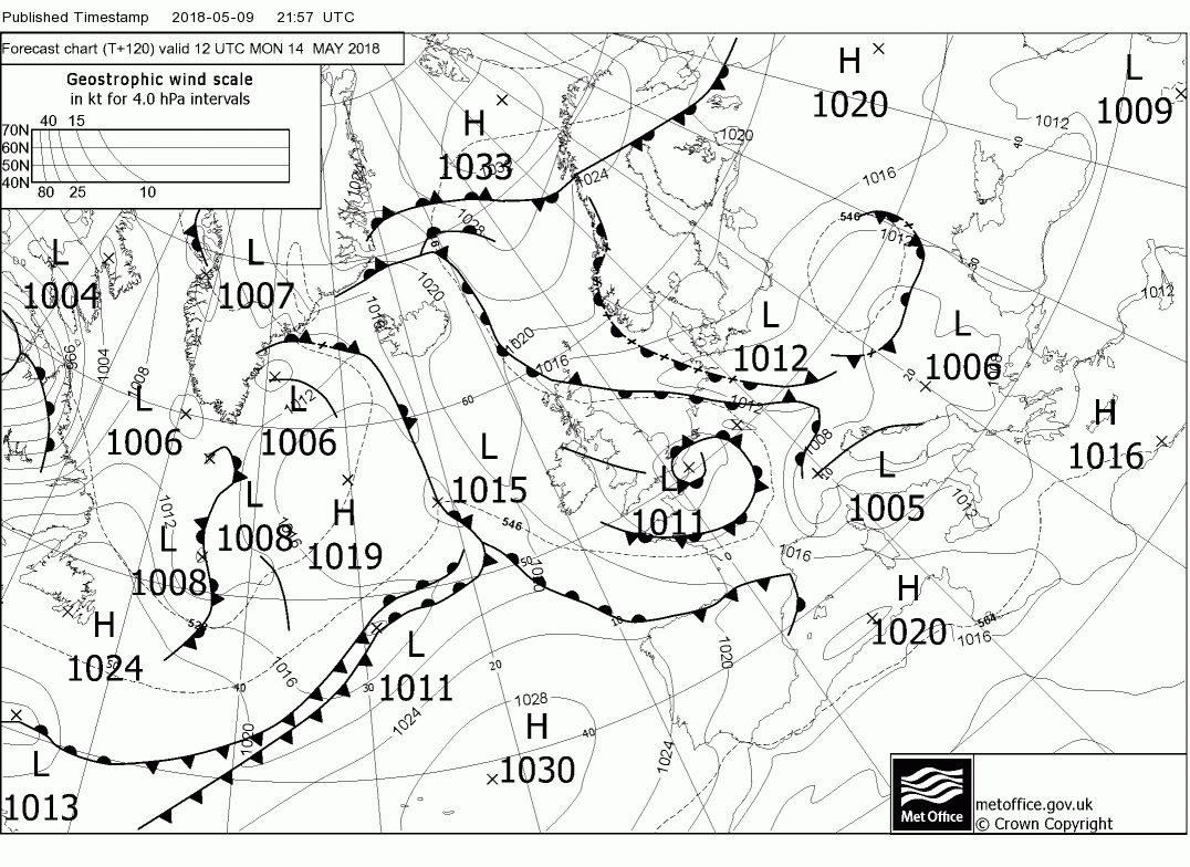
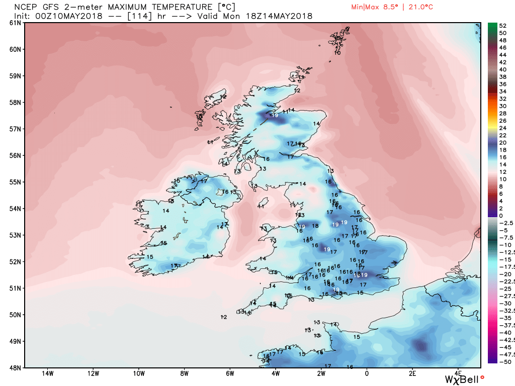
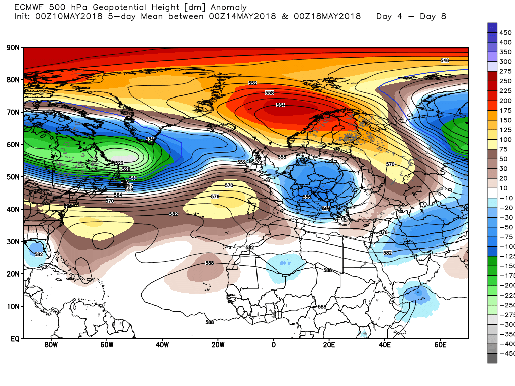
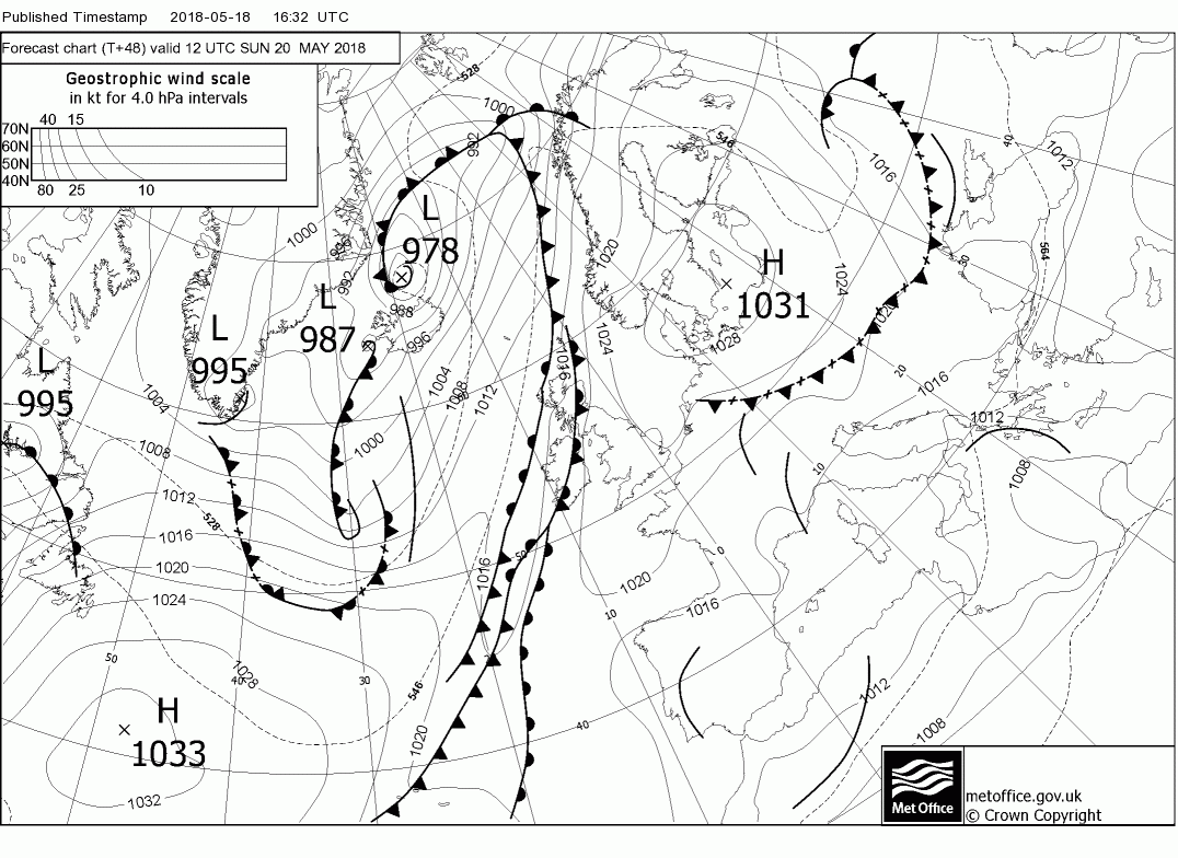
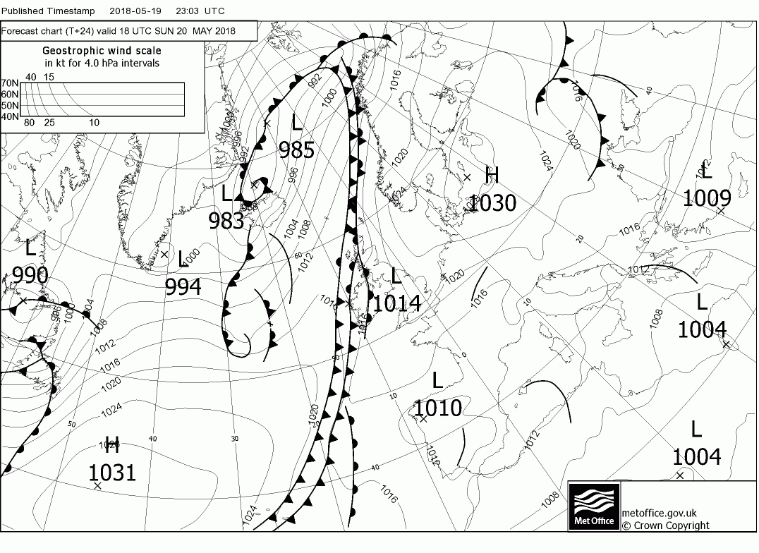
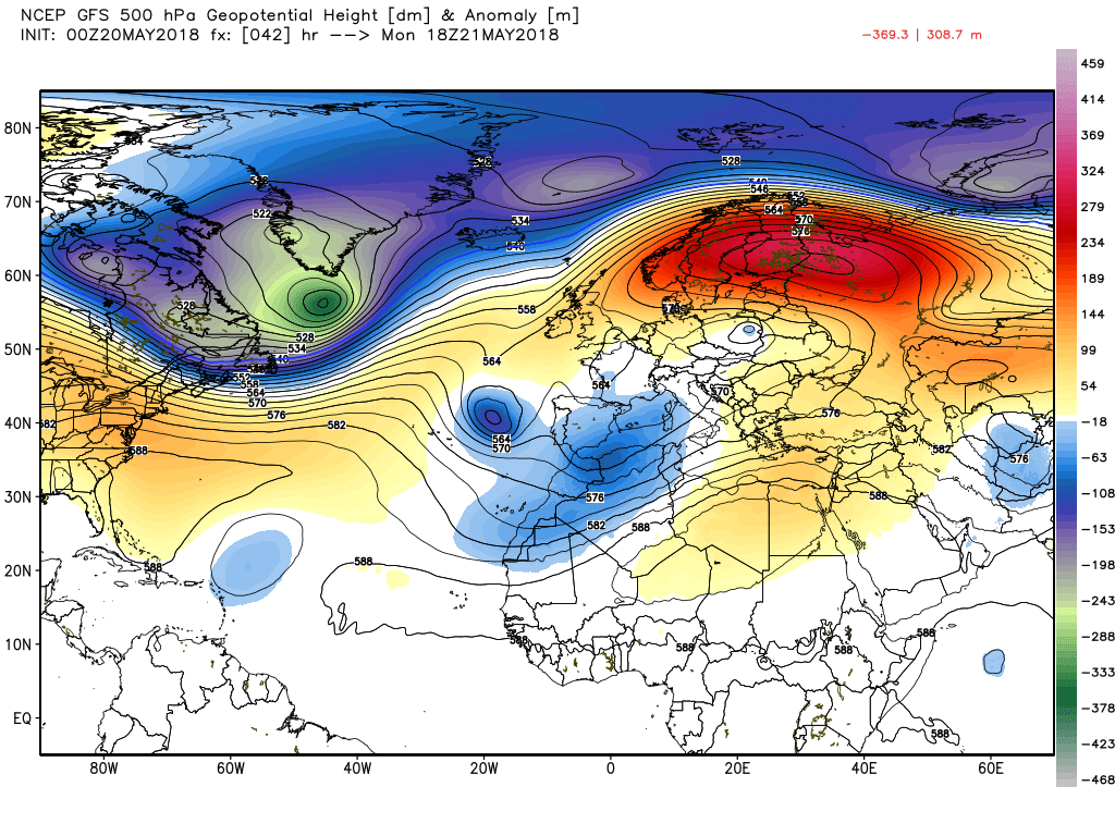
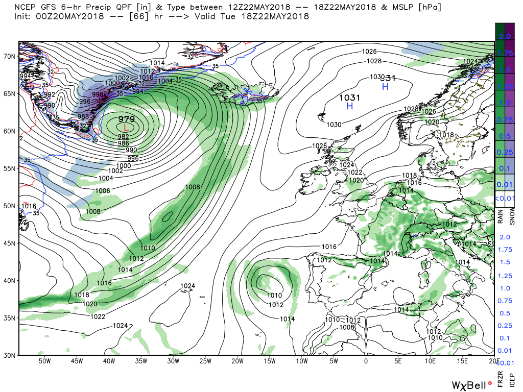
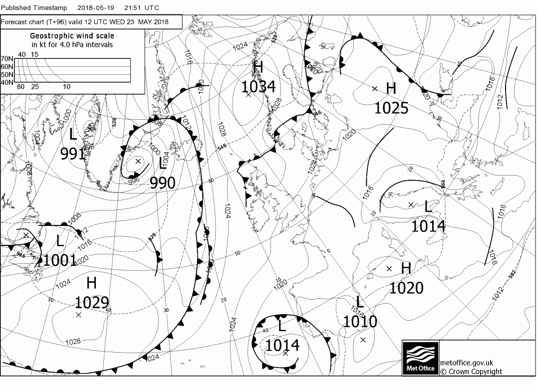
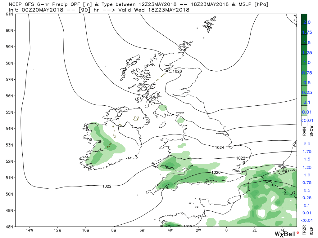
But by Friday the battle between the eastbound energy exiting North America and the block gets underway in earnest with the block to the east unrelenting and the Bermuda high amplifying in the Atlantic deconstructing the trough. Thus the surface low south of Iceland is almost stationary as the associated front struggles to push east across Ireland in the gently southerly flow over the UK. So again the eastern half of the UK remaining dry and generally temps still around average.