It's going to be further south, Johnny, affecting only the far SW tip of Scotland. To give you an idea of how far south the warning area has moved, I'm under it!
Well, no loss what a friend gets Chris.
JohnnyO. o/

It's going to be further south, Johnny, affecting only the far SW tip of Scotland. To give you an idea of how far south the warning area has moved, I'm under it!
") P.
P.Storm damage in cornwal today, high tides and high winds are not a good combination but still not as bad as up country, let's be careful out there!
Glad to hear that damage is limited in severity. Here's Liam Dutton on a cold weekend and possibly something wintry in the medium term:Storm damage in cornwal today, high tides and high winds are not a good combination but still not as bad as up country, let's be careful out there!
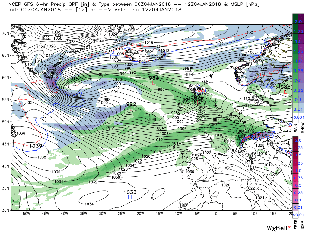
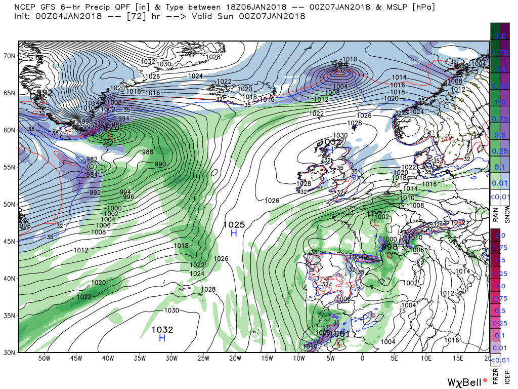
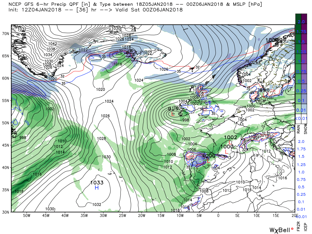
Today sees a belt of moderate rain moving north east (just cleared here) with the low over NW Scotland at 12. This moves quickly east to Denmark leaving quite a complex surface analysis before another low and more rain brings more rain to the south overnight with snow in Scotland.
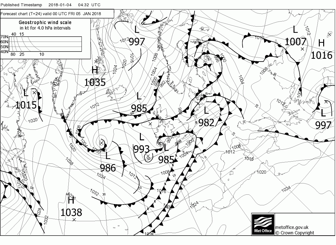
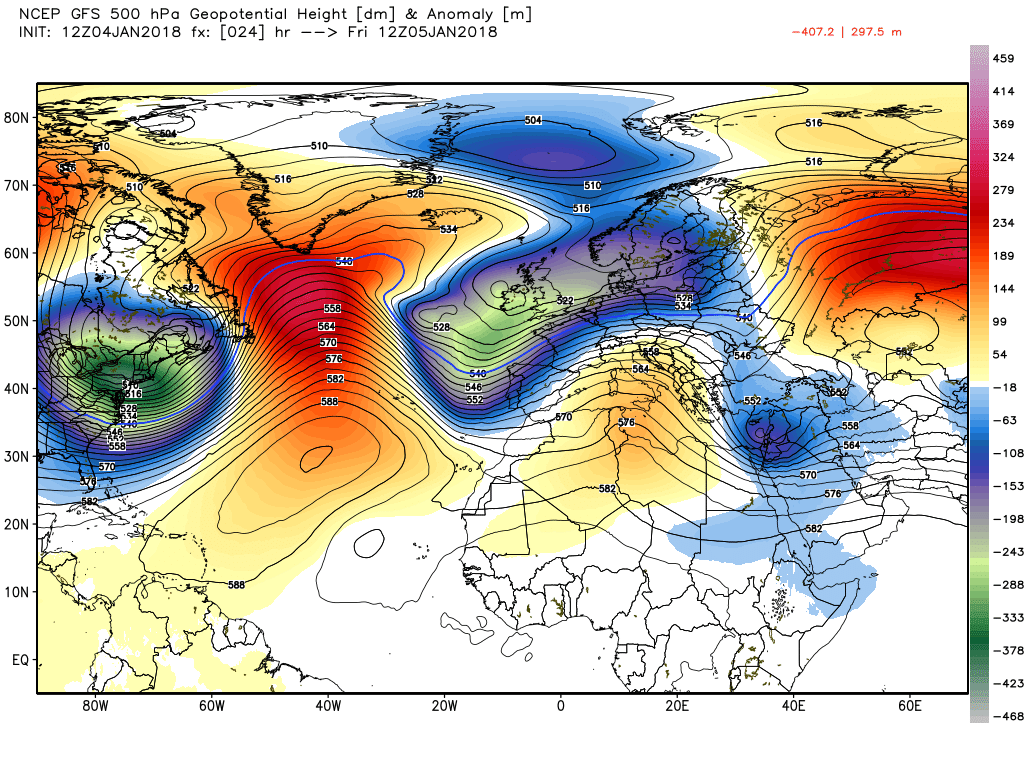
By 00 Saturday the expected amplification of the high pressure is taking place in the Atlantic as it ridges north then north east pushing the upper trough over the UK south. It is worth noting here the low that has formed between Greenland and Iceland as it is the movement east of this low that delineates the boundary between the warmer air to the south and the much colder airmass to the north. This is illustrated very well as the ridge sinks south and the north easterly flow introduces a modified form of the colder air into the UK over the weekend.
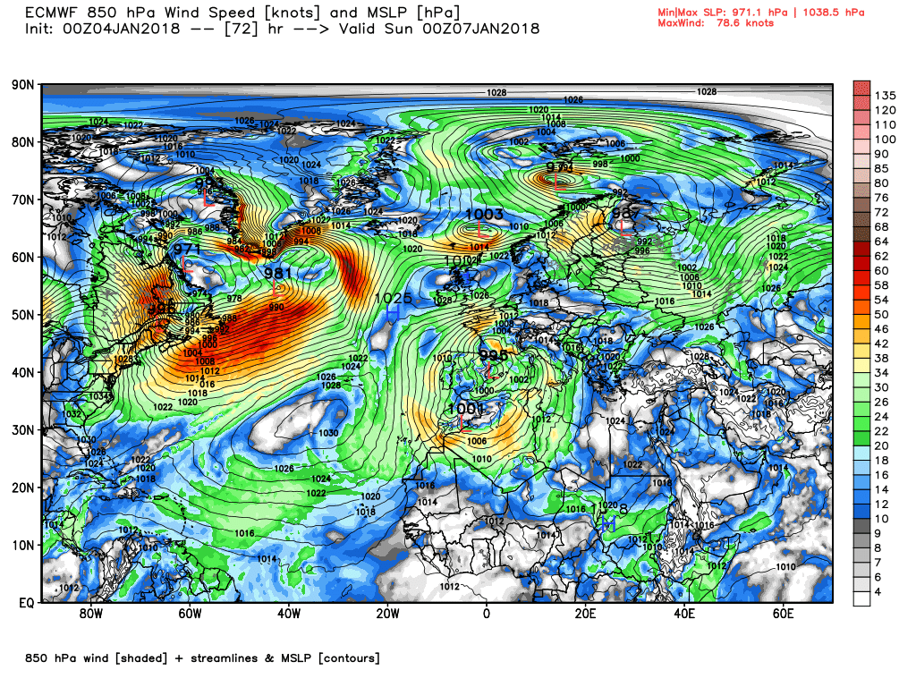
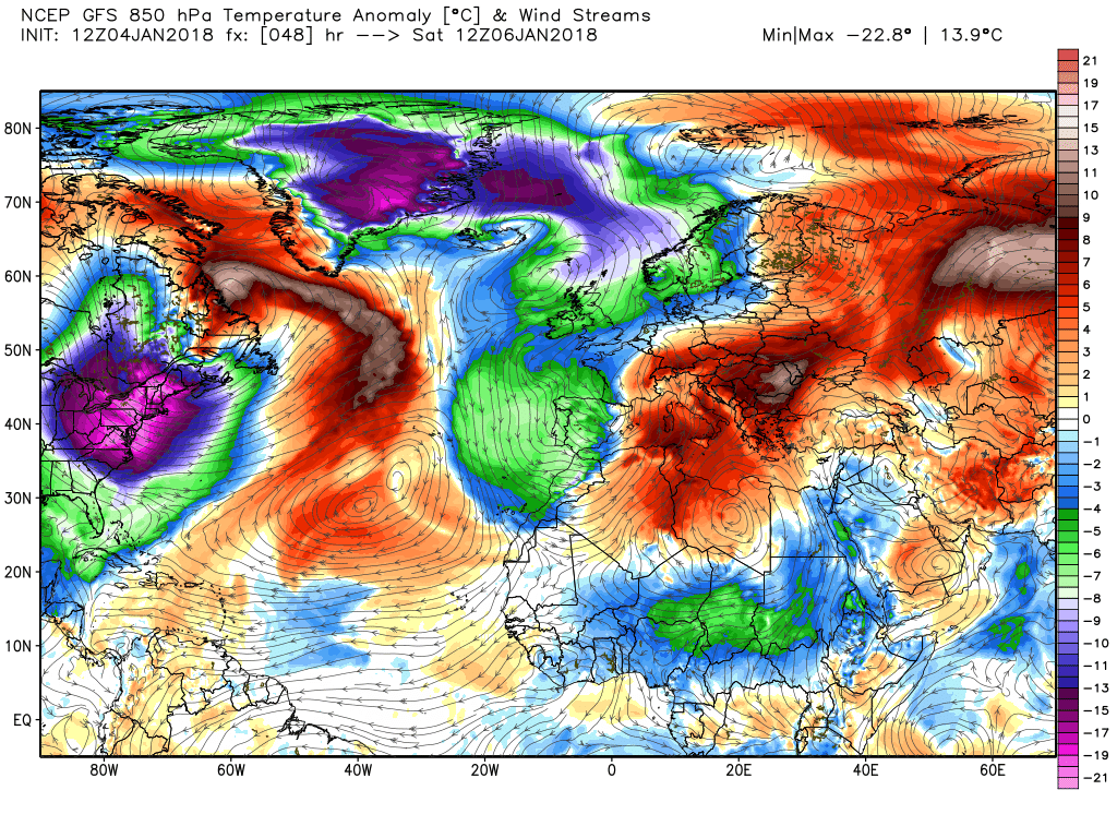
The ecm surface analysis for T48, 72. Quite a strong easterly on Saturday in the south with max temps in the plus 6C range but markedly colder on Scotland and struggling to get above freezing.
Nasty then, Colum? Anyway, drier but colder for the weekend and early next week.Found the compost bin lid down the lane last night, illuminated in the main beams. Noticed on the way out this morning the lid is missing from the incinerator bin as well. Looking forward to a quieter evening - mice allowing.
We can cope with drier and colder the noise over the last couple of nights has been intense.
5 miles of moorland behind your home sounds lovely even if the wind is howling across it.Know what you mean Count, we've got about 5 miles of shrubland and moors behind our home and it's been like a continual, low volume air raid siren wailing in the background.
JohnnyO. o/
5 miles of moorland behind your home sounds lovely even if the wind is howling across it.
It's okay to look at Paul, however it's mostly just a quagmire of clay from autumn through to late springtime, never drains. I'm quite sure that's where Conan Doyle got the idea for the Grimpen Myre in Hound of the Baskervilles from ...
JohnnyO. o/
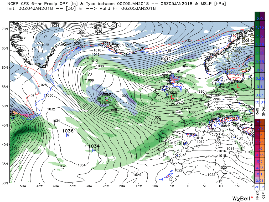
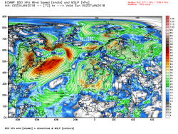
Tomorrow midday sees the UK and the eastern Atlantic under a complex upper trough with various surface lows and fronts littered about bringing sporadic rain and some snow in Scotland, Whilst to the west the high pressure is ridging north and then north east towards Iceland.
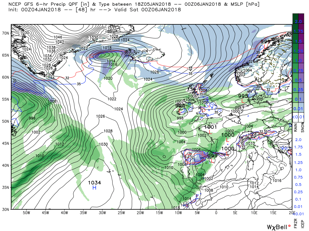
Over the next 24 hours the ridge moves east and the extension south towards Scotland forcing the trough south. Crucially the low that has formed between Greenland and Scotland has also tracked east and the associated front marks the boundary between the warm and cold air as the latter now descends on the UK in the resulting North easterly wind.
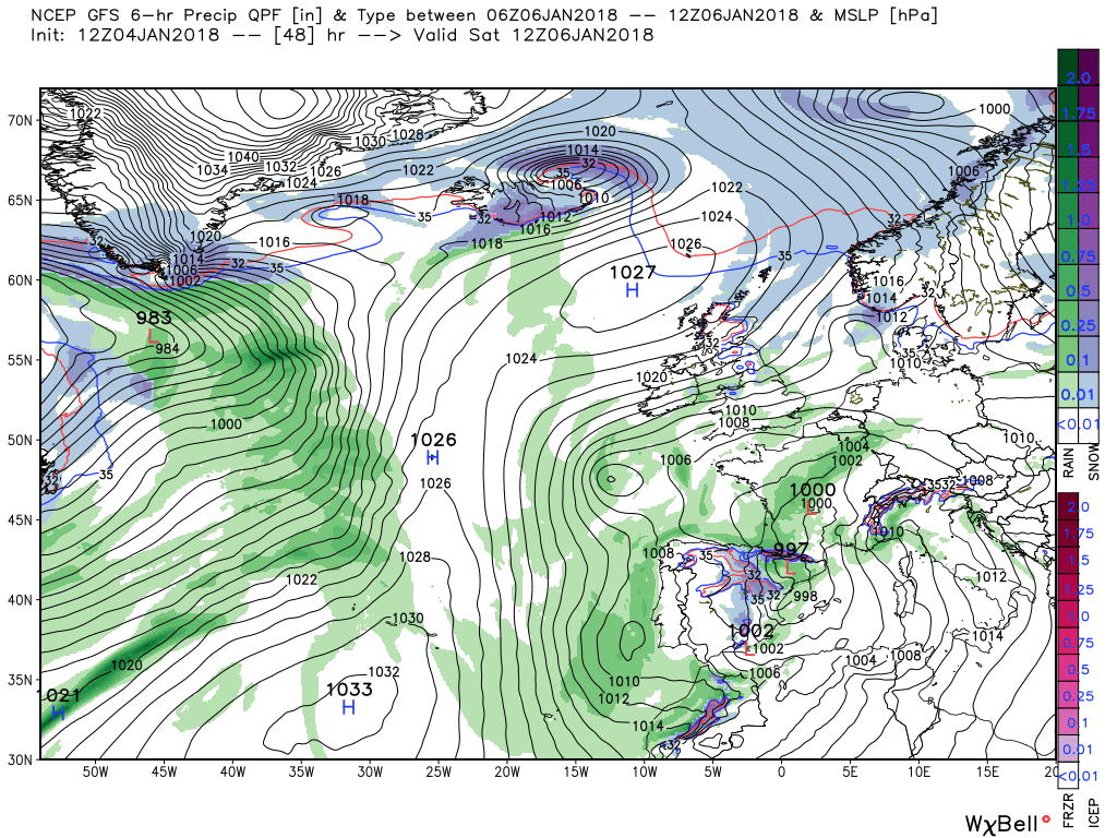
By 12 Sunday the ridge has slipped further south and east resulting in quite a stiff easterly wind in the south of England and max temps around 4C in England and progressively colder further north and around freezing in Scotland.
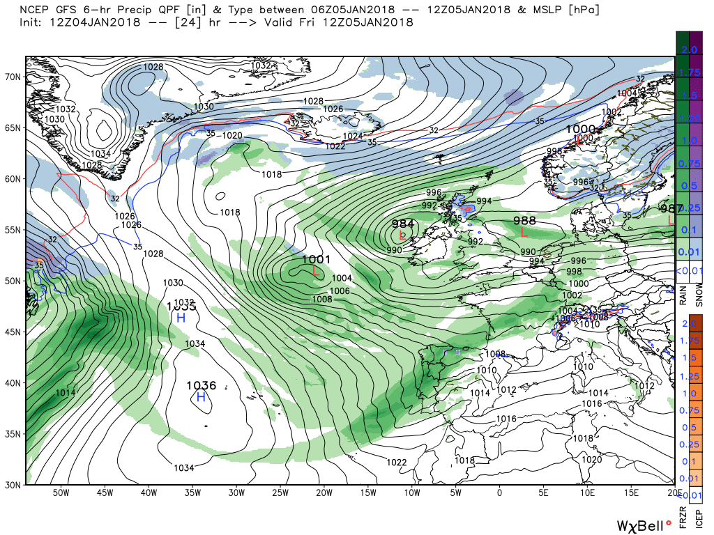
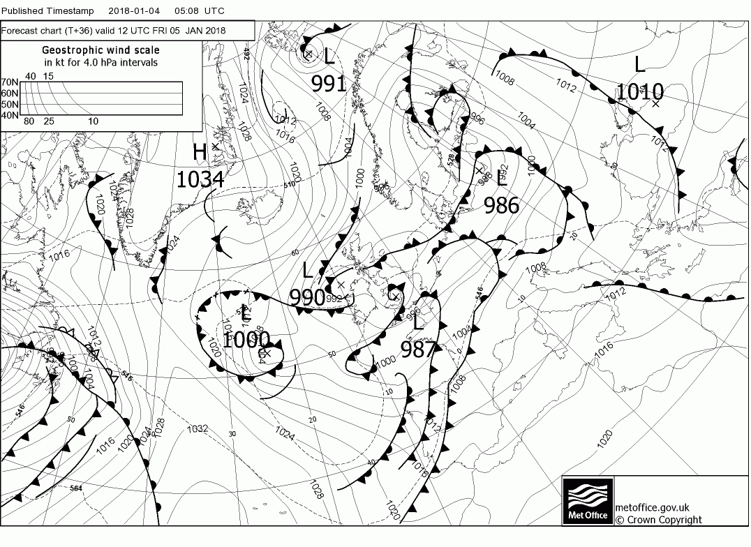
The ecm has the small perturbation that's on the fax above over Bristol at 06 tomorrow. Could bring some more prolonged rain and strong winds for a time in the south west.