You really wouldn't want to see a photo of me in a wetsuit........really!P.
My parting is straight, my navel central and my nerve unbroken ! Takes all the Army and the Navy to put the wind up ... JohnnyO. o/

You really wouldn't want to see a photo of me in a wetsuit........really!
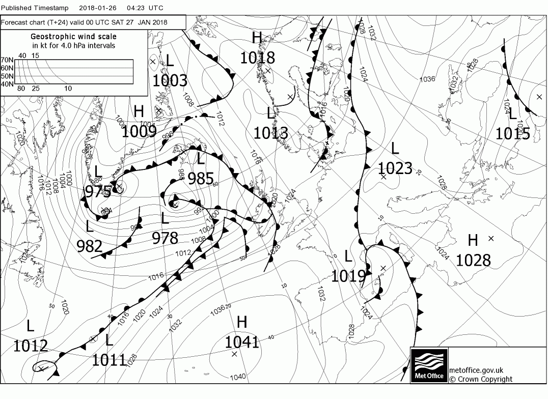
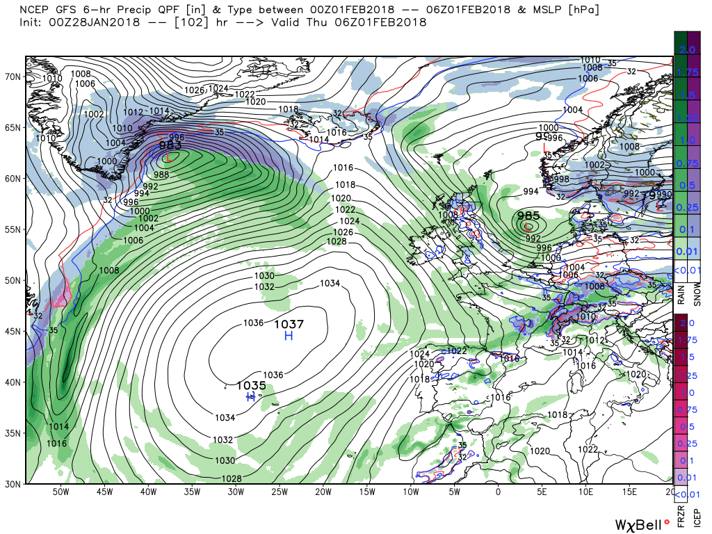
Yes, showery and went dark for about 30min looked like a proper storm was about to happen but has passed over now.Is it showery in your area, BM? Malcolm from Camborne on Netweather reports hail there.
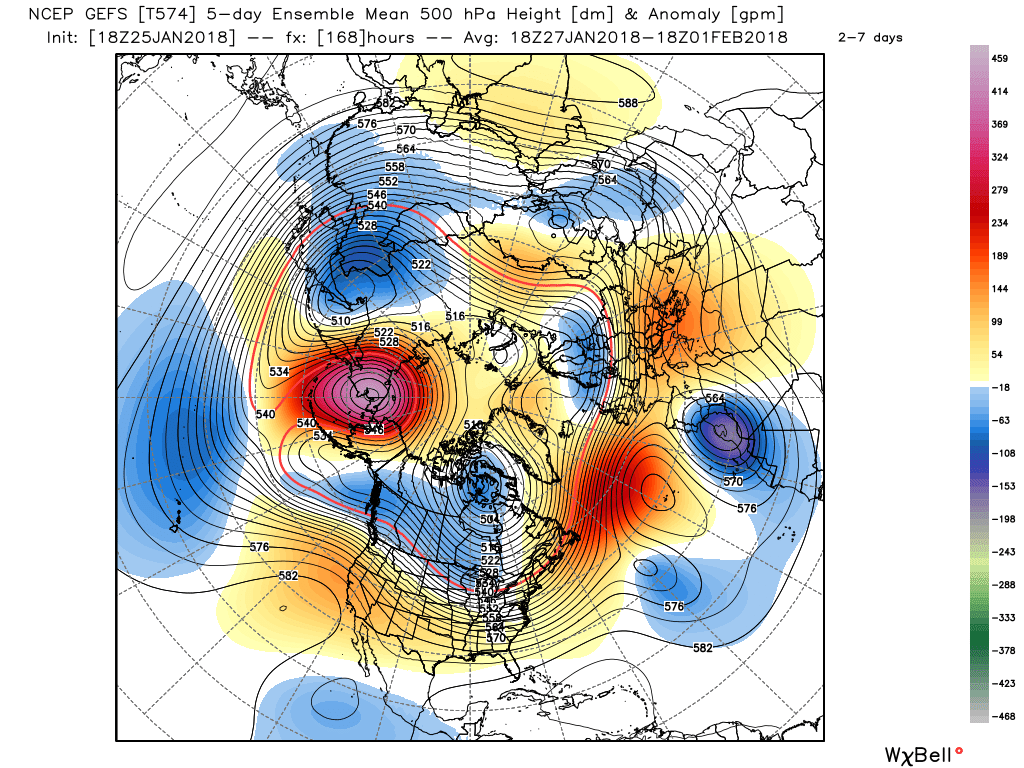
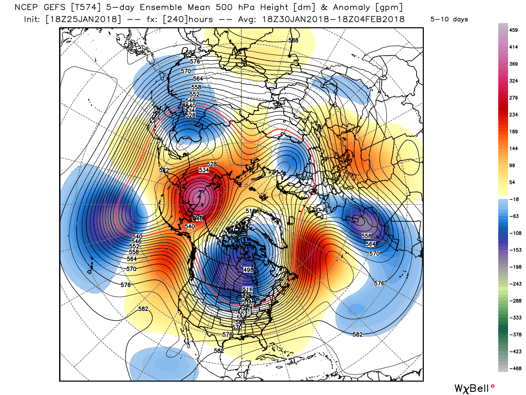
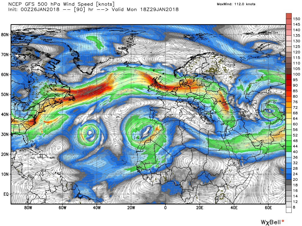
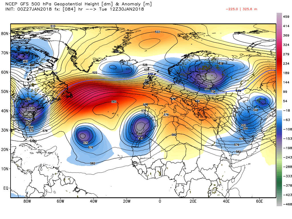
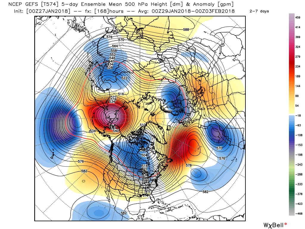
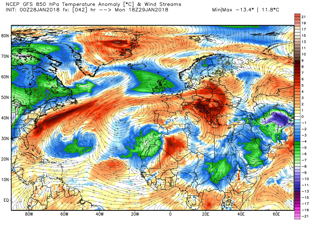
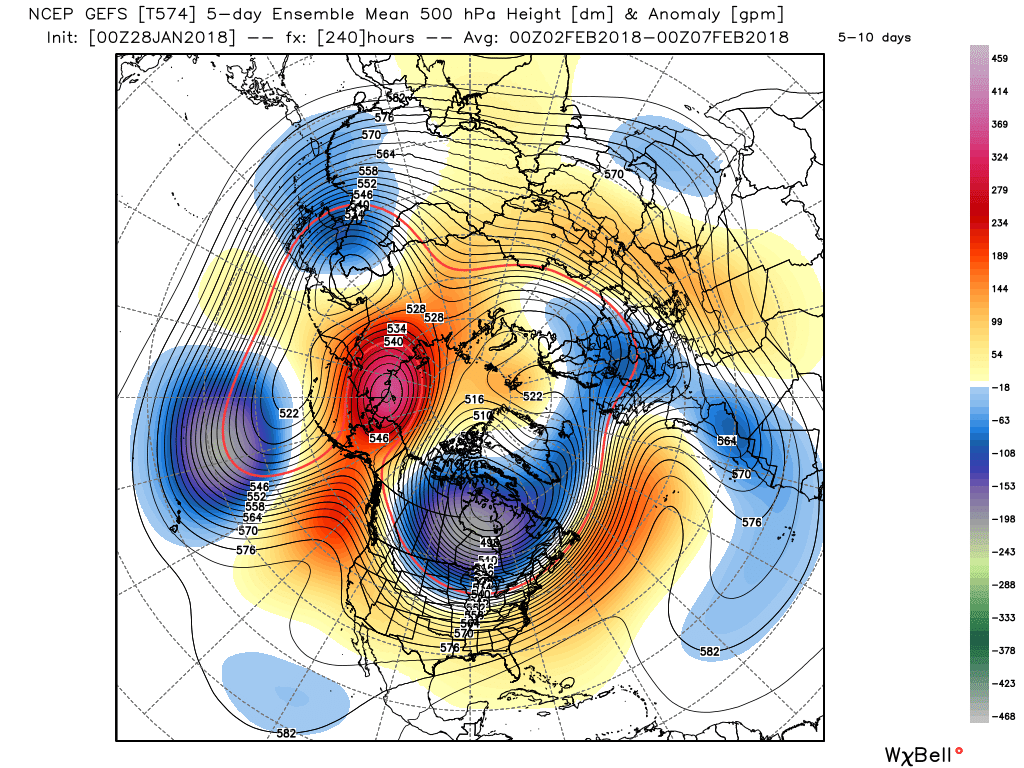
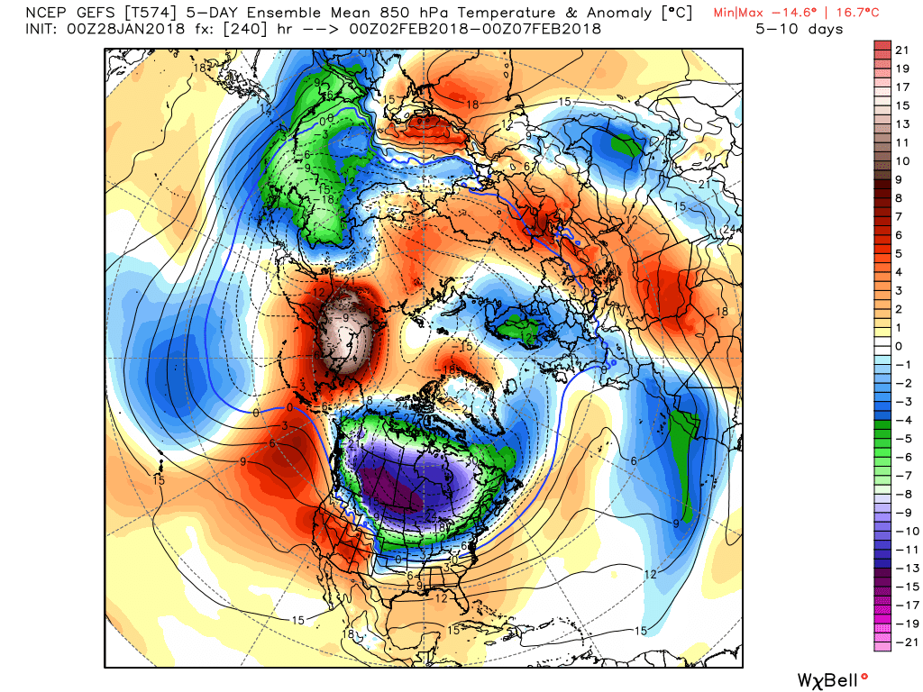
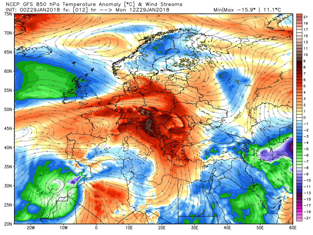
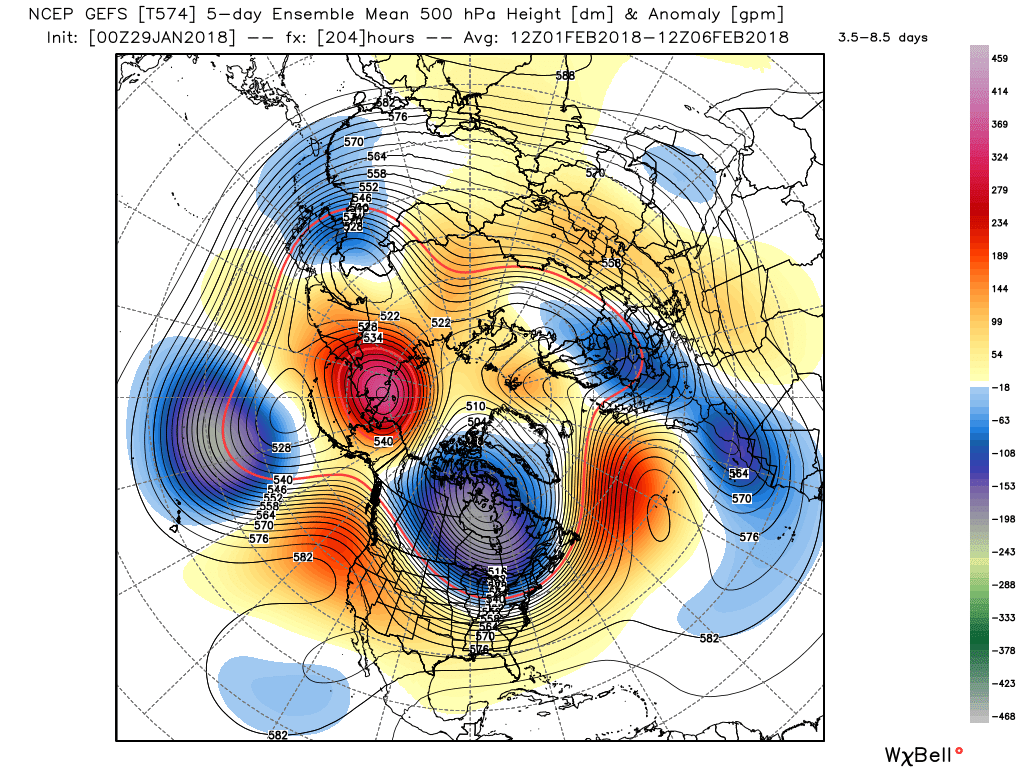
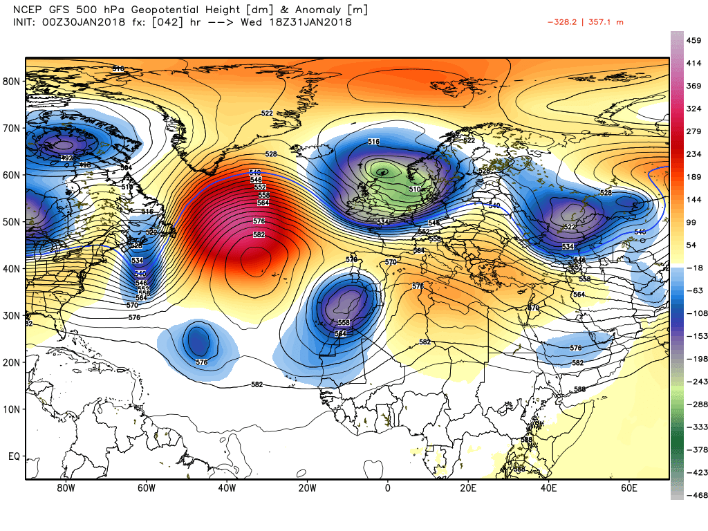
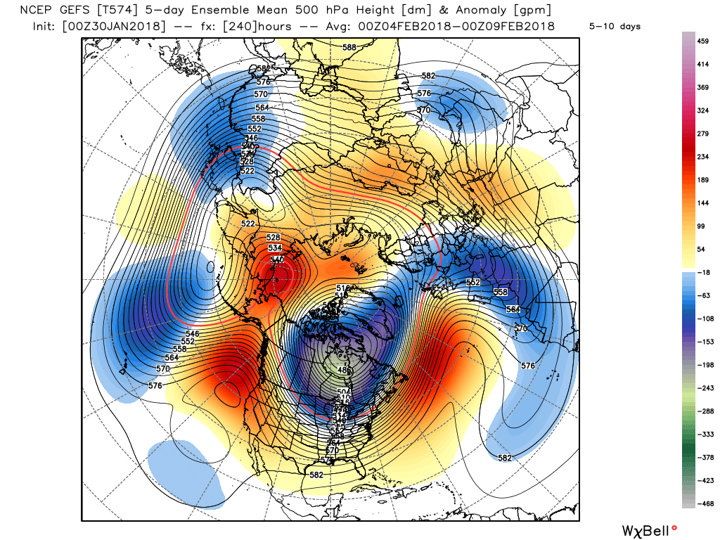
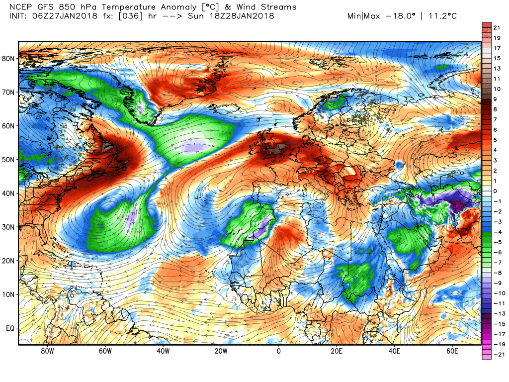
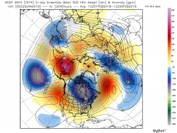
As I mentioned yesterday morning the expected forthcoming pattern change has been well signposted and i feel it worth mentioning again this morning, illustrated by a couple of the the GEFS anomalies, as it puts where we are going in the short term into perspective.
As can be seen in the 2-7 range upstream there is a strong high cell in the Bering Sea area, the Canadian vortex and a fairly flat flow across North America This results in a strong westerly upper flow across the Atlantic around the high pressure to the south which becomes influenced in the eastern Atlantic by the cut off upper low in the western Mediterranean. Quite important because quite early on in the piece the interaction between the east bound energy and the orientation of the high pressure is paramount.
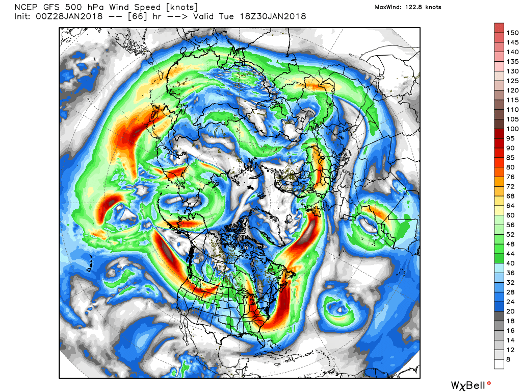
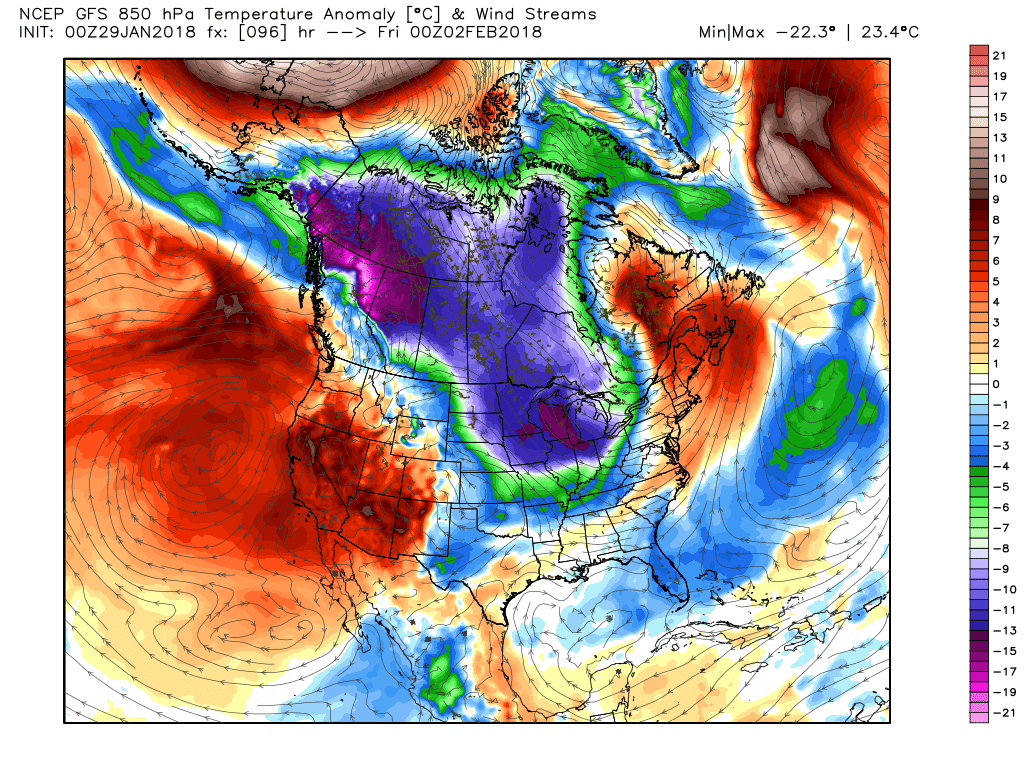
But as can be seen as we move quickly into the 5-10 period upstream becomes much more amplified with the EPO ridge and the N. American trough which in turn reflects on the downstream high/trough axis but that is for another thread.
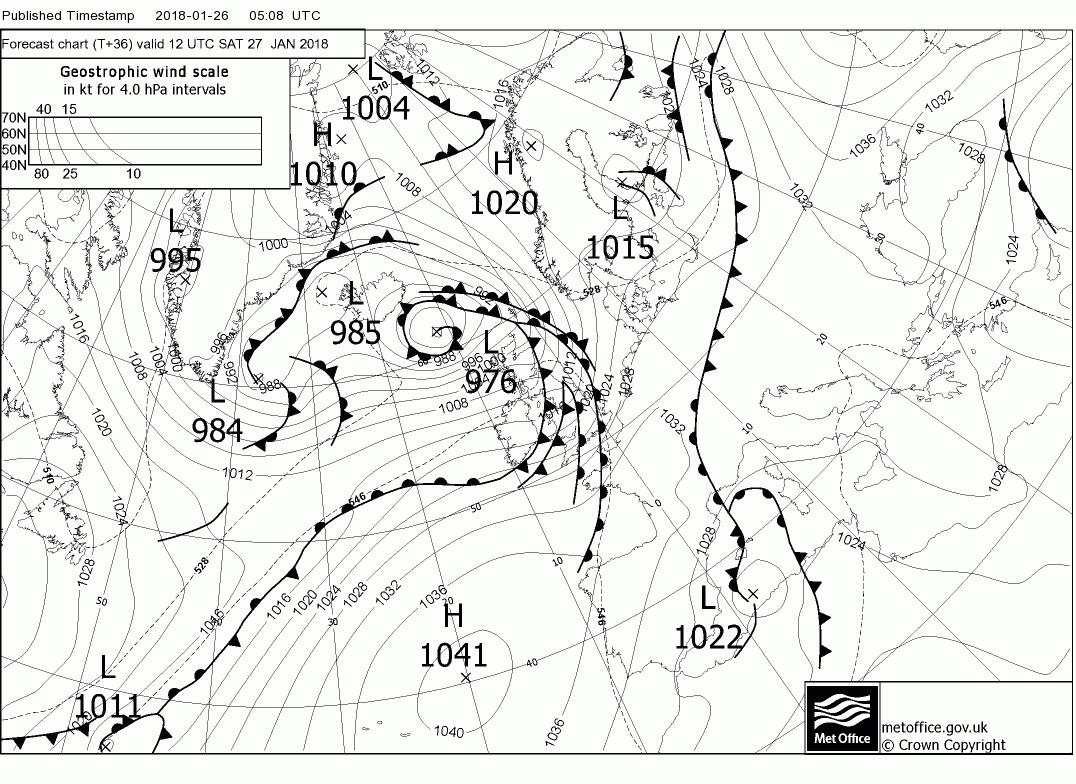
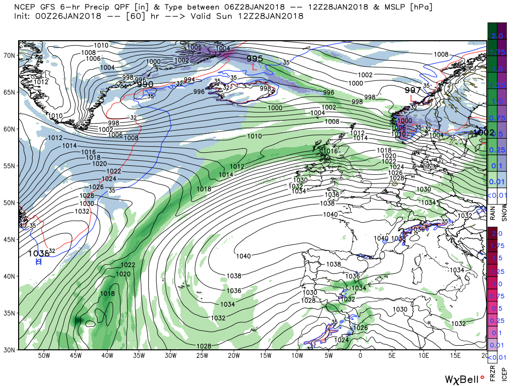
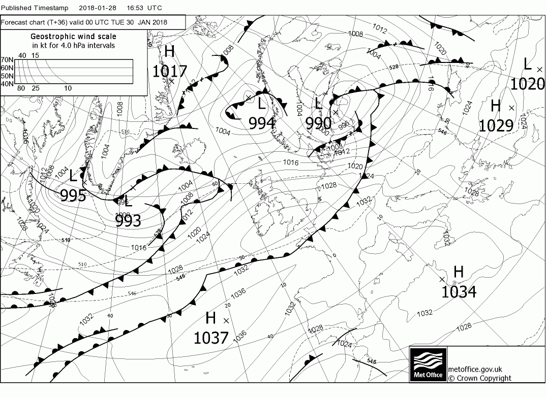
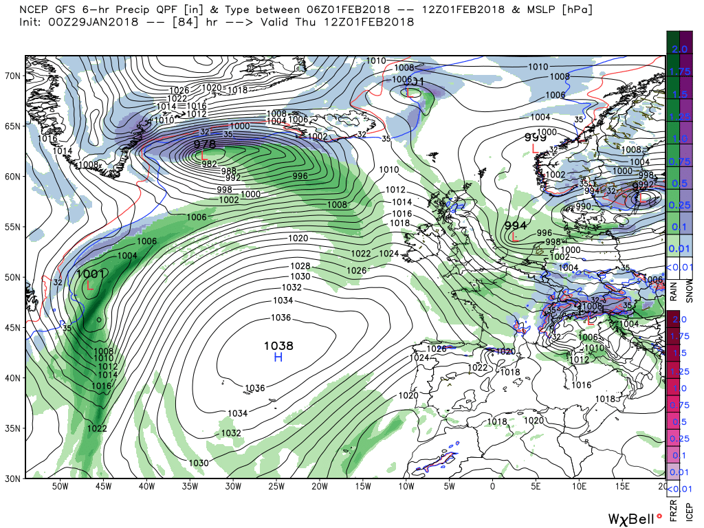
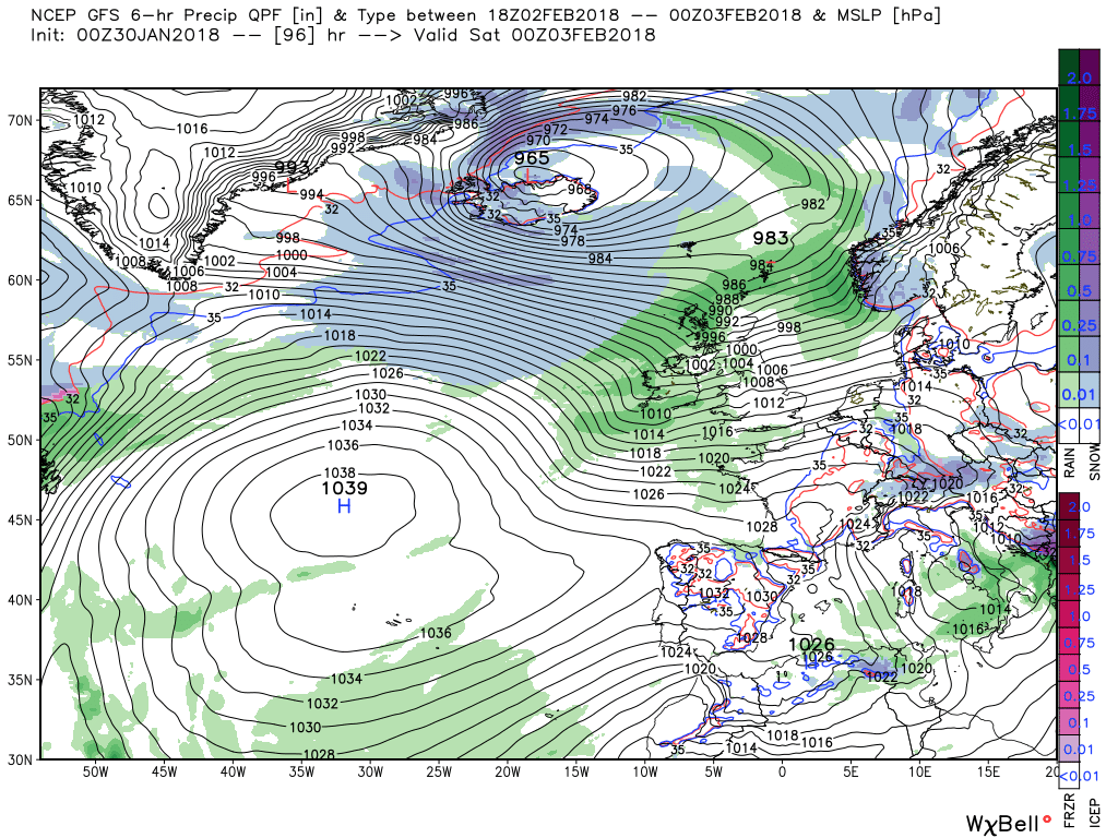
So back to the here and now. Not a lot to add to last evening. Today will be a much better day, less wind and sunny intervals for most so enjoy as the next complex frontal system is on it's way by late this evening. (Don't know where Exeter find all these fronts) These duly cross the UK on Saturday bringing rain and strong winds, perhaps gales in Scotland, leaving sunny spells and squally showers in the their wake.
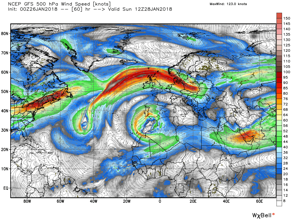
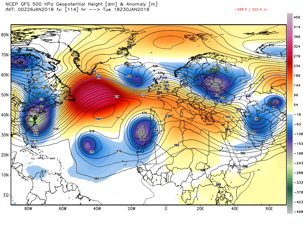
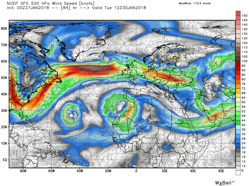
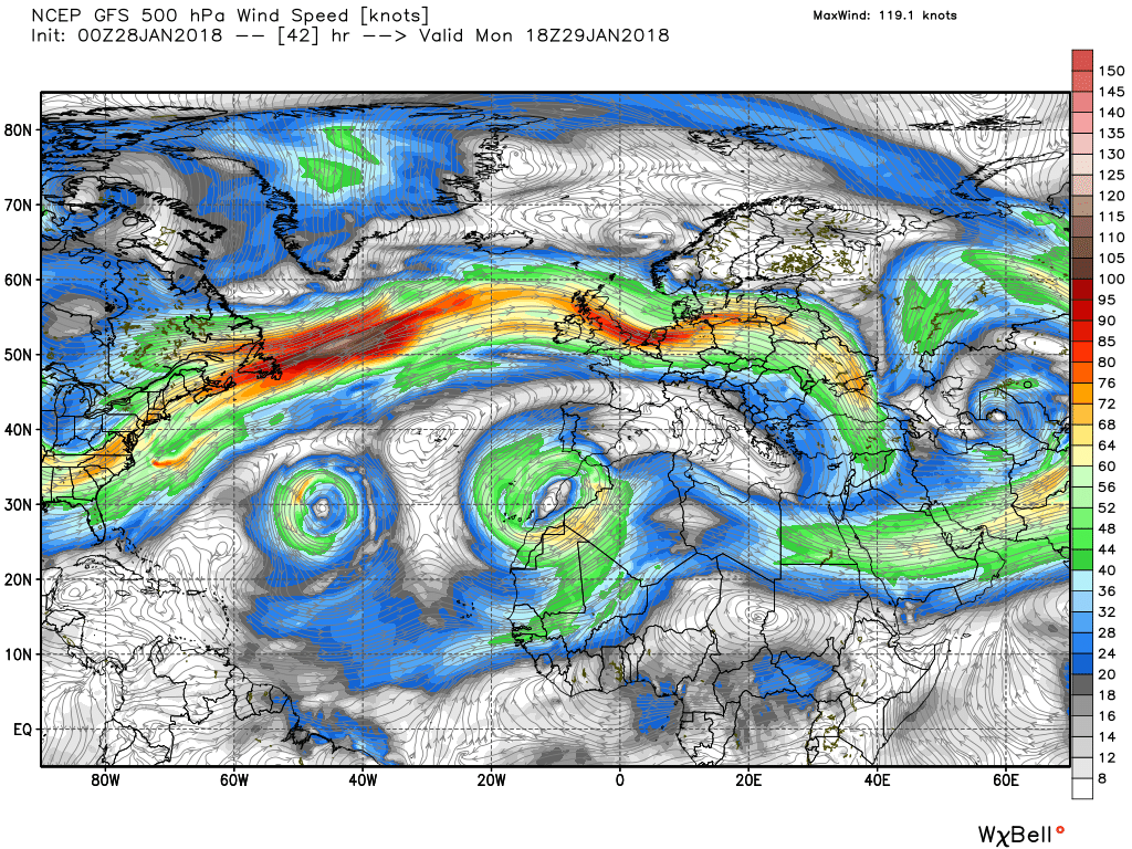
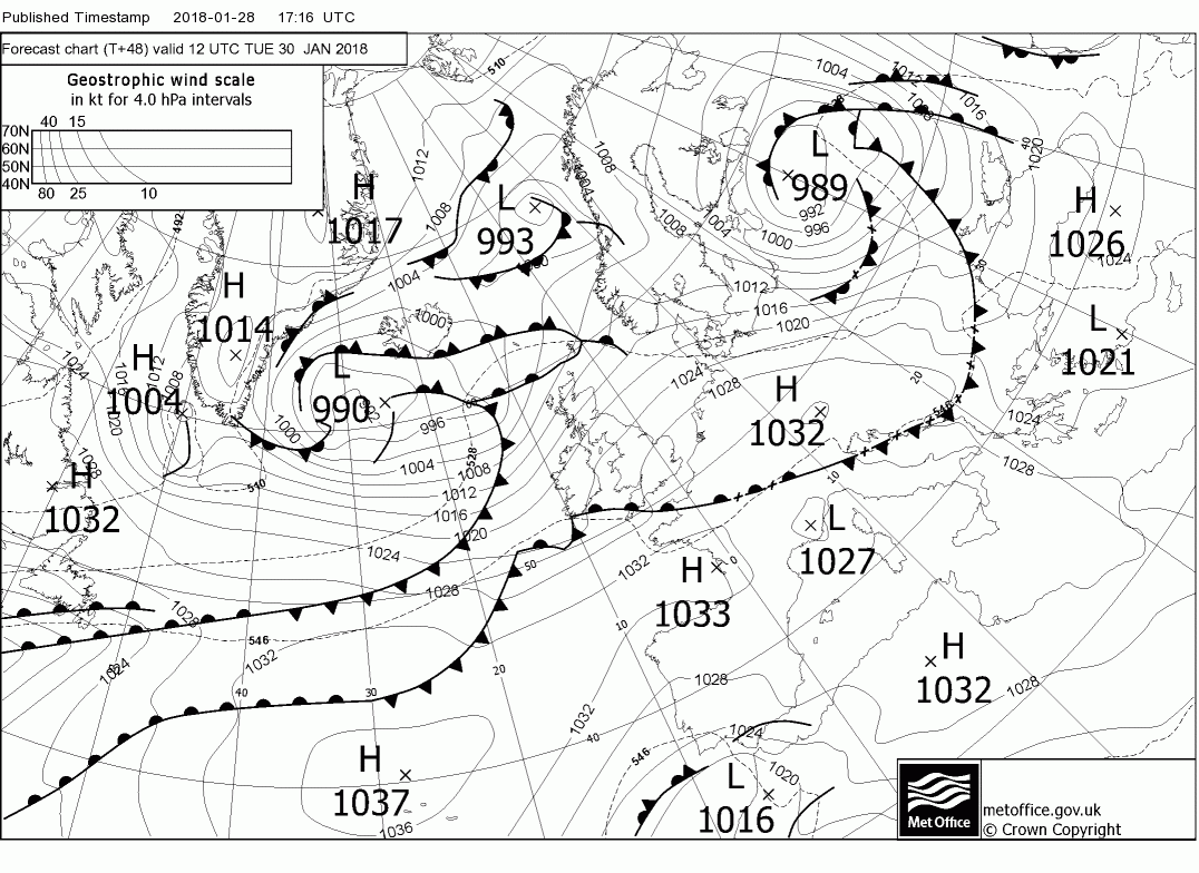
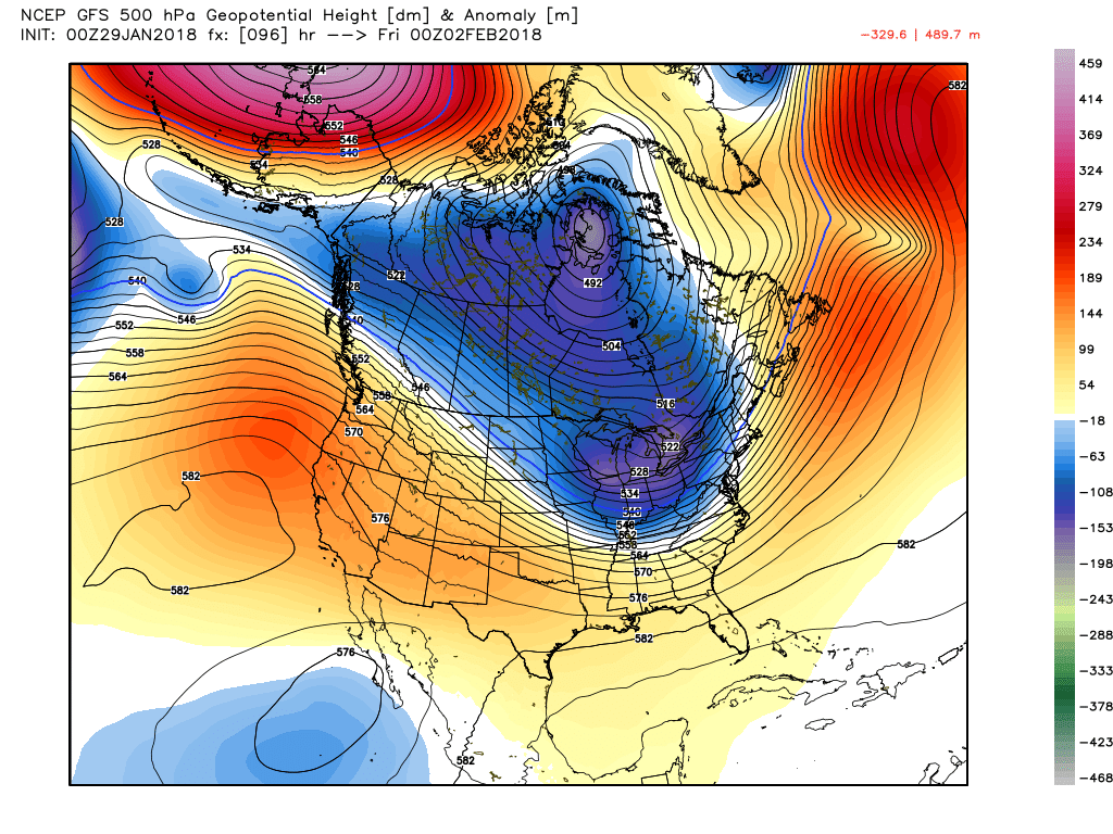
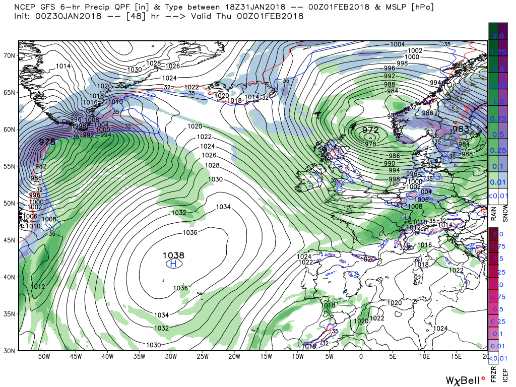
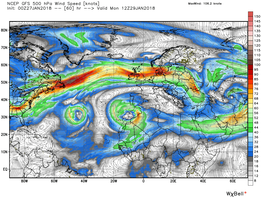
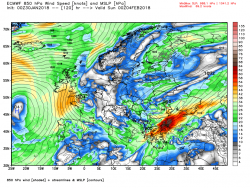
By 1200 Sunday the high pressure is semi in charge with the UK in a fresh, quite mild, westerly flow and dry for most areas. The exception being northern Scotland where the influence of the cut off low way to the south west is being felt with a front trailing from there around the high pressure into Scotland. The two energy flows can be clearly seen on the 500mb chart.
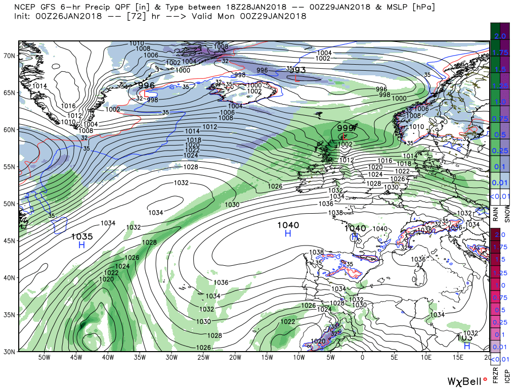
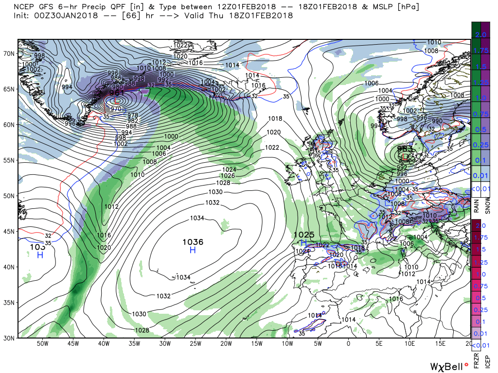
A wave forms on the front and tracks into Norway though Monday whilst the energy in the northern arm exerts some control and the front itself tracks south bringing rain with it as it travels and leaving cooler brighter weather in it's wake
From this point we are rapidly entering the arena where we started this morning so best left here.
Along the theme of yesterday last night's NOAA to get some general context. I wont go into detail, much the same as yesterday, but the 6-10 is very pertinent to the the near time evolution with the HP/trough axis in the eastern Atlantic. The divergence of the upper flow in the later period, although of much interest, will be subject of discussion elsewhere.
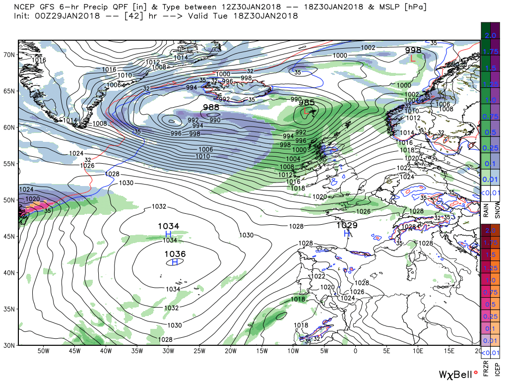
Today the front(s) and rain currently affecting the west of the UK will move east during the morning becoming quite patchy further south but heavy in Scotland where there may well be severe gales later as the low pressures to the NW merge and track ESE to be north of the Shetlands by midnight.
The gales abate overnight and Sunday sees the UK in a brisk, moist, and relatively mild airstream but heavy rain is impacting Scotland courtesy of the front previously discussed associated with the low away to the south west which briefly subjects the UK to two energy flows.
The front is forced south overnight Sunday through Monday as the main energy flow out of the eastern seaboard exerts itself clearing the south coast by Monday evening.
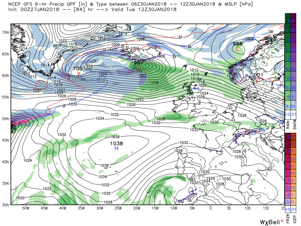
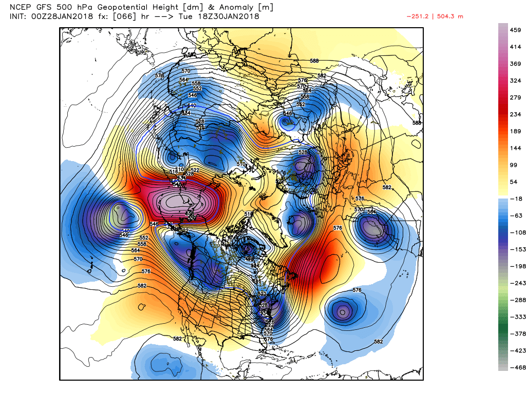
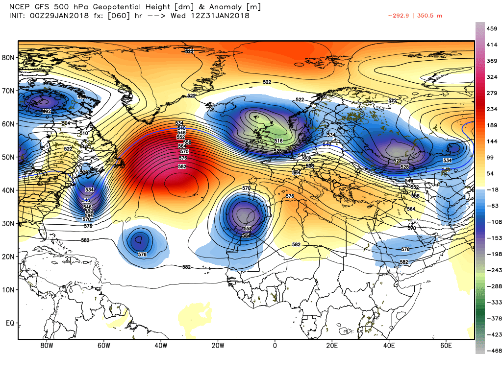
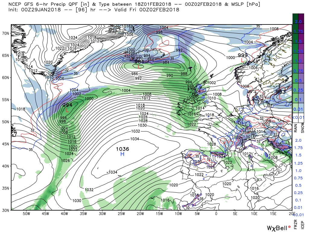
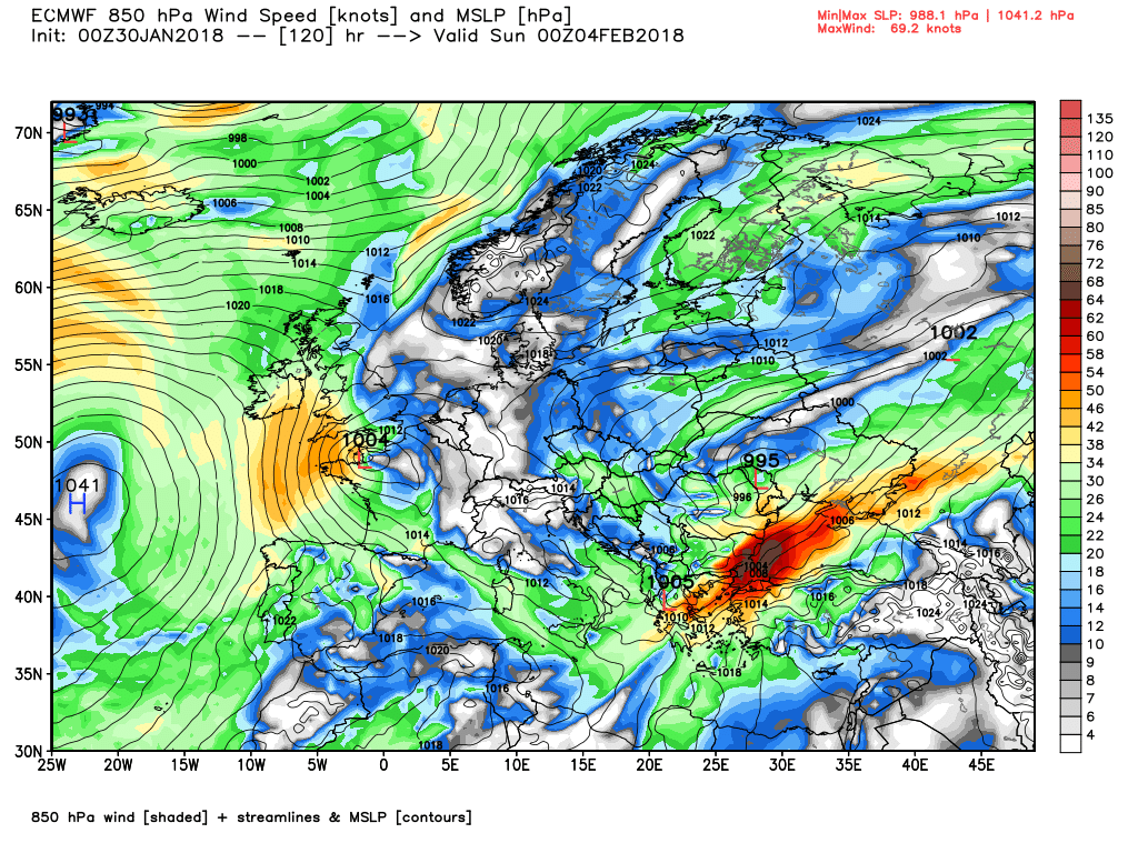
By 1200 Tuesday we are at the beginning of the upstream pattern changes and the Atlantic is the scene of the battle between the east bound energy leaving North America and the high pressure to the south with the UK at the coal face of this interaction, This is quite well illustrated taking three charts for that that time.
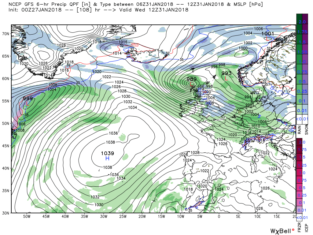
flash forward another 24 hours and with the HP amplifying north as part of this interaction and thus the trough tracking south east you can see where the NOAA anomaly is coming from, albeit slightly earlier, but illustrated very well by the GEFS 2-7 this morning. And this sets the tone, so to speak
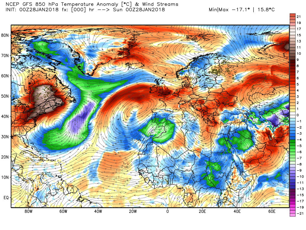
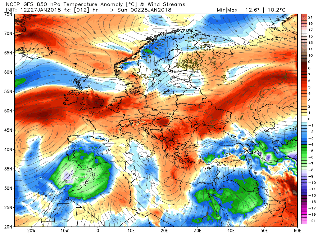
Thank you Chris, cryptic posts, even ever so slightly just confuses me, I'm not too good at cryptic crosswords.........Slightly cryptic post from Malcolm this morning - I think I'll message him for the sake of needing clarity:
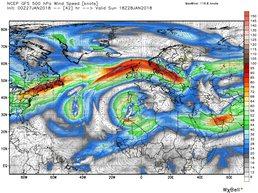
P. P.He was referring to the divided jet flow in this image...Thank you Chris, cryptic posts, even ever so slightly just confuses me, I'm not too good at cryptic crosswords.........
Have a great weekend
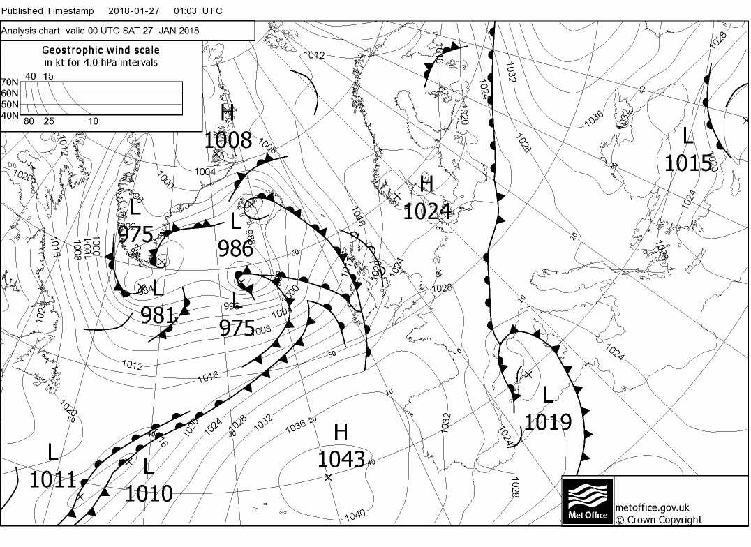
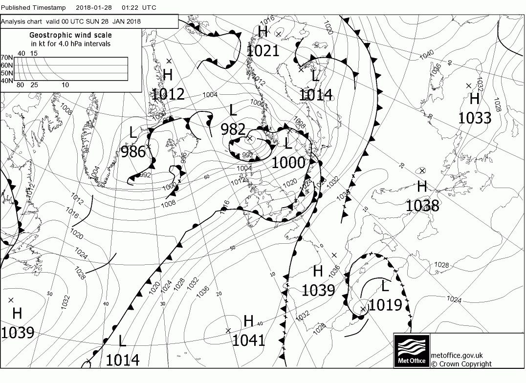
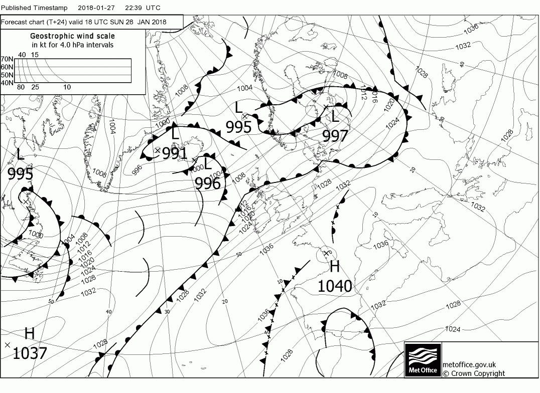
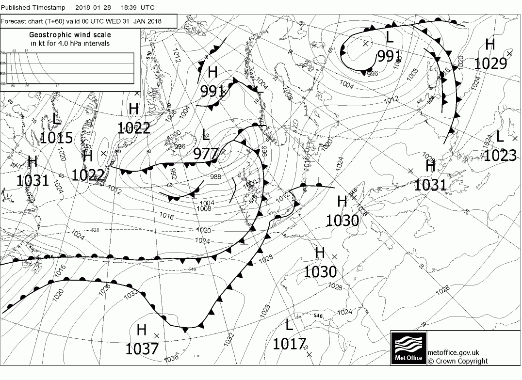
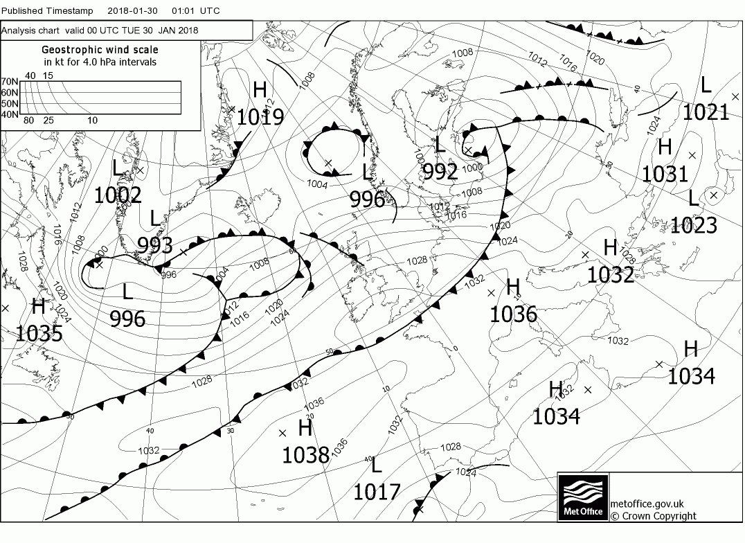
The synopsis at midnight;
Low pressure to the north of the UK with the main low west of southern Norway thus still windy in northern Scotland. A pretty fresh westerly wind further south as well but fresh is probably not the right word as England and Wales are under a Tm airmass with frontal systems to the west
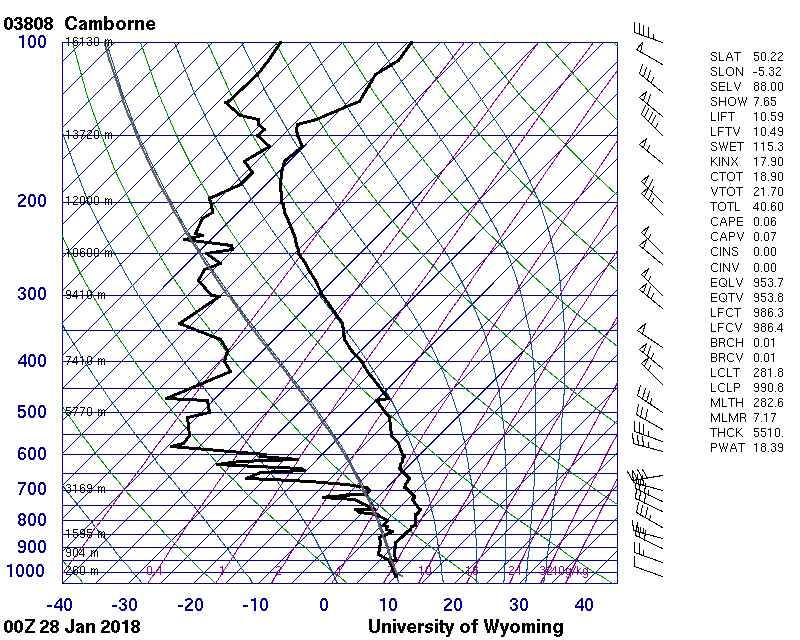
The airmasses are clearly defined and a glance at the Camborne 00 sounding shows the tropopause at 143mb in the Tm air.
So on to the nitty gritty
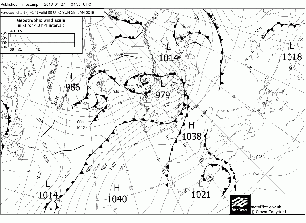
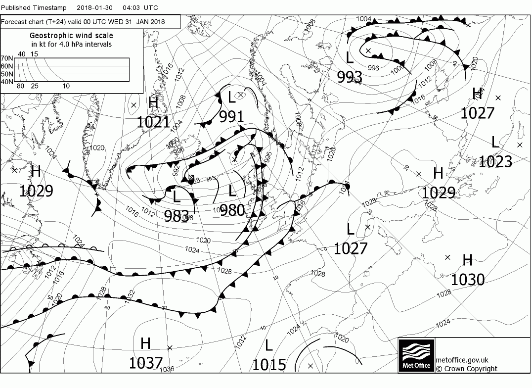
Today most of the country remains in the Tm air, thus cloudy and mild, perhaps the sun breaking through in the east, the exception being western Scotland where an open wave has formed on the fronts as they track NE bringing heavy rain
Overnight and through Monday the front tracks south leaving a cooler and showery airstream in it's wake but resulting in quite strong winds in the warmer air ahead of it's travels. The front clears the south coast by 1800
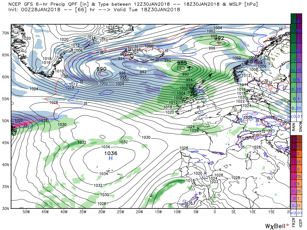
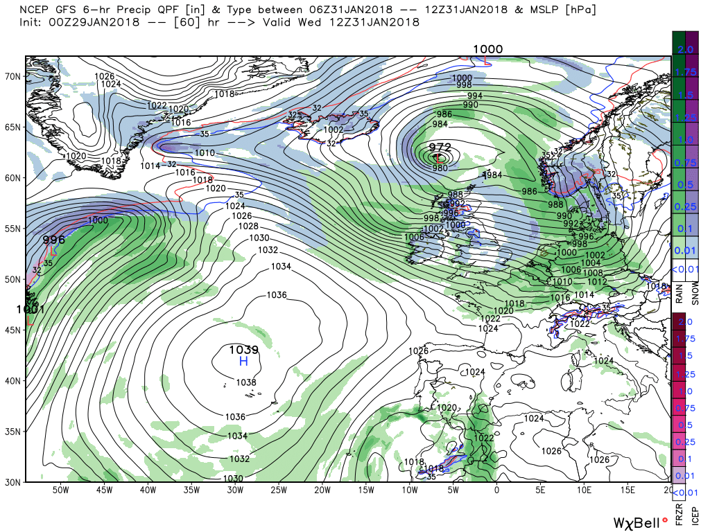
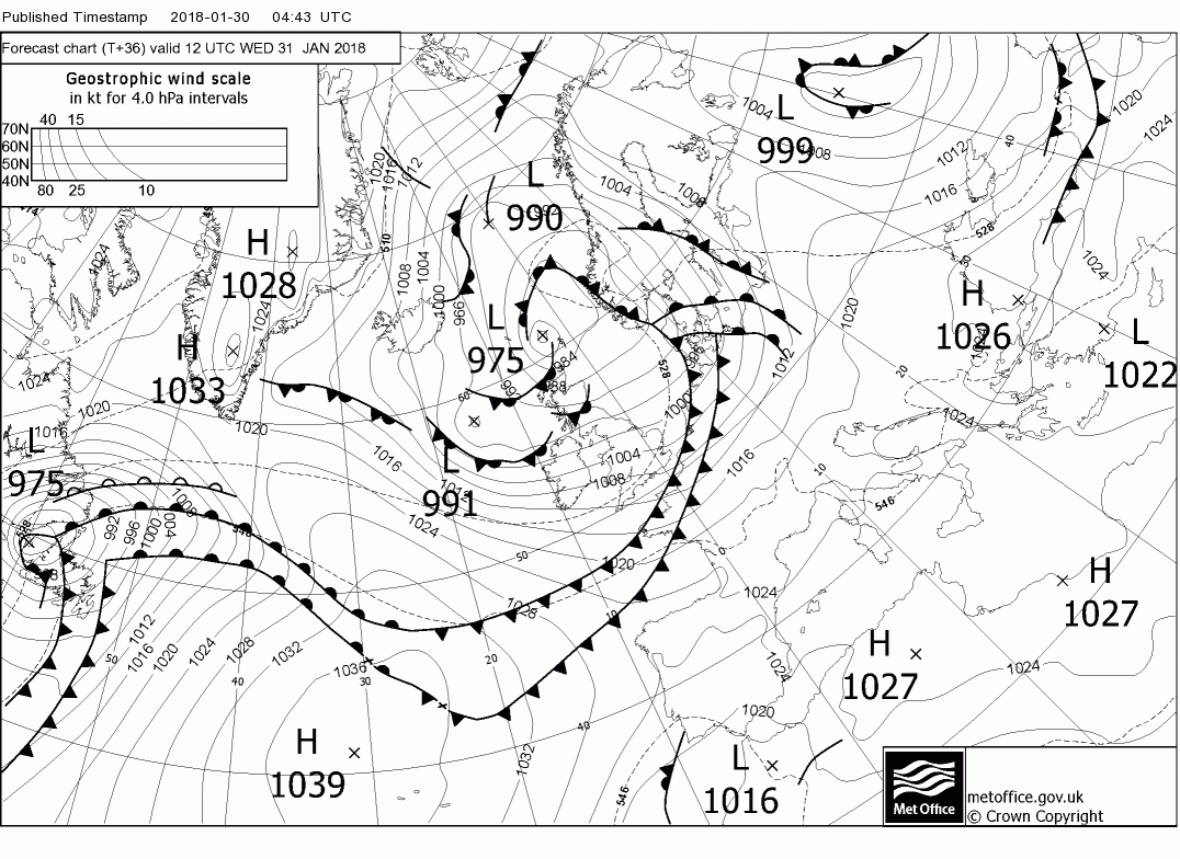
We are now entering a period when changes are afoot upstream where the EPO ridge is starting to sniff the coffee and the Canadian vortex/trough becoming established and in the meantime there is a lot of energy leaving the eastern seaboard eastbound and over the next few days this will interact with high pressure and depending how they phase will determine the detail of the weather over the UK. Thus as can be seen by 1800 Tuesday there is low pressure to the NW/N with a low 985mb NNW of Scotland with the associated front bringing heavy rain and strong winds to the north.
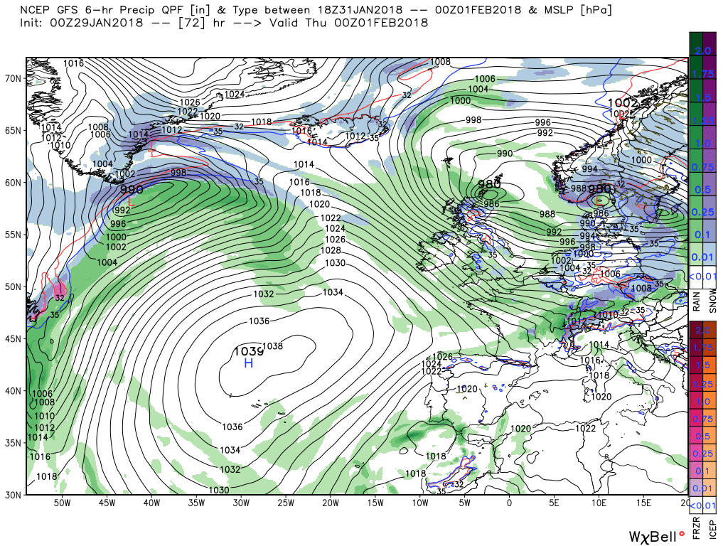
But fully in keeping with the above mentioned phasing the high pressure then amplifies in the Atlantic forcing the upper trough south east which veers the surface wind across the UK Wednesday/Thursday resulting in strong winds, possibly gales in exposed areas, and frequent squally showers.
And regarding the pattern upstream mentioned earlier, this morning's GEFS anomaly is quite informative.
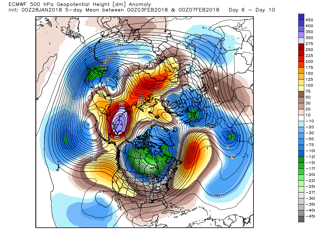
Not much point in looking in too much detail at the ecm in the short term but just to note the similarity between the anomaly and the GEFS above. The EPS is still inclining to the key players in the ext period remaining the intense Canadian vortex and trough to the NW and the diverging upper flow in the eastern Atlantic associated with some positive anomalies and some ridging n. Scandinavia and the positively aligned trough to the south of the UK
The cold front currently across North Wales and the north of England will continue to track south clearing the south coast by this afternoon. Some strong winds, with cloud and patchy rain in the Tm (Tropical Martime) air preceding it but clearer Pm (Polar Maritime) behind it with the odd shower.
Most of the UK will have a dry and quite clear and frosty night but frontal systems to the west of Scotland and Cornwall will track east bringing rain and strong winds to western Scotland and rain into the south west England and south Wales overnight into Tuesday.. This will move east during the day but the rain will persist over western Scotland, perhaps snow on the mountains, as the front associated with the depression 985mb over the Faeroes moves south east and impacting N. Ireland by 1800.
Thus by 00 the cold front is lying across the borders with a couple of frontal ripples across the south of England and still very windy in the north with frequent wintry showers.
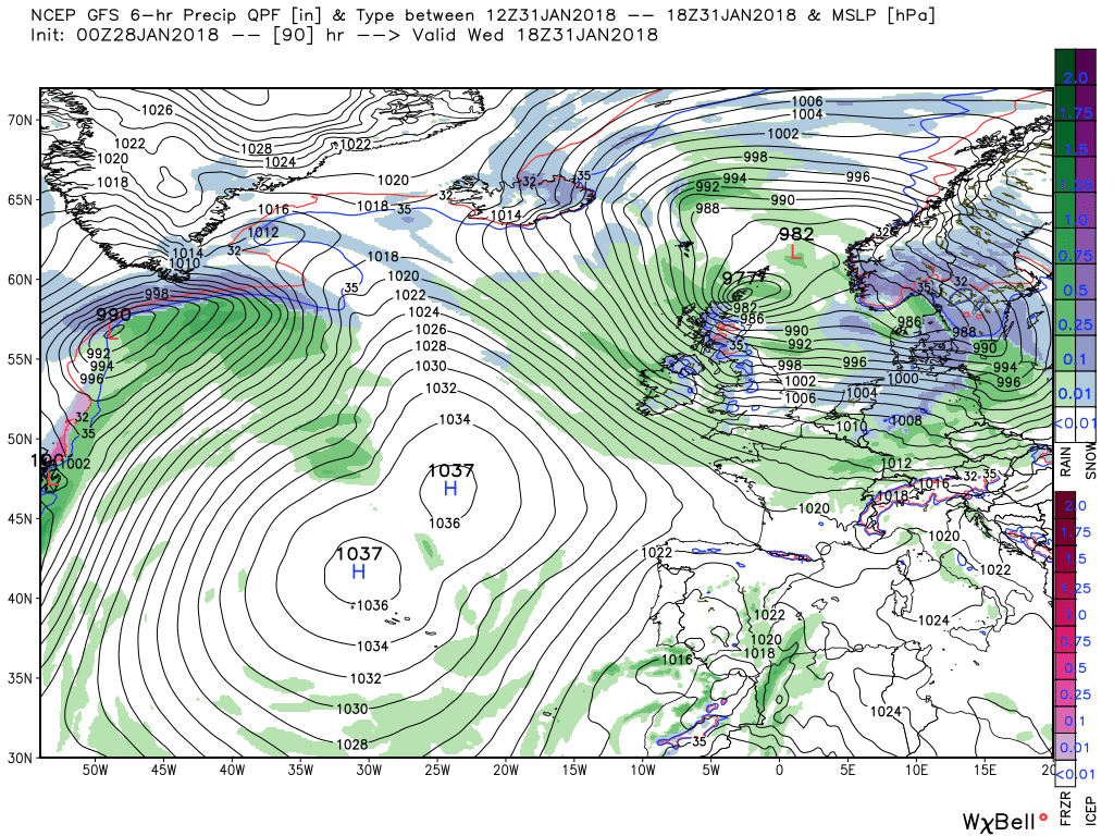
From here some amplification takes place and the Azores HP starts pushing north which impacts the upper trough to the north west and it starts tracking south east. Thus the surface low does likewise which veers the strong surface wind north west and ensues a continuation of the squally wintry showers, particularly in the north and along western coasts.
The low continues to run down the North Sea during Thursday and in the process veering the wind even more but probably concentrating the showers now down the eastern side of the country but the brief respite of a very transient ridge is very short lived as the next low tracks east south of Iceland and the associated front(s) are already impacting western Scotland and N. Ireland by 00 Friday.
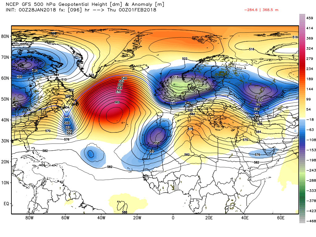
We have now reached the stage of the pattern change upstream with the EPO ridge (https://www.theweathernetwork.com/news/articles/epo-what-you-need-to-know/43796/0), high cell Siberia and the active vortex/cold trough scenario.
And how this plays out downstream in the medium term continues to be of interest with the the interplay of the Azores, positive anomalies and some ridging in the Svalbard area, and the positively aligned trough to the SE/S of the UK. Where will it all end?
It was rather chilly here later, though it was very mild first thing. Quite a harsh ground frost this morning, though.Positively balmy yesterday, got the washing dry during the day and woke to a toasty warm house
The overlying theme with the current outputs is unsettled in the short term with the interaction and phasing of the cooler and warmer air with a lot of eastbound energy leaving the eastern seaboard. But, according to last night's anomalies, as the pattern change takes place upstream. the flow will diverge in the eastern Atlantic as the Azores/trough axis becomes more influential initiating a more settled period over, at least, the southern half of the UK and perhaps more as time goes on. But I digress. Temps generally a little below average.
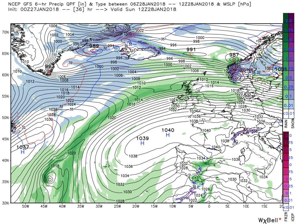
A pretty frosty start in many areas today with some showers in the west of Scotland but there is a shallow wave west of Cornwall tracking east that will bring patchy rain to the south west/ south and up north a frontal system will bring some some heavy rain and strong winds into western Scotland. The fronts and rain will track south east during the evening and overnight whilst the little wave in the south tracks east.
By 1200 tomorrow the fronts will have cleared the south coast leaving the UK in a strong north westerly with a deep low 975mb in the vicinity of the Shetland Isles. Thus squally wintry showers, perhaps of snow in the north, and more frequent there and on western coastal areas.
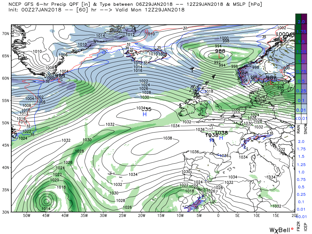
At this point, keeping in mind my earlier comment, the Azores stars ridging in mid Atlantic forcing the upper trough south east, This of course impacts the surface analysis with the low slipping down the North Sea to be over Denmark by 1800 on Thursday and the strong surface wind will veer northerly in the process with the squally showers tending to die out, apart from down the east coast, as the ridge moves east over the UK.
But this ridging is extremely transient as a strong jet swinging south of the North American trough and across the Atlantic in conjunction with a deep low over Iceland quickly suppresses it and by midnight Saturday the fronts associated with the aforementioned low are already impacting Scotland and strong winds are once more the order of the day over the UK.
Returning briefly to the opening comment this morning's GEFS anomaly is not supporting the increasing influence of the Azores and the Canadian vortex. trough to the north west starts to dominate which is a little surprising in some respects. It will be interesting to see what the EPS comes up with this morning but that is for the other thread to sort.
The ecm does have a variation next weekend. It forms a more intense little wave on the front as it tracks south east on Saturday and in fact is an enclosed low over N. France by 00 Sunday. And at first glance the ecm deterministic output does seem more in line with last evening's anomalies mentioned in an earlier post.
Very unusual in late January!It was clear last night and I was expecting a frost too but it never appeared, I think it was actually a local record high at 11°C.
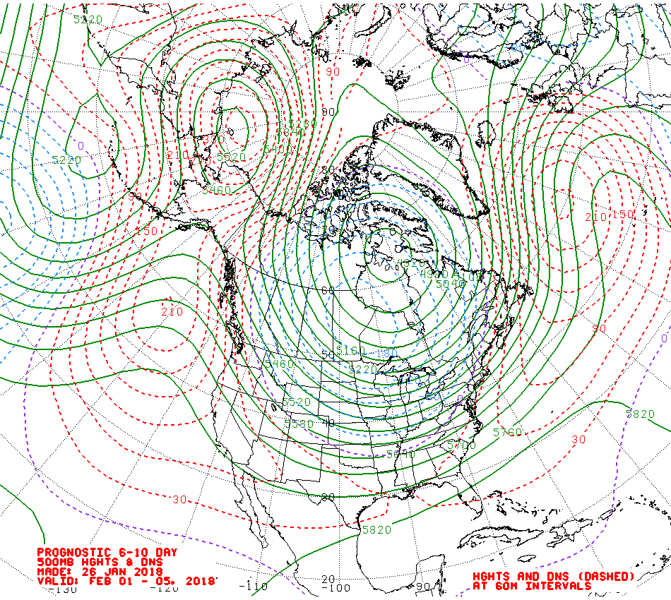
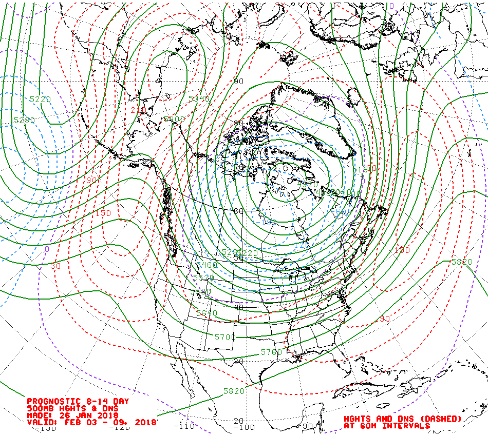
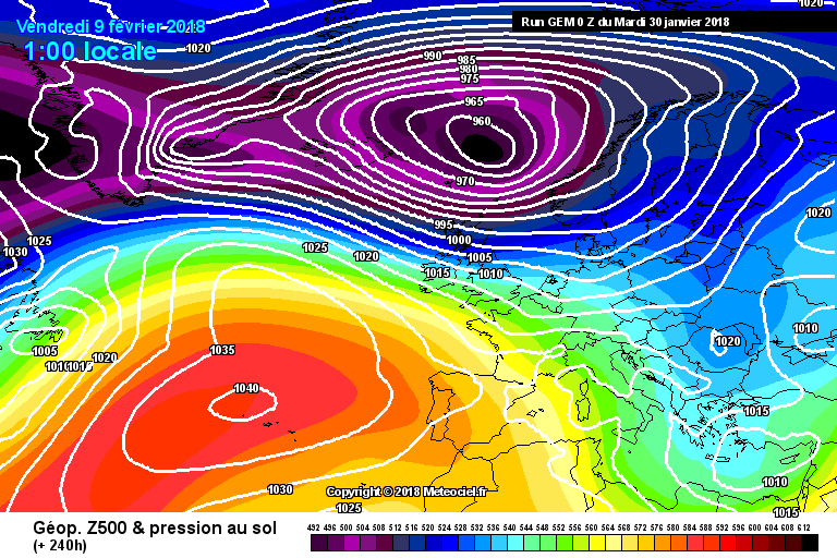
MY chance to look at the medium term model output this morning. Last week showed teases aplenty in FI regarding easterlies and Scandinavian blocks but perhaps that's all they ever were. We have a sharp colder blast this week and perhaps over the weekend too but that's not what most on here want and I suspect cold and dry won't cut it either. Some encouraging signs from the teleconnections however for further into February but perhaps too early for the model output at this time.
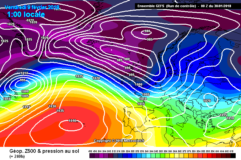
Anyway, this morning we're looking at the models for Friday February 9th:
Starting with ECM 00Z OP at T+240:
After last week's teases, a classic winter chart for the British Isles. Between the Azores HP centred over the Azores (no surprise there) and a deep LP over Iceland the British Isles is in a WSW'ly flow. A transient ridge is coming in to cross the British Isles so a quieter spell before more showers or rain from a following trough which might well form a secondary feature.
On to GEM 00Z at the same time:
Some people are very rude about GEM but this model has, in my view, done very well of late. It has wanted nothing to do with phantom E'lies or Scandinavian ridges apart from a brief flirtation which gets swept away rapidly. It does over-blow Atlantic LPs on occasion and may have done so here but the British Isles is in a cold NW'ly flow with sunshine and showers and wintry to high ground I'd imagine. The angle of the trough is well into Europe so the Azores HP has no option to topple so this version of cold/cool zonality which we've had for much of this winter continues.
GFS 00Z OP at the same time:
A recognisable blend of the above solutions and after last week's huge divergence, it's pleasant to see more unanimity across the models so it's a W'ly flow from GFS this morning but a small transient ridge crossing before more unsettled conditions and an interesting little LP lurking between the two HP cells so let's see where that goes further into FI.
That does cross the British Isles but the mode into the middle of February is stormy and unsettled as a lobe of PV energy drops into the Atlantic in the form of a major LP. Some indications in the 10HPA strat profile of a new and unusually placed warming but we'll need plenty more runs to see if this is indicative of anything.
GFS 00Z Control at T+240:
A more sharply-aligned trough here so a cold and unstable NW'ly flow for the British Isles with the likelihood of snow to higher ground. Very unsettled to the end of the run but perhaps just a hint of the Atlantic weakening.
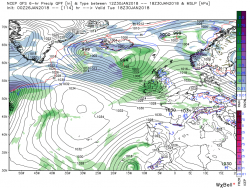
Looking at the GEFS at T+240:
http://www.meteociel.fr/cartes_obs/gens_panel.php?modele=0&mode=1&ech=240
A single rogue E'ly remains but plenty of cold N or NW'ly options out there and our old friend cold zonality which played so well for much of the north a couple of weeks ago may make a come back in February when such a flow would still be potent.
In summary, for fans of snow in the lowland south it's a bleak outlook this morning - for fans of snow in Scotland and on high ground, plenty of opportunities for transient falls. The trend toward a more settled period has ebbed away and the powerful jet fuelled by the extremely cold and tightly-organised PV is in charge throwing LP after LP across the Atlantic. The Azores HP keeps them far enough to the north not to offer any potential damage in terms of wind or excessive rainfall but those hoping for a prolonged drier spell are going to be as disappointed as those seeking snow.
I see more than a hint of our friend cool zonality in the outlook and the potential for a stormy mid-February. Beyond that, who knows ? Hints of the Atlantic weakening as the PV comes under significant attack may offer some hope - the MJO seems to have been forgotten about. One or two charts looking even further ahead suggest late February into early March may see a pattern change but in the short term I see nothing slowing down that intensely cold engine over NE Canada.
https://www.metoffice.gov.uk/public/weather/warnings#?date=2018-01-31Yellow warning details
Snow & ice
Between 03:00 Wed 31st and 18:00 Wed 31st
Following a spell of rain, temperatures will fall quickly allowing ice to form on untreated surfaces. Frequent blustery showers of rain, sleet, snow and hail will then also develop. Some roads and railways are likely to be affected by snow with longer journey times by road, bus and train services. Some injuries from slips and falls on icy surfaces are also possible.
Yellow warning details
Snow & ice
Between 18:00 Wed 31st and 11:00 Thu 1st
Temperatures will quickly fall allowing ice to form on untreated surfaces. Frequent blustery showers of rain, sleet, snow and hail are also expected. Some roads and railways are likely to be affected by snow with longer journey times by road, bus and train services. Some injuries from slips and falls on icy surfaces are also possible.
Nasty!We're already at Bikini Amber Alert here chez JohnnyO, thanks Chris. Wind rising and driving, freezing rain.
JohnnyO. o/