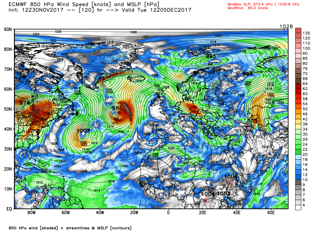
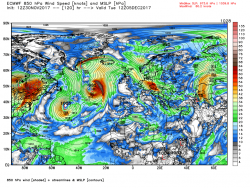
According to this evening's ecm by Monday midday the High cell to our west is coming under increasing pressure from the usual sources, the Canadian vortex lobe and the eastern seaboard and is being realigned, albeit the UK remains in the north westerly airstream,
By T120 This battle between the upstream forces and the high pressure results in very complex trough in mid Atlantic at the interface with various surface low pressure centers with the main two being phased together west of Ireland and over Iceland whilst the high cell is still in situ adjacent to the UK
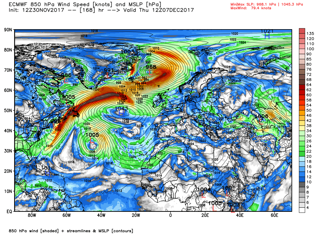
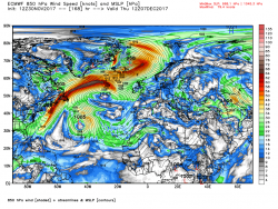
The complex low pressure to the NW does eventually get more organised (more or less) and by Thursday 00 is centred over Iceland with a strong WNW flow south of Greenland east pushing fronts south east across north west UK as the high pressure is eventually worn down.
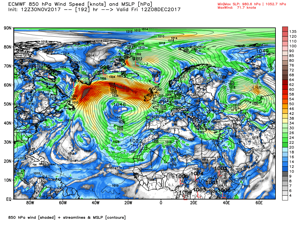
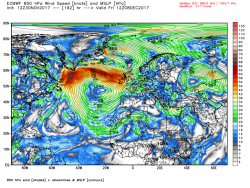
From this point we see once again a resurgence of the Bermuda high pressure courtesy of the plunging cold trough in eastern N. America which results in a very strong thermal gradient across southern Greenland, a 170kt jet, and a very strong north westerly over the UK bringing rain and gales.
A good place to leave it.
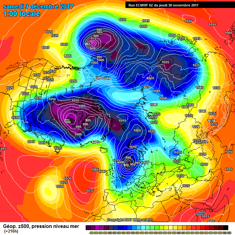
A summation of the temp contour and anomaly and as I type I can hear the strains of,
The Hills are Alive to the Sound of Music, emanating from the country park.

") P.
P.