My own synoptic analysis for the next few days, won't bother with Thursday/Friday's low until nearer the time, but will concentrate on tonight, tomorrow and Wednesday.
Current synoptic overview
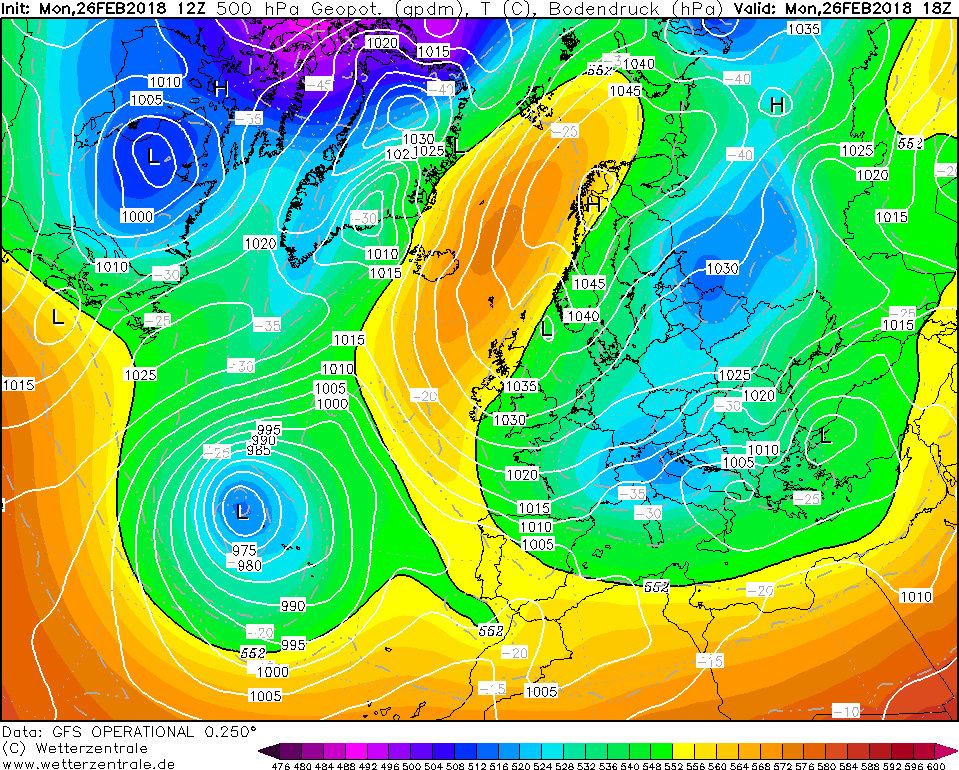
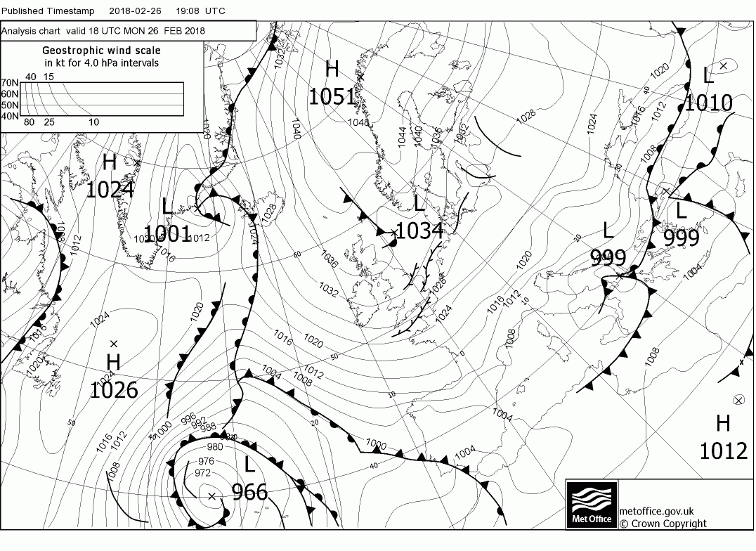
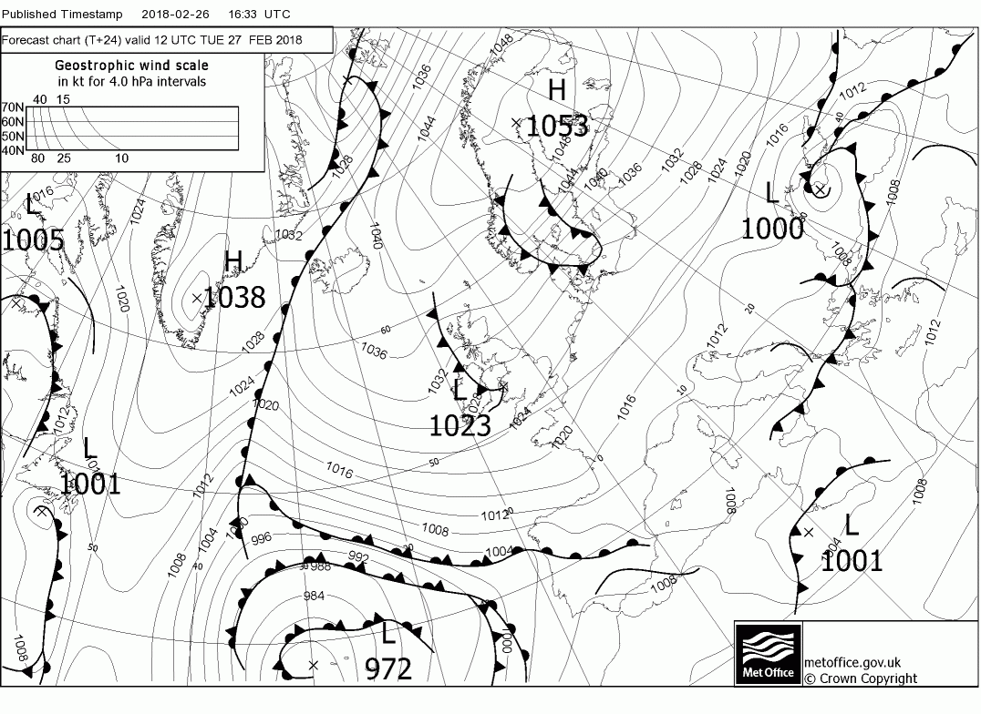
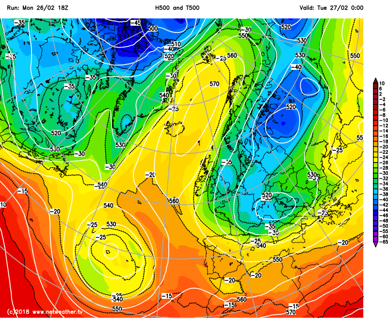
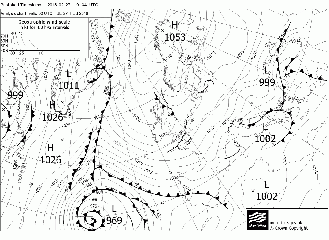
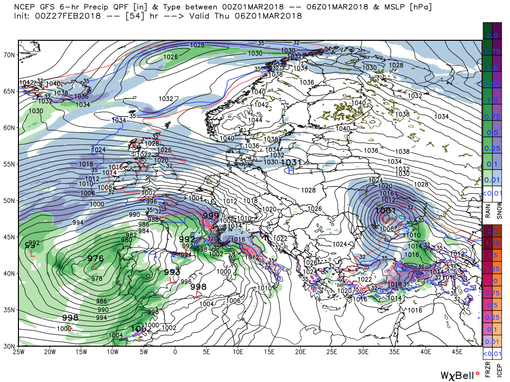
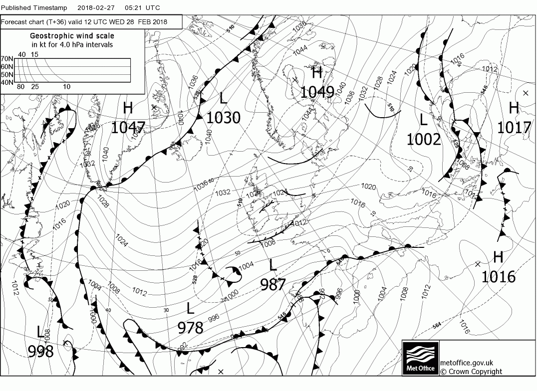
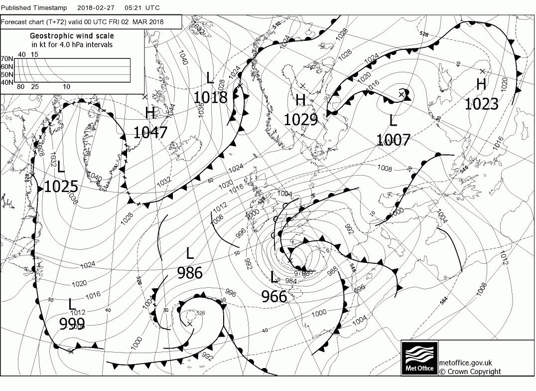
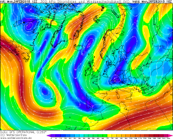
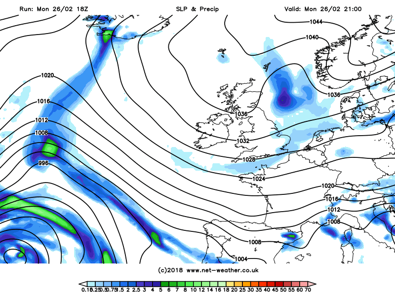
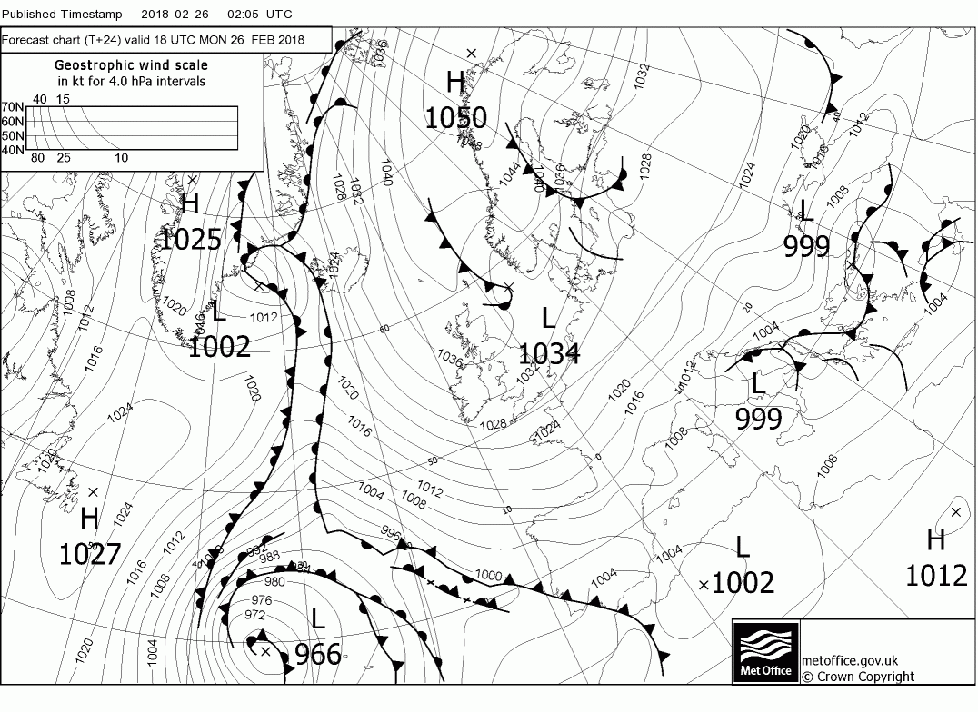
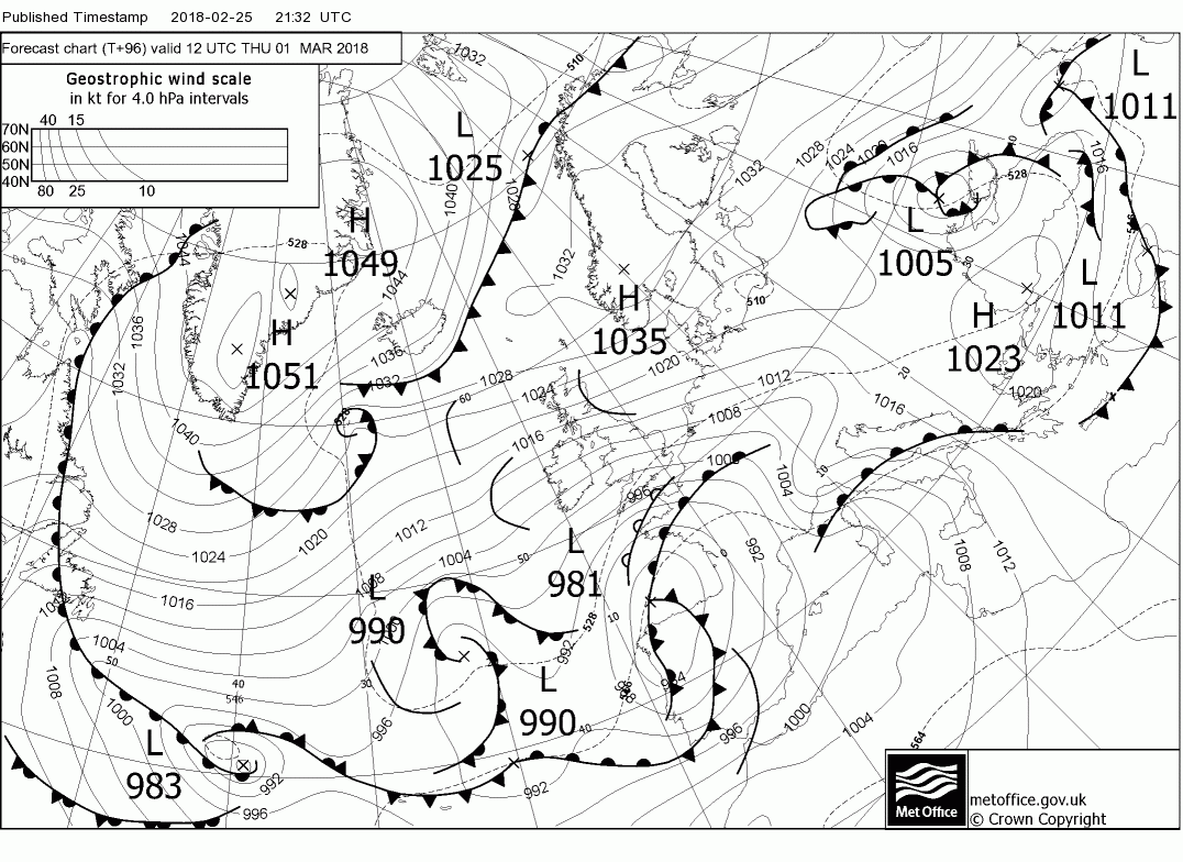
A large blocking anticyclone is in place over Scandinavia, with a surface high around 1051mb centred over northern Norway Monday evening and a strong upper ridge over the Norwegian Sea extending from Iceland NE toward Svalbard. A slow-moving low pressure system affects central and eastern Mediterranean. Below 500mb/MSLP and T+00 fax from Exeter for 18z this evening
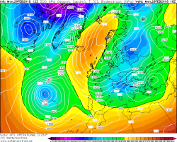

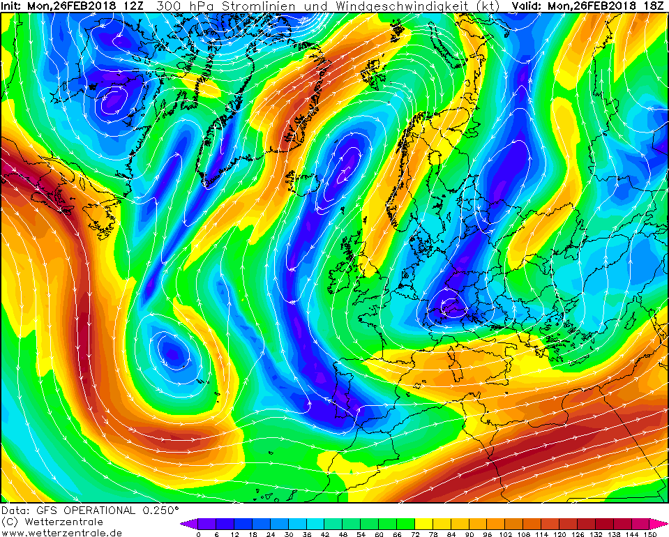
The jet stream loops around the Scandinavian ridge going northeast over eastern Greenland before dropping south over Svalbard then southwest across Scandinavia and then on across the British Isles, south into Iberia before joining the southern arm of the jet extending from the Azores eastward across the Mediterranean.
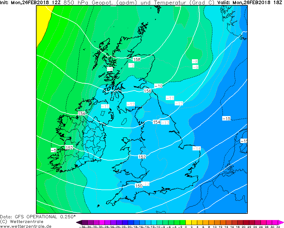
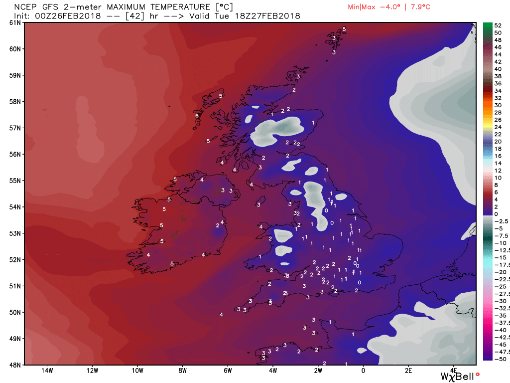
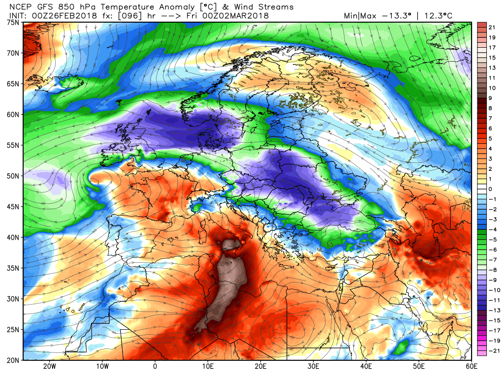
Between Mediterranean low and the high over Scandinavia, a very cold easterly flow covers much of Europe, bringing snow as far south as Rome today, while the deep cold air (-13 to -14C 1500m above) crossing the relatively warmer North Sea (between 5-6C) is causing a classic ‘lake effect' snow shower machine.
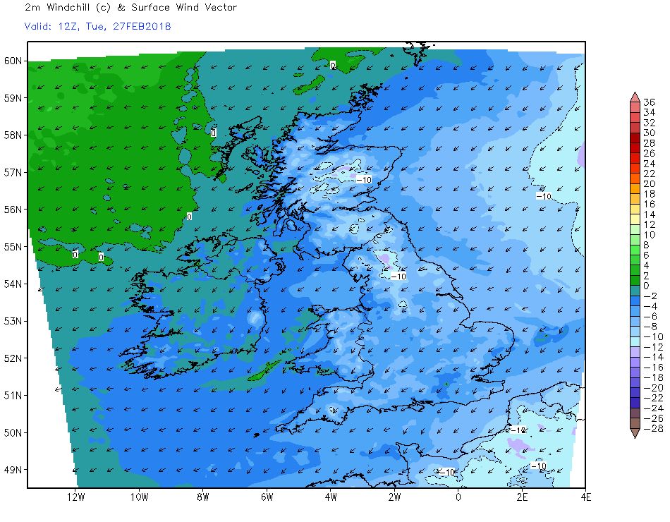
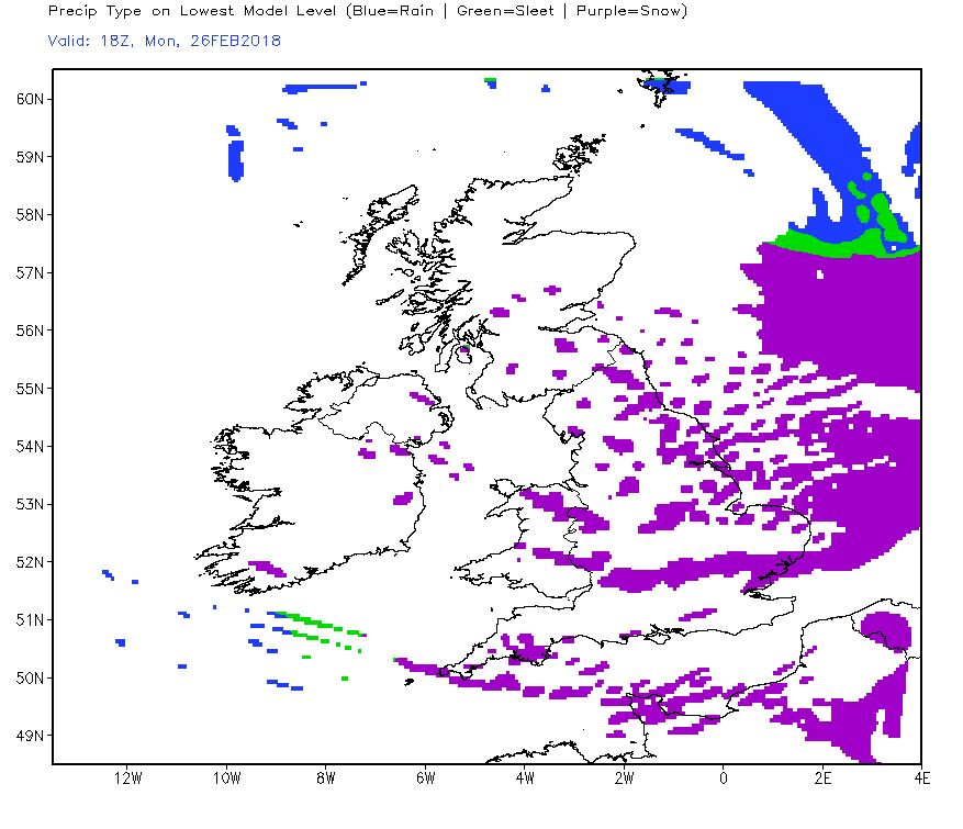
 Tonight
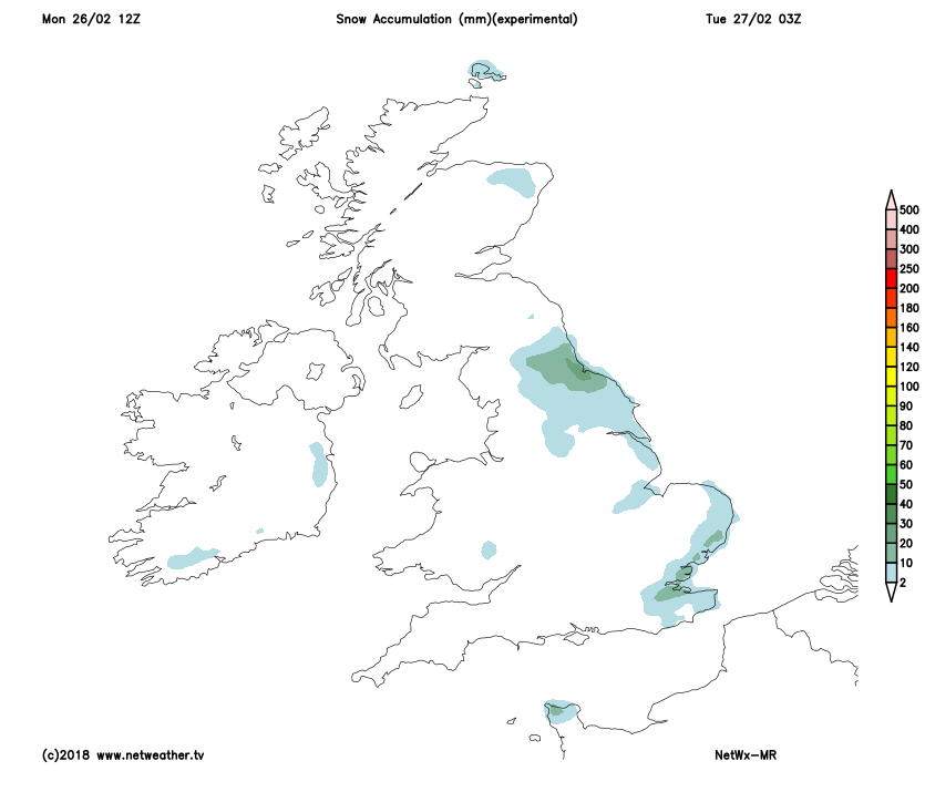
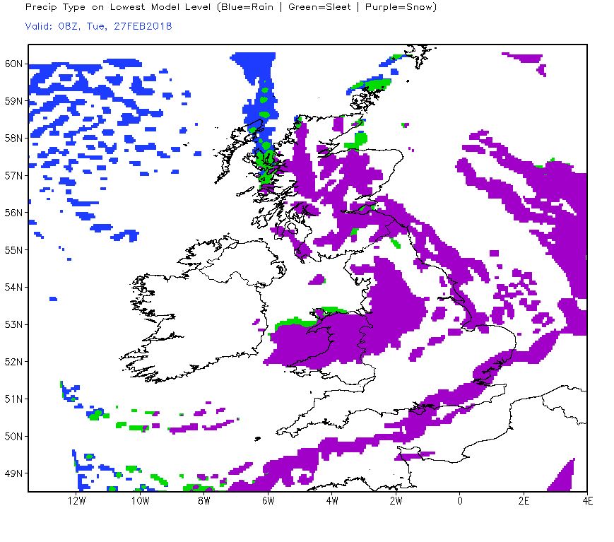
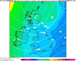
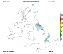
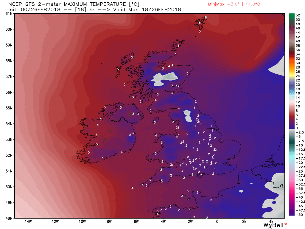
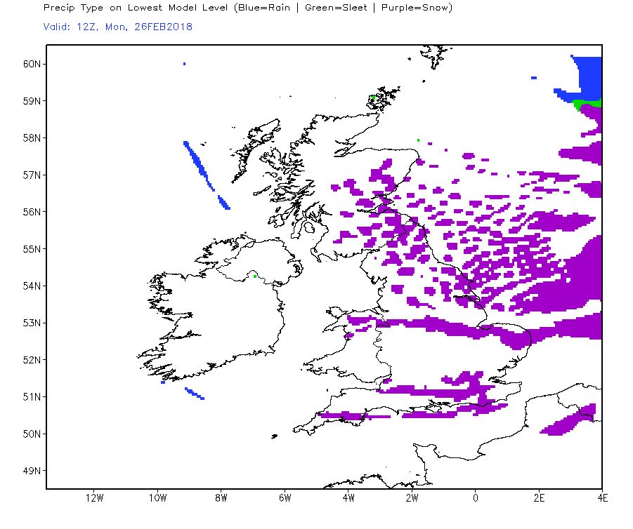
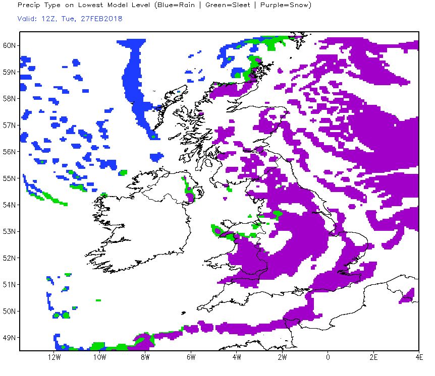
Wind convergence zones this evening and overnight will enhance snow showers activity across eastern and southeastern England – particularly areas southwest of the Wash as far as the Southeast Midlands, also from areas around the Thames Estuary/North Kent coast and southwest across Kent and East Sussex. We could see up to 10-15cm in some spots that receive frequent heavy falls through the night, but not far away may see only a few centimetres at best.
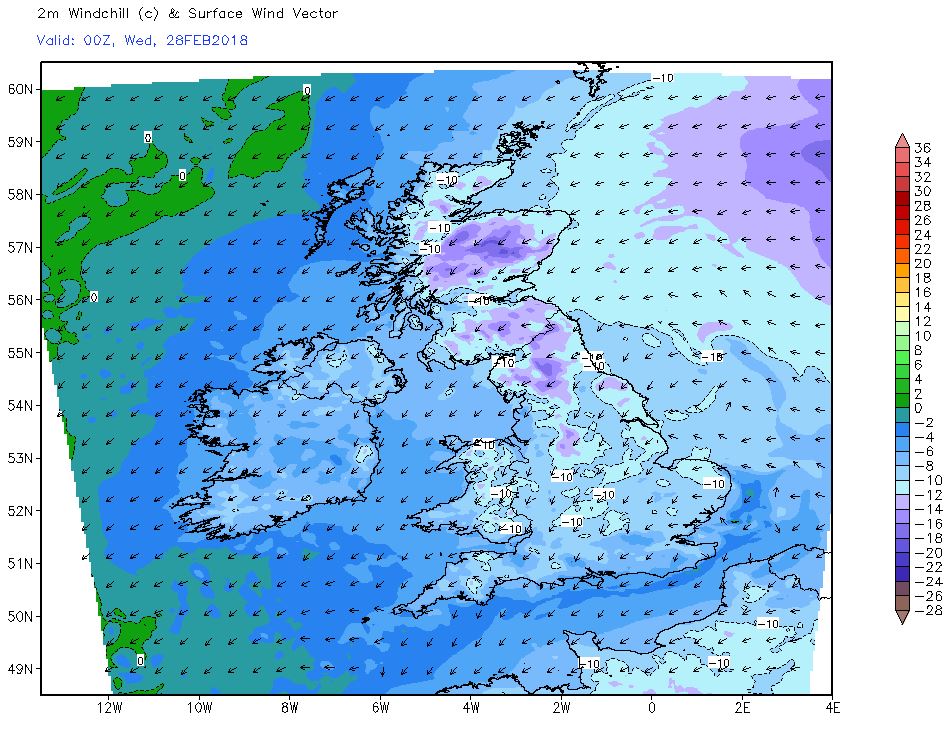
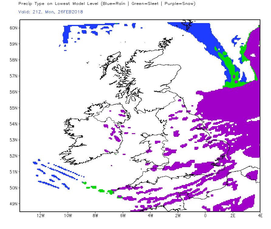
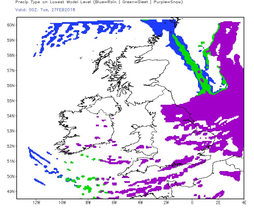
 Tuesday
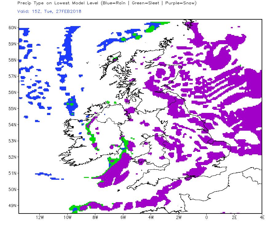
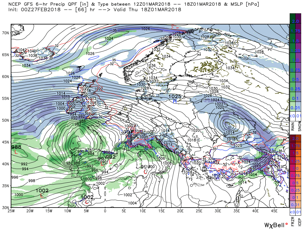
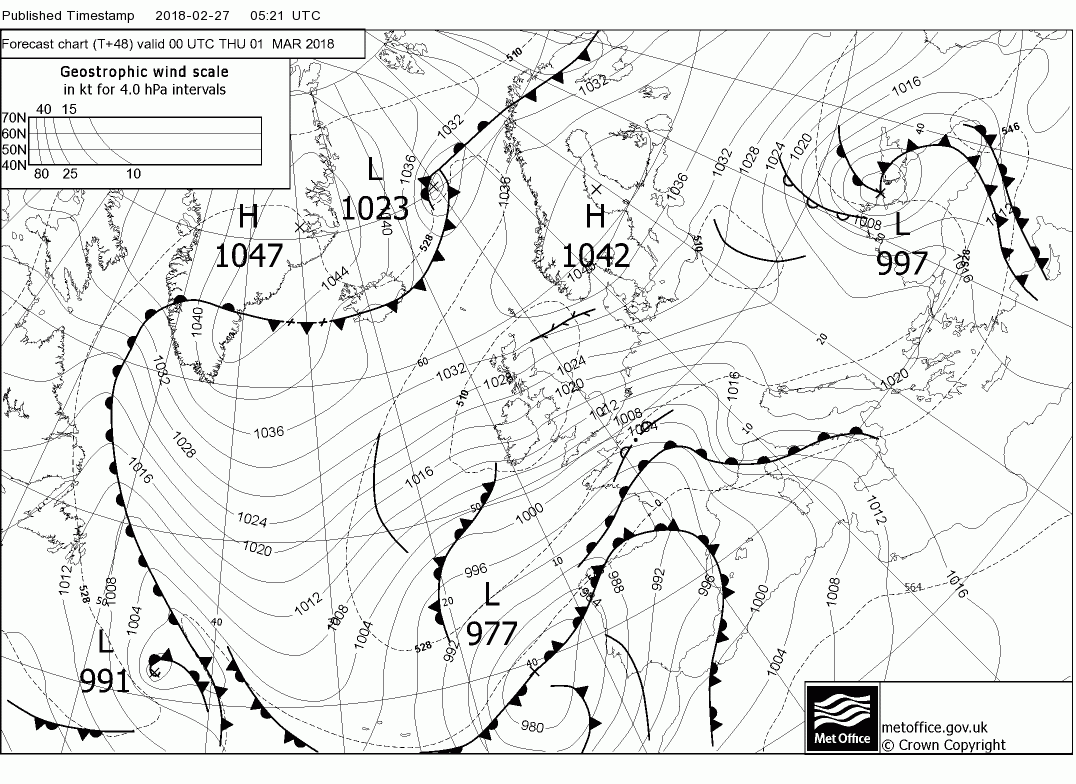
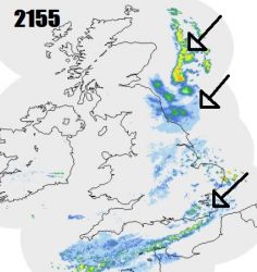
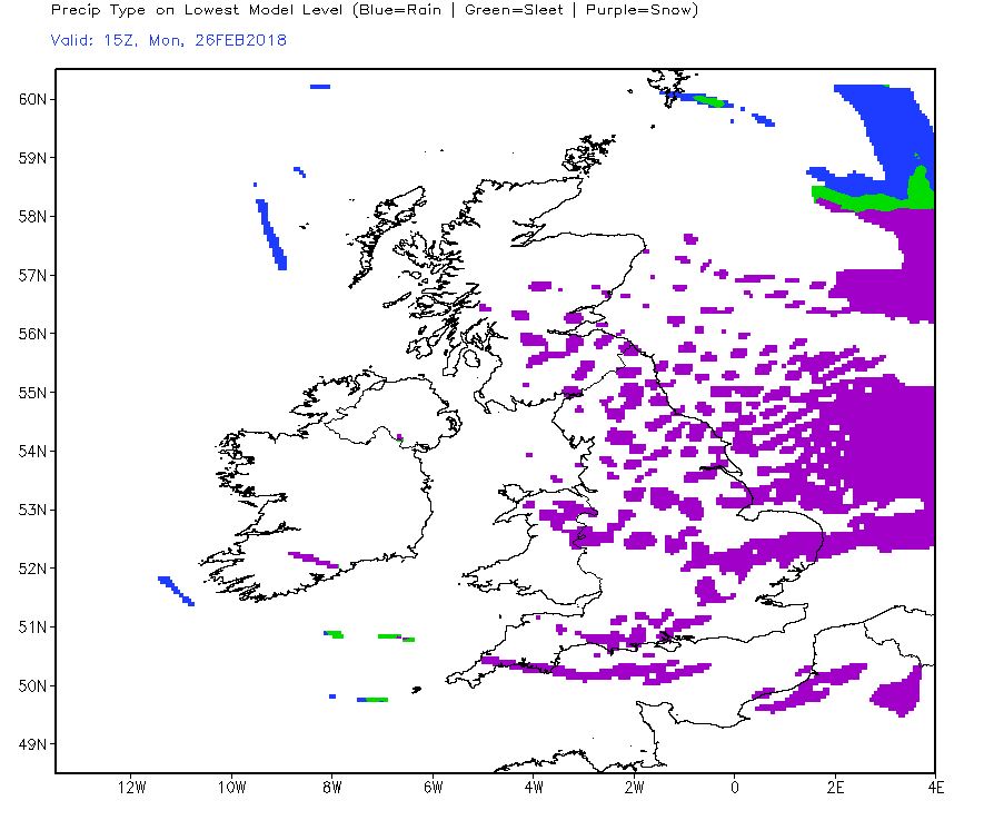
Scattered snow showers overnight elsewhere along eastern coasts overnight giving a dusting in places. Then as we head into Tuesday morning and already appearing on the radar this evening is a mass of heavy snowfall over the North Sea off eastern Scotland and northern England – which marks an area of enhanced ascent ahead and along a surface trough and associated back-to-front frontal system over the North Sea moving toward NE Britain. This will bring an area of heavy snow showers or more persistent heavy snow in across parts of eastern Scotland and NE England overnight, before spreading southwest across northern England and north Wales during Tuesday morning. Further scattered snow showers for eastern areas through Tuesday, some flurries getting further inland towards the west too.

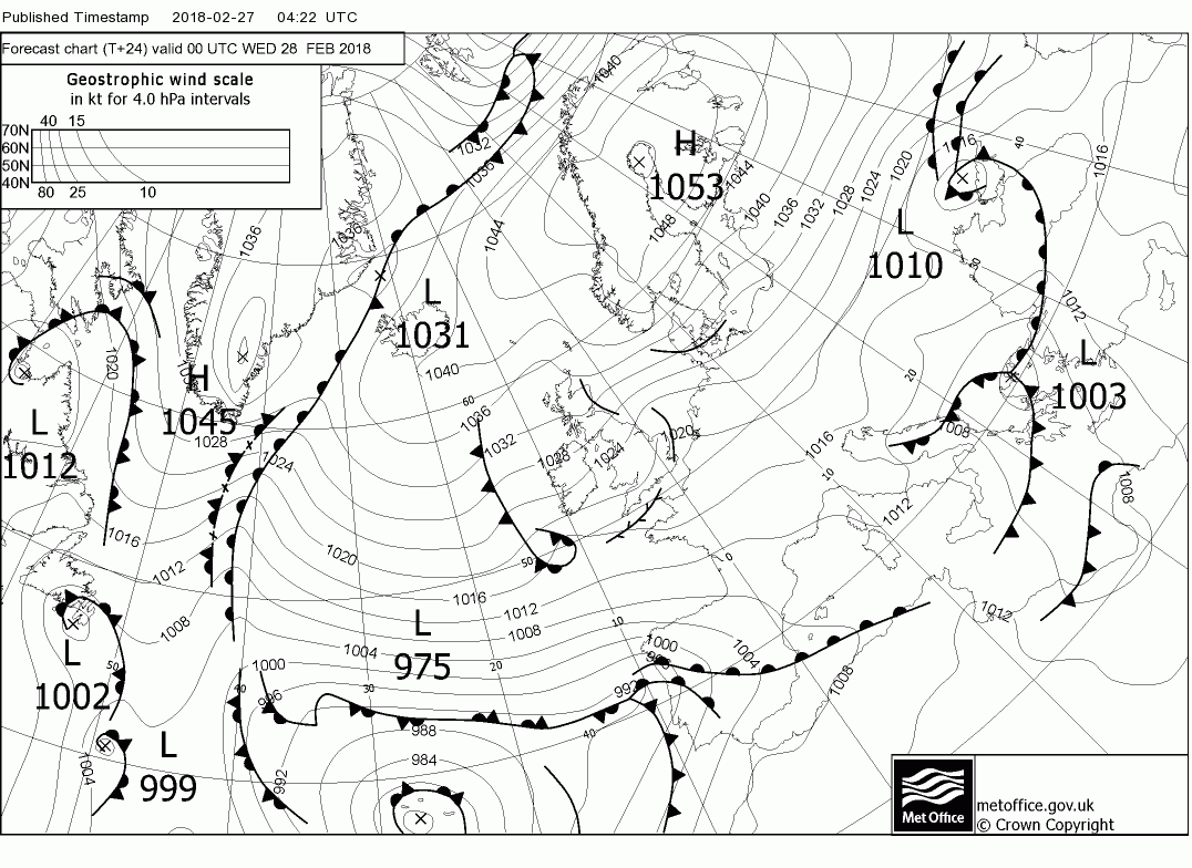
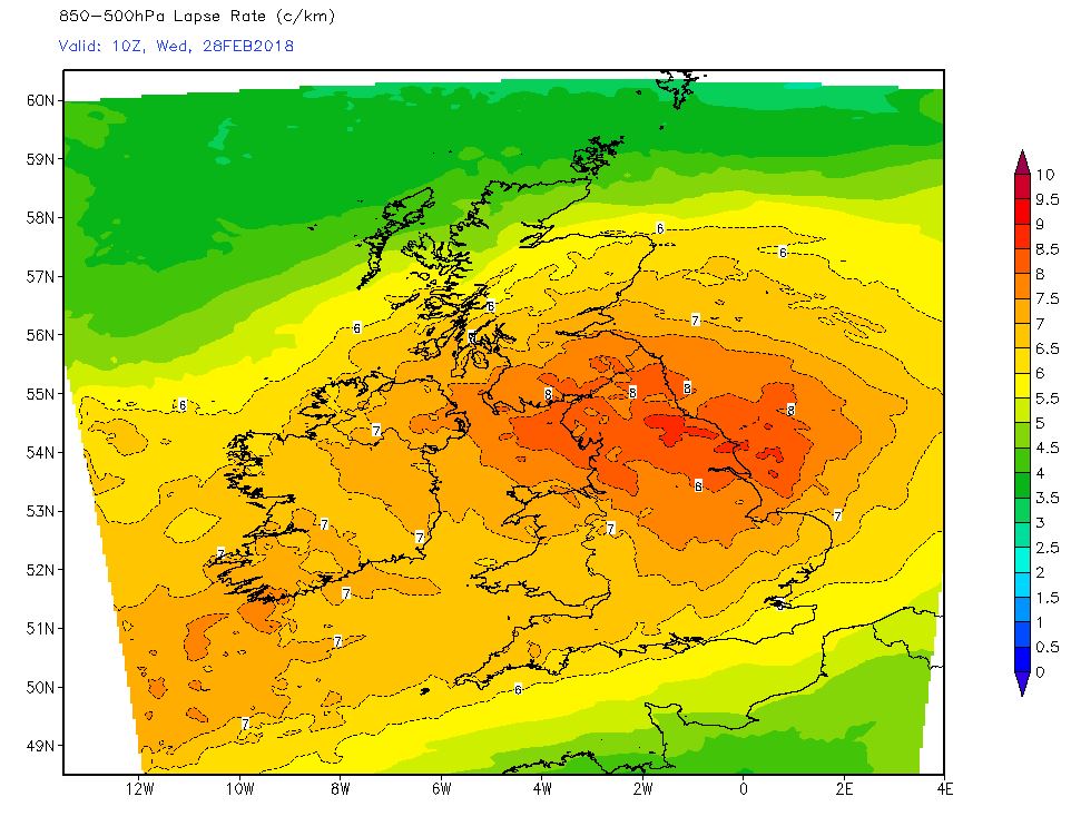
A unusually deep pool of cold air or upper low, coming out of NW Russia tonight, moves southwest on Tuesday and over the British Isles Tuesday night into Wednesday morning. This deep upper cold pool is forecast to have 500mb temperatures of below -40C and will create steep lapse rates allowing vigorous convection, with increase of thunder and lightning, over the north North Sea and into eastern Scotland and NE England. It may also enhance snow shower activity further south along North Sea coasts of England Tuesday night.
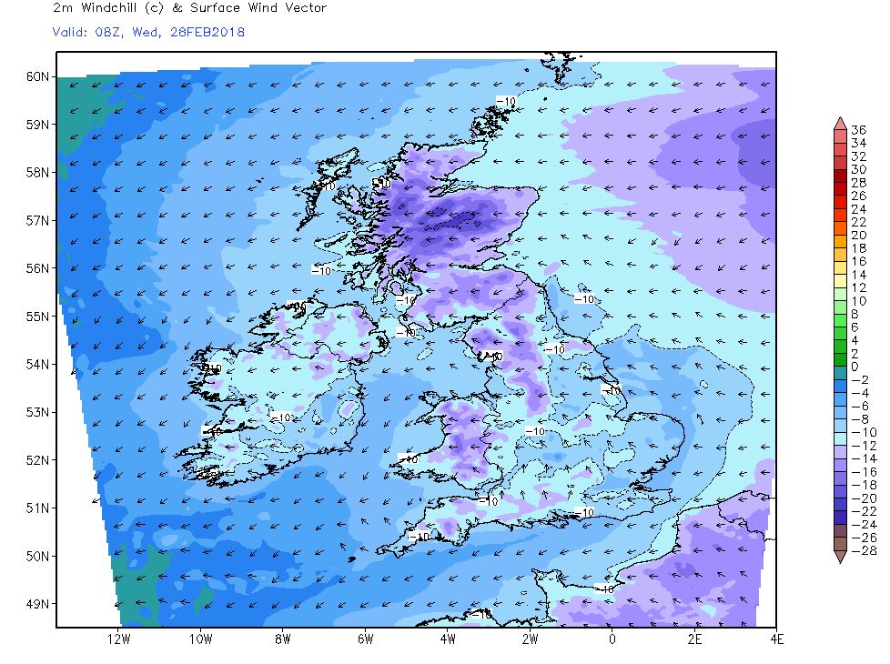
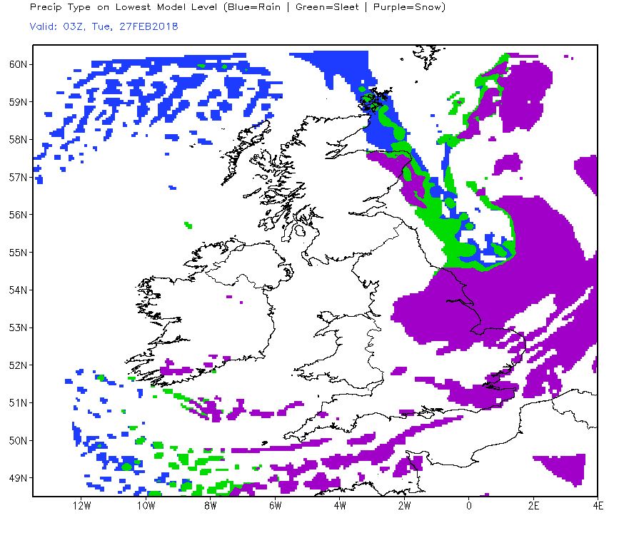
 Wednesday
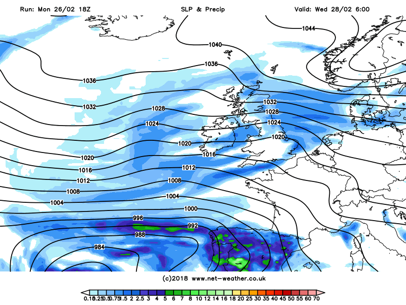
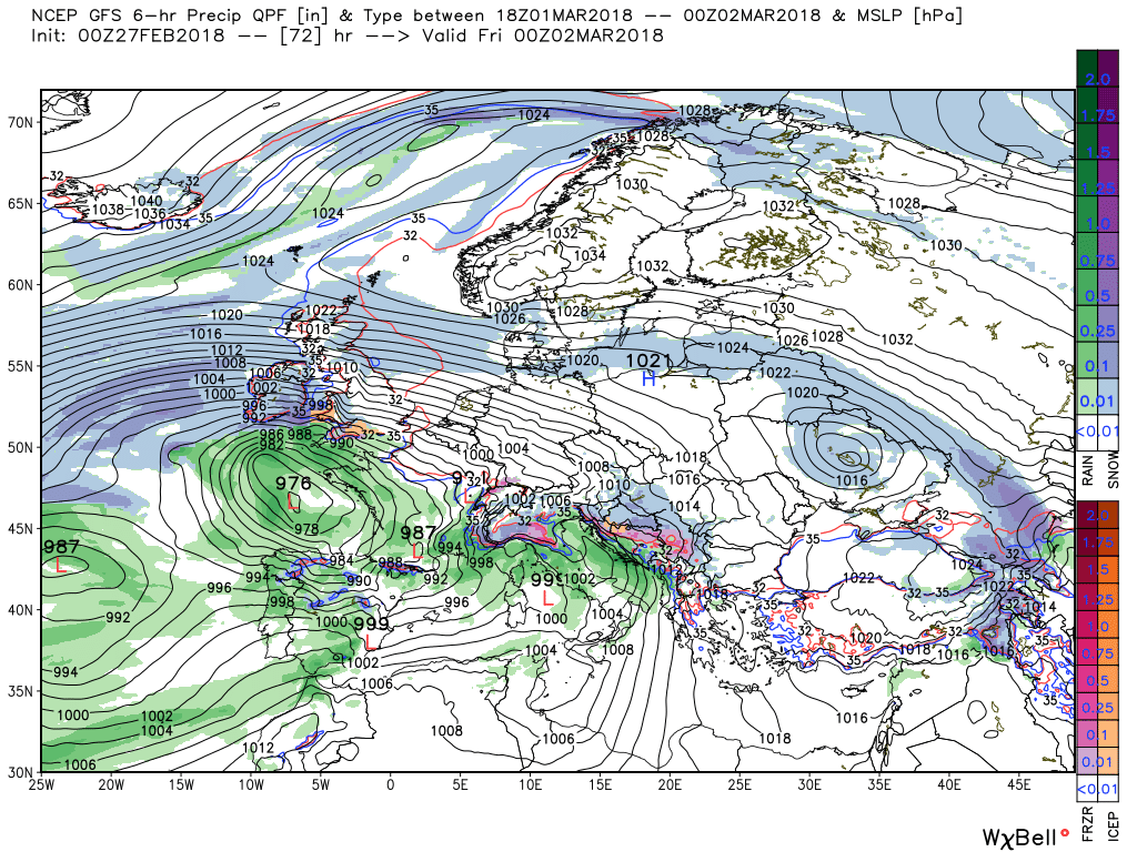
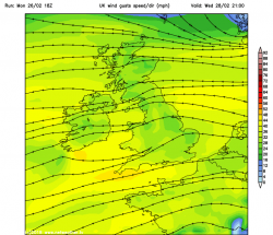
Into Wednesday, and it looks like the wind will veer more easterly or southeasterly while strengthening – which will mean snow shower activity will ease across SE England, with shorter sea track to near continent and concentrate showers along eastern coastal areas from East Anglia northwards with longer sea track but showers also getting well inland across central and northern Britain. The strong easterly wind, which may touch gale force towards eastern coasts, may cause drifting of snow, given its powdery nature.


") P.
P.