Looks like we have a pattern change coming this weekend and I'll describe what I think may happen based on the model output.
However first, lets have some context… why is the pattern changing? Well a big part of the change can be attributed to the Pacific North American pattern (PNA). What is this?, well here are some basic diagrams to show its effects. The top two panels show the synoptic pattern and the bottom two show the temperature anomalies.
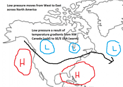
The synoptic pattern over the USA when the PNA is strongly positive is one where we have high pressure over the western USA (like recently). That is the main thing and usually there is lower pressure over NE Canada or the NE USA.
Positive PNA - SLP Negative PNA - SLP
Positive PNA - temperature Negative PNA - temperature
So its probably little surprise that this pattern has contributed to increased wildfire activity in this region. The downstream effects (North Atlantic) are that the Azores high is more likely to ridge North which is what we have been seeing.
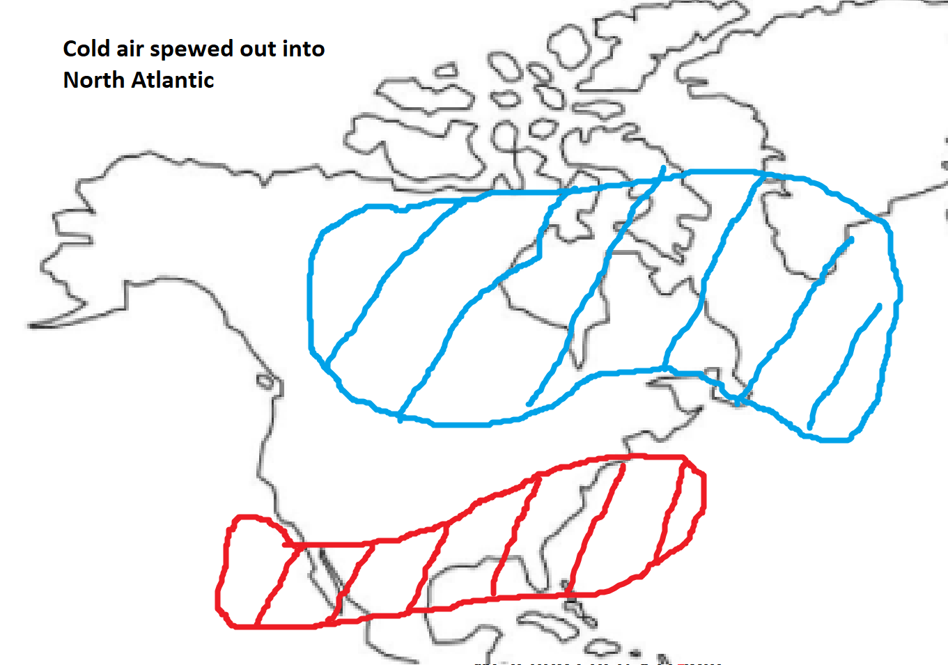
Due to the cold air from Canada being deposited over the SE USA, low pressure systems over around the coastal areas where cold continental air meets the warmer temperatures of the North Atlantic. Low pressure systems typically move NE off the Eastern seaboard and some of these get trapped in the far NE Canada or USA. Thus encouraging ridging of the Azores high.
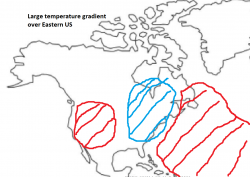
However we are seeing a transition to a more negative PNA which is shown on the right hand panel. Often the high Pressure over California is not as strong allowing the jet to dive further west in the USA instead. The SE USA is often under warm air from the Gulf of Mexico. Areas of low pressure zip across Canada and carry cold Canadian air into the North Atlantic.
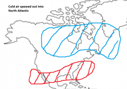
We therefore see a region of rapid deepening of low pressure due to the cold Canadian air meeting the warmer Atlantic. Low pressure moves past Greenland and warm air from the SW Atlantic hits us instead.
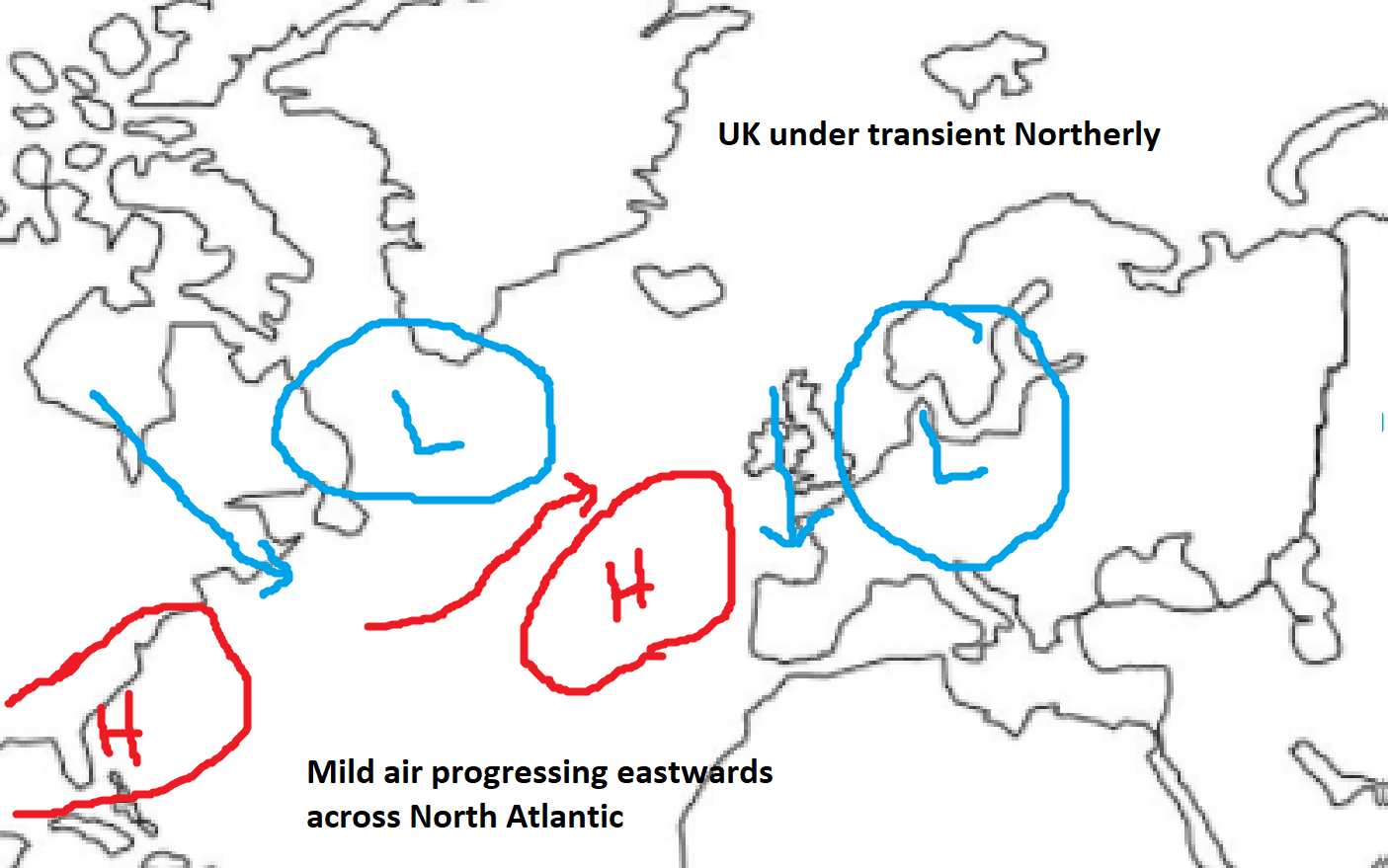
Now there are some variations over the PNA but a somewhat similar kind of pattern change explains why there is a stronger chance of mild westerlies coming into play over the UK.
Though how this Atlantic energy is split will determine how mild the UK gets. So here is the basic scenario on Sunday. Now we have mild air racing across the North Atlantic but a slightly displaced Azores high close by. From here three scenarios could develop within the following couple of days.
Sunday

Scenario 1: 15% Scenario 2: 35% Scenario 3: 50%
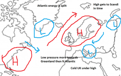
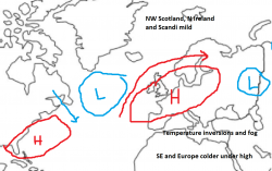
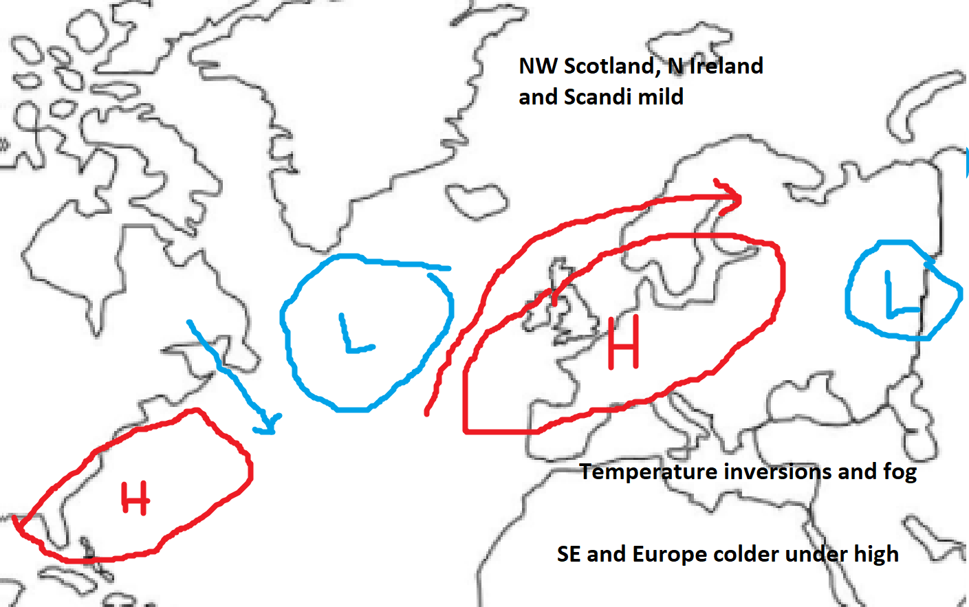
The first is a Scandinavian high which has a fair chance of happening but it probably wouldn't occur that quickly due to the amount of energy in the North Atlantic jet. Also there is the issue of that low over Scandi blocking its Eastward progress.
The second is an anticyclonic outlook. Here the Azores high ridges across but a lot of energy goes over the top. Many parts of the UK would still be cold because of the short days. Slack winds and weak solar heating means temperatures can't recover during the day. In these situations T850 ensembles can be misleading because it can be cold at the surface despite warmer temperatures higher up (known as a temperature inversion). Warm air will likely affect NW areas though and a slight modification could see either the whole of the UK cold or mild.
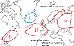
The final scenario is one where the Atlantic wins out over the following few days. This could lead to either mild SW winds if there is a pressure build to our east as well or a more alternating mild/cool pattern with westerlies.
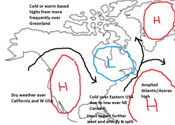
Finally a Scandi high could develop later from the other two Scenarios. The middle panel wouldn't be that bad if some blocking could develop from the high pressure. Overall these are just a bunch of scenarios that I think will develop from the model output. Lets see what the 12z's bring.

")