- Messages
- 6,299
- Location
- Norfolk, England
- Thread Starter
- #97
Thanks - it's actually good for me to do this sort of thing!Take your time Chris, we all have our off days, your writings are interesting but you health is more important, take care.
Great, keep it coming thenThanks - it's actually good for me to do this sort of thing!
Can you make the weather nicer?Thanks - it's actually good for me to do this sort of thing!
Can you make the weather nicer?
So warm wet and windy for a while , could be worse!If my explanation is still confusing, the following link is a pretty good reference, though it refers to 500mB/hPa charts and airflow diverging at the top of a low pressure cell, neither of which I wasn't going to mention yet:
http://www.atmo.arizona.edu/students/courselinks/fall12/atmo336/lectures/sec1/p500mb.html
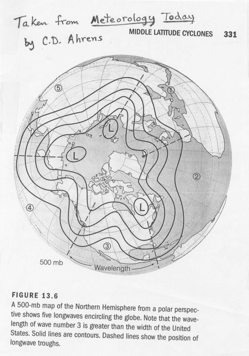
From that link, the following image is a simplified northern hemisphere chart derived from a model output, with the North Pole in the centre, as though you were directly hoving above it and viewing the northern hemisphere from that angle:
As the caption states, this is a Wave 5 pattern, with the ridges numbered.
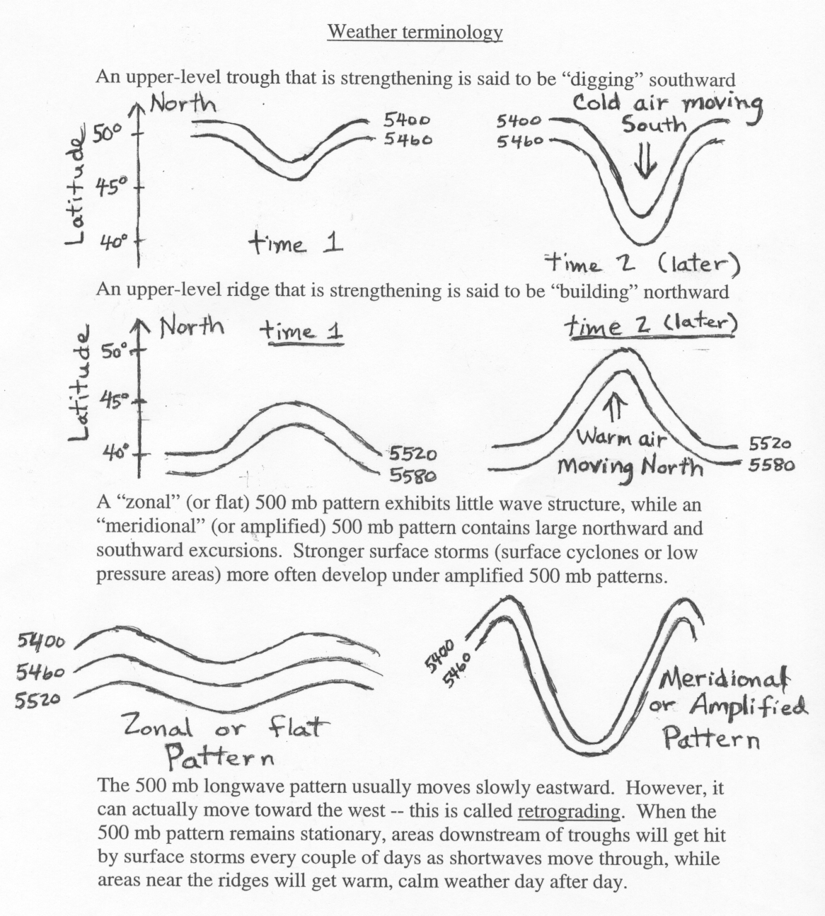
Below is another diagram from the same linked site, showing the difference between a zonal and meridional jet:
That isn't a current output, merely an example.So warm wet and windy for a while , could be worse!
I re-wrote, in two parts, the lengthy lesson from page 5, as Blademonkey struggled with it (I worded it badly).Oh man! I've a lot of catching up to do on this thread!
Keeping my weather eye out for developments in western Scotland Chris, ( see what I did rhere ).
JohnnyO. o/
Don't know if you saw 'dangerous earth' BBC 4 last night - chasing tornadoes? If not, there's always iplayer..Model update - any sign of the high pressure moving to sit to our north-west has diminished. Rest of the month likely to be unsettled, with, as usual, the brunt of the wind and rain being for the north and west, though the south and east will also see wet and breezy weather at times. Really, the only uncertainty at present for later in the month and the Christmas period is the exact location of the nuisance European high - if it drops south and west back to the Azores from whnce it came, the flow will be fom the west. This would put most of the country into unsettled weather with temperatures around average. If it stays over south-west Europe, as it is at present, the south and east will be mainly dry, cloudy and exceptionally mild (14-16C), while areas further north west will be wetter, windier, and around average temperatures (low double figures Celcius). Anyone who was considering a flutter on a White Christmas would be well advised to hang onto their money.
Don't know if you saw 'dangerous earth' BBC 4 last night - chasing tornadoes? If not, there's always iplayer..